Bienfait
Bienfait, Saskatchewan | |
|---|---|
Town | |
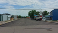
 Main Street | |
 Location of Bienfait in Saskatchewan | |
| Coordinates: 49°08′47″N 102°47′44″W / 49.1465°N 102.7956°W | |
| Country | Canada |
| Province | Saskatchewan |
| Region | South East |
| Census division | 1 |
| Post office established | 1893 |
| Village | Apr 16, 1912 |
| Town | March 1, 1957 |
| Government | |
| • Mayor | Ken Bonokoski |
| Area | |
| • Total | 3.09 km2 (1.19 sq mi) |
| Population (2011) | |
| • Total | 780 |
| • Density | 252.4/km2 (654/sq mi) |
| Postal code | S0C 0M0 |
| Area code(s) | 306 |
| [1][2] | |

Bienfait /ˈbiːnfeɪt/[3] is a town in Saskatchewan on Highway 18 that is 14 km (9 miles) east of Estevan. It is 30 km north-west of the town of North Portal, which is next to the Canadian-American border and is also 10 km south of Estevan. It is surrounded by the RM of Coalfields.
For services, Bienfait has one school, a restaurant, and a gas station. There is also a curling rink[4] and an ice rink,[5] which is where the Bienfait Coalers[6] of the Big 6 Hockey League play.[7] The Coalers have won the Lincoln Trophy 15 times, which is the most of any team.
The Bienfait Museum is in the old CPR Station on the east end of town.[8] The original location for the station was on the CPR line on the north side of town.
History[]
Bienfait was incorporated as the Village of Bienfait on April 16, 1912. It became a town on March 1, 1957, and was named by the Canadian Pacific Railway after Antoine Charles Bienfait, a banker with Adolphe Boissevain & Company of Amsterdam since the firm had been involved in the sale of Canadian Pacific shares in Europe.[9]
In 1931, striking coal miners marched from Bienfait to nearby Estevan, which resulted in the Estevan Riot.
Train/Caboose Lot[]
On the north side of town on Railway Avenue at the head of Main Street, sits a Manitoba & Saskatchewan Coal Company (M&S) Locomotive #3522, which is on the Canadian Register of Historic Places. The M&S Locomotive was built in 1907 and used to transport coal from the mines to Bienfait to market until 1968. It was one of the last commercially-functioning steam engines in Canada.[10]
The town of Bienfait acquired the locomotive in 1968 and the caboose in 2000. The caboose is an old Canadian National Railway caboose. This site was added to the list of historic places in Saskatchewan on 28 March 2002.
Demographics[]
| Canada census – Bienfait community profile | |||
|---|---|---|---|
| 2011 | 2006 | ||
| Population: | 780 (+4.3% from 2006) | 748 (-4.8% from 2001) | |
| Land area: | 3.09 km2 (1.19 sq mi) | 3.09 km2 (1.19 sq mi) | |
| Population density: | 252.4/km2 (654/sq mi) | 242.1/km2 (627/sq mi) | |
| Median age: | 33.2 (M: 33.6, F: 32.6) | 32.1 (M: 33.3, F: 31.1) | |
| Total private dwellings: | 330 | 320 | |
| Median household income: | |||
| References: 2011[11] 2006[12] earlier[13] | |||
Gallery[]

M&S Locomotive in Bienfait
Main Street Bienfait, looking north with the locomotive at the end of the road

M&S Locomotive plaque


See also[]
References[]
- ^ National Archives, Archivia Net. "Post Offices and Postmasters". Archived from the original on 6 October 2006. Retrieved 6 September 2009.
- ^ Government of Saskatchewan, MRD Home. "Municipal Directory System". Archived from the original on January 15, 2016. Retrieved 2014-03-11.
- ^ The Canadian Press (2017), The Canadian Press Stylebook (18th ed.), Toronto: The Canadian Press
- ^ "▷ BIENFAIT CURLING RINK ✔ All the information about BIENFAIT CURLING RINK ✔ BIENFAIT".
- ^ "DiscoverEstevan".
- ^ https://www.eliteprospects.com/team/25441/bienfait-coalers
- ^ https://www.bigsixhockey.com/
- ^ "Bienfait Coalfields Historical Society Museum | Tourism Saskatchewan".
- ^ Bienfait Saskatchewan, History and Genealogy Page
- ^ "HistoricPlaces.ca - HistoricPlaces.ca".
- ^ "2011 Community Profiles". 2011 Canadian Census. Statistics Canada. July 5, 2013. Retrieved 2012-12-24.
- ^ "2006 Community Profiles". 2006 Canadian Census. Statistics Canada. March 30, 2011. Retrieved 2012-12-24.
- ^ "2001 Community Profiles". 2001 Canadian Census. Statistics Canada. February 17, 2012.
- Endicott, Stephen (2002). Bienfait: The Saskatchewan Miners' Struggle of '31. Toronto: University of Toronto Press. ISBN 0-8020-8452-4.
Places adjacent to Bienfait | ||||||||||||||||
|---|---|---|---|---|---|---|---|---|---|---|---|---|---|---|---|---|
| ||||||||||||||||
| Subdivisions | |
|---|---|
| Communities | |
| Cities | |
| Topics |
|
| |
| Cities |  | ||||
|---|---|---|---|---|---|
| Towns | |||||
| Villages | |||||
| Rural municipalities | |||||
| First Nations |
| ||||
| Indian reserves | |||||
| Unincorporated communities |
| ||||
- Coalfields No. 4, Saskatchewan
- Towns in Saskatchewan
- Division No. 1, Saskatchewan