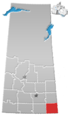
Cannington Lake
Cannington Lake | |
|---|---|
| Organized Hamlet of Cannington Lake | |
 Cannington Lake | |
 Cannington Lake | |
| Coordinates: 49°46′58″N 102°09′37″W / 49.78278°N 102.16028°W | |
| Country | Canada |
| Province | Saskatchewan |
| Region | South-eastern |
| Census division | 1 |
| Rural Municipality | Moose Mountain |
| Government | |
| • Governing body | Rural Municipality of Moose Mountain |
| • MP | Robert Kitchen |
| • MLA | Dan D'Autremont |
| Population (2016) | |
| • Total | 0 |
| Time zone | CST |
| Area code(s) | 306 |
| Highways | Highway 16 |
| Railways | Canadian Pacific Railway |
| [1][2][3][4] | |
Cannington Lake, also known as Cannington Lake Resort, is a hamlet within the Rural Municipality of Wawken No. 93, Saskatchewan, Canada. Listed as a designated place by Statistics Canada, the hamlet had a population of 0 in the Canada 2011 Census.[5]
The resort is on the north-eastern shore of the lake and has over twenty lots owned with six occupied cabins. The 2016 Canada Census does not list a population for Cannington Lake, only for the RM of Moose Mountain, which was 492.[6]
It was once a popular resort as the population would grow in the summer months. It was home to several powered and unpowered campsites, several BBQ areas, two boat launches, a beach, several rentable cabins, a miniature golf course, and other services. Over the years the lake water levels declined severely due to beaver damming so many of the residents had moved their cabins away. Other nearby lakes, such as White Bear (Carlyle) Lake and Kenosee Lake have had similar issues with beaver dams. The lake levels have been on the rise in recent years due to beaver control measures. This may rejuvenate the area into a summer retreat once again.

Demographics[]
| 2011 | |
|---|---|
| Population | 0 (- 100.0% from 2006) |
| Land area | 0.16 km2 (0.062 sq mi) |
| Population density | |
| Median age | |
| Total private dwellings | |
| Median household income | $N/A |
The lake[]

Cannington Lake is an elevated lake situated in a Boreal Forest south-east of Moose Mountain Provincial Park on the eastern edge of the Moose Mountain Upland. It is located at 49°46′0″N, 102°10′2″W, has a surface area of 146.5 hectares, and a shoreline of 9.5 kilometres.[10]
The western half of the lake is on the White Bear First Nation. A few kilometers to the east is Cannington Manor Provincial Park. Carlyle is to the south-west and is the closest town.
The lake is excellent for canoeing and kayaking as it is not too large and rarely has strong winds. There is also a 6 km long nature path about the lake that goes by five ponds.
See also[]
References[]
- ^ National Archives, Archivia Net, Post Offices and Postmasters
- ^ Government of Saskatchewan, MRD Home, Municipal Directory System, archived from the original on 21 November 2008
- ^ Canadian Textiles Institute. (2005), CTI Determine your provincial constituency, archived from the original on 11 September 2007
- ^ Commissioner of Canada Elections, Chief Electoral Officer of Canada (2005), Elections Canada On-line
- ^ Canada 2011 Census: Designated places in Saskatchewan
- ^ "Census Profile, 2016 Census - Moose Mountain No. 63, Rural municipality [Census subdivision], Saskatchewan and Ontario [Province]". 8 February 2017.
- ^ "2011 Community Profiles". 2011 Canadian Census. Statistics Canada. 21 March 2019.
- ^ "2006 Community Profiles". 2006 Canadian Census. Statistics Canada. 20 August 2019.
- ^ "2001 Community Profiles". 2001 Canadian Census. Statistics Canada. 18 July 2021.
- ^ Government of Canada, Natural Resources Canada. "Place names - Cannington Lake". www4.rncan.gc.ca.
External links[]
 Canada portal
Coordinates: 49°46′58″N 102°09′37″W / 49.78278°N 102.16028°W
- Wawken No. 93, Saskatchewan
- Former designated places in Saskatchewan
- Organized hamlets in Saskatchewan
- Division No. 1, Saskatchewan
- Lakes of Saskatchewan

