Benson, Saskatchewan
This article does not cite any sources. (November 2013) |
Benson | |
|---|---|
 | |
 Location of Benson in Saskatchewan | |
| Coordinates: 49°26′48″N 102°59′39″W / 49.446570°N 102.994290°WCoordinates: 49°26′48″N 102°59′39″W / 49.446570°N 102.994290°W | |
| Country | Canada |
| Province | Saskatchewan |
| Rural Municipality | Benson |
| Postal code | S0C 0L0 |
| Area code(s) | 306 |
| Highways | Highway 47 |

Benson is an unincorporated community in the Canadian province of Saskatchewan. It is located between Estevan and Stoughton on Highway 47. Currently it has a curling rink, community hall and the municipal offices of Rural Municipality of Benson No. 35. The geographical location for Benson is north of the Canada–US border and North Dakota.
On July 1st, 1935, Benson was hit by a tornado, killing 1, injuring 2, and leveling multiple structures.
Gallery[]
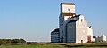
Grain elevator

The Benson School in 1995 after it closed


| Cities |  | ||||
|---|---|---|---|---|---|
| Towns | |||||
| Villages | |||||
| Rural municipalities | |||||
| First Nations |
| ||||
| Indian reserves | |||||
| Unincorporated communities |
| ||||
This article about a location in the Census Division No. 1 of Saskatchewan is a stub. You can help Wikipedia by . |
Categories:
- Benson No. 35, Saskatchewan
- Designated places in Saskatchewan
- Former villages in Saskatchewan
- Unincorporated communities in Saskatchewan
- Populated places disestablished in 2003
- Division No. 1, Saskatchewan
- Saskatchewan Division No. 1 geography stubs