Davidson, Saskatchewan
Davidson | |
|---|---|
Town | |
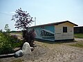
 Davidson's business district Washington Avenue | |
| Nickname(s): Community In Motion | |
 Davidson Location of Davidson in Saskatchewan | |
| Coordinates: 51°10′N 105°35′W / 51.16°N 105.58°W | |
| Country | Canada |
| Province | Saskatchewan |
| Region | Saskatchewan |
| Census division | No. 11 |
| Rural Municipality | No. 252 |
| Post Office established | 1903 |
| Village Incorporated | March 7, 1904 |
| Town Incorporated | November 15, 1906 |
| Government | |
| • Mayor | Elaine Ebenal[1] |
| • Governing body | Davidson Town Council |
| Area | |
| • Land | 4.49 km2 (1.73 sq mi) |
| Population (2011) | |
| • Total | 1,025 |
| • Density | 228.4/km2 (592/sq mi) |
| Time zone | CST |
| Postal code | S0G 1A0 |
| Area code(s) | 306 |
| Highways | Highway 11 |
| Waterways | Lake Diefenbaker Last Mountain Lake |
| Website | Official website |
| [2][3] | |


Davidson is a town in south central Saskatchewan, Canada. It is located 104 kilometres (65 mi) south-east of Saskatoon beside provincial highway 11 as well as Highway 44, in the rural municipality of Arm River. It is located approximately halfway between Saskatoon and Regina, is a popular stopping-off with many restaurants and gas stations located adjacent to the highway.
History[]
In 1902 Colonel Andrew Duncan Davidson, an enthusiastic entrepreneur from Glencoe, Ontario, came to Saskatchewan in hopes of creating a 'midway' settlement between the cities of Regina and Saskatoon. With agriculture as one of his driving passions, Davidson, through the Saskatchewan Valley Land Company, purchased 700,000 acres (2,800 km2) from the railway and the federal government[4] in an area where the soil was particularly suitable for grain farming. Davidson organized a train route that travelled from Chicago to Saskatoon; making one stop in Davidson on the way. This train route brought American bankers, entrepreneurs and newspapermen in hopes of starting up new businesses in the area. With the expansion of the community underway, Davidson also managed to sell more than 180,000 acres (730 km2) of land in the area.[5]
Within a short period of time, Davidson, which was declared the name of the community, was nicknamed the 'Midway Town' because of its central location. On 15 November 1906, Davidson was officially declared a town.[6]
During World War II the Royal Canadian Air Force built and operated RCAF Station Davidson as a component of the British Commonwealth Air Training Plan.[7] The station was constructed on a site 7 kilometres (4.3 mi) east of the town. This site should not be confused with Davidson Municipal Airport which is adjacent to the town, on the south end.
Geography[]
Climate[]
| ||||||||||||||||||||||||||||||||||||||||||||||||||||||||||||||||||||||||||||||||||||||||||||||||||||||||||||||||||||||||||||||
Demographics[]
| Canada census – Davidson community profile | |||
|---|---|---|---|
| 2011 | 2006 | ||
| Population: | 1025 (7.0% from 2006) | 958 (-7.4% from 2001) | |
| Land area: | 4.49 km2 (1.73 sq mi) | 4.49 km2 (1.73 sq mi) | |
| Population density: | 228.4/km2 (592/sq mi) | 213.5/km2 (553/sq mi) | |
| Median age: | 47.4 (M: 44.5, F: 49.9) | 48.4 (M: 46.3, F: 50.2) | |
| Total private dwellings: | 517 | 496 | |
| Median household income: | $55,249 | ||
| References: 2011[9] 2006[10] earlier[11] | |||
Sports and recreation[]
Hockey, baseball, fitness, curling, figure skating, dance, gymnastics, and riding are some of the activities offered to members of the community. The Davidson Cyclones of the Long Lake Hockey League play at the Davidson AGT Centre.[12]
Davidson is home to the 9-hole grass green, Davidson Golf and Country Club.
The swimming pool beside the local campground offers swimming lessons.
Gallery[]
Train station
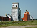
Grain elevators

Coffee pot monument in Davidson, Saskatchewan. Approximately 24 feet tall, and would hold 150,000 cups of coffee - claimed to be the world's largest.Erected in 1996, and featured on a Canadian postage stamp in 2010, the town is now considering renovation of the monument.[13]


Education[]
Davidson Elementary School and Davidson High School were formerly part of the Davidson School Division, which also included schools in the communities of Kenaston, Craik and Eyebrow. As of January 1, 2006, DES and DHS are part of the Sun West School Division. In a small community, the school is at its core. This allows many opportunities for the community to get actively involved in the school and vice versa. Some of the partnerships between the school and the community include working for "Communities in Bloom," contributing to the recycling program at SARCAN, and planting trees around the newly established walking trail. Davidson School's mission statement is "Developing, Encouraging, Succeeding; Creating the Future"
Media[]
The community newspaper is The Davidson Leader, publishing since 1904.
See also[]
References[]
- ^ "Council officials | Town of Davidson, Saskatchewan". Archived from the original on 2020-12-01. Retrieved 2020-12-01.
- ^ National Archives, Archivia Net. "Post Offices and Postmasters". Archived from the original on 6 October 2006. Retrieved 23 September 2013.
- ^ Government of Saskatchewan, MRD Home. "Municipal Directory System (Town of Davidson)". Archived from the original on 15 January 2016. Retrieved 23 September 2013.
- ^ "Saskatchewan Valley Land Co". Liberal Party (Canada). c. 1906. Retrieved 2013-09-23.
- ^ Regehr, Theodore D. (1998). "Davidson, Andrew Duncan". In Cook, Ramsay; Hamelin, Jean (eds.). Dictionary of Canadian Biography. XIV (1911–1920) (online ed.). University of Toronto Press. Retrieved 2013-09-23.
- ^ McLennan, David (2006). "Davidson". Encyclopedia of Saskatchewan (online ed.). Canadian Plains Research Center, University of Regina. Retrieved 2013-09-23.
- ^ Hatch, F. J. (1983). The Aerodrome of Democracy: Canada and the British Commonwealth Air Training Plan, 1939-1945 (PDF). Ottawa: Directorate of History, Department of National Defence. pp. 133–134, 207. ISBN 0-660-11443-7.
- ^ Environment Canada Canadian Climate Normals 1971–2000, accessed 24 July 2010
- ^ "2011 Community Profiles". 2011 Canadian Census. Statistics Canada. July 5, 2013. Retrieved 2012-09-11.
- ^ "2006 Community Profiles". 2006 Canadian Census. Statistics Canada. March 30, 2011. Retrieved 2012-09-11.
- ^ "2001 Community Profiles". 2001 Canadian Census. Statistics Canada. February 17, 2012.
- ^ http://longlakehockey.com/
- ^ http://leaderonline.ca/town-wants-input-on-coffee-pot-restoration/ Town wants input on coffee pot restoration, retrieved 2017 Sept 4
External links[]
- Official website
 Canada portal
Places adjacent to Davidson, Saskatchewan | |
|---|---|
- Towns in Saskatchewan
- World War II sites in Canada
- Military history of Canada during World War II