Waldron, Arkansas
Waldron, Arkansas | |
|---|---|
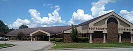   Clockwise from top: Scott County Courthouse, Downtown Waldron, and the Old Scott County Courthouse | |
 Location of Waldron in Scott County, Arkansas. | |
| Coordinates: 34°53′57″N 94°5′29″W / 34.89917°N 94.09139°WCoordinates: 34°53′57″N 94°5′29″W / 34.89917°N 94.09139°W | |
| Country | United States |
| State | Arkansas |
| County | Scott |
| Area | |
| • Total | 5.80 sq mi (15.01 km2) |
| • Land | 5.71 sq mi (14.78 km2) |
| • Water | 0.09 sq mi (0.23 km2) |
| Elevation | 659 ft (201 m) |
| Population (2010) | |
| • Total | 3,618 |
| • Estimate (2019)[1] | 3,374 |
| • Density | 591.20/sq mi (228.28/km2) |
| Time zone | UTC-6 (Central (CST)) |
| • Summer (DST) | UTC-5 (CDT) |
| ZIP codes | 72924, 72958 |
| Area code(s) | 479 |
| FIPS code | 05-72380 |
| GNIS feature ID | 0078668 |

Waldron is a city in Scott County, Arkansas, United States. Its population was 3,618 at the 2010 census.[3] The city is the county seat of Scott County.[4]
History[]
Waldron was platted in 1845 by surveyor W. P. Waldron, and named for him.[5] A post office called Waldron has been in operation since 1846.[6] Waldron incorporated in 1875.[7]
Geography[]
Waldron is located at 34°53′57″N 94°5′29″W / 34.89917°N 94.09139°W (34.899191, -94.091483).[8]
According to the United States Census Bureau, the city has a total area of 5.0 square miles (13 km2), of which 5.0 square miles (13 km2) is land and 0.1 square miles (0.26 km2) (1.19%) is water.
Waldron is located approximately 38 miles south of Fort Smith, near the Poteau River.
Demographics[]
| Historical population | |||
|---|---|---|---|
| Census | Pop. | %± | |
| 1850 | 90 | — | |
| 1870 | 162 | — | |
| 1880 | 289 | 78.4% | |
| 1890 | 487 | 68.5% | |
| 1900 | 487 | 0.0% | |
| 1910 | 900 | 84.8% | |
| 1920 | 918 | 2.0% | |
| 1930 | 1,077 | 17.3% | |
| 1940 | 1,298 | 20.5% | |
| 1950 | 1,292 | −0.5% | |
| 1960 | 1,619 | 25.3% | |
| 1970 | 2,132 | 31.7% | |
| 1980 | 2,642 | 23.9% | |
| 1990 | 3,024 | 14.5% | |
| 2000 | 3,508 | 16.0% | |
| 2010 | 3,618 | 3.1% | |
| 2019 (est.) | 3,374 | [1] | −6.7% |
| U.S. Decennial Census[9] | |||
As of the census[10] of 2000, there were 3,508 people, 1,430 households, and 899 families residing in the city. The population density was 704.4 people per square mile (272.0/km2). There were 1,563 housing units at an average density of 313.8 per square mile (121.2/km2). The racial makeup of the city was 90.42% White, 0.14% Black or African American, 0.91% Native American, 0.11% Asian, 7.16% from other races, and 1.25% from two or more races. 15.31% of the population were Hispanic or Latino of any race.
There were 1,430 households, out of which 31.3% had children under the age of 18 living with them, 45.9% were married couples living together, 11.3% had a female householder with no husband present, and 37.1% were non-families. 33.0% of all households were made up of individuals, and 16.8% had someone living alone who was 65 years of age or older. The average household size was 2.38 and the average family size was 3.00.
In the city, the population was spread out, with 26.9% under the age of 18, 10.2% from 18 to 24, 25.6% from 25 to 44, 19.6% from 45 to 64, and 17.8% who were 65 years of age or older. The median age was 35 years. For every 100 females, there were 96.6 males. For every 100 females age 18 and over, there were 87.8 males.
The median income for a household in the city was $21,921, and the median income for a family was $26,829. Males had a median income of $25,256 versus $16,136 for females. The per capita income for the city was $12,193. About 22.8% of families and 25.9% of the population were below the poverty line, including 31.1% of those under age 18 and 14.7% of those age 65 or over.
Education[]
Public education for elementary and secondary school students is primarily provided by the Waldron School District, which leads to graduation from Waldron High School. The district and school mascot and athletic emblem is the Bulldog with orange and black serving as the district and school colors.
Notable people[]
- Gary Darnell, college football coach
- Terry Rice, member of the Arkansas House of Representatives from Waldron
- Ashley McBryde, country music singer-songwriter
Climate[]
The climate in this area is characterized by hot, humid summers and generally mild to cool winters. According to the Köppen Climate Classification system, Waldron has a humid subtropical climate, abbreviated "Cfa" on climate maps.[11]
References[]
- ^ Jump up to: a b "Population and Housing Unit Estimates". United States Census Bureau. May 24, 2020. Retrieved May 27, 2020.
- ^ "2019 U.S. Gazetteer Files". United States Census Bureau. Retrieved June 30, 2020.
- ^ "Waldron, AR Population - Census 2010 and 2000 Interactive Map, Demographics, Statistics, Quick Facts - CensusViewer".
- ^ "Find a County". National Association of Counties. Retrieved 2011-06-07.
- ^ Waldron from the Encyclopedia of Arkansas History and Culture. Retrieved 7 July 2019.
- ^ "Post Offices". Jim Forte Postal History. Retrieved 9 February 2018.
- ^ McCutchen, Henry Grady (1922). History of Scott County, Arkansas. 22. p. 55.
- ^ "US Gazetteer files: 2010, 2000, and 1990". United States Census Bureau. 2011-02-12. Retrieved 2011-04-23.
- ^ "Census of Population and Housing". Census.gov. Retrieved June 4, 2015.
- ^ "U.S. Census website". United States Census Bureau. Retrieved 2008-01-31.
- ^ Climate Summary for Waldron, Arkansas
External links[]
- Encyclopedia of Arkansas History & Culture entry: Waldron (Scott County)
| show Municipalities and communities of Scott County, Arkansas, United States |
|---|

| show Authority control |
|---|
- Cities in Scott County, Arkansas
- Cities in Arkansas
- County seats in Arkansas