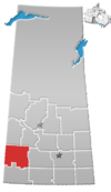
Wartime, Saskatchewan
Wartime | |
|---|---|
Unincorporated community | |
 Old church in Wartime | |
 Wartime | |
| Coordinates: 51°07′30″N 108°06′47″W / 51.1250°N 108.1130°W | |
| Country | |
| Province | |
| Region | Southwest |
| Census division | 8 |
| Rural Municipality | Monet No. 257 |
| Government | |
| • Type | Municipal |
| • Governing body | Rural Municipality of Monet |
| Time zone | UTC-6 (CST) |
| Area code(s) | 306 |
| Highways | |
| Railways | Canadian Pacific Railway |
| [1][2][3][4] | |
Wartime is an unincorporated community and former hamlet, within the Rural Municipality of Monet No. 257, Saskatchewan, Canada. The community is located along Highway 44 approximately 13 km west of Elrose along Canadian National Railway's Elrose sub-division track.[5] The community once boasted a train station built in 1914 which was demolished in 1978, two grain elevators; a Saskatchewan Wheat Pool and a Federal elevator as well as a wooden water tank.[6] The elevators have disappeared but the water tower is still standing and in use.
Etymology[]
Settlers began arriving in the area around 1909 and by the fall of 1913 construction of the CN railway had reached as far as nearby Elrose, Saskatchewan. Preparations for the railroad bed had made it as far as Wartime by 1914 and resulted in a few buildings being built. The outbreak of the First World War occurred at this time so the town was named Wartime.[7] The rails were laid in 1915 and the post office opened that same year and operated until 1990. In 1923, the Canadian Pacific Railway extended a line from Rosetown to Kyle, passing through Wartime.

Notable people[]
William Hunter "Bill" McKnight, SOM PC (born July 12, 1940 - October 4, 2019) was born in Wartime, Saskatchewan. He served as Minister of Agriculture, Minister of Indian Affairs and Northern Development, Minister of National Defence during the first Gulf War, Minister of Energy, Mines and Resources and Minister of Labour in the Progressive Conservative government of Brian Mulroney.
See also[]
References[]
- ^ National Archives, Archivia Net, Post Offices and Postmasters, archived from the original on 2006-10-06
- ^ Canadian Textiles Institute. (2005), CTI Determine your provincial constituency, archived from the original on 2007-09-11
- ^ Government of Saskatchewan, MRD Home. "Municipal Directory System". Archived from the original on 2016-01-15. Retrieved 2014-12-16.
- ^ Commissioner of Canada Elections, Chief Electoral Officer of Canada (2005), Elections Canada On-line, archived from the original on 2007-04-21
- ^ "CN Elrose Subdivision". Traingeek - Trains and Photography. Retrieved 2019-05-26.
- ^ Eric (2014-02-01). "Trackside Treasure: Wartime in Saskatchewan". Trackside Treasure. Retrieved 2019-05-26.
- ^ Russell, E.T. (1993). What's In a Name. Fifth House Books; 3rd ed. ISBN 1895618983.
Coordinates: 51°12′50″N 108°11′30″W / 51.21389°N 108.19167°W
- Monet No. 257, Saskatchewan
- Unincorporated communities in Saskatchewan
- Saskatchewan geography stubs


