Washington County, Wisconsin
Washington County | |
|---|---|
U.S. county | |
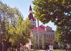 Washington County courthouse | |
 Location within the U.S. state of Wisconsin | |
 Wisconsin's location within the U.S. | |
| Coordinates: 43°22′N 88°14′W / 43.37°N 88.23°W | |
| Country | |
| State | |
| Founded | 1836 |
| Named for | George Washington |
| Seat | West Bend |
| Largest city | West Bend |
| Area | |
| • Total | 436 sq mi (1,130 km2) |
| • Land | 431 sq mi (1,120 km2) |
| • Water | 5.0 sq mi (13 km2) 1.2%% |
| Population (2010) | |
| • Total | 131,887 |
| • Estimate (2020) | 136,445 |
| • Density | 300/sq mi (120/km2) |
| Time zone | UTC−6 (Central) |
| • Summer (DST) | UTC−5 (CDT) |
| Congressional district | 5th |
| Website | www |

Washington County is a county in the U.S. state of Wisconsin. As of the 2010 census, the population was 131,887.[1] Its county seat is West Bend.[2] The county was created from Wisconsin Territory in 1836 and organized in 1845.[3] It was named after President George Washington.[4]
Washington County is part of the Milwaukee-Waukesha-West Allis, WI Metropolitan Statistical Area.
History[]
Washington County was created on December 7, 1836 by the Wisconsin Territory Legislature, with Port Washington designated as the county seat. It was run administratively from Milwaukee County until 1840, when an Act of Organization allowed the county self-governance, and the county seat was moved to Grafton, then called Hamburg. This solution was not satisfactory, as at that time four cities were vying to become the county seat: Port Washington, Grafton, Cedarburg, and West Bend. At least four inconclusive elections were held between 1848 and 1852, but the results were unusable due to accusations of foul play and serious irregularities.
In 1852, the state Legislature attempted to split the county into a northern and southern half, with the northern half retaining the name and the southern half becoming Tuskola County. Voters refused this decision, so in 1853 the Legislature again split the county, this time into a western and eastern portion. The western portion remained Washington County, with West Bend as its county seat, while the eastern portion became Ozaukee County, with Port Washington as its county seat. [5]
Geography[]
According to the U.S. Census Bureau, the county has a total area of 436 square miles (1,130 km2), of which 431 square miles (1,120 km2) is land and 5.0 square miles (13 km2) (1.2%) is water.[6] It is the fifth-smallest county in Wisconsin by total area.
Major highways[]
 Interstate 41
 U.S. Highway 41
 U.S. Highway 45
 Highway 28 (Wisconsin)
 Highway 33 (Wisconsin)
 Highway 60 (Wisconsin)
 Highway 83 (Wisconsin)
 Highway 144 (Wisconsin)
 Highway 145 (Wisconsin)
 Highway 164 (Wisconsin)
 Highway 167 (Wisconsin)
 Highway 175 (Wisconsin)
Airports[]
Hartford Municipal Airport (KHXF) and West Bend Municipal Airport (KETB) serve the county and surrounding communities.
Adjacent counties[]
- Fond du Lac County - northwest
- Sheboygan County - northeast
- Ozaukee County - east
- Milwaukee County - southeast
- Waukesha County - south
- Dodge County - west
Demographics[]
| Historical population | |||
|---|---|---|---|
| Census | Pop. | %± | |
| 1840 | 343 | — | |
| 1850 | 19,485 | 5,580.8% | |
| 1860 | 23,622 | 21.2% | |
| 1870 | 23,919 | 1.3% | |
| 1880 | 23,442 | −2.0% | |
| 1890 | 22,751 | −2.9% | |
| 1900 | 23,589 | 3.7% | |
| 1910 | 23,784 | 0.8% | |
| 1920 | 25,713 | 8.1% | |
| 1930 | 26,551 | 3.3% | |
| 1940 | 28,430 | 7.1% | |
| 1950 | 33,902 | 19.2% | |
| 1960 | 46,119 | 36.0% | |
| 1970 | 63,839 | 38.4% | |
| 1980 | 84,848 | 32.9% | |
| 1990 | 95,328 | 12.4% | |
| 2000 | 117,493 | 23.3% | |
| 2010 | 131,887 | 12.3% | |
| 2020 (est.) | 136,445 | [7] | 3.5% |
| U.S. Decennial Census[8] 1790–1960[9] 1900–1990[10] 1990–2000[11] 2010–2020[1] | |||

As of the census[12] of 2000, there were 117,493 people, 43,842 households, and 32,749 families residing in the county. The population density was 273 people per square mile (105/km2). There were 45,808 housing units at an average density of 106 per square mile (41/km2). The racial makeup of the county was 97.69% White, 0.40% Black or African American, 0.25% Native American, 0.57% Asian, 0.03% Pacific Islander, 0.40% from other races, and 0.66% from two or more races. 1.30% of the population were Hispanic or Latino of any race. 59.9% were of German, 6.3% Polish and 5.5% Irish ancestry. 95.5% spoke English, 2.0% German and 1.7% Spanish as their first language.
There were 43,842 households, out of which 36.40% had children under the age of 18 living with them, 64.20% were married couples living together, 7.20% had a female householder with no husband present, and 25.30% were non-families. 20.30% of all households were made up of individuals, and 7.60% had someone living alone who was 65 years of age or older. The average household size was 2.65 and the average family size was 3.08.
In the county, the population was spread out, with 26.70% under the age of 18, 7.20% from 18 to 24, 31.50% from 25 to 44, 23.40% from 45 to 64, and 11.20% who were 65 years of age or older. The median age was 37 years. For every 100 females there were 99.50 males. For every 100 females age 18 and over, there were 97.00 males.
Communities[]

Cities[]
- Hartford (partly in Dodge County)
- Milwaukee (mostly in Milwaukee County and Waukesha County)
- West Bend (county seat)
Villages[]
- Germantown
- Jackson
- Kewaskum (partly in Fond du Lac County)
- Newburg (partly in Ozaukee County)
- Richfield
- Slinger
Towns[]
Census-designated place[]
Unincorporated communities[]
- Ackerville
- Addison
- Aurora
- Boltonville
- Cedar Creek
- Cedar Lake
- Cheeseville
- Colgate
- Diefenbach Corners
- Fillmore
- Hubertus
- Kirchhayn
- Kohlsville
- Mayfield
- Myra
- Nenno
- Nabob
- Orchard Grove
- Pike Lake
- Pleasant Hill
- Rockfield
- Rugby Junction
- Saint Anthony
- Saint Lawrence
- Saint Michaels
- Thompson
- Toland's Prairie
- Victory Center
- Wayne
- Young America
Government[]
The County Executive is , a Republican who is the 1st County Executive, with the office having been established in 2020.
Politics[]
Like most other suburban counties surrounding Milwaukee (the "WOW counties"), Washington County is a Republican stronghold. Since 1940, the county has been won by the Republican presidential candidate in every election except 1964, as is the case in neighboring Ozaukee and Waukesha counties. Additionally, John F. Kennedy, Lyndon Johnson and Jimmy Carter are the only Democratic presidential candidates since the 1936 election to have crossed the 40 percent mark.
See also[]
References[]
- ^ Jump up to: a b "State & County QuickFacts". United States Census Bureau. Archived from the original on February 28, 2016. Retrieved January 24, 2014.
- ^ "Find a County". National Association of Counties. Retrieved June 7, 2011.
- ^ "Wisconsin: Individual County Chronologies". Wisconsin Atlas of Historical County Boundaries. The Newberry Library. 2007. Archived from the original on April 14, 2017. Retrieved August 15, 2015.
- ^ "Winnebago Took Its Name from an Indian Tribe". The Post-Crescent. December 28, 1963. p. 14. Retrieved August 25, 2014 – via Newspapers.com.

- ^ Quickert, Carl (1912). Washington County, Wisconsin: Past and Present. S.J. Clarke Publishing Company. pp. 51–52. Retrieved 24 February 2021.
- ^ "2010 Census Gazetteer Files". United States Census Bureau. August 22, 2012. Retrieved August 9, 2015.
- ^ "County Population Totals: 2010-2020". Retrieved June 20, 2021.
- ^ "U.S. Decennial Census". United States Census Bureau. Retrieved August 9, 2015.
- ^ "Historical Census Browser". University of Virginia Library. Retrieved August 9, 2015.
- ^ Forstall, Richard L., ed. (March 27, 1995). "Population of Counties by Decennial Census: 1900 to 1990". United States Census Bureau. Retrieved August 9, 2015.
- ^ "Census 2000 PHC-T-4. Ranking Tables for Counties: 1990 and 2000" (PDF). United States Census Bureau. April 2, 2001. Retrieved August 9, 2015.
- ^ "U.S. Census website". United States Census Bureau. Retrieved May 14, 2011.
- ^ Leip, David. "Dave Leip's Atlas of U.S. Presidential Elections". uselectionatlas.org. Retrieved November 11, 2020.
Further reading[]
- History of Washington and Ozaukee Counties, Wisconsin. Chicago: Western Historical Company, 1881.
- Quickert, Carl. The Story of Washington County. West Bend, Wis.: Author, 1923.
- Quickert, Carl (ed.). Washington County, Wisconsin: Past and Present. Chicago: S. J. Clarke, 1912.
External links[]
- Washington County website
- Washington County map at the Wisconsin Department of Transportation
- Washington County Convention & Visitors Bureau
| show Places adjacent to Washington County, Wisconsin |
|---|

| show Municipalities and communities of Washington County, Wisconsin, United States |
|---|


Coordinates: 43°22′N 88°14′W / 43.37°N 88.23°W
| show Authority control |
|---|
- Wisconsin counties
- Washington County, Wisconsin
- 1845 establishments in Wisconsin Territory
- Populated places established in 1845