Waverly, Nebraska
Waverly, Nebraska | |
|---|---|
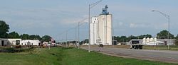 Waverly, seen from the northeast along U.S. Highway 6 | |
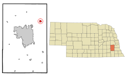 Location of Waverly, | |
| Coordinates: 40°54′52″N 96°31′44″W / 40.91444°N 96.52889°WCoordinates: 40°54′52″N 96°31′44″W / 40.91444°N 96.52889°W | |
| Country | United States |
| State | Nebraska |
| County | Lancaster |
| Area | |
| • Total | 2.38 sq mi (6.17 km2) |
| • Land | 2.38 sq mi (6.17 km2) |
| • Water | 0.00 sq mi (0.00 km2) |
| Elevation | 1,122 ft (342 m) |
| Population | |
| • Total | 3,277 |
| • Estimate (2019)[3] | 4,075 |
| • Density | 1,712.18/sq mi (660.95/km2) |
| Time zone | UTC-6 (Central (CST)) |
| • Summer (DST) | UTC-5 (CDT) |
| ZIP code | 68462 |
| Area code(s) | 402 |
| FIPS code | 31-51770 |
| GNIS feature ID | 0834510[4] |
| Website | www.citywaverly.com |

Waverly is a city in Lancaster County, Nebraska, United States. It is part of the Lincoln, Nebraska Metropolitan Statistical Area. The population was 3,227 at the 2010 census.
History[]
Waverly was platted in 1870 when the railroad was extended to that point.[5] It was named after Walter Scott's 1814 historical novel Waverley; several of the city's street names were taken from the novel as well.[6] Waverly was incorporated as a village in 1885.[7] From 1921 to 1966 Waverly consolidated its school district with several surrounding school districts, allowing for the school system in Waverly to grow.[7]
Geography[]
Waverly is located at 40°54′52″N 96°31′44″W / 40.91444°N 96.52889°W (40.914371, -96.528969).[8]
According to the United States Census Bureau, the city has a total area of 2.35 square miles (6.09 km2), all land.[9]
Demographics[]
| Historical population | |||
|---|---|---|---|
| Census | Pop. | %± | |
| 1880 | 132 | — | |
| 1890 | 490 | 271.2% | |
| 1900 | 266 | −45.7% | |
| 1910 | 297 | 11.7% | |
| 1920 | 334 | 12.5% | |
| 1930 | 315 | −5.7% | |
| 1940 | 306 | −2.9% | |
| 1950 | 310 | 1.3% | |
| 1960 | 511 | 64.8% | |
| 1970 | 1,152 | 125.4% | |
| 1980 | 1,726 | 49.8% | |
| 1990 | 1,869 | 8.3% | |
| 2000 | 2,448 | 31.0% | |
| 2010 | 3,277 | 33.9% | |
| 2019 (est.) | 4,075 | [3] | 24.4% |
| U.S. Decennial Census[10] 2013 Estimate[11] | |||
2010 census[]
As of the census[2] of 2010, there were 3,277 people, 1,113 households, and 903 families living in the city. The population density was 1,394.5 inhabitants per square mile (538.4/km2). There were 1,152 housing units at an average density of 490.2 per square mile (189.3/km2). The racial makeup of the city was 98.2% White, 0.2% African American, 0.2% Native American, 0.3% Asian, 0.4% from other races, and 0.9% from two or more races. Hispanic or Latino of any race were 1.4% of the population.
There were 1,113 households, of which 49.9% had children under the age of 18 living with them, 67.7% were married couples living together, 9.1% had a female householder with no husband present, 4.3% had a male householder with no wife present, and 18.9% were non-families. 16.0% of all households were made up of individuals, and 4.4% had someone living alone who was 65 years of age or older. The average household size was 2.90 and the average family size was 3.24.
The median age in the city was 32.8 years. 33.4% of residents were under the age of 18; 5.5% were between the ages of 18 and 24; 31.2% were from 25 to 44; 20.8% were from 45 to 64; and 9.2% were 65 years of age or older. The gender makeup of the city was 50.4% male and 49.6% female.
2000 census[]
As of the census of 2000, there were 2,448 people, 838 households, and 670 families living in the city. The population density was 2,621.9 people per square mile (1,016.3/km2). There were 860 housing units at an average density of 921.1 per square mile (357.0/km2). The racial makeup of the city was 98.00% White, 0.12% African American, 0.53% Native American, 0.29% Asian, 0.04% Pacific Islander, 0.16% from other races, and 0.86% from two or more races. Hispanic or Latino of any race were 0.82% of the population.
There were 838 households, out of which 47.7% had children under the age of 18 living with them, 67.9% were married couples living together, 8.9% had a female householder with no husband present, and 20.0% were non-families. 17.5% of all households were made up of individuals, and 7.4% had someone living alone who was 65 years of age or older. The average household size was 2.86 and the average family size was 3.26.
In the city, the population was spread out, with 32.6% under the age of 18, 7.2% from 18 to 24, 31.9% from 25 to 44, 19.2% from 45 to 64, and 9.2% who were 65 years of age or older. The median age was 32 years. For every 100 females, there were 94.0 males. For every 100 females age 18 and over, there were 91.1 males.
As of 2000 the median income for a household in the city was $52,454, and the median income for a family was $56,875. Males had a median income of $36,960 versus $25,938 for females. The per capita income for the city was $18,009. About 3.2% of families and 3.1% of the population were below the poverty line, including 2.4% of those under age 18 and 9.2% of those age 65 or over.
Education[]
District 145: Evelyn Hamlow Elementary School; pre-school-2nd grade: Waverly Intermediate School-{W.I.S}; 3rd-5th grade: Waverly Middle School; 6th-8th grade: Waverly High School; 9th-12th
References[]
- ^ "2019 U.S. Gazetteer Files". United States Census Bureau. Retrieved July 26, 2020.
- ^ a b "U.S. Census website". United States Census Bureau. Retrieved 2012-06-24.
- ^ a b "Population and Housing Unit Estimates". United States Census Bureau. May 24, 2020. Retrieved May 27, 2020.
- ^ "US Board on Geographic Names". United States Geological Survey. 2007-10-25. Retrieved 2008-01-31.
- ^ "Waverly, Lancaster County". Center for Advanced Land Management Information Technologies. University of Nebraska. Retrieved 19 August 2014.
- ^ Fitzpatrick, Lillian L. (1960). Nebraska Place-Names. University of Nebraska Press. p. 94. ISBN 0-8032-5060-6. A 1925 edition is available for download at University of Nebraska—Lincoln Digital Commons.
- ^ a b "Waverly Nebraska History – City of Waverly". www.citywaverly.com. Retrieved 2018-03-25.
- ^ "US Gazetteer files: 2010, 2000, and 1990". United States Census Bureau. 2011-02-12. Retrieved 2011-04-23.
- ^ "US Gazetteer files 2010". United States Census Bureau. Retrieved 2012-06-24.
- ^ United States Census Bureau. "Census of Population and Housing". Retrieved June 22, 2013.
- ^ "Population Estimates". United States Census Bureau. Retrieved 2014-07-16.
External links[]
Municipalities and communities of Lancaster County, Nebraska, United States | ||
|---|---|---|
| Cities | ||
| Villages | ||
| CDPs | ||
| Other communities | ||
| Footnotes | ‡This populated place also has portions in an adjacent county or counties | |
| ||
- Cities in Lancaster County, Nebraska
- Cities in Nebraska
- Lincoln, Nebraska metropolitan area
- Ukrainian communities in the United States