Wayne Township, Butler County, Ohio
Wayne Township, Butler County, Ohio | |
|---|---|
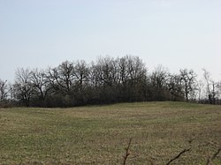 Prehistoric Mann Mound | |
 Location of Wayne Township in Butler County | |
| Coordinates: 39°30′26″N 84°32′36″W / 39.50722°N 84.54333°WCoordinates: 39°30′26″N 84°32′36″W / 39.50722°N 84.54333°W | |
| Country | United States |
| State | Ohio |
| County | Butler |
| Area | |
| • Total | 36.6 sq mi (94.9 km2) |
| • Land | 36.6 sq mi (94.8 km2) |
| • Water | 0.04 sq mi (0.1 km2) |
| Elevation | 850 ft (259 m) |
| Population (2010) | |
| • Total | 4,443 |
| • Density | 121/sq mi (46.9/km2) |
| Time zone | UTC-5 (Eastern (EST)) |
| • Summer (DST) | UTC-4 (EDT) |
| FIPS code | 39-82082[2] |
| GNIS feature ID | 1085823[1] |
| Website | waynetownship |

Wayne Township, one of thirteen townships in the county, is located in north-central Butler County, Ohio, United States between Trenton and Oxford. It had a total population of 4,443 at the 2010 census,[3] up from 4,252 in 2000. Exclusive of the two incorporated villages in the township, Jacksonburg and Seven Mile, Wayne Township had a population of 3,884 in 2010. It has an area of 36.6 square miles (94.9 km2),[3] comprising one whole survey township in the Congress Lands.
History[]
Wayne was the sixth township of the county, erected from St. Clair Township by the Butler County Commissioners on December 2, 1805, with these boundaries:
- Beginning at the southeast corner of the third township of the third west of the Miami; thence north with the eastern boundary line of said third range to the north boundary line of the county; thence west with said northern boundary line to the west bounard line of said third range; thence south with the said last-mentioned line to the southwest corner of the aforesaid third township in the third range aforesaid; thence to the place of beginning.
Name[]
Named for General Anthony Wayne, it is one of twenty Wayne Townships in Ohio.
Historic population figures[]
- 1900—1,343
- 1910—1,267
- 1920—1,226
- 1930—1,299
- 1940—1,402
- 1950—1,792
- 1960—2,348
- 1970—3,803
- 1980—3,676
- 1990—3,916
- 2000—4,252
- 2010—4,443
Geography[]
Located in the northern part of the county, it borders the following townships:
- Gratis Township, Preble County - north
- Madison Township - east
- St. Clair Township - south
- Hanover Township - southwest corner
- Milford Township - west
- Somers Township, Preble County - northwest corner
Two villages are located in Wayne Township: Jacksonburg in the northeast, and part of Seven Mile, in the south.
Government[]
The township is governed by a three-member board of trustees, who are elected in November of odd-numbered years to a four-year term beginning on the following January 1. Two are elected in the year after the presidential election and one is elected in the year before it. There is also an elected township fiscal officer,[4] who serves a four-year term beginning on April 1 of the year after the election, which is held in November of the year before the presidential election. Vacancies in the fiscal officership or on the board of trustees are filled by the remaining trustees.
Public services[]
The township is in the Edgewood Local School District.
The township is in the Trenton and Seven Mile telephone exchanges.
Major roads are U.S. Route 127 (the principal road between Hamilton and Eaton), and State Routes 73 (the principal road between Oxford and Middletown), 122, 503, and 744.
References[]
- ^ Jump up to: a b "US Board on Geographic Names". United States Geological Survey. 2007-10-25. Retrieved 2008-01-31.
- ^ "U.S. Census website". United States Census Bureau. Retrieved 2008-01-31.
- ^ Jump up to: a b "Geographic Identifiers: 2010 Demographic Profile Data (G001): Wayne township, Butler County, Ohio". U.S. Census Bureau, American Factfinder. Archived from the original on February 12, 2020. Retrieved February 21, 2014.
- ^ §503.24, §505.01, and §507.01 of the Ohio Revised Code. Accessed 4/30/2009.
- Bert S. Barlow, W.H. Todhunter, Stephen D. Cone, Joseph J. Pater, and Frederick Schneider, eds. Centennial History of Butler County, Ohio. Hamilton, Ohio: B.F. Bowen, 1905.
- Jim Blount. The 1900s: 100 Years In the History of Butler County, Ohio. Hamilton, Ohio: Past Present Press, 2000.
- Butler County Engineer's Office. Butler County Official Transportation Map, 2003. Fairfield Township, Butler County, Ohio: The Office, 2003.
- A History and Biographical Cyclopaedia of Butler County, Ohio with Illustrations and Sketches of Its Representative Men and Pioneers. Cincinnati, Ohio: Western Biographical Publishing Company, 1882. [1]
- Ohio. Secretary of State. The Ohio municipal and township roster, 2002-2003. Columbus, Ohio: The Secretary, 2003.
External links[]
| show Municipalities and communities of Butler County, Ohio, United States |
|---|

| show Authority control |
|---|
- Townships in Butler County, Ohio
- Townships in Ohio
- 1805 establishments in Ohio
- Populated places established in 1805