Weststellingwerf
Weststellingwerf
Weststellingwarf (Stellingwerfs) | |
|---|---|
Municipality | |
 Weststellingwerf city hall | |
 Flag  Coat of arms | |
 Location in Friesland | |
| Coordinates: 52°53′N 6°0′E / 52.883°N 6.000°ECoordinates: 52°53′N 6°0′E / 52.883°N 6.000°E | |
| Country | Netherlands |
| Province | Friesland |
| Government | |
| • Body | Municipal council |
| • Mayor | (PvdA) |
| Area | |
| • Total | 228.45 km2 (88.21 sq mi) |
| • Land | 220.30 km2 (85.06 sq mi) |
| • Water | 8.15 km2 (3.15 sq mi) |
| Elevation | 2 m (7 ft) |
| Population (January 2019)[4] | |
| • Total | 25,840 |
| • Density | 117/km2 (300/sq mi) |
| Time zone | UTC+1 (CET) |
| • Summer (DST) | UTC+2 (CEST) |
| Postcode | 8388–8398, 8470–8489 |
| Area code | 0527, 0561 |
| Website | www |

Weststellingwerf (Dutch: [ˈʋɛststɛlɪŋˌʋɛrf] (![]() listen); Stellingwarfs: Weststellingwarf or Stellingwarf-Westaende) is a municipality in the province of Friesland in the northern Netherlands.
It is one of the municipalities of Friesland, where the spoken language is not West Frisian; instead, Stellingwerfs, a dialect of Dutch Low Saxon, is spoken here.
listen); Stellingwarfs: Weststellingwarf or Stellingwarf-Westaende) is a municipality in the province of Friesland in the northern Netherlands.
It is one of the municipalities of Friesland, where the spoken language is not West Frisian; instead, Stellingwerfs, a dialect of Dutch Low Saxon, is spoken here.
Population centres[]
A small part of the village Willemsoord lays within Weststellingwerf and is also mainly named as a village, but stated by municipality as a hamlet.
The other hamlets are: , , , , , , (partially) and (partially)
Topography[]

Dutch Topographic map of the municipality of Weststellingwerf, 2013.
Wolvega[]

Wolvega is the capital city of Weststellingwerf.
Transportation[]
Railway Station: Wolvega
Notable people[]

- Peter Stuyvesant (1592–1672) last governor of New Amsterdam[5]
- Johan Eilerts de Haan (1865-1910) Dutch explorer and soldier
- Johan van Minnen (1932–2016) journalist and politician.
- Johan Veenstra (born 1946) an author, poet and columnist
- Sijtje van der Lende (born 1950) former speed skater, competed at the 1976 and 1980 Winter Olympics
- Gerard van Klaveren (born 1951) politician, Mayor of Weststellingwerf 2005-2017
- Monique Knol (born 1964) former racing cyclist, won gold and bronze medals in two consecutive Summer Olympics
Gallery[]
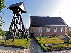
Kerk Boijl

Molen Windlust in Noordwolde

Keersluis in de Linde

Noardwâlde, PKN-tsjerke


References[]
- ^ "Burgemeester G. van Klaveren" [Burgemeester G. van Klaveren] (in Dutch). Gemeente Weststellingwerf. Archived from the original on 6 October 2013. Retrieved 5 October 2013.
- ^ "Kerncijfers wijken en buurten 2020" [Key figures for neighbourhoods 2020]. StatLine (in Dutch). CBS. 24 July 2020. Retrieved 19 September 2020.
- ^ "Postcodetool for 8471KR". Actueel Hoogtebestand Nederland (in Dutch). Het Waterschapshuis. Retrieved 5 October 2013.
- ^ "Bevolkingsontwikkeling; regio per maand" [Population growth; regions per month]. CBS Statline (in Dutch). CBS. 1 January 2019. Retrieved 1 January 2019.
- ^ . Encyclopædia Britannica. 25 (11th ed.). 1911.
External links[]
 Media related to Weststellingwerf at Wikimedia Commons
- Official website
- News and events,Weststellingwerf (Dutch website)
| show Places adjacent to Weststellingwerf |
|---|

- Weststellingwerf
- Municipalities of Friesland