Whinney Banks
The neutrality of this article is disputed. (October 2012) |
This article does not cite any sources. (May 2014) |
| Whinney Banks | |
|---|---|
| Housing estate | |
 St Francis of Assisi Church | |
 Whinney Banks Location within North Yorkshire | |
| OS grid reference | NZ476181 |
| Unitary authority |
|
| Ceremonial county | |
| Region | |
| Country | England |
| Sovereign state | United Kingdom |
| Post town | MIDDLESBROUGH |
| Postcode district | TS5 |
| Police | Cleveland |
| Fire | Cleveland |
| Ambulance | North East |

Whinney Banks, also less commonly known as Acklam Green, is a neighbourhood in west Middlesbrough, England. The area is on the Old River Tees's southern banks, the river's main flow was redirected with the Mandale Cut, the A19 is between the river and the neighbourhood. It is within the TS5 postcode area and a part of the Ayresome ward, along with West Lane.
History[]
Whinney Banks was originally of around 550 houses, built in the 1930s and 1940s, forming part of a wider expanse of social housing in west Middlesbrough. The area became unpopular, by the late 1990s over a third of the properties were void. In 1999 the area became part of the New Deal for Communities area, becoming a project for housing renewal. Work then started on acquiring and demolishing 412 houses in preparation for redevelopment.
In 2004, Bellway Homes was appointed to lead the £50 million redevelopment of the site. This involved the construction of 454 new houses. The development used the name of Acklam Green, being off Acklam Road.
Gallery[]

Whinney Banks Pond
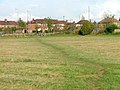
North part of Whinney Banks


References[]
Places adjacent to Whinney Banks | ||||||||||||||||
|---|---|---|---|---|---|---|---|---|---|---|---|---|---|---|---|---|
| ||||||||||||||||
This Middlesbrough location article is a stub. You can help Wikipedia by . |
- Areas within Middlesbrough
- North Yorkshire geography stubs