White River, South Dakota
White River, South Dakota
Makhízita Wakpá | |
|---|---|
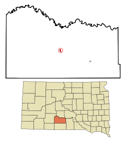 Location in Mellette County and the state of South Dakota | |
| Coordinates: 43°34′10″N 100°44′46″W / 43.56944°N 100.74611°WCoordinates: 43°34′10″N 100°44′46″W / 43.56944°N 100.74611°W | |
| Country | United States |
| State | South Dakota |
| County | Mellette |
| Incorporated | 1912[1] |
| Area | |
| • Total | 0.52 sq mi (1.35 km2) |
| • Land | 0.52 sq mi (1.35 km2) |
| • Water | 0.00 sq mi (0.00 km2) |
| Elevation | 2,136 ft (651 m) |
| Population | |
| • Total | 581 |
| • Estimate (2019)[3] | 574 |
| • Density | 1,101.73/sq mi (425.51/km2) |
| Time zone | UTC-6 (Central (CST)) |
| • Summer (DST) | UTC-5 (CDT) |
| ZIP code | 57579 |
| Area code(s) | 605 |
| FIPS code | 46-71340[5] |
| GNIS feature ID | 1266934[6] |

White River (Lakota: Makhízita wakpá;[7] "White Dirt River") is a city in and the county seat of Mellette County.[8] South Dakota, United States. The population was 581 at the 2010 census.
History[]
White River was founded as the seat of the newly formed Mellette County in 1911.[9] The town was named after the White River.[10]
Geography[]
White River is located at 43°34′10″N 100°44′46″W / 43.56944°N 100.74611°W (43.569438, -100.746161).[11]
According to the United States Census Bureau, the city has a total area of 0.52 square miles (1.35 km2), all land.[12]
Demographics[]
| Historical population | |||
|---|---|---|---|
| Census | Pop. | %± | |
| 1920 | 417 | — | |
| 1930 | 471 | 12.9% | |
| 1940 | 562 | 19.3% | |
| 1950 | 465 | −17.3% | |
| 1960 | 583 | 25.4% | |
| 1970 | 617 | 5.8% | |
| 1980 | 561 | −9.1% | |
| 1990 | 595 | 6.1% | |
| 2000 | 598 | 0.5% | |
| 2010 | 581 | −2.8% | |
| 2019 (est.) | 574 | [3] | −1.2% |
| U.S. Decennial Census[13] | |||
2010 census[]
As of the census[4] of 2010, there were 581 people, 211 households, and 135 families residing in the city. The population density was 1,117.3 inhabitants per square mile (431.4/km2). There were 245 housing units at an average density of 471.2 per square mile (181.9/km2). The racial makeup of the city was 48.9% White, 0.3% African American, 40.6% Native American, 0.3% Asian, 0.9% from other races, and 9.0% from two or more races. Hispanic or Latino of any race were 2.1% of the population.
There were 211 households, of which 39.8% had children under the age of 18 living with them, 38.4% were married couples living together, 17.1% had a female householder with no husband present, 8.5% had a male householder with no wife present, and 36.0% were non-families. 28.9% of all households were made up of individuals, and 10.4% had someone living alone who was 65 years of age or older. The average household size was 2.52 and the average family size was 3.01.
The median age in the city was 39.4 years. 28.9% of residents were under the age of 18; 7.9% were between the ages of 18 and 24; 20.3% were from 25 to 44; 24.6% were from 45 to 64; and 18.2% were 65 years of age or older. The gender makeup of the city was 46.8% male and 53.2% female.
2000 census[]
As of the census[5] of 2000, there were 598 people, 219 households, and 141 families residing in the city. The population density was 1,169.7 people per square mile (452.7/km2). There were 252 housing units at an average density of 492.9 per square mile (190.8/km2). The racial makeup of the city was 51.84% White, 43.48% Native American, 0.17% Asian, and 4.52% from two or more races. Hispanic or Latino of any race were 1.00% of the population.
There were 219 households, out of which 35.2% had children under the age of 18 living with them, 40.6% were married couples living together, 17.8% had a female householder with no husband present, and 35.2% were non-families. 30.1% of all households were made up of individuals, and 12.3% had someone living alone who was 65 years of age or older. The average household size was 2.53 and the average family size was 3.12.
In the city, the population was spread out, with 29.4% under the age of 18, 8.5% from 18 to 24, 23.1% from 25 to 44, 20.9% from 45 to 64, and 18.1% who were 65 years of age or older. The median age was 36 years. For every 100 females, there were 93.5 males. For every 100 females age 18 and over, there were 87.6 males.
The median income for a household in the city was $25,500, and the median income for a family was $34,531. Males had a median income of $26,250 versus $15,536 for females. The per capita income for the city was $12,794. About 23.5% of families and 25.1% of the population were below the poverty line, including 29.2% of those under age 18 and 30.5% of those age 65 or over.
Frontier Days[]
Started in 1912 in White River as a community celebration, Frontier Days[14] continues today as a yearly event and attracts people from around the world. Frontier Days will be held August 20-22, 2021, celebrating 110 years of thrilling rodeo action. The rodeo features all of the major events and includes a Ranch Bronc Ride. Also incorporated into the celebration are a parade, rodeo and a traditional Lakota Wacipi.
See also[]
References[]
- ^ "SD Towns" (PDF). South Dakota State Historical Society. Retrieved 2010-02-17.
- ^ "2019 U.S. Gazetteer Files". United States Census Bureau. Retrieved July 30, 2020.
- ^ Jump up to: a b "Population and Housing Unit Estimates". United States Census Bureau. May 24, 2020. Retrieved May 27, 2020.
- ^ Jump up to: a b "U.S. Census website". United States Census Bureau. Retrieved 2012-06-21.
- ^ Jump up to: a b "U.S. Census website". United States Census Bureau. Retrieved 2008-01-31.
- ^ U.S. Geological Survey Geographic Names Information System: White River
- ^ Ullrich, Jan F. (2014). New Lakota Dictionary (2nd ed.). Bloomington, IN: Lakota Language Consortium. ISBN 978-0-9761082-9-0.
- ^ "Find a County". National Association of Counties. Retrieved 2011-06-07.
- ^ Hellmann, Paul T. (May 13, 2013). Historical Gazetteer of the United States. Routledge. ISBN 978-1135948597. Retrieved 30 November 2013.
- ^ Federal Writers' Project (1940). South Dakota place-names, v.1-3. University of South Dakota. p. 68.
- ^ "US Gazetteer files: 2010, 2000, and 1990". United States Census Bureau. 2011-02-12. Retrieved 2011-04-23.
- ^ "US Gazetteer files 2010". United States Census Bureau. Archived from the original on 2012-01-25. Retrieved 2012-06-21.
- ^ United States Census Bureau. "Census of Population and Housing". Retrieved June 13, 2016.
- ^ About White River Frontier Days. Otterman Post 94.
External links[]
![]() Media related to White River, South Dakota at Wikimedia Commons
Media related to White River, South Dakota at Wikimedia Commons
| show Municipalities and communities of Mellette County, South Dakota, United States |
|---|

| show Authority control |
|---|
- Cities in Mellette County, South Dakota
- Cities in South Dakota
- County seats in South Dakota