Miller, South Dakota
City of Miller, South Dakota | |
|---|---|
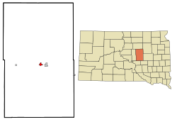 Location in Hand County and the state of South Dakota | |
| Coordinates: 44°31′12″N 98°59′11″W / 44.52000°N 98.98639°WCoordinates: 44°31′12″N 98°59′11″W / 44.52000°N 98.98639°W | |
| Country | United States |
| State | South Dakota |
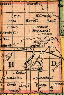
| County | Hand |
| Incorporated | 1905[1] |
| Government | |
| • Mayor | Ronald Blachford |
| Area | |
| • Total | 0.99 sq mi (2.57 km2) |
| • Land | 0.99 sq mi (2.56 km2) |
| • Water | 0.00 sq mi (0.00 km2) |
| Elevation | 1,578 ft (481 m) |
| Population | |
| • Total | 1,489 |
| • Estimate (2019)[4] | 1,334 |
| • Density | 1,347.47/sq mi (520.18/km2) |
| Time zone | UTC-6 (Central) |
| • Summer (DST) | UTC-5 (Central Daylight Time) |
| Zip Code | 57362 |
| Area code(s) | 605 |
| FIPS code | 46-42460 |
| GNIS feature ID | 1256470[5] |
| Website | www |

Miller is a city in and county seat of Hand County, South Dakota, United States.[6] The population was 1,489 at the 2010 census.
History[]
The city was named for its founder, .[7] The post office has been in operation since 1881.[8]
Geography[]
According to the United States Census Bureau, the city has a total area of 0.98 square miles (2.54 km2), all land.[9]
Miller has been assigned the ZIP code 57362.
Climate[]
| Climate data for Miller, South Dakota (1991−2020 normals, extremes 1902−present) | |||||||||||||
|---|---|---|---|---|---|---|---|---|---|---|---|---|---|
| Month | Jan | Feb | Mar | Apr | May | Jun | Jul | Aug | Sep | Oct | Nov | Dec | Year |
| Record high °F (°C) | 65 (18) |
70 (21) |
90 (32) |
98 (37) |
107 (42) |
112 (44) |
113 (45) |
112 (44) |
110 (43) |
97 (36) |
82 (28) |
70 (21) |
113 (45) |
| Average high °F (°C) | 26.2 (−3.2) |
30.6 (−0.8) |
42.6 (5.9) |
56.3 (13.5) |
68.2 (20.1) |
78.2 (25.7) |
84.8 (29.3) |
82.6 (28.1) |
74.4 (23.6) |
58.9 (14.9) |
43.5 (6.4) |
30.4 (−0.9) |
56.4 (13.6) |
| Daily mean °F (°C) | 16.6 (−8.6) |
20.3 (−6.5) |
31.7 (−0.2) |
44.1 (6.7) |
56.4 (13.6) |
66.9 (19.4) |
72.7 (22.6) |
70.3 (21.3) |
61.7 (16.5) |
47.2 (8.4) |
32.9 (0.5) |
21.2 (−6.0) |
45.2 (7.3) |
| Average low °F (°C) | 7.0 (−13.9) |
9.9 (−12.3) |
20.7 (−6.3) |
31.9 (−0.1) |
44.7 (7.1) |
55.6 (13.1) |
60.7 (15.9) |
58.1 (14.5) |
49.1 (9.5) |
35.4 (1.9) |
22.3 (−5.4) |
12.1 (−11.1) |
34.0 (1.1) |
| Record low °F (°C) | −48 (−44) |
−43 (−42) |
−27 (−33) |
0 (−18) |
15 (−9) |
30 (−1) |
35 (2) |
32 (0) |
18 (−8) |
−10 (−23) |
−22 (−30) |
−38 (−39) |
−48 (−44) |
| Average precipitation inches (mm) | 0.42 (11) |
0.77 (20) |
0.91 (23) |
2.21 (56) |
3.51 (89) |
3.86 (98) |
3.01 (76) |
2.46 (62) |
1.95 (50) |
2.02 (51) |
0.61 (15) |
0.59 (15) |
22.32 (567) |
| Average snowfall inches (cm) | 7.0 (18) |
10.7 (27) |
6.8 (17) |
5.1 (13) |
0.0 (0.0) |
0.0 (0.0) |
0.0 (0.0) |
0.0 (0.0) |
0.0 (0.0) |
1.1 (2.8) |
4.3 (11) |
8.7 (22) |
43.7 (111) |
| Average precipitation days (≥ 0.01 in) | 4.0 | 4.7 | 4.8 | 7.5 | 10.3 | 10.1 | 7.9 | 7.4 | 5.9 | 6.0 | 3.2 | 4.3 | 76.1 |
| Average snowy days (≥ 0.1 in) | 3.3 | 3.7 | 2.5 | 1.6 | 0.0 | 0.0 | 0.0 | 0.0 | 0.0 | 0.5 | 1.8 | 3.4 | 16.8 |
| Source: NOAA[10][11] | |||||||||||||
Demographics[]
| Historical population | |||
|---|---|---|---|
| Census | Pop. | %± | |
| 1890 | 536 | — | |
| 1900 | 544 | 1.5% | |
| 1910 | 1,202 | 121.0% | |
| 1920 | 1,478 | 23.0% | |
| 1930 | 1,447 | −2.1% | |
| 1940 | 1,460 | 0.9% | |
| 1950 | 1,916 | 31.2% | |
| 1960 | 2,081 | 8.6% | |
| 1970 | 2,148 | 3.2% | |
| 1980 | 1,931 | −10.1% | |
| 1990 | 1,678 | −13.1% | |
| 2000 | 1,530 | −8.8% | |
| 2010 | 1,489 | −2.7% | |
| 2019 (est.) | 1,334 | [4] | −10.4% |
| U.S. Decennial Census[12] | |||
2010 census[]
As of the census[3] of 2010, there were 1,489 people, 724 households, and 396 families living in the city. The population density was 1,519.4 inhabitants per square mile (586.6/km2). There were 839 housing units at an average density of 856.1 per square mile (330.5/km2). The racial makeup of the city was 97.8% White, 0.2% African American, 0.5% Native American, 0.1% Asian, 0.3% from other races, and 1.1% from two or more races. Hispanic or Latino of any race were 0.6% of the population.
There were 724 households, of which 20.3% had children under the age of 18 living with them, 46.1% were married couples living together, 7.5% had a female householder with no husband present, 1.1% had a male householder with no wife present, and 45.3% were non-families. 43.2% of all households were made up of individuals, and 25.4% had someone living alone who was 65 years of age or older. The average household size was 1.97 and the average family size was 2.70.
The median age in the city was 51.2 years. 18.9% of residents were under the age of 18; 4.6% were between the ages of 18 and 24; 17.8% were from 25 to 44; 25.5% were from 45 to 64; and 33.2% were 65 years of age or older. The gender makeup of the city was 45.9% male and 54.1% female.
2000 census[]
As of the census of 2000, there were 1,530 people, 720 households, and 406 families living in the city. The population density was 1,614.1 people per square mile (621.8/km2). There were 845 housing units at an average density of 891.4 per square mile (343.4/km2). The racial makeup of the city was 99.15% White, 0.07% African American, 0.13% Native American, 0.07% Asian, 0.20% from other races, and 0.39% from two or more races. Hispanic or Latino of any race were 0.26% of the population.
There were 720 households, out of which 21.4% had children under the age of 18 living with them, 48.6% were married couples living together, 6.1% had a female householder with no husband present, and 43.5% were non-families. 41.9% of all households were made up of individuals, and 26.4% had someone living alone who was 65 years of age or older. The average household size was 2.03 and the average family size was 2.77.
In the city, the population was spread out, with 19.1% under the age of 18, 4.4% from 18 to 24, 21.1% from 25 to 44, 22.1% from 45 to 64, and 33.3% who were 65 years of age or older. The median age was 49 years. For every 100 females, there were 83.7 males. For every 100 females age 18 and over, there were 78.9 males.
As of 2000 the median income for a household in the city was $28,929, and the median income for a family was $39,293. Males had a median income of $25,962 versus $17,216 for females. The per capita income for the city was $18,401. About 4.2% of families and 9.5% of the population were below the poverty line, including 8.2% of those under age 18 and 12.2% of those age 65 or over.
Notable people[]
- Harlan J. Bushfield, U.S. Senator and Governor of South Dakota
- Vera C. Bushfield, interim U.S. Senator, wife of Harlan Bushfield
- Neil Fulton, Dean of University of South Dakota School of Law
- Dale Hargens, member of the South Dakota House of Representatives
- John B. Heilman, member of the South Dakota House of Representatives
- Frank Henderson, justice of the South Dakota Supreme Court
- James Jones, member of the South Dakota House of Representatives
- John L. Pyle, Attorney General of South Dakota
Popular culture[]
Miller was the focal point of a 2002 episode of “This American Life” discussing a racial incident that occurred in the town.[13]
See also[]
References[]
- ^ "SD Towns" (PDF). South Dakota State Historical Society. Archived from the original (PDF) on 2010-02-10. Retrieved 2010-02-14.
- ^ "2019 U.S. Gazetteer Files". United States Census Bureau. Retrieved July 30, 2020.
- ^ a b "U.S. Census website". United States Census Bureau. Retrieved 2012-06-21.
- ^ a b "Population and Housing Unit Estimates". United States Census Bureau. May 24, 2020. Retrieved May 27, 2020.
- ^ "US Board on Geographic Names". United States Geological Survey. 2007-10-25. Retrieved 2008-01-31.
- ^ "Find a County". National Association of Counties. Retrieved 2011-06-07.
- ^ Chicago and North Western Railway Company (1908). A History of the Origin of the Place Names Connected with the Chicago & North Western and Chicago, St. Paul, Minneapolis & Omaha Railways. p. 102.
- ^ "Hand County". Jim Forte Postal History. Retrieved 22 March 2015.
- ^ "US Gazetteer files 2010". United States Census Bureau. Archived from the original on 2012-07-02. Retrieved 2012-06-21.
- ^ "NowData - NOAA Online Weather Data". National Oceanic and Atmospheric Administration. Retrieved October 13, 2021.
- ^ "Station: Miller, SD". U.S. Climate Normals 2020: U.S. Monthly Climate Normals (1991-2020). National Oceanic and Atmospheric Administration. Retrieved October 13, 2021.
- ^ United States Census Bureau. "Census of Population and Housing". Retrieved July 15, 2014.
- ^ "High Speed Chase - This American Life". thisamericanlife.org. 16 August 2002. Retrieved 18 April 2018.
External links[]
| Wikimedia Commons has media related to Miller, South Dakota. |
Municipalities and communities of Hand County, South Dakota, United States | ||
|---|---|---|
| Cities |  | |
| Towns | ||
| Townships | ||
| CDP | ||
| Other community | ||
| Footnotes | ‡This populated place also has portions in an adjacent county or counties | |
| ||
- Cities in South Dakota
- Cities in Hand County, South Dakota
- County seats in South Dakota