Yellepit, Washington
Yellepit, Washington | |
|---|---|
Former unincorporated community | |
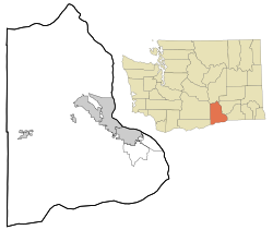 Yellepit, Washington Location of Yellepit, Washington | |
| Coordinates: 46°03′39″N 118°57′05″W / 46.0609672°N 118.9513912°WCoordinates: 46°03′39″N 118°57′05″W / 46.0609672°N 118.9513912°W[1] | |
| Country | United States |
| State | Washington |
| County | Benton |
| Elevation | 341 ft (104 m) |
| Time zone | UTC-8 (Pacific (PST)) |
| • Summer (DST) | UTC-7 (PDT) |
| ZIP code | 99337 |
| Area code(s) | 509 |
| GNIS feature ID | 1511443[2] |

Yellepit was an unincorporated community in Benton County, Washington, United States, located approximately three miles southwest of Wallula on the west bank of the Columbia River.
History[]
The community was named Yellepit in honor of a chief of the Walla Walla tribe who was encountered by the Lewis and Clark Expedition.[4] The community once had a large train depot, water tank and other buildings. In 1953 the community site was inundated by the waters of Lake Wallula.[5]
References[]
- ^ "Yellepit". Geographic Names Information System. United States Geological Survey. Retrieved 2012-10-28.
- ^ a b "US Board on Geographic Names". United States Geological Survey. 2007-10-25. Retrieved 2008-01-31.
- ^ "U.S. Census website". United States Census Bureau. Retrieved 2008-01-31.
- ^ "Station Roster Master List: Yellepit". Northern Pacific Railway Historical Association. Retrieved October 30, 2012.
- ^ "Washington Place Names database". Tacoma Public Library. Retrieved October 30, 2012.
External links[]
Municipalities and communities of Benton County, Washington, United States | ||
|---|---|---|
| Cities |  | |
| CDPs | ||
| Unincorporated communities | ||
| Ghost towns | ||
| ||

This Benton County, Washington state location article is a stub. You can help Wikipedia by . |
Categories:
- Unincorporated communities in Benton County, Washington
- Northern Pacific Railway
- Unincorporated communities in Washington (state)
- Central Washington geography stubs