Yuma County, Arizona
Yuma County | |
|---|---|
U.S. county | |
 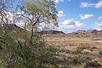 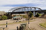   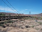 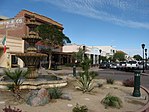 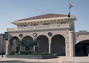 Clockwise from top: Old Yuma City Hall, Ocean to Ocean Bridge, Kofa Mountains, Downtown Yuma, Yuma County administration building, McPhaul Suspension Bridge, Yuma County Courthouse and the Sonoran Desert near Yuma. | |
 Flag  Seal | |
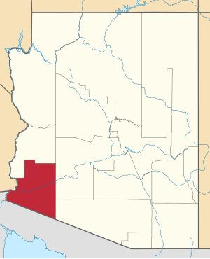 Location within the U.S. state of Arizona | |
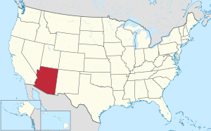 Arizona's location within the U.S. | |
| Coordinates: 32°47′13″N 113°58′58″W / 32.786944444444°N 113.98277777778°W | |
| Country | |
| State | |
| Founded | November 9, 1864 |
| Seat | Yuma |
| Largest city | Yuma |
| Area | |
| • Total | 5,519 sq mi (14,290 km2) |
| • Land | 5,514 sq mi (14,280 km2) |
| • Water | 5.1 sq mi (13 km2) 0.09%% |
| Population (2010) | |
| • Total | 195,751 |
| • Estimate (2019) | 213,787 |
| • Density | 35/sq mi (14/km2) |
| Time zone | UTC−7 (Mountain) |
| Congressional districts | 3rd, 4th |
| Website | www |

Yuma County is a county in the southwestern corner of the U.S. state of Arizona. As of the 2010 census, its population was 195,751.[1] The county seat is Yuma.[2]
Yuma County includes the Yuma, Arizona Metropolitan Statistical Area.
The county borders three states: Sonora, Mexico, to the south, and two other states to the west, across the Colorado River: California of the United States and the Mexican state of Baja California.
History[]
Long settled by Native Americans of indigenous cultures for thousands of years, this area was controlled by the Spanish Empire in the colonial era. In the 19th century, it was part of independent Mexico before the Mexican–American War and Gadsden Purchase.
Yuma County was one of four original Arizona counties created by the 1st Arizona Territorial Legislature.[citation needed] The county territory was defined as being west of longitude 113° 20' and south of the Bill Williams River.[3] Its original boundaries remained the same until 1982, when La Paz County was created from its northern half.
The original county seat was the city of La Paz; in 1871 it was moved to Arizona City, later renamed as Yuma in 1873.[4]
Economy[]
Agriculture is a $3 billion business annually, employing tens of thousands of workers but at minimum wages.[citation needed] During the winter agricultural season from November to March, some 40,000 Mexican workers cross the border daily to work in United States fields.[5] The area is watered by the Colorado River, and the sector supplies a large part of the US leafy vegetables.[6][7] The Yuma Lettuce Days festival and agritourism is connected to Yuma agriculture.
Leaders in the county are aware their economy is tied to that of Mexican states on the other side of the border; both have to be considered. "There are automotive plants in Ciudad Juárez, across from El Paso; aerospace plants in Mexicali, southwest of Yuma; and medical devices’ manufacturers in Tijuana, near San Diego. On the American side, there is a mix of retail stores, warehouses and trucking companies..."[5]
Because of Yuma County's location along the U.S.-Mexico border, large numbers of aliens entering the United States illegally pass through Yuma County. From October 2004 to July 2005, some 124,400 undocumented foreign nationals were apprehended in the area, a 46% increase over the previous year.[8] In 2015, however, only 6,000 people were apprehended, as the border was fortified and augmented.[citation needed] The number of undocumented immigrants also declined with slumps in the US economy.[5]
Government[]
The Board of Supervisors is the governing body of the county and a number of special districts. The board has members from five districts.[9] The Board adopts ordinances, establishes programs, levies taxes, appropriates funds, appoints certain officials, and zones property and regulates development in the unincorporated area. In addition, members of the Board represent the County on numerous intergovernmental agencies.[10]
In 2016 county voters elected more Democrats to the Board than Republicans, for the first time since 2004.[11] In Arizona's first 52 years as a state, Yuma County was a primarily Democratic county, only voting for Republicans four times in presidential elections prior to 1968. From 1968 on, it has consistently voted for Republican presidential candidates. However, their margins of victory have been reduced in recent years as the county has rapidly grown in population & become majority-Hispanic. Donald Trump only won the county by 560 votes over Hillary Clinton in the presidential election of 2016.
Geography[]
According to the U.S. Census Bureau, the county has an area of 5,519 square miles (14,290 km2), of which 5,514 square miles (14,280 km2) is land and 5.1 square miles (13 km2) (0.09%) is water.[13] The lowest point in the state of Arizona is on the Colorado River in San Luis in Yuma County, where it flows out of Arizona and into Sonora in Mexico.
Yuma County is in the west, and northwestern regions of the north–south Sonoran Desert that extends through Sonora state of Mexico to the border of northern Sinaloa state. West of the county across the Colorado River in southeast California is the Colorado Desert, (a northwestern subregion of the Sonoran Desert). North of the county, with La Paz County the regions merge into the southeastern Mojave Desert. Southwest of Yuma County, is the entirety of Northwest Mexico, at the north shoreline of the Gulf of California, and the outlet of the Colorado River into the Colorado River Delta region, now altered with lack of freshwater inputs. Notable mountains in Yuma County include the Gila Mountains and the Tule Mountains.
Adjacent counties and municipalities[]
- La Paz County - north
- Maricopa County - northeast
- Pima County - east
- Baja California, Mexico - southwest
- Sonora, Mexico - southeast
- Imperial County, California - west
Major highways[]
 Interstate 8
 Historic U.S. Route 80
 U.S. Route 95
 Arizona State Route 195
 State Route 280
National protected areas[]
- Cabeza Prieta National Wildlife Refuge (part)
- Imperial National Wildlife Refuge (part)
- Kofa National Wildlife Refuge (part)
Climate[]
| hideClimate data for Yuma, Arizona (1981–2010 normals,[b] extremes 1876–present) | |||||||||||||
|---|---|---|---|---|---|---|---|---|---|---|---|---|---|
| Month | Jan | Feb | Mar | Apr | May | Jun | Jul | Aug | Sep | Oct | Nov | Dec | Year |
| Record high °F (°C) | 88 (31) |
97 (36) |
102 (39) |
107 (42) |
120 (49) |
122 (50) |
124 (51) |
120 (49) |
123 (51) |
112 (44) |
98 (37) |
86 (30) |
124 (51) |
| Mean maximum °F (°C) | 79.4 (26.3) |
85.0 (29.4) |
92.9 (33.8) |
100.0 (37.8) |
106.8 (41.6) |
112.6 (44.8) |
114.7 (45.9) |
114.3 (45.7) |
110.8 (43.8) |
102.1 (38.9) |
89.1 (31.7) |
77.8 (25.4) |
116.2 (46.8) |
| Average high °F (°C) | 69.6 (20.9) |
73.8 (23.2) |
79.9 (26.6) |
86.4 (30.2) |
95.3 (35.2) |
103.5 (39.7) |
106.8 (41.6) |
106.2 (41.2) |
101.3 (38.5) |
89.9 (32.2) |
77.5 (25.3) |
68.3 (20.2) |
88.3 (31.3) |
| Average low °F (°C) | 47.6 (8.7) |
50.1 (10.1) |
54.4 (12.4) |
59.6 (15.3) |
67.3 (19.6) |
74.6 (23.7) |
82.1 (27.8) |
82.3 (27.9) |
76.8 (24.9) |
65.0 (18.3) |
53.9 (12.2) |
46.6 (8.1) |
63.4 (17.4) |
| Mean minimum °F (°C) | 37.3 (2.9) |
39.7 (4.3) |
43.9 (6.6) |
49.1 (9.5) |
56.4 (13.6) |
64.3 (17.9) |
74.1 (23.4) |
73.6 (23.1) |
65.3 (18.5) |
54.2 (12.3) |
43.1 (6.2) |
36.4 (2.4) |
34.6 (1.4) |
| Record low °F (°C) | 22 (−6) |
25 (−4) |
31 (−1) |
38 (3) |
39 (4) |
50 (10) |
61 (16) |
58 (14) |
50 (10) |
35 (2) |
29 (−2) |
22 (−6) |
22 (−6) |
| Average precipitation inches (mm) | 0.37 (9.4) |
0.39 (9.9) |
0.33 (8.4) |
0.15 (3.8) |
0.08 (2.0) |
0.01 (0.25) |
0.29 (7.4) |
0.47 (12) |
0.53 (13) |
0.21 (5.3) |
0.22 (5.6) |
0.51 (13) |
3.56 (90) |
| Average precipitation days (≥ 0.01 in) | 2.6 | 2.2 | 1.9 | 0.7 | 0.4 | 0.2 | 1.0 | 2.4 | 1.4 | 1.1 | 1.2 | 2.3 | 17.4 |
| Mean monthly sunshine hours | 268.4 | 270.8 | 335.5 | 365.5 | 407.4 | 415.4 | 392.6 | 375.6 | 341.7 | 319.6 | 270.1 | 252.7 | 4,015.3 |
| Percent possible sunshine | 84 | 88 | 90 | 94 | 95 | 97 | 90 | 91 | 92 | 91 | 86 | 81 | 90 |
| Average ultraviolet index | 3 | 5 | 7 | 8 | 10 | 10 | 11 | 10 | 9 | 6 | 4 | 3 | 7 |
| Source 1: NOAA[14][15][16] | |||||||||||||
| Source 2: Weather Atlas [17] | |||||||||||||
Demographics[]
| Historical population | |||
|---|---|---|---|
| Census | Pop. | %± | |
| 1870 | 1,621 | — | |
| 1880 | 3,215 | 98.3% | |
| 1890 | 2,671 | −16.9% | |
| 1900 | 4,145 | 55.2% | |
| 1910 | 7,733 | 86.6% | |
| 1920 | 14,904 | 92.7% | |
| 1930 | 17,816 | 19.5% | |
| 1940 | 19,326 | 8.5% | |
| 1950 | 28,006 | 44.9% | |
| 1960 | 46,235 | 65.1% | |
| 1970 | 60,827 | 31.6% | |
| 1980 | 90,554 | 48.9% | |
| 1990 | 106,895 | 18.0% | |
| 2000 | 160,026 | 49.7% | |
| 2010 | 195,751 | 22.3% | |
| 2019 (est.) | 213,787 | [18] | 9.2% |
| U.S. Decennial Census[19] 1790–1960[20] 1900–1990[21] 1990–2000[22] 2010–2018[1] | |||
2000 census[]
As of the 2000 census, there were 160,026 people, 53,848 households, and 41,678 families residing in the county. The population density was 29 people per square mile (11/km2). There were 74,140 housing units at an average density of 13 per square mile (5/km2). The county's racial makeup was 68.3% White, 2.2% Black or African American, 1.6% Native American, 0.9% Asian, 0.1% Pacific Islander, 23.6% from other races, and 3.2% from two or more races. 50.5% of the population were Hispanic or Latino of any race. 43.7% reported speaking Spanish at home [1].
There were 53,848 households, out of which 36.9% had children under the age of 18 living with them, 62.3% were married couples living together, 11.2% had a female householder with no husband present, and 22.6% were non-families. 18.5% of all households were made up of individuals, and 8.9% had someone living alone who was 65 years of age or older. The average household size was 2.86 and the average family size was 3.27.
In the county, the population was spread out, with 28.9% under the age of 18, 10.0% from 18 to 24, 25.6% from 25 to 44, 18.9% from 45 to 64, and 16.5% who were 65 years of age or older. The median age was 34 years. For every 100 females there were 102.00 males. For every 100 females age 18 and over, there were 101.10 males.
The median income for a household in the county was $32,182, and the median income for a family was $34,659. Males had a median income of $27,390 versus $22,276 for females. The per capita income for the county was $14,802. About 15.5% of families and 19.2% of the population were below the poverty line, including 27.9% of those under age 18 and 8.7% of those age 65 or over.
2010 census[]
As of the 2010 census, there were 195,751 people, 64,767 households, and 48,976 families residing in the county.[23] The population density was 35.5 inhabitants per square mile (13.7/km2). There were 87,850 housing units at an average density of 15.9 per square mile (6.1/km2).[24] The racial makeup of the county was 70.4% white, 2.0% black or African American, 1.6% American Indian, 1.2% Asian, 0.2% Pacific islander, 20.8% from other races, and 3.8% from two or more races. Those of Hispanic or Latino origin made up 59.7% of the population.[23] In terms of ancestry, 10.6% were German, 7.4% were English, 6.9% were Irish, and 3.2% were American.[25]
Of the 64,767 households, 41.1% had children under the age of 18 living with them, 56.8% were married couples living together, 13.8% had a female householder with no husband present, 24.4% were non-families, and 19.6% of all households were made up of individuals. The average household size was 2.93 and the average family size was 3.39. The median age was 33.8 years.[23]
The median income for a household in the county was $40,340 and the median income for a family was $42,718. Males had a median income of $36,345 versus $27,262 for females. The per capita income for the county was $18,418. About 17.6% of families and 20.9% of the population were below the poverty line, including 30.7% of those under age 18 and 12.7% of those age 65 or over.[26]
Communities[]

Cities[]
Town[]
Census-designated places[]
Other unincorporated communities[]
Ghost towns[]
Indian reservations[]
County population ranking[]
The population ranking of the following table is based on the 2010 census of Yuma County.[27][28]
† county seat
| Rank | City/Town/etc. | Population (2010 Census) | Municipal type | Incorporated |
|---|---|---|---|---|
| 1 | † Yuma | 93,064 | City | 1914 |
| 2 | Fortuna Foothills | 26,265 | CDP | |
| 3 | San Luis | 25,505 | City | 1979 |
| 4 | Somerton | 14,287 | City | 1918 |
| 5 | Avenue B and C | 4,176 | CDP | |
| 6 | Wellton | 2,882 | Town | 1970 |
| 7 | Donovan Estates | 1,508 | CDP | |
| 8 | Martinez Lake | 798 | CDP | |
| 9 | Gadsden | 678 | CDP | |
| 10 | Rancho Mesa Verde | 625 | CDP | |
| 11 | Tacna | 602 | CDP | |
| 12 | Orange Grove Mobile Manor | 594 | CDP | |
| 13 | El Prado Estates | 504 | CDP | |
| 14 | Dateland | 416 | CDP | |
| 15 | Wall Lane | 415 | CDP | |
| 16 | Drysdale | 272 | CDP | |
| 17 | Wellton Hills | 258 | CDP | |
| 18 | Padre Ranchitos | 171 | CDP | |
| 19 | Buckshot | 153 | CDP | |
| 20 | Aztec | 47 | CDP |
See also[]
Notes[]
- ^ This comprises 359 votes (33.7%) for Progressive Theodore Roosevelt, 189 votes (18.2%) for Socialist Eugene V. Debs, and 5 votes (0.1%) for Prohibition Party candidate Eugene W. Chafin.
- ^ Mean monthly maxima and minima (i.e. the highest and lowest temperature readings during an entire month or year) calculated based on data at said location from 1981 to 2010.
References[]
- Specific
- ^ Jump up to: a b "State & County QuickFacts". United States Census Bureau. Archived from the original on January 10, 2016. Retrieved May 18, 2014.
- ^ "Find a County". National Association of Counties. Archived from the original on May 31, 2011. Retrieved June 7, 2011.
- ^ Wagoner, Jay J. (1970). Arizona Territory 1863-1912: A Political history. Tucson: University of Arizona Press. pp. 58. ISBN 0-8165-0176-9.
- ^ Walker, Henry (1986). Historical Atlas of Arizona, p. 32. University of Oklahoma Press, Norman. ISBN 978-0-8061-2024-9
- ^ Jump up to: a b c Fernanda Santo, "In Arizona County Where Latinos Have an Edge, So Did Trump", New York Times, December 13, 2016; accessed December 13, 2016
- ^ "Sweat Vinaigrette". Edible Baja Arizona Magazine. May 9, 2016.
- ^ Nolte, Kurt D. "Winter Lettuce Production" (PDF). University of Arizona.
- ^ Economist, August 27, 2005
- ^ "Board of Supervisors | Yuma County". www.yumacountyaz.gov. Retrieved March 29, 2018.
- ^ "Committees served by Board Members | Yuma County". www.yumacountyaz.gov. Retrieved July 6, 2020.
- ^ Santos, F. (December 13, 2016). In Arizona county where Latinos have an edge, so did Trump. The New York Times. Retrieved from https://www.nytimes.com/2016/12/13/us/politics/yuma-county-arizona-latinos-trump.html
- ^ "Dave Leip's Atlas of United States Presidential Elections". Retrieved June 11, 2011.
- ^ "2010 Census Gazetteer Files". United States Census Bureau. August 23, 2012. Retrieved August 23, 2015.
- ^ "NOWData - NOAA Online Weather Data". National Weather Service. Retrieved October 25, 2019.
- ^ "Station Name: AZ YUMA MCAS - COOP". National Oceanic and Atmospheric Administration. Retrieved October 25, 2019.
- ^ "FTP NOAA Weather Data file". National Oceanic and Atmospheric Administration. Retrieved April 12, 2016.
- ^ "Yuma, Arizona, USA - Monthly weather forecast and Climate data". Weather Atlas. Retrieved May 17, 2019.
- ^ "Population and Housing Unit Estimates". Retrieved May 10, 2019.
- ^ "U.S. Decennial Census". United States Census Bureau. Retrieved May 18, 2014.
- ^ "Historical Census Browser". University of Virginia Library. Retrieved May 18, 2014.
- ^ "Population of Counties by Decennial Census: 1900 to 1990". United States Census Bureau. Retrieved May 18, 2014.
- ^ "Census 2000 PHC-T-4. Ranking Tables for Counties: 1990 and 2000" (PDF). United States Census Bureau. Retrieved May 18, 2014.
- ^ Jump up to: a b c "DP-1 Profile of General Population and Housing Characteristics: 2010 Demographic Profile Data". United States Census Bureau. Archived from the original on February 13, 2020. Retrieved January 20, 2016.
- ^ "Population, Housing Units, Area, and Density: 2010 - County". United States Census Bureau. Archived from the original on February 13, 2020. Retrieved January 20, 2016.
- ^ "DP02 SELECTED SOCIAL CHARACTERISTICS IN THE UNITED STATES – 2006-2010 American Community Survey 5-Year Estimates". United States Census Bureau. Archived from the original on February 13, 2020. Retrieved January 20, 2016.
- ^ "DP03 SELECTED ECONOMIC CHARACTERISTICS – 2006-2010 American Community Survey 5-Year Estimates". United States Census Bureau. Archived from the original on February 13, 2020. Retrieved January 20, 2016.
- ^ "2010 U.S. Census website". United States Census Bureau. Retrieved February 13, 2016.
- ^ https://www.census.gov/geo/maps-data/maps/block/2010/
- General
- "Cross-Border, Cross-Purposes". The Economist. August 27-September 2, 2005.
External links[]
- Yuma County official web site
 Geographic data related to Yuma County, Arizona at OpenStreetMap
| show Places adjacent to Yuma County, Arizona |
|---|
| show Municipalities and communities of Yuma County, Arizona, United States |
|---|


| show Authority control |
|---|
Coordinates: 32°47′13″N 113°58′58″W / 32.78694°N 113.98278°W
- Arizona counties
- Yuma County, Arizona
- 1864 establishments in Arizona Territory
- Populated places established in 1864