Interstate 8
 | |||||||
|---|---|---|---|---|---|---|---|
 I-8 highlighted in red | |||||||
| Route information | |||||||
| Maintained by Caltrans and ADOT | |||||||
| Length | 350.34 mi (563.82 km) | ||||||
| Existed | 1964–present | ||||||
| Major junctions | |||||||
| West end | Sunset Cliffs Boulevard / Nimitz Boulevard in San Diego, CA | ||||||
| |||||||
| East end | |||||||
| Location | |||||||
| States | California, Arizona | ||||||
| Counties | CA: San Diego, Imperial AZ: Yuma, Maricopa, Pinal | ||||||
| Highway system | |||||||
| |||||||
| |||||||
| |||||||

Interstate 8 (I-8) is an Interstate Highway in the southwestern United States. It runs from the southern edge of Mission Bay at Sunset Cliffs Boulevard in San Diego, California, almost at the Pacific Ocean, to the junction with I-10, just southeast of Casa Grande, Arizona. In California, the freeway travels through the San Diego metropolitan area as the Ocean Beach Freeway and the Mission Valley Freeway before traversing the Cuyamaca Mountains and providing access through the Imperial Valley, including the city of El Centro. Crossing the Colorado River into Arizona, I-8 continues through the city of Yuma across the Sonoran Desert to Casa Grande, in between the cities of Phoenix and Tucson.
The first route over the Cuyamaca Mountains was dedicated in 1912, and a plank road served as the first road across the Imperial Valley to Yuma; east of there, the Gila Trail continued east to Gila Bend. These were later replaced by U.S. Route 80 (US 80) across California and part of Arizona, and Arizona State Route 84 (SR 84) between Gila Bend and Casa Grande. The US 80 freeway through San Diego was largely complete by the time it was renumbered as I-8 in the 1964 state highway renumbering; east of San Diego, the US 80 roadway was slowly replaced by I-8 as construction progressed in the Imperial Valley. The Arizona portion of the road was built starting in the 1960s. Several controversies erupted during the construction process; questionable labor practices in Imperial County led to the federal conviction of mobster Jimmy Fratianno, and a U.S. House of Representatives subcommittee found that the Arizona government had mismanaged financial resources.
The route was completed in 1975 through California, and by 1977 through Arizona, though the bridge over the Colorado River was not completed until 1978. Since then, the freeway through San Diego has been widened due to increasing congestion, and another portion in Imperial County had to be rebuilt following damage by the remnants of Hurricane Kathleen.
Route description[]
I-8 is part of the National Highway System,[3][4] a network of highways that are considered essential to the country's economy, defense, and mobility by the Federal Highway Administration.[5] The freeway from the eastern junction with California State Route 98 (SR 98) to the eastern end is designated as part of the Juan Bautista de Anza National Historic Trail auto tour route, promoted by the National Park Service.[6]
San Diego to Arizona border[]
The freeway begins at the intersection of Sunset Cliffs Boulevard and Nimitz Boulevard in San Diego. For its first few miles, it parallels the San Diego River floodway. Near Old Town San Diego, I-8 intersects with I-5 as well as with Rosecrans Avenue, the former routing of SR 209.[7] As the freeway enters Mission Valley, it continues eastward, bisecting the area known as "Hotel Circle" that has several hotels. I-8 then has interchanges with SR 163, I-805, and I-15. In La Mesa, the route intersects SR 125, and in El Cajon it intersects with SR 67. From Mission Valley through El Cajon, it is paralleled by the San Diego Trolley Green Line.
East of El Cajon, it ascends into the mountains and the Cleveland National Forest, traveling through towns such as Alpine then going by the Viejas Casino before reaching Pine Valley. This route achieves four 4,000-foot (1219.2 meters) high points at Carpenter Summit, then crosses the Pine Valley Creek Bridge before the Laguna Summit, followed by the Crestwood Summit, then the Tecate Divide,[8] After the Laguna Summit, the road passes a U.S. border patrol interior checkpoint that was constructed in 1995 near Buckman Springs Road turnoff just east of the summit.[9] However, this resulted in smugglers driving the wrong way on I-8 at high speeds in order to avoid the checkpoint, causing several crashes, even after concrete barriers were installed.[10][11] The freeway intersects with SR 79 in the national forest before passing through the La Posta and Campo Indian reservations.
In Boulevard, I-8 has an interchange with the eastern end of SR 94.[12][13]
I-8 straddles the San Diego–Imperial county line for a few miles before turning east. At the Mountain Springs/In-Ko-Pah grade, the freeway is routed down two separate canyons—Devils Canyon for westbound traffic and In-Ko-Pah Gorge for eastbound traffic—as it descends 3,000 ft (910 m) in 11 mi (18 km).[8] In places, the median is over 1.5 mi (2.4 km) wide.[13][14] This portion of the road is known for high winds through the canyons that have made driving difficult, sometimes resulting in closure of the freeway;[15] in 1966, the California Highway Patrol estimated that winds blew at speeds of up to 100 mph (160 km/h).[16] The route enters the Imperial Valley, where it intersects with SR 98, a highway leading to Calexico, and passes near the Desert View Tower. I-8 then goes through Coyote Wells before entering the city of El Centro several miles later.[13][14]
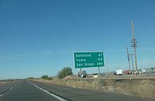
In El Centro, I-8 intersects with SR 86 and SR 111, both north–south routes which connect to I-10 in the Coachella Valley, north of the Salton Sea. SR 115 and SR 98 end at I-8 east of El Centro. The route also has the lowest above-ground elevation of any Interstate at 52 ft (16 m) below sea level near El Centro.[17] The freeway then traverses the Imperial Sand Dunes Recreation Area and intersects with SR 186 leading south to Baja California Norte, Mexico.[13][14] I-8 runs parallel to the All-American Canal across the desert for roughly 55 mi (89 km).[18] At points in eastern Imperial County, the Mexican border is less than 0.5 mi (0.80 km) south of the Interstate. I-8 then passes through Felicity and Winterhaven before crossing the Colorado River on a bridge into Yuma, Arizona.[13][14]
I-8 is part of the California Freeway and Expressway System[19] and is eligible for the State Scenic Highway System from I-5 to the western junction of SR 98,[20] though it is not an official state scenic highway.[21] It is officially known as the Border Friendship Route from San Diego to the Arizona state line. The Interstate is signed as the Ocean Beach Freeway west of I-5. For the entire length within San Diego County and into Imperial County, it is signed as the Kumeyaay Highway, after the local Native American tribe and their traditional trade route which the Interstate follows.[22][23] Between Old Town and El Cajon, I-8 is called the Mission Valley Freeway.[14] In 2014, I-8 had an annual average daily traffic (AADT) of 11,800 vehicles between Bonds Corner Road and SR 115, as well as between SR 98 and Imperial Highway, and 239,000 vehicles between I-805 and I-15, the latter of which was the highest AADT for the highway in California.[24]
Yuma to Casa Grande[]
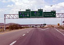
I-8 enters Arizona from California at the Colorado River bridge at Yuma. It initially heads south through Yuma until the interchange with US 95, where the freeway begins to turn to the east and passes through eastern Yuma and Fortuna Foothills, briefly paralleling US 95 and passing through a second border inspection station. In the Gila Mountains, the eastbound lanes of I-8 cross under the westbound freeway, briefly traveling to the left near Telegraph Pass before reverting back. West of Wellton, the highway takes a northeasterly course, paralleling the Gila River and passing to the south of Roll. Through this part of Arizona, I-8 passes along the northern edge of the Barry M. Goldwater Air Force Range and to the south of the Yuma Proving Ground. It keeps a northeastern heading, passing through the community of Dateland, until it reaches Gila Bend. There, the freeway intersects SR 85 heading north to Phoenix and south to the Organ Pipe Cactus National Monument.[2][25]
After leaving Gila Bend, I-8 takes a southeastern course as it passes through the Sonoran Desert National Monument. Exiting the national monument grounds, the highway continues on an easterly bearing to a junction with SR 84, a highway that parallels I-8 to the north and goes through Casa Grande, while I-8 passes to the south of both Stanfield and Casa Grande. I-8 reaches its eastern terminus southeast of at an interchange with I-10, which continues south (eastbound) to Tucson, and north (westbound) to Phoenix.[2][25]
The combination of SR 85 between I-10 and I-8 as well as I-8 between SR 85 and I-10 in Casa Grande has been promoted as a bypass of the Phoenix area for long-distance travelers on I-10.[26] In 2014, I-8 had an AADT of 5,200 vehicles between Butterfield Trail and Freeman Road, and 44,400 vehicles between SR 280 and Araby Road east of Yuma, the latter of which was the highest AADT for the highway in Arizona.[27] In the early 2010s, I-8 from Casa Grande to Gila Bend was sometimes used for smuggling both drugs and humans.[28]
History[]
The I-8 designation was accepted as a chargeable Interstate by the American Association of State Highway Officials in 1957,[29] and was added to the state highway system in 1964 by the California State Legislature; the US 80 designation was removed at that time.[30][31]
San Diego area[]
The freeway that would become I-8 was constructed in the mid-20th century through the San Diego area. The section west of I-5 was originally part of SR 109, and was added to I-8 in 1972. In later years, the California Department of Transportation (Caltrans) made efforts to widen the freeway as congestion increased.
Initial construction[]
Much of Alvarado Canyon Road from San Diego to La Mesa was originally built between 1947 and 1950, a bypass of the old US 80 routing along El Cajon Boulevard and La Mesa Boulevard.[32] Work began to convert the original US 80 divided highway into a freeway in 1960,[33] and the freeway was complete west of El Cajon by April 1962.[34] Priority was given to planning US 80 in 1962 by the California Chamber of Commerce.[35] In 1964, I-8 was officially designated by the California State Legislature, and the US 80 designation was removed.[30][31] By 1965, I-8 from Fairmount Avenue to El Cajon Boulevard was one of the first freeway stretches in the county to have a center barrier installed in the median.[36]
The Ocean Beach Freeway section west of I-5 was authorized as Route 286 in 1959.[37] In 1962, four alternate routes were proposed for this part of the freeway, and for Rosecrans Street.[38] Route 286 was renumbered to SR 109 in the 1964 renumbering.[31] Plans for the Old Town interchange between I-5 (formerly US 101), I-8 (formerly US 80), SR 209 (Rosecrans Street), and SR 109 date from 1962, although several concerns had to be taken into account, including the preservation of historical Old Town and keeping traffic through the area moving during construction. The goal was to begin the process in 1966, and complete the interchange in 1969.[39][40] There were concerns about a $3 million shortfall in funding (about $18 million in 2019 dollars)[41] during May 1966, which caused the San Diego Chamber of Commerce Highway Committee to recommend the completion of SR 109 as a project.[42] This was projected to be the final highway project before I-5 was completed in San Diego County.[43]
The building phase started on September 22, 1966, on the interchange that was to replace the intersection of Pacific Highway and Rosecrans Street. The cost of the interchange was projected to be $10.86 million[44] (about $65 million in 2019 dollars).[41] SR 109 was planned to follow Camino del Rio up to the Frontier traffic circle, where the city of San Diego would resume construction; both SR 109 and SR 209 were to be built in the future.[45] The eight-lane freeway was projected to relieve traffic in the Frontier Street area coming from the San Diego Sports Arena. Bidding for the SR 109 contract was to begin in 1968, after the City Council endorsed the route in December 1967. Completion of both the interchange and SR 109 was planned for early 1969.[46] An interchange was planned at Midway Drive, and the western end of the freeway was to be at Sunset Cliffs and Nimitz boulevards.[47] The cost of the SR 109 project was estimated to be $2.3 million[48] (about $13 million in 2019 dollars).[41]
The ramp from south I-5 to Camino del Rio opened in February 1968,[46] and a second ramp from southbound I-5 to eastbound I-8 opened in August 1968, with the remainder of the project to be completed in summer 1969.[49] The groundbreaking for the Ocean Beach Freeway took place on September 23, 1968, with the estimated completion to take place within 15 months.[48] However, rain in February 1969 delayed many construction projects across the county, including the SR 109 extension.[50] The entire project was completed in September, with the road scheduled to open in October.[51] The routing of SR 109 was officially added to I-8 in 1972.[52]
Subsequent expansion[]
Even before the freeway was complete in California, bidding began in 1964 on widening I-8 from six to eight lanes between near Fairmount Avenue and Spring Street, in San Diego and La Mesa.[53] Three years later, a contract was granted for the widening of the Fairmount Avenue to Ward Road stretch, adding two lanes to the freeway.[54] In 1974, the San Diego City Council reached an agreement with state officials to improve I-8 from east of Pacific Highway to Texas Street, over the objections of Councilman Floyd Morrow, who objected to solving traffic issues by continuing to expand freeways. The cost was estimated to be $8 million[55] (about $33 million in 2019 dollars).[41]
The La Mesa City Council asked the state to modify the interchange with SR 125 in 1974; the original interchange did not allow for access to SR 125 from I-8 east or to I-8 west from SR 125.[56] Widening of the portion from SR 125 to El Cajon Boulevard to five lanes in each direction was under way in October.[57] By 1981, the environmental impact report had been completed, and the $50 million (about $121 million in 2019 dollars)[41] project to add ramps and widen I-8 was awaiting clearance from the Federal Highway Administration.[58] Additional ramps to SR 67 were nearing completion in May 1985,[59] and were completed to I-15 north in October.[60] In 1986, the project revamping the SR 125 interchange was under way, at a cost of $80 million (about $161 million in 2019 dollars);[41] it would add two more lanes to I-8 from Jackson Drive to Fuerte Drive, and allow for SR 125 to be extended north past I-8.[61]
By 1977, traffic had reached 172,300 vehicles a day, which had increased by nearly 10 percent over the previous year. It was hoped that the construction of SR 52 would help to reduce the congestion.[62] A revised Mission Gorge Road eastbound exit opened in 1979, merging with traffic from I-15.[63] Traffic reached 212,000 vehicles a day by February 1981, and Caltrans declared I-8 east of I-805 the busiest highway in the region.[64] In 1987, Caltrans determined that I-8 west between College Avenue and Waring Road had the highest ratio of cars to number of lanes worldwide, at 2400 cars per hour.[65] Plans to add another lane to I-8 west from College Avenue to I-15 began in March 1992.[66]
Caltrans proposed the installation of a metered traffic signal on I-8 west in Lakeside during 1987, in order to improve traffic flow in the mornings by inserting a short delay before entering San Diego should the rate exceed 2,000 vehicles per hour.[67] However, the state put its plans on hold shortly thereafter, following several concerns from the public, and from state senator Jim Ellis.[68]
Cuyamaca Mountains[]
Early road[]

A stagecoach road existed into the 19th century that passed through the mountains east of San Diego.[15] Before the freeway was constructed, the automobile road through the mountains east of San Diego was narrow and wound through the mountains; it was officially dedicated in 1912.[69][70] This trip was known to take up to four hours, and frequently resulted in the radiator boiling over, flat tires, or broken fan belts; inclement weather would result in cars becoming mired in the mud. The road was paved in 1926, and was open by 1927; remnants of this road were still present in the late 20th century. Another road was built in the early 1930s, to remove curves and widen the lanes.[15] This was a two-lane road that still had many switchbacks, with one popularly known as "Dead Man's Curve".[71] Construction of I-8 took place atop much of the roadbed of the highway from the early 1930s.[15] The delay in extending a road to San Diego caused increased development in Los Angeles and resulted in that city becoming the trade and population center of Southern California, according to the San Diego Union.[72]
Planning and construction[]
Completion of the freeway was the second highest priority according to the Highway Development Association in May 1963, after the I-5 freeway.[73] Bidding began on the portion from Broadway in El Cajon to Harritt Road in September 1963. This section of the freeway was to parallel US 80 to the south up to Lakeview Road, and then to the north.[74] This portion of the freeway was scheduled to be complete by May 1965.[75] By January 1965, I-8 had been completed from I-5 east to an interchange with Lake Jennings Park Road,[76] just south of the latter's intersection with the southern terminus of Harritt Road.[12] At a cost of $3.44 million (about $22 million in 2019 dollars),[41] the project reduced the grade and curves at what was known as "Tunnel Hill" that hindered the flow of traffic.[77] The part of the freeway from west of Harritt Road to west of Alpine was up for bidding in October 1964,[78] and the Highway Commission set aside $2.1 million (about $13 million in 2019 dollars)[41] for this 1.6-mile-long (2.6 km) stretch in February 1965.[79] A contract for $1.42 million (about $9 million in 2019 dollars)[41] was issued in August 1965.[80] The entire 6-mile (9.7 km) stretch from Lake Jennings Road to Harbison Canyon Road was under construction by September 1965 and was scheduled to be complete by the next year.[81]
In the Mountain Springs pass between San Diego and Imperial counties, the eastbound lanes traverse the pass on the former roadbed of US 80 through In-Ko-Pah Gorge near Myers Creek. The westbound lanes were placed on a different routing through Devil's Canyon that had been constructed by November 1963. A contract for paving the 9.7 miles (15.6 km) from the San Diego–Imperial county line to SR 98, including the eastbound lanes, was given to the Isbell Construction Company for $3.69 million (about $24 million in 2019 dollars)[41] in May 1963. This portion was completed in May 1965 "through some of the most rugged, hottest sections of San Diego and Imperial counties," according to The San Diego Union. Construction ran into difficulties following concerns regarding potential landslides. The westbound lanes were built first, and temporarily contained both directions of traffic while the old highway was converted into the eastbound lanes.[82][83] The Los Angeles Times described the stretch east of Mountain Springs as follows: "Through it the freeway engineers have hacked two separate roadways not even in sight of each other, but so overpowering in the sheer magnitude of the cuts through the mountains that it is almost impossible to believe human beings could have so overpowered hostile nature ...."[84] Access to the site for construction workers was difficult, and many slopes had to be stabilized. Temperatures reached 120 °F (49 °C) in the summer and 4 °F (−16 °C) in winter, with winds reaching up to 80 mph (130 km/h).[85] While using nuclear explosions to conduct blasting operations in the Laguna Mountains was considered as a possibility, the proposal was not considered to be practical at the time.[86] Two cables and a hook were used to move girders into place; this was the first use of a cable in Southern California road construction.[87]
The portion from Boulevard to near the Imperial County line was included in the California Highway Commission budget for 1965–1966.[88] A 6.7-mile (10.8 km) extension from Mountain Springs west to what was then known as Road J-35 was given $3.3 million (about $21 million in 2019 dollars)[41] in funding by the Highway Commission in May 1965.[89] The 10-mile (16 km) section in between this one and the Mountain Springs pass section was in planning by that September, and was scheduled to begin the building phase shortly thereafter, with the section extending west of Boulevard to follow.[90] That section, from Crestwood to Boulevard, was to begin construction soon after the $3 million (about $18 million in 2019 dollars)[41] contract was given out in January 1966.[91] The coming of the freeway from both west and east of Jacumba was projected to be a significant event in the history of the town.[84] Cafes and gas stations went out of business once the freeway bypassed the town; however, many retirees relocated into the town since the high traffic levels were gone.[72] The labeling of the town Boulevard as Manzanita on I-8 signs raised controversy and forced the Division of Highways to obscure the name on the signs until the issue was resolved.[92]
Construction continued with the issuing of a $6.55 million contract (about $39 million in 2019 dollars)[41] to widen a 5.7-mile (9.2 km) section of I-8 through Alpine, from Harbison Canyon to east of West Victoria Drive, and to begin construction in April or May 1967, to be completed in 1969. This would leave only a 30-mile (48 km) stretch of I-8 that was not at freeway standards.[93][94] As the process continued, concerns about increased smog from the additional traffic were raised in October 1967.[95] A 3.7-mile (6.0 km) section to the east of Alpine was scheduled to have bidding opened in November of that year, and was to be finished in 1968; this would produce a continuous freeway from San Diego to the eastern terminus of this route.[96] Both of these projects were underway by May 1968.[97] An additional contract was given out for $7.8 million (about $45 million in 2019 dollars)[41] in August to continue the freeway east from Alpine Street to Japatul Valley Road; this would bring the freeway near Descanso Junction.[98] Roughly 5.5 million cubic yards (4.2×10⁶ m3) of dirt and rock were to be generated by all three of these construction projects, since half of a mountain would have to be removed with a million pounds of dynamite. The third project was built near the site of an abandoned attempt to build a tunnel for the old highway after World War II, which proved to be too expensive.[99]

By mid-February 1969, one segment of the freeway running through Alpine was nearing completion and was scheduled to open on February 21; another section was scheduled to open in April. However, although dirt and rocks were transported on a conveyor belt across US 80 to become part of an embankment for the Sweetwater River Bridge, the grading of the mountain near Viejas Grade and the Sweetwater River had not been completed on the final link. The historic Ellis Grade radiator stop was to be removed and replaced with one at Vista Point.[100] On April 19, 1969, the part 2.5 mi (4.0 km) east of Alpine opened to traffic.[101] All of the Alpine part of I-8 opened on May 22, 1969, after a ribbon-cutting ceremony; yet the Viejas Grade segment was now projected to be completed by 1972.[102] The bridge over the Sweetwater River was under construction by 1970,[103] and the entire segment cost $22.1 million[104] (about $115 million in 2019 dollars).[41] By May, this segment was estimated to be completed in the later part of that year.[69] The leveling of the grade resulted in the second highest fill in the state at 360 ft (110 m).[105]
Finishing the freeway[]
The final portion of I-8 in California, between Japatul Valley Road and west of Boulevard, was prioritized in the 1969–1970 state budget.[106] Due to financial concerns, it was announced in September 1968 that the target date for completing the Interstate Highway System would be extended until 1974, from 1972. The missing portion of I-8 was expected to cost $45 million and be constructed in three parts, with one part being started each year.[107] The segments between Japatul Valley Road and west of Laguna Junction, and from La Posta Road to west of Boulevard, were delayed for an entire year at the end of 1969 due to a nationwide effort to fight inflation by reducing spending.[108] A 6.6-mile (10.6 km) segment from Buckman Springs to Crestwood received funding in May 1970, which would leave only an 8-mile (13 km) stretch of the freeway uncompleted when built.[104] The drive time from San Diego to El Centro had been reduced to two hours, according to the California Division of Highways.[69] By August 1970, the remainder of the freeway had been funded, with the part from Japatul Valley Road to Laguna Junction costing $22 million (about $114 million in 2019 dollars),[41] and the Laguna Junction to Crestwood portion costing $15 million[109] (about $78 million in 2019 dollars).[41]
In May 1971, El Centro Mayor Alex Gay requested that passing lanes be added to the remaining two-lane part of I-8 in between El Centro and San Diego due to the frequent traffic jams in between Japatul Valley and Crestwood. At this time, this was the only missing link through the mountains.[110] Bidding took place on the $16.5 million (about $81 million in 2019 dollars)[41] La Posta Road to Crestwood Road and the Japatul Valley Road to Sunrise Highway portions in November 1971.[111] As part of this series of projects, the highest concrete bridge in the state at the time was to be built at 430 ft (130 m) over Pine Valley Creek on the segment between Japatul Valley Road and Sunrise Highway. The contract came in at $22.6 million (about $107 million in 2019 dollars),[41] over $5 million (about $24 million in 2019 dollars)[41] beyond budget due to the difficulty of the bridge construction. All three of the projects to complete I-8 were projected to be complete by mid-1974.[112] However, in March 1972, it was announced that the La Posta Road portion of the project would be delayed due to budget troubles.[113]
By the beginning of 1974, the new projected completion date for I-8 was mid-1975, with 22 mi (35 km) of two-lane highway remaining.[114] The Pine Valley Creek bridge and the segment extending from Japatul Valley Road to Pine Valley was dedicated on November 24, 1974, and was scheduled to open on November 26; this left 8 mi (13 km) of freeway to be constructed.[115] The final stretch of I-8 in California, from Sunrise Highway to La Posta Road, was completed in May 1975.[72]
The Buckman Springs rest area opened in January 1979 in eastern San Diego County.[116] In 1987, the first 65 mph (105 km/h) speed limit sign was posted east of El Cajon, the first one in the state; the speed limit on all I-8 east of El Cajon, except for the Mountain Springs Grade portion, was raised similarly.[117]
Imperial Valley[]
Construction[]

The highway through Imperial Valley was originally a plank road made of pieces of wood that were tied together.[70] The Ocean-to-Ocean Bridge across the Colorado River was open in 1915.[118] Following this, US 80 was built through the valley as the main east–west route.[119] Plans for a new freeway across the southernmost reaches of California date from before 1950.[120] The bridge over the Colorado River was replaced in 1956, at a cost of $1.2 million, and was in use until 1978, when the I-8 bridge was built.[121] In 1957, the City of El Centro expressed a desire for the new freeway to replace US 80 to be routed along the southern limits of the city. Caltrans engineer Jacob Dekema stated at the time that the four-lane freeway would not be constructed on the US 80 routing due to possible expansion of the Naval Air Facility El Centro.[122]
In October 1964, the portion of I-8 between Imperial Avenue in El Centro to SR 111 appeared in the state budget.[123] By December, a route for the part of I-8 just west of the Colorado River was being examined by the California Highway Commission.[124] Construction was underway on the stretch from Seeley to SR 111 by June 1966, and the entire portion through the county was planned for completion by 1968.[125] This 12.2-mile (19.6 km) portion, extending west to Drew Road, was planned for completion by early 1967, at a cost of $200 million (about $1.19 billion in 2019 dollars);[41] however, by then, the date for completion of the freeway had slipped to 1972.[120] The state ordered the building of the portion from west of Coyote Wells to just east of Drew Road in September 1967.[126] The next year, Dekema indicated that the goal was to have I-8 completed by 1973, citing a deadline in order to have the federal government pay for up to ninety percent of the costs; the other freeways in the region were to be delayed because of this.[127]
In early 1970, the portion of the freeway from west of Ogilby Road to east of Algodones Road was under construction, and projections were to have this portion completed by later that year. This $5.2 million (about $27 million in 2019 dollars)[41] project also included resurfacing the freeway that had already been built through the Colorado Desert Sandhills;[69] this part of the freeway had been built between 1961 and 1965.[128][129] By this time, it was estimated that the drive from San Diego to El Centro now took 2 hours, as opposed to the 3.5 hours required two decades earlier, and the two days required in the pioneer era.[69] This part of the freeway was opened in July 1970.[130][131] As the freeway was constructed through the valley, it caused a break in many north–south roads. These breaks were located where access to the part of the road on the other side of the freeway was cut off. Plans were put in place to build frontage roads to improve access through the region.[132]
The 16-mile (26 km) portion of I-8 bypassing Holtville began construction in December 1969, and was nearing completion in May 1971, to result in a continuous freeway that connected two existing segments from in San Diego County to just west of Winterhaven. It was estimated that the bypass would save travelers 20 minutes of travel time through the Imperial Valley. The cost of this project was $11.2 million (about $61 million in 2019 dollars).[41] However, Holtville residents raised concerns about SR 115 providing the only access to the eastern part of the city,[133] notably the narrow and curved portion leading from the freeway into town. Work on the Holtville portion began at 3:30 a.m. daily during the summer in order to avoid the desert heat. In addition to this, construction of the Highline Canal overpass involved a 120-foot (37 m) steel span that was prefabricated and made of girders that were hoisted into position by barges. The Matich Construction Company attempted to set the world record for laying the most concrete in a day, aided by the level terrain, but failed to do so after the concrete mixer malfunctioned.[134] That same year, bids for an Arizona plant inspection station near Winterhaven, next to the California agricultural inspection station, were submitted.[135]
The last 6.5-mile (10.5 km) part of the California portion, from near Algodones Road to west of the Arizona state line, was to enter the bidding phase in early 1972.[136] I-8 was scheduled to be completed in the summer of 1975 between San Diego and Yuma, although there would be a break in the freeway around Yuma;[70] this occurred by October 1975.[121] At the time the California portion was completed, it was the preferred route to Phoenix from some areas of Los Angeles, since I-10 had not been completed.[70]
The missing portion of the highway was the new bridge over the Colorado River, which was built at a cost of $7.4 million[121] (about $28 million in 2019 dollars).[41] In June 1975, there were concerns regarding the state delaying new construction projects due to financial concerns, and the effects this would have on the bridge.[137] The bid for the project was awarded to Novo-Rados Construction in October 1975, as one of the final projects before the construction freeze.[138] The new bridge, which replaced the old US 80 bridge, was dedicated on August 18, 1978; this completed I-8 from San Diego to Casa Grande. The Arizona Department of Transportation and the City of Yuma assisted in the planning process. By the time the California portion of the freeway was complete, the average cost was $1 million per mile[121] (about $3 million in 2019 dollars).[41] The bridge opened on September 20, 1978. The State of California was responsible for the bridge erection, even though the State of Arizona owned half of the bridge.[139]
Fratianno allegations[]
Jimmy Fratianno was associated with Frank Bompensiero, the San Diego mafia leader, in a criminal lawsuit involving the Fratianno Trucking Company and the Miles and Sons Trucking Company in 1966;[140] he was known to law enforcement as "the Mafia's West Coast executioner," with up to 16 deaths for which he was potentially responsible. Both companies were awarded the contracts to transport dirt during the construction of I-8 in El Centro. Drivers were coerced to agree to buy the trucks, although the Fratianno Company still retained the ownership; they also had portions of their wages withheld from them. Following this, the drivers were loaned money from Leo Moceri, another mafia leader.[140][141] An investigation in early 1966 after complaints from the drivers led to state charges against the two firms as well as five people in August.[142] There were concerns that John Erreca, the state director of public works, had a conflict of interest with Fratianno and did not enforce the law; however, both Transportation Administrator Robert Bradford (upon a request for investigation from then Governor Pat Brown) and the Federal Bureau of Investigation found that there was no conflict of interest.[143][144]
The truck drivers were given $36,000 (about $215,000 in 2019 dollars)[41] in back pay from the state government.[145] Fratianno and Bompensiero were charged with fraud, as well as state labor and public utility code violations. While charges were dropped against Bompensiero, Fratianno was found guilty.[140][141] The Imperial County Board of Supervisors estimated that $25,000 (about $655,000 in 2019 dollars)[41] in damage to county roads took place due to overloaded trucks.[146] The federal government fined him $10,000 (about $57,000 in 2019 dollars),[41] which he never paid, and placed him on probation for three years; he was imprisoned when he did not pay, but was released in September 1969. His ex-wife, Jewell, as well as the company, were fined $4,014 (about $20,000 in 2019 dollars)[41] individually for their responsibility in the matter.[147] For the state charges, he was sentenced in 1969 to one to three years in prison, after pleading guilty to the charges.[148] He was incarcerated in following a parole violation until 1973.[140]
Storm damage[]
Following Tropical Storm Kathleen in September 1976, a flood eroded 400 pieces of the roadway from westbound I-8 near Ocotillo, resulting in the construction of a detour. The freeway reopened to traffic in February 1978 after the damage was repaired and a new bridge was built, at a cost of $1 million[149][150] (about $3 million in 2019 dollars).[41] But, in 1982, the freeway was closed again near Ocotillo due to flooding following another storm.[151]
Arizona[]
Between Yuma and Gila Bend, I-8 runs alongside the routes of both the Gila Trail and the Butterfield Overland Mail Company line. The latter was a stagecoach line that went between Tipton, Missouri, and San Francisco, with several stations in between, and was used to transport passengers across the country at 5 mph (8.0 km/h) between 1858 and 1861.[152] In later years, the Southern Pacific Railroad was constructed, paralleling the Gila River east of Fortuna;[153] by 1877, the tracks were complete to Yuma. Work continued the next year, and, by 1880, the tracks were extended to Tucson from Yuma.[154]
This portion of the route of US 80, predecessor of I-8, was originally part of the proposed state system of highways in 1921.[155] By 1926, this section became part of the cross-country highway US 80. The route was not paved at this time, but was a gravel road along the entire corridor.[156] By 1928, the portion of I-8 between Gila Bend and Casa Grande was designated as SR 84.[157] A small portion of the highway was paved near Yuma and SR 84 was under construction by the next year.[158] SR 84 was completed by 1930, but not paved, and the segment of US 80 between Aztec and Sentinel had been paved.[159]
Paving of SR 84 had commenced by 1934, with the portion of the highway in Maricopa County being paved.[160] A group of San Diego citizens raised concerns about the road from Yuma to Gila Bend not being paved in 1934, due to the impact that this would have on tourism in San Diego, and made a request to the federal government to have it paved.[161] The entire future corridor of I-8 had been paved from Yuma to Casa Grande by 1935.[162] Drivers were told to bring spare fan belts, radiator hoses, and additional drinking water for the journey traversing the desert.[163] A "Shortcuts Association" began in 1952 to promote SR 84 as a route to bypass Phoenix on the way to San Diego.[164]
With the coming of the Interstate Highways, the corridor was to be upgraded to Interstate standards. In late 1958, a group of motel owners whose properties were located on SR 84 strongly objected to any routing of I-8 that would not go through the city of Casa Grande.[165] Motel owners in Yuma proposed their own alternative in 1961 to the four routings of I-8 through the city that had been proposed, raising concerns about losing revenue from tourism.[166] In January 1962, the alternatives were narrowed down to two, with one of them being the route supported by the motel owners. However, nearby school officials expressed concerns regarding that route, because 1200 students would no longer be able to walk to school if the freeway was constructed along that route.[167] Later that year, a new route had been proposed, along the Southern Pacific Railroad tracks and the Colorado River.[168] Construction started on the first sections of I-8 in Arizona in 1961 between Yuma and Gila Bend. The initial construction was divided into four different sections awarded to different contractors. Work commenced with a section of US 80 between Sentinel and Gila Bend on December 10, 1960. This was also the section of I-8 completed in Arizona on April 18, 1962.[169] By 1963, work was well under way, with portions of US 80 between Mohawk and Gila Bend, and SR 84 between Gila Bend and near Stanfield upgraded.[170] Other merchants objected to the routing, and met with the Yuma County Board of Supervisors to raise their concerns following the final approval of the route in 1964.[171] A new park was to be built east of the Colorado River crossing, just opposite downtown; city officials hoped that this would give an improved look to the town as drivers first arrived.[172]
Nevertheless, there was controversy over the work in Arizona as well. In 1964, a U.S. House of Representatives investigation discovered that poor management and lack of efficiency were prevalent in four of the projects constructing the I-8 freeway. The Arizona Highway Department was specifically cited in the report for not taking into account protecting government interests when selecting labor for the projects. Several errors were discovered, and one of them, adding too much clay to the gravel mixture, cost the state of Arizona $26,278 (about $171,000 in 2019 dollars)[41] to fix.[173][174] By that year, construction had begun on the freeway west of Casa Grande, while the rest of the Arizona routing was in the design stages.[175]
In 1965, a $1.46 million (about $9 million in 2019 dollars)[41] contract was granted to build the 5.7-mile (9.2 km) portion from near Araby Road east through Fortuna Wash.[176] Two years later, it was estimated that construction would be complete by 1969, except for the Colorado River bridge. The highway was in progress through the Telegraph Pass east of Yuma, and the portions from Avenue 9-E to 4-E, from there to 4th Street in Yuma, and to the river were estimated to cost $9.69 million (about $58 million in 2019 dollars)[41] in total.[177] Following local complaints, Francis Turner, the executive director of the federal Bureau of Public Roads, agreed to look at constructing an interchange at Trekell Road in Casa Grande again, after an earlier decline to do so.[178] Work began on the Casa Grande part of the freeway in March 1968, at a cost of $3 million[179] (about $17 million in 2019 dollars).[41] That year, many gas station, motel, and restaurant owners noticed a drop in business, possibly due to concerns regarding construction traffic due to I-8; however, they hoped for increased business following completion of the freeway.[180] The Yuma County Chamber of Commerce made plans to promote tourism in the town following the completion of I-8 by late 1968.[181]
Bidding on the last portion of the freeway to be completed in Casa Grande, from Midway Road to I-10, was to begin in January 1969.[182] By November, the freeway east of Yuma was under construction, at a cost of $3.7 million[183] (about $20 million in 2019 dollars).[41] On June 15, 1970, eastbound traffic began on I-8 in Casa Grande, with an exit at both Trekell and Thorton roads, with westbound traffic soon to follow.[179] Businesses did not notice much change with the opening of the eastbound lanes.[184] In 1971, I-8 was nearly complete, including a new alignment east of Yuma built parallel and to the south of the original US 80 alignment. A new alignment was also built to the south of the SR 84 alignment at the eastern end of the highway from southwest of Stanfield to the eastern terminus at I‑10 southeast of Casa Grande. The only portions of I-8 not completed at this time were the Gila Bend bypass and the western end near Yuma.[185] The portion east of 16th Street in Yuma was completed in June 1972;[186] the Arizona State Highway Commission authorized the $1.6 million (about $11 million in 2019 dollars)[41] contract to construct the 6-mile (9.7 km) portion through Gila Bend in August.[187] Some Yuma businesses had noticed a decrease in revenue at this time; the Arizona Highway Department agreed to modify some signs to eliminate any confusion.[188] The part of I-8 between 16th and 4th streets was under construction in 1976, which was the only incomplete part of the freeway, along with the bridge over the Colorado River. The water treatment plant in Yuma was to be moved due to the potential of an accident with a vehicle carrying hazardous materials flying off the bridge and contaminating the water supply.[189][190] The freeway in both states was completed with the opening of the bridge on September 20, 1978.[139]
As the Interstate was completed, the highways that it replaced were removed from the state highway system. In 1973, the SR 84 designation was removed from the highway from Gila Bend to the split where I-8 followed a new alignment southwest of Stanfield.[191] In 1977, the US 80 designation was removed from this stretch in favor of I-8.[192]
Exit list[]
| State | County | Location | mi[1][2] | km | Exit[1] | Destinations | Notes |
|---|---|---|---|---|---|---|---|
| California | San Diego | San Diego | 0.00 | 0.00 | Nimitz Boulevard / Sunset Cliffs Boulevard – Mission Bay Park | At-grade intersection | |
| 0.50 | 0.80 | 1 | West Mission Bay Drive / Sports Arena Boulevard | Westbound exit and eastbound entrance | |||
| 1.67 | 2.69 | 2A-B | Signed as exits 2A (north) and 2B (south); no eastbound exit to I-5 north; exit 20 on I-5; former US 101 | ||||
| Rosecrans Street | Westbound exit and eastbound entrance; signed with exit 2B; former SR 209 south | ||||||
| 2.03 | 3.27 | 2C | Morena Boulevard | No eastbound exit | |||
| 2.60 | 4.18 | 3 | Taylor Street / Hotel Circle | ||||
| 3.88 | 6.24 | 4A | Hotel Circle | Westbound exit is via exit 3 | |||
| 4.06 | 6.53 | 4B–C | Signed as exits 4B (south) and 4C (north) eastbound, 4A (south) and 4B (north) westbound; exit 3 on SR 163; former US 395 | ||||
| 4.69 | 7.55 | 5 | Mission Center Road / Auto Circle | ||||
| 5.55 | 8.93 | 6A | Texas Street / Qualcomm Way | Qualcomm Way was formerly Stadium Way | |||
| 6.03 | 9.70 | 6B | Exit 17 on I-805 | ||||
| 7.29– 7.31 | 11.73– 11.76 | 7 | Signed as exits 7A (north) and 7B (south) eastbound and flipped westbound; exit 6B on I-15 / SR 15; former SR 103 | ||||
| 7.94 | 12.78 | 8 | Mission Gorge Road / Fairmount Avenue | Eastbound exit is part of exit 7 | |||
| 8.71 | 14.02 | 9 | Waring Road | ||||
| 9.99 | 16.08 | 10 | College Avenue | Serves San Diego State University | |||
| La Mesa | 11.24 | 18.09 | 11 | Lake Murray Boulevard / 70th Street | |||
| 12.22 | 19.67 | 12 | Fletcher Parkway / Baltimore Drive | Baltimore Drive not signed eastbound | |||
| 12.62 | 20.31 | 13A | Spring Street – Downtown La Mesa | No westbound exit | |||
| 12.75 | 20.52 | El Cajon Boulevard | Westbound exit and eastbound entrance; former I-8 Bus. and US 80 west | ||||
| 13.41 | 21.58 | 13B | Jackson Drive / Grossmont Boulevard | No eastbound entrance; no westbound signage for Grossmont Boulevard | |||
| 14.05 | 22.61 | 14A | La Mesa Boulevard / Grossmont Center Drive | Signed as exit 14B eastbound | |||
| 14.20 | 22.85 | 14B | Signed as exit 14A eastbound; exit 18A on SR 125; formerly SR 67 south of I-8 | ||||
| 14.30 | 23.01 | 14C | Severin Drive / Fuerte Drive | ||||
| El Cajon | 15.31 | 24.64 | 15 | El Cajon Boulevard (I-8 Bus. east) | Eastbound exit and westbound entrance; former US 80 east | ||
| 16.24 | 26.14 | 16 | Main Street | ||||
| 16.95 | 27.28 | 17A | Johnson Avenue | Eastbound exit and westbound entrance | |||
| 17.45 | 28.08 | 17B–C | Signed as exits 17B (SR 67) and 17C (Magnolia Avenue) eastbound; SR 67 exit 1 | ||||
| 18.12 | 29.16 | 18 | Mollison Avenue | ||||
| 19.01 | 30.59 | 19 | 2nd Street ( west) | Former SR 54 west | |||
| 19.50 | 31.38 | 20A | East Main Street (I-8 Bus. west) | Westbound exit and eastbound entrance | |||
| 20.40 | 32.83 | 20B | Greenfield Drive – Crest | Signed as exit 20 eastbound | |||
| Lakeside | 21.69 | 34.91 | 22 | Los Coches Road – Lakeside | |||
| 23.47 | 37.77 | 23 | Lake Jennings Park Road | ||||
| | 27.34 | 44.00 | 27 | Dunbar Lane – Harbison Canyon | |||
| Alpine | 30.11 | 48.46 | 30 | Tavern Road (I-8 Bus. east) – Alpine | |||
| 32.99 | 53.09 | 33 | Willows Road / Alpine Boulevard (I-8 Bus. west) – Alpine | ||||
| | 35.98 | 57.90 | 36 | East Willows Road | Former US 80 | ||
| | 39.48 | 63.54 | 40 | ||||
| Pine Valley | 45.18 | 72.71 | 45 | Pine Valley, Julian | |||
| 46.58 | 74.96 | 47 | Sunrise Highway (CR S1) | ||||
| | 50.49 | 81.26 | 51 | Buckman Springs Road | |||
| | 53.63 | 86.31 | 54 | Kitchen Creek Road – | |||
| | 60.50 | 97.37 | 61 | Crestwood Road – | |||
| | 65.25 | 105.01 | 65 | ||||
| | 73.30 | 117.96 | 73 | Jacumba | |||
| San Diego–Imperial county line | | 76.93 | 123.81 | 77 | In-Ko-Pah Park Road | ||
| Imperial | | 80.21 | 129.09 | 80 | Mountain Springs Road | ||
| | 87.13 | 140.22 | 87 | Eastbound exit and westbound entrance | |||
| Ocotillo | 89.04 | 143.30 | 89 | Imperial Highway (CR S2) – Ocotillo | |||
| | 100.60 | 161.90 | 101 | Dunaway Road | |||
| | 107.05 | 172.28 | 107 | Drew Road (CR S29) – Seeley | |||
| | 111.11 | 178.81 | 111 | Forrester Road (CR S30) | |||
| El Centro | 114.09 | 183.61 | 114 | Imperial Avenue (I-8 Bus. east) – El Centro | |||
| 115.09 | 185.22 | 115 | Former US 99 | ||||
| 116.08 | 186.81 | 116 | Dogwood Road (CR S31) | ||||
| | 118.06 | 190.00 | 118 | Signed as exits 118A (south) and 118B (north) | |||
| | 119.66 | 192.57 | 120 | Bowker Road | |||
| | 124.90 | 201.01 | 125 | ||||
| | 127.61 | 205.37 | 128 | Bonds Corner Road | Former SR 115 | ||
| | 130.62 | 210.21 | 131 | Former US 80 | |||
| | 142.87 | 229.93 | 143 | ||||
| | 145.95 | 234.88 | 146 | Brock Research Center Road | |||
| | 150.60 | 242.37 | 151 | ||||
| | 155.82 | 250.77 | 156 | Grays Well Road | |||
| | 158.81 | 255.58 | 159 | Ogilby Road (CR S34) | |||
| Felicity | 163.69 | 263.43 | 164 | Sidewinder Road | |||
| 165.73 | 266.72 | 166 | Former US 80 east | ||||
| | 169.97 | 273.54 | 170 | Winterhaven Drive (I-8 Bus. east) | Western terminus of I-8 Bus. | ||
| | 171.54 | 276.07 | 172 | Fourth Avenue (I-8 Bus.) – Winterhaven | Former US 80 | ||
| Colorado River | 171.98 0.00 | 276.77 0.00 | California–Arizona line | ||||
| Arizona | Yuma | Yuma | 0.59 | 0.95 | 1 | Redondo Center Drive / Giss Parkway | Redondo Center Dr. not signed westbound |
| 2.23 | 3.59 | 2 | |||||
| 3.98 | 6.41 | 3 | Avenue 3E | Former SR 280 | |||
| 7.66 | 12.33 | 7 | |||||
| 9.44 | 15.19 | 9 | Eastern terminus of I-8 BL; former US 80 west | ||||
| Fortuna Foothills | 12.27 | 19.75 | 12 | Fortuna Road | |||
| 14.28 | 22.98 | 14 | Foothills Boulevard | ||||
| | 21.06 | 33.89 | 21 | Dome Valley | Former US 80 east | ||
| Wellton | 30.84 | 49.63 | 30 | Avenue 29E – Wellton | |||
| Noah | 37.99 | 61.14 | 37 | Avenue 36E – Roll | |||
| | 42.10 | 67.75 | 42 | Avenue 40E – Tacna | |||
| | 54.98 | 88.48 | 54 | Avenue 52E – Mohawk Valley | Former US 80 west | ||
| | 67.49 | 108.61 | 67 | Dateland | |||
| | 73.53 | 118.34 | 73 | Aztec | |||
| | 78.51 | 126.35 | 78 | Spot Road | |||
| Maricopa | | 87.10 | 140.17 | 87 | Sentinel, Hyder, Agua Caliente | ||
| | 102.34 | 164.70 | 102 | Painted Rock Road | |||
| | 106.56 | 171.49 | 106 | Paloma Road | |||
| Gila Bend | 111.49 | 179.43 | 111 | Citrus Valley Road | |||
| 115.68 | 186.17 | 115 | Former US 80 east | ||||
| 118 | Future interchange[193] | ||||||
| 119.47 | 192.27 | 119 | Former SR 84 west | ||||
| | 140.86 | 226.69 | 140 | Freeman Road | |||
| | 144.60 | 232.71 | 144 | Vekol Valley Road | |||
| Pinal | | 151.73 | 244.19 | 151 | |||
| | 161.61 | 260.09 | 161 | Stanfield | |||
| | 167.61 | 269.74 | 167 | Montgomery Road | |||
| | 169.72 | 273.14 | 169 | Bianco Road | |||
| | 172.62 | 277.80 | 172 | Thornton Road – Casa Grande | |||
| | 174.62 | 281.02 | 174 | Trekell Road – Casa Grande | |||
| Casa Grande | 178.36 | 287.04 | 178 | Signed as exits 178A (west) and 178B (east); additional entrance from Sunland Gin Road; exit 199 on I-10 | |||
1.000 mi = 1.609 km; 1.000 km = 0.621 mi
| |||||||
Auxiliary routes[]
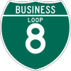
There are no three-digit auxiliary routes of I-8. However, there are four signed business routes related to I-8 that provide additional access to particular towns or cities:
- El Cajon Boulevard passes through downtown El Cajon.
- The El Centro business loop runs along Adams Avenue in downtown El Centro.
- The Yuma business loop begins in Winterhaven before crossing the Colorado River into Yuma and providing access to the downtown area.
- The Gila Bend business loop connects with Arizona State Route 85.[12][194]
See also[]
 Arizona portal
 California portal
 California Roads portal
 U.S. Roads portal
References[]
Footnotes[]
- ^ a b c Warring, KS (January 9, 2008). "Interstate 8 Freeway Interchanges" (PDF). California Numbered Exit Uniform System. Sacramento: California Department of Transportation. Archived (PDF) from the original on August 20, 2016. Retrieved February 5, 2009.
- ^ a b c d Roadway Inventory Management Section, Multimodal Planning Division (December 31, 2013). "2013 State Highway System Log" (PDF). Phoenix: Arizona Department of Transportation. pp. 1–11. Retrieved October 15, 2019.
- ^ Federal Highway Administration (March 25, 2015). National Highway System: California (South) (PDF) (Map). Scale not given. Washington, DC: Federal Highway Administration. Retrieved May 25, 2015.
- ^ Federal Highway Administration (May 7, 2015). Arizona (PDF) (Map). Scale not given. Washington, DC: Federal Highway Administration. Retrieved May 29, 2015.
- ^ Natzke, Stefan; Neathery, Mike & Adderly, Kevin (June 20, 2012). "What is the National Highway System?". National Highway System. Washington, DC: Federal Highway Administration. Retrieved July 1, 2012.
- ^ National Park Service. "Juan Bautista de Anza National Historic Trail Guide: Imperial County". National Park Service. Archived from the original on July 5, 2008. Retrieved October 6, 2008.
National Park Service. "Juan Bautista de Anza National Historic Trail Guide: Yuma County". National Park Service. Archived from the original on October 11, 2008. Retrieved October 6, 2008.
National Park Service. "Juan Bautista de Anza National Historic Trail Guide: Maricopa County". National Park Service. Archived from the original on November 20, 2008. Retrieved October 6, 2008.
National Park Service. "Juan Bautista de Anza National Historic Trail Guide: Pinal County". National Park Service. Archived from the original on November 20, 2008. Retrieved October 6, 2008. - ^ Thomas Brothers (1998). San Diego County Road Atlas (Map). 1:316,800. Irvine, CA: Thomas Brothers. p. 1232. ISBN 0-88130-902-8. OCLC 38909538.
- ^ a b Google. Acme Mapper (Map). Acme Maps. Archived from the original on July 14, 2014. Retrieved April 28, 2013.
{{cite map}}:|author=has generic name (help) - ^ Sanchez, Leonel (October 19, 1995). "Border Patrol Will Open Checkpoint on I-8". San Diego Union-Tribune. p. A1. OCLC 25257675.
- ^ Vigil, Jennifer (September 21, 2003). "State Asked for Barriers to Stop I-8 Cross-overs". San Diego Union-Tribune. p. B1. OCLC 25257675.
- ^ "Smugglers Make East County Highways Deadly". San Diego Union-Tribune. October 13, 2005. p. B13. OCLC 25257675.
- ^ a b c Thomas Brothers (2009). San Diego County Road Atlas (Map). Irvine, CA: Thomas Brothers. pp. 429–430, 1232–1237, 1251–1252, 1268–1270, 1298–1300. ISBN 978-1-58174-110-0. OCLC 263420904.
- ^ a b c d e Rand McNally (2008). The Road Atlas: United States, Canada, and Mexico (Map). 1"≈25 miles. Chicago: Rand McNally. p. 15. ISBN 978-0-528-93961-7. OCLC 173493291.
Rand McNally (2008). The Road Atlas: United States, Canada, and Mexico (Map). 1"≈3 miles. Chicago: Rand McNally. p. 17. San Diego inset. ISBN 978-0-528-93961-7. OCLC 173493291. - ^ a b c d e Thomas Brothers (2000). California Road Atlas and Driver's Guide (Map). Irvine, CA: Thomas Brothers. pp. 107, 111, 112, 212, 213, 214, V. OCLC 41359350.
- ^ a b c d McVicar, Jim (May 9, 1985). "I-8 grade challenges the motorist". The San Diego Union. p. II7. OCLC 13155544.
- ^ Hudson, Ken (March 8, 1966). "Screen To Curb Devilish Wind". The San Diego Union. p. A17. OCLC 13155544.
- ^ Federal Highway Administration (February 29, 2012). "Previous Interstate Facts of the Day". Celebrating the Eisenhower Interstate Highway System. Federal Highway Administration. Archived from the original on April 26, 2006. Retrieved September 29, 2012.
- ^ Pittman (1995), p. 341.
- ^ "Article 2 of Chapter 2 of Division 1". California Streets and Highways Code. Sacramento: California Office of Legislative Counsel. Retrieved February 6, 2019.
- ^ "Article 2.5 of Chapter 2 of Division 1". California Streets & Highways Code. Sacramento: California Office of Legislative Counsel. Retrieved February 6, 2019.
- ^ California Department of Transportation (August 2019). "Officially Designated State Scenic Highways and Historic Parkways" (XLSX). Sacramento: California Department of Transportation. Retrieved December 14, 2016.
- ^ California Department of Transportation; California State Transportation Agency (January 2015). 2014 Named Freeways, Highways, Structures and Other Appurtenances in California. Sacramento: California Department of Transportation. pp. 14, 233. Archived from the original (PDF) on May 30, 2015. Retrieved May 30, 2015.
- ^ Hoffman, Geralyn Marie; Gamble, Lynn H.; San Diego State University Institute for Regional Studies of the Californias (2006). A Teacher's Guide to Historical and Contemporary Kumeyaay Culture. San Diego: San Diego State University Institute for Regional Studies of the Californias. p. 24. ISBN 978-0-925613-51-6. OCLC 173480703. Archived from the original on 2016-11-30. Retrieved 2016-10-10.
- ^ California Department of Transportation (2014). "All Traffic Volumes on CSHS". Sacramento: California Department of Transportation. Retrieved December 14, 2016.
- ^ a b Google (April 11, 2008). "Overview Map of I-8 in Arizona" (Map). Google Maps. Google. Retrieved April 11, 2008.
- ^ Arizona Department of Transportation. Exit 200 eastbound overhead (Highway guide sign). Casa Grande, AZ: Arizona Department of Transportation. Archived from the original on December 20, 2014. Retrieved October 27, 2012.
- ^ Arizona Department of Transportation (2014). "Average Annual Daily Traffic" (PDF). Arizona Department of Transportation. Archived (PDF) from the original on March 29, 2017. Retrieved December 14, 2016.
- ^ Collom, Lindsey (January 29, 2011). "Arizona, Federal Officials Target Smugglers on Interstate 8". The Arizona Republic. Phoenix. OCLC 2609778. Retrieved June 21, 2014.
- ^ Public Roads Administration (August 14, 1957). Official Route Numbering for the National System of Interstate and Defense Highways as Approved by the American Association of State Highway Officials (Map). Scale not given. Washington, DC: Public Roads Administration. Archived from the original on November 10, 2012. Retrieved April 4, 2012.
- ^ a b "Route Renumbering: New Green Markers Will Replaces Old Shields" (PDF). California Highways and Public Works. 43 (1–2): 11–14. March–April 1964. ISSN 0008-1159. OCLC 7511628. Archived (PDF) from the original on March 28, 2014. Retrieved March 8, 2012.
- ^ a b c California State Assembly. "An act to add Section 253 and Article 3 (commencing with Section 300) to Chapter 2 of Division 1 of, and to repeal Section 253 and Article 3 (commencing with Section 300) of Chapter 2 of Division 1 of, the..." 1963 Session of the Legislature. Statutes of California. State of California. Ch. 385 p. 1182.
- ^ Mack, Joseph (May–June 1950). "Alvarado Canyon". California Highways and Public Works. 29 (4): 42–43. OCLC 7511628.
- ^ "State Asks Bids For Link in U.S. 80 Project Here". The San Diego Union. January 6, 1959. p. A13. OCLC 13155544.
- ^ "Freeway Link Opens Tomorrow on U.S. 80". The San Diego Union. April 23, 1962. p. A18. OCLC 13155544.
- ^ "State C of C Urges New Roads in Area". The San Diego Union. August 23, 1962. p. C17. OCLC 13155544.
- ^ Brooks, Joe (January 7, 1965). "More Freeway Center Barriers Are Planned". The San Diego Union. p. A21. OCLC 13155544.
- ^ California State Assembly. "An act to amend Sections 306, 320, 332, 351, 362, 365, 369, 374, 382, 388, 397, 407, 408, 409, 410, 415, 422, 435, 440, 446, 453, 456, 460, 467, 470, 476, 487, 492, 493, 494, 506, 521, 528, and 529..." 1959 Session of the Legislature. Statutes of California. State of California. Ch. 1062 p. 3121.
- ^ "Alternate Routes Studied For Midway Area Freeways". The San Diego Union. August 27, 1962. p. A17. OCLC 13155544.
- ^ "Light Industry Center Urged For Midway-Frontier Area". The San Diego Union. August 15, 1962. p. A17. OCLC 13155544.
- ^ "$11 Million Interchange Projected". The San Diego Union. March 16, 1965. p. A15. OCLC 13155544.
- ^ a b c d e f g h i j k l m n o p q r s t u v w x y z aa ab ac ad ae af ag ah ai aj Thomas, Ryland; Williamson, Samuel H. (2020). "What Was the U.S. GDP Then?". MeasuringWorth. Retrieved September 22, 2020. United States Gross Domestic Product deflator figures follow the Measuring Worth series.
- ^ "Fund Loss Feared For State Highways Under Transit Plan". The San Diego Union. May 11, 1966. p. A22. OCLC 13155544.
- ^ James, Paul (August 1, 1966). "Interstate 5 Will Have 36 Interchanges For Easy Travel". The San Diego Union. p. B1. OCLC 13155544.
- ^ Brown, Joe (March 26, 1967). "'Stack' Like Plate Of Spaghetti". The San Diego Union. p. B1. OCLC 13155544.
- ^ "$11 Million Interchange To Link Freeways". The San Diego Union. December 4, 1966. p. B4. OCLC 13155544.
- ^ a b "Interstate 5 and 8 Ramps to Close". The San Diego Union. February 27, 1968. p. C1. OCLC 13155544.
- ^ "Council Approves 109 Freeway Route". The San Diego Union. December 29, 1967. p. B3. OCLC 13155544.
- ^ a b "Ground Broken For Beach Freeway". The San Diego Union. September 24, 1968. p. C3. OCLC 13155544.
- ^ "Interstate 5–8 Revisions Due On Monday". The San Diego Union. August 3, 1968. p. B1. OCLC 13155544.
- ^ Clance, Homer (February 25, 1969). "2,000 To 3,000 Building Men Idled By Rain". The San Diego Union. p. B8. OCLC 13155544.
- ^ Scarr, Lew (September 26, 1969). "Dedication of Ocean Beach Freeway Slated". The San Diego Union. p. B1. OCLC 13155544.
- ^ California State Assembly. "An act to amend Sections 263.3, 263.8, and 415 of, and to add Section 486 to, the Streets and Highways Code, relating to state highways". 1972 Session of the Legislature. Statutes of California. State of California. Ch. 1216 p. 2351.
- ^ "Bids on 4 Southland Road Projects Called". Los Angeles Times. March 24, 1964. p. 22. OCLC 3638237.
- ^ "Contract Let For Widening of Interstate 8". The San Diego Union. March 31, 1967. p. B11. OCLC 13155544.
- ^ "I-8 Freeway Improvement Pact OKd". The San Diego Union. February 20, 1974. p. B4. OCLC 13155544.
- ^ Staff (July 25, 1974). "City Asks Interchange Construction". The San Diego Union. p. B3. OCLC 13155544.
- ^ "Roadwork Begins In Area". The San Diego Union. October 31, 1974. p. B3. OCLC 13155544.
- ^ "Interchange Project Nears Green Light". The San Diego Union. May 20, 1981. p. B3. OCLC 13155544.
- ^ Grimaldi, James (May 30, 1985). "El Cajon Freeway Ramps to Open Soon". Evening Tribune. p. B6. OCLC 37687666.
- ^ Jahn, Ed (October 25, 1985). "Ramps are Opened Between Northbound I-15 and I-8". The San Diego Union. p. B2. OCLC 13155544.
- ^ Taylor, Kathie (December 5, 1986). "Detour-Sign Watchers Have Field Day at Interchange". Evening Tribune. p. B22. OCLC 37687666.
- ^ Hudson, Ken (May 1, 1977). "Traffic Congestion Plagues Interstate 8". The San Diego Union. p. B1. OCLC 13155544.
- ^ "New Mission Gorge Exit on I-8 to Open Today". Los Angeles Times. August 23, 1979. p. SD A10. OCLC 3638237.
- ^ Fuentes, Henry (April 20, 1984). "CalTrans Study Says Interstate 8 Stretch is Busiest Artery in Area". The San Diego Union. p. B3. OCLC 13155544.
- ^ Okerblom, Jim (September 20, 1987). "Interstate 8 from College Avenue to Waring is the Amazon of Freeways". The San Diego Union. p. B6. OCLC 13155544.
- ^ Kucher, Karen (March 3, 1992). "Lane-Widening May Snarl Traffic on I-8". San Diego Union-Tribune. p. B1. OCLC 25257675.
- ^ Okerblom, Jim (October 28, 1987). "Stoplight on I-8 May Ease Traffic". The San Diego Union. p. B1. OCLC 13155544.
- ^ Carson, Daniel (October 29, 1987). "Stoplight Turned Red by Protests". The San Diego Union. p. B1. OCLC 13155544.
- ^ a b c d e McVicar, Jim (May 19, 1970). "San Diego-Yuma Freeway Dream Nearing Fruition". The San Diego Union. p. B3. OCLC 13155544.
- ^ a b c d Vance, Fred (June 8, 1975). "New Road Links San Diego, Yuma". Los Angeles Times. p. G3. OCLC 3638237.
- ^ McVicar, Jim (March 7, 1985). "Out of Way-side Ellis Rest stop still remembered". The San Diego Union. p. B4. OCLC 13155544.
- ^ a b c Harrison, Donald (May 25, 1975). "Last Section Of Interstate 8 To Yuma Opens Thursday". The San Diego Union. p. B10. OCLC 13155544.
- ^ "Top Priority Urged On S.D, Oceanside Freeway Sections". The San Diego Union. May 28, 1963. p. A18. OCLC 13155544.
- ^ "Bids For US 80 Extension Asked". The San Diego Union. September 24, 1963. p. B1. OCLC 13155544.
- ^ "San Diego County Freeway System". The San Diego Union. February 22, 1965. p. A3. OCLC 13155544.
- ^ Van Denburgh, Russell (January 7, 1965). "Freeway System Big, Growing". The San Diego Union. p. C6. OCLC 13155544.
- ^ California Division of Highways (September 1965). "I-8 East of El Cajon". California Highways and Public Works. 44 (5): 40–41. OCLC 7511628.
- ^ "State To Ask Bids On Alpine Road Link". The San Diego Union. October 13, 1964. p. B1. OCLC 13155544.
- ^ Staff (February 25, 1965). "Money For Freeway West Of Alpine OKd". The San Diego Union. p. A33. OCLC 13155544.
- ^ "State Awards Freeway Job". The San Diego Union. August 7, 1965. p. B20. OCLC 13155544.
- ^ "Work Set To Start On New Freeway Link". The San Diego Union. September 29, 1965. p. A21. OCLC 13155544.
- ^ "State Reviews Low Road Bid For US 80". The San Diego Union. November 13, 1963. p. A17. OCLC 13155544.
- ^ "Jacumba Grade Opens Tomorrow". The San Diego Union. May 2, 1965. p. A22. OCLC 13155544.
- ^ a b Ainsworth, Ed (May 22, 1966). "Jacumba Ready For Big Moment". Los Angeles Times. p. F6. OCLC 3638237.
- ^ California Division of Highways (January 1964). "Mountain Springs Grade". California Highways and Public Works. 43 (1): 43–44. OCLC 7511628.
- ^ Zimmerman, Robert (March 26, 1963). "Atom Blasts Won't Build New US 80". The San Diego Union. p. A11. OCLC 13155544.
- ^ Kaye, Peter (March 9, 1963). "Steel Is Taming Devil's Canyon". The San Diego Union. p. A1. OCLC 13155544.
- ^ "$42 Million County Road Fund OKd". The San Diego Union. October 30, 1964. pp. A1–A2. OCLC 13155544.
- ^ "$12 Million Allocated for Work on Freeways". Los Angeles Times. May 27, 1965. p. A2. OCLC 3638237.
- ^ "Bids To Be Sought For Building Freeway In Laguna Mountains". The San Diego Union. September 14, 1965. p. A15. OCLC 13155544.
- ^ "Contract Let For $3 Million US 80 Job". The San Diego Union. January 29, 1966. p. B1. OCLC 13155544.
- ^ Staff (August 1, 1967). "Community's Name Argument Resumes". Los Angeles Times. p. A2. OCLC 3638237.
- ^ "$6.5 Million Road Job Let". The San Diego Union. April 18, 1967. p. B3. OCLC 13155544.
- ^ Staff (May 1, 1967). "Contract Let for Segment of Freeway". Los Angeles Times. p. 28. OCLC 3638237.
- ^ "Smog Problem Eyed By El Cajon Council". The San Diego Union. October 20, 1967. p. B3. OCLC 13155544.
- ^ Staff (October 22, 1967). "Bid Opening Set on Interstate 8". Los Angeles Times. p. 26. OCLC 3638237.
- ^ "Freeway Building Continues To Tie In County Cities". The San Diego Union. May 12, 1968. p. B4. OCLC 13155544.
- ^ "3-Mile Interstate 8 Freeway Job Let". The San Diego Union. August 23, 1968. p. B8. OCLC 13155544.
- ^ Hudson, Ken (September 8, 1968). "Million Points of Dynamite Slated to Clear Way for Interstate 8 Route". The San Diego Union. p. B2. OCLC 13155544.
- ^ Hudson, Ken (February 12, 1969). "Interstate 8 Alpine Section Opens April 21". The San Diego Union. p. B3. OCLC 13155544.
- ^ "Freeway Link Opens At Alpine". The San Diego Union. April 20, 1969. p. B2. OCLC 13155544.
- ^ Hudson, Ken (May 23, 1969). "Interstate 8 Section Opened Near Alpine". The San Diego Union. p. B3. OCLC 13155544.
- ^ "Mountain Freeway Link Progresses". The San Diego Union. January 25, 1970. p. B3. OCLC 13155544.
- ^ a b "County Freeways Dealt $47 Million". The San Diego Union. April 24, 1970. OCLC 13155544.
- ^ Stone, Joe (May 26, 1970). "Highway Group Gets Scenic Tour". The San Diego Union. p. B1. OCLC 13155544.
- ^ Clance, Homer (March 19, 1968). "18 Highway Projects Get Top Priority". The San Diego Union. p. C1. OCLC 13155544.
- ^ "Area's Freeways Losing Race With The Population". The San Diego Union. September 22, 1968. p. B4. OCLC 13155544.
- ^ "$26.8 Million Freeway Jobs OKd in County". The San Diego Union. October 22, 1969. p. B3. OCLC 13155544.
- ^ Clance, Homer (August 9, 1970). "Area Freeway Work Costs $107.5 Million". The San Diego Union. p. B1. OCLC 13155544.
- ^ Staff (May 10, 1971). "Improving of Highway Link Sought". The San Diego Union. p. B1. OCLC 13155544.
- ^ Staff (November 26, 1971). "Interstate 8 Bids Called By State". The San Diego Union. p. B3. OCLC 13155544.
- ^ Stewart, John (February 20, 1972). "430-Foot-High Bridge Planned For Route 8". The San Diego Union. p. B3. OCLC 13155544.
- ^ Kistler, Robert (March 29, 1972). "Money Problems Delay $150 Million in Freeway Work". Los Angeles Times. p. A1. OCLC 3638237.
- ^ "Public's Mood Shifts Away From Freeways". The San Diego Union. January 8, 1974. p. X16. OCLC 13155544.
- ^ "Pine Valley Creek Bridge Dedicated". The San Diego Union. November 24, 1974. pp. B1, B4. OCLC 13155544.
- ^ "San Diego". Los Angeles Times. January 18, 1979. p. SD2. OCLC 3638237.
- ^ Padilla, Steve (May 30, 1987). "1st 65 mph Sign Put Up East of El Cajon". The San Diego Union. p. B1. OCLC 13155544.
- ^ Knaub, Mark (February 1, 2012). "Early Transportation Options Included Plank Road Over Sand Dunes". Yuma Sun.
- ^ California Division of Highways (1936–1937). Road Map of the State of California (Map). [1:1,463,040]. Sacramento: California Division of Highways. OCLC 26939810.
- ^ a b "Completion of Freeway Link Nears". The San Diego Union. August 22, 1966. p. B3. OCLC 13155544.
- ^ a b c d "Bridge Completes Last Link In Interstate 8 Job". The San Diego Union. August 19, 1978. p. A3.
- ^ "Highway 80 Relocation Outlined". Los Angeles Times. March 28, 1957. p. B8. OCLC 3638237.
- ^ "$42 Million OKd for County Roads". The San Diego Union. October 30, 1964. p. A2. OCLC 13155544.
- ^ "Highway Group Studies New Route". The Yuma Sun. December 20, 1964. p. 5.
- ^ "High of 110 Predicted for Today". The San Diego Union. June 19, 1966. p. A30. OCLC 13155544.
- ^ "Rains Cause Flooding, Power Loss". The San Diego Union. September 2, 1967. p. B3. OCLC 13155544.
- ^ Hudson, Ken (April 5, 1968). "Freeway 8 to Yuma Seen by '73". The San Diego Union. p. B3. OCLC 13155544.
- ^ California Division of Highways (1961). Road Map of the State of California (Map). [1:1,411,705]. Sacramento: California Division of Highways. OCLC 60337964.
- ^ California Division of Highways (1965). Road Map of the State of California (Map). [1:1,411,705]. Sacramento: California Division of Highways. OCLC 381149522.
- ^ "Interstate 8 Link Ready". The San Diego Union. July 13, 1970. p. B1. OCLC 13155544.
- ^ MacMillan, Doug (July 24, 1970). "Interstate 8 Link Due by Next May". The San Diego Union (Imperial Valley ed.). p. B1. OCLC 13155544.
- ^ Ruane, Richard (February 21, 1971). "1,200 Miles of County's Roads Paved". The San Diego Union (Imperial Valley ed.). p. B1. OCLC 13155544.
- ^ Staff (May 18, 1971). "Final Work Being Done On Freeway". The San Diego Union (Imperial Valley ed.). p. B1. OCLC 13155544.
- ^ MacMillan, Doug (April 29, 1971). "Interstate 8 Link To Open Near Holtville Next Month". The San Diego Union (Imperial Valley ed.). p. B1. OCLC 13155544.
- ^ "El Centro Firm's Bid Low For Inspection Station". The San Diego Union (Imperial Valley ed.). September 18, 1970. p. B1. OCLC 13155544.
- ^ Staff (December 15, 1971). "Vegetable Shipments Up". The San Diego Union (Imperial Valley ed.). p. B1. OCLC 13155544.
- ^ Staff (June 19, 1975). "State Orders Halt In New Road Projects". The San Diego Union. p. B1. OCLC 13155544.
- ^ "$14.9 Million Road Project Awarded to Daley Corp". The San Diego Union. October 4, 1975. p. B5. OCLC 13155544.
- ^ a b "Yuma I-8 Bridge Opens". The San Diego Union. September 21, 1978. p. B4. OCLC 13155544.
- ^ a b c d Clance, Homer (February 14, 1977). "Bompensiero Move Into Top Mafia Post Here in 1960". The San Diego Union. pp. B1, B4. OCLC 13155544.
- ^ a b Houston, Paul (August 18, 1966). "Ex-Convict Seized in Conspiracy Case". Los Angeles Times. p. 3. OCLC 3638237.
- ^ Houston, Paul (August 26, 1966). "Long-Burning Wage Dispute Flares Anew in Trucking Fraud Case". Los Angeles Times. pp. A1, A3. OCLC 3638237.
- ^ Staff (October 12, 1966). "Report Clearing Erreca Just Whitewash, Accuser Charges". Los Angeles Times. p. 3. OCLC 3638237.
- ^ "FBI Clears Erreca of Interest Conflict". Los Angeles Times. November 4, 1966. p. A8. OCLC 3638237.
- ^ Brown, Nettie (December 10, 1967). "Truck Drivers to Get $36,000 in Back Pay". Los Angeles Times. p. B4. OCLC 3638237.
- ^ Staff (November 25, 1966). "Supervisors Get Advice on Road Damage Costs". Los Angeles Times. p. 23. OCLC 3638237.
- ^ Himaka, Mitch (July 11, 1971). "Court Orders Fratianno To Appear Here". The San Diego Union. p. B1. OCLC 13155544.
- ^ "Fratianno Gets Prison Term". The San Diego Union. January 12, 1969. p. B7. OCLC 13155544.
- ^ Dillon, Patrick (September 14, 1976). "Imperial Riverside Counties Ruled Storm Disaster Areas". The San Diego Union. p. A1. OCLC 13155544.
- ^ "Storm-Damaged Freeway Reopens". The San Diego Union. February 18, 1978. p. B1. OCLC 13155544.
- ^ Weber, Dick (December 10, 1982). "Rainstorm Floods and Blocks I-8 Near Ocotillo". The San Diego Union. p. A1. OCLC 13155544.
- ^ Trimble (2004), pp. 399–340.
- ^ Darton, D.H. (1933). Guidebook of the Western United States. Washington D.C.: Government Printing Office. Archived from the original on February 3, 2015.
- ^ Heath, Erle (1945). Seventy-Five Years of Progress. San Francisco: Southern Pacific Bureau of News. Archived from the original on 2014-05-02. Retrieved 2014-07-17.
- ^ Arizona Highway Department (1921). Tentative 7% System (Map). Phoenix: Arizona Highway Department. Archived from the original on March 19, 2016. Retrieved December 14, 2016.
- ^ Arizona Highway Department (1926). Map of Arizona (Map). Phoenix: Arizona Highway Department. Archived from the original on March 4, 2016. Retrieved December 14, 2016.
- ^ Arizona Department of Transportation (February 7, 1928). "Resolution 1928-P-144". Right-of-Way Resolutions. Arizona Department of Transportation. Archived from the original on September 4, 2011. Retrieved May 4, 2008.
- ^ Arizona Highway Department (1929). Map of Arizona (Map). Phoenix: Arizona Highway Department. Archived from the original on March 26, 2016. Retrieved December 14, 2016.
- ^ Arizona Highway Department (1930). Condition Map of State Highway System (Map). Phoenix: Arizona Highway Department. Archived from the original on March 19, 2016. Retrieved December 14, 2016.
- ^ Arizona Highway Department (1934). Condition Map of State Highway System (Map). Phoenix: Arizona Highway Department. Archived from the original on March 14, 2016. Retrieved May 4, 2008.
- ^ "SD Aid Sought to Win Funds for Improving Route to City". The San Diego Union (Imperial Valley ed.). April 1, 1934. p. A1. OCLC 13155544.
- ^ DeMerse, H.M. (1935). Road Map of Arizona (Map). Phoenix: Arizona Highway Department. Archived from the original on May 6, 2008. Retrieved May 4, 2008.
- ^ Trimble (2004), p. 154.
- ^ "Group to Mark SD Shortcuts". The San Diego Union. August 26, 1952. p. A6. OCLC 13155544.
- ^ Mauntz, Ted (November 20, 1958). "Motel Men Seem to Prefer Fenced-Off Road Through City". Casa Grande Dispatch. p. 1. OCLC 16877473.
- ^ "Yuma Motel Owners Urge Different Route". The Yuma Daily Sun. December 3, 1961. p. 16. OCLC 11279925.
- ^ "Interstate 8 Appears Set for One of Two Routes". The Yuma Daily Sun. January 4, 1962. p. 1. OCLC 11279925.
- ^ "Highway Dept. Plans Traffic Study Here". The Yuma Daily Sun. September 5, 1962. p. 1. OCLC 11279925.
- ^ Cole, Ben (May 1, 1963). "State Road Jobs Eyed by House". Arizona Republic. Phoenix. pp. 1, 4. Archived from the original on August 26, 2019. Retrieved June 10, 2019 – via Newspapers.com.
- ^ Arizona Highway Department; Rand McNally (1963). Road Map of Arizona (Map). 1 in:24 mi. Arizona Highway Department. Archived from the original on June 21, 2011. Retrieved May 4, 2008.
- ^ Grounds, Lucy (January 10, 1964). "Yuma Mesa Merchants Protest to County About Bypass". The Arizona Republic. Phoenix. p. 17. OCLC 2609778.
- ^ "Shrewd Planning Used to Revitalize Yuma". The Arizona Republic. July 3, 1966. p. A17. OCLC 2609778.
- ^ Cole, Ben (May 8, 1963). "Officials Claim Shock at Road Test Fakes". The Arizona Republic. Phoenix. p. 1. OCLC 2609778.
- ^ "House Unit Lambastes Arizona Road Building". Los Angeles Times. June 20, 1964. p. 8. OCLC 3638237.
- ^ "Arizonans May Use Freeways Long Before Interstate System Complete". The Arizona Republic. June 28, 1964. p. 16A. OCLC 2609778.
- ^ "$1.5 Million Interstate 8 Job Let For 5.7 Miles near Araby Road". The Yuma Daily Sun. January 16, 1966. OCLC 112799251.
- ^ "Yuma Will Have I-8 Freeway by 1969". The Yuma Daily Sun. February 23, 1967. p. 6. OCLC 11279925.
- ^ "Highway Chief Promises to Reconsider Access". Casa Grande Dispatch. June 4, 1967. p. 1. OCLC 16877473.
- ^ a b "Traffic Starts Today on I-8 Eastbound Lane". Casa Grande Dispatch. June 15, 1970. p. 1. OCLC 16877473.
- ^ O'Neill, Don (August 18, 1968). "Yuma Motel People Know about Hwy. 80 Traffic Drop". The Yuma Daily Sun. p. 3. OCLC 11279925.
- ^ "Yuma Chamber Plans To Gather Tourists from Interstate 8 Bypass". The Yuma Daily Sun. December 4, 1968. p. 1. OCLC 11279925.
- ^ "Bids To Be Called For Final I-8 Link". Casa Grande Dispatch. January 20, 1969. p. 1. OCLC 16877473.
- ^ "Yuma Construction Totals $12 Million". The Yuma Daily Sun. November 23, 1969. p. 5. OCLC 11279925.
- ^ Kramer, Donovan Jr. (June 17, 1970). "Businessmen Have Mixed Views on Opening of Interstate 8". Casa Grande Dispatch. p. 1. OCLC 16877473.
- ^ Arizona Highway Department Photogrammetry and Mapping Division (1971). Road Map of Arizona (Map). Phoenix: Arizona Highway Department. Archived from the original on June 21, 2011. Retrieved May 4, 2008.
- ^ "Interstate 8 Section Opens Wednesday at 10". The Yuma Daily Sun. June 6, 1972. p. 1. OCLC 15337492.
- ^ "Gila Bend I-8 Link Gets OK". Tucson Daily Citizen. August 26, 1972. p. 6. OCLC 15304868.
- ^ Staff (June 27, 1972). "11 Major Sign Changes Promised on Interstate 8". The Yuma Daily Sun. p. 1. OCLC 15337492.
- ^ Battin, John (October 2, 1970). "I-8 Bridge and Water Works Are on Collision Course Here". The Yuma Daily Sun. p. 1. OCLC 15337492.
- ^ Bush, Ernie (January 1, 1976). "Downtown Busy With Construction". The Yuma Daily Sun. p. 14. OCLC 15337492.
- ^ Arizona Department of Transportation (September 21, 1973). "Resolution 1973-20-075". Right-of-Way Resolutions. Arizona Department of Transportation. Archived from the original on March 16, 2012. Retrieved May 4, 2008.
- ^ Arizona Department of Transportation (September 16, 1977). "Resolution 1977-16-A-048". Right-of-Way Resolutions. Arizona Department of Transportation. Archived from the original on September 15, 2011. Retrieved May 4, 2008.
- ^ "Final Environmental Assessment and Section 4(f) Evaluation" (PDF). PDF. Arizona Department of Transportation. February 2010. Archived from the original (PDF) on April 9, 2016. Retrieved September 18, 2019.
- ^ Google (December 18, 2014). "Interstate 8" (Map). Google Maps. Google. Retrieved December 18, 2014.
Works cited[]
- Pittman, Ruth (1995). Roadside History of California. Missoula, Montana: Mountain Press Publishing Company. ISBN 978-0-87842-318-7. OCLC 32396018.
- Trimble, Marshall (2004). Roadside History of Arizona (2nd ed.). Missoula, Montana: Mountain Press Publishing Company. ISBN 978-0-87842-471-9. OCLC 12945147.
External links[]
Route map:

| ( • help)
|
| Wikimedia Commons has media related to Interstate 8. |
- Interstate 8 at California Highways
- Interstate 8 at the Interstate Guide
- Interstate 8 in California and Arizona at AA Roads
- Old SR 209 and the Cabrillo National Monument at Floodgap Roadgap
- Interstate 8 Traffic Conditions at California Department of Transportation
| Signed | |
|---|---|
| Unsigned | |
| Lists | |
| Other |
|
Major Interstates highlighted | |
- Interstate 8
- Gila River
- Interstate Highway System
- Interstate Highways in California
- Interstate Highways in Arizona
- Southern California freeways
- Roads in San Diego County, California
- Roads in Imperial County, California
- Transportation in Yuma County, Arizona
- Transportation in Maricopa County, Arizona
- Transportation in Pinal County, Arizona