Zemplín (village)
Zemplín | |
|---|---|
 | |
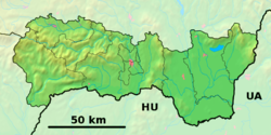 Zemplín Location in Slovakia | |
| Coordinates: 48°26′N 21°49′E / 48.433°N 21.817°ECoordinates: 48°26′N 21°49′E / 48.433°N 21.817°E | |
| Country | Slovakia |
| Region | Košice |
| District | Trebišov |
| First mentioned | 1214 |
| Area | |
| • Total | 14.67 km2 (5.66 sq mi) |
| Elevation | 106 m (348 ft) |
| Population (2019) | |
| • Total | 368 |
| • Density | 25/km2 (65/sq mi) |
| Postal code | 076 34 |
| Car plate | TV |


Zemplín (Hungarian: Zemplén) is a village and municipality in Trebišov District of the Košice Region.
History[]
In historical records the village was first mentioned in 1214.[1]
During the Nazi occupation of Hungary in 1944, the village's entire Jewish population was deported to a ghetto in Sátoraljaújhely, and later to concentration camps where they were murdered.
Geography[]
The village lies at an altitude of 106 metres and covers an area of 14,67 km².[2] It is located near the junction point of the rivers Ondava and Latorica (tributaries of the river Bodrog) in eastern Slovakia. Zemplín is also the location of Zemplín Castle, former administrative center of the former Zemplén County during the time the Kingdom of Hungary ruled the area.
Ethnicity[]
According to the 2001 census, 64.2% of inhabitants were Hungarians and 35.8% were Slovaks.
In 2019 the village had a population of 368.[3]
References[]
| show Municipalities of Trebišov District |
|---|
| show Authority control |
|---|
This article relating to the geography of the Trebišov District is a stub. You can help Wikipedia by . |
- Villages and municipalities in Trebišov District
- Trebišov District geography stubs