Zhongning County
Zhongning
中宁县 جْونِئٍ ثِيًا | |
|---|---|
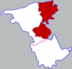 Zhongning in Zhongwei | |
 Zhongwei in Ningxia | |
| Coordinates (Zhongning government): 37°29′30″N 105°41′06″E / 37.4918°N 105.6849°ECoordinates: 37°29′30″N 105°41′06″E / 37.4918°N 105.6849°E | |
| Country | People's Republic of China |
| Autonomous region | Ningxia |
| Prefecture-level city | Zhongwei |
| Area | |
| • Total | 3,280.17 km2 (1,266.48 sq mi) |
| Population | |
| • Total | 312,921 |
| • Density | 95/km2 (250/sq mi) |
| Time zone | UTC+8 (China Standard) |

| Zhongning | |||
|---|---|---|---|
 Wolfberry harvest celebration | |||
| Simplified Chinese | 中宁 | ||
| Traditional Chinese | 中寧 | ||
| Literal meaning | central peace | ||
| |||
Zhongning County is a county under the administration of Zhongwei city in west-central Ningxia Hui Autonomous Region of the People's Republic of China, bordering Inner Mongolia to the northwest. It is the point at which the northern twist of the Yellow River begins, creating the Ordos Loop. It has a total area of 2,841 square kilometers (1,097 sq mi), and a population of approximately 410,000 people.
Zhongning County is an agricultural county. In addition to traditional agricultural products, Wolfberries have begun to be cultivated in recent years. However, due to a drought,[when?] the growing range for the berries has not significantly increased. The county government is located in the town of Ningan and the county's postal code is 755100.
Administrative divisions[]
Zhongning County has 6 towns and 6 townships.
- 6 towns
- (宁安镇, نِئٍاً جٍ)
- Enhe (恩和镇, عٍحَ جٍ)
- (新堡镇, ثٍبَوْ جٍ)
- (石空镇, شِکْو جٍ)
- (鸣沙镇, مٍْشَا جٍ)
- (大战场镇, دَاجًاچَانْ جٍ)
- 6 townships
- (徐套乡, ثُتَوْ ثِيَانْ)
- (喊叫水乡, خًاڭِيَوْشُ ثِيَانْ)
- (余丁乡, ۋِدٍ ثِيَانْ)
- Baima (白马乡, بَيْمَا ثِيَانْ)
- (舟塔乡, جِوْتَا ثِيَانْ)
- (太阳梁乡, تَيْيَانْلِيَانْ ثِيَانْ)
| show Authority control |
|---|
This Ningxia location article is a stub. You can help Wikipedia by . |
- Zhongning County
- County-level divisions of Ningxia
- Northwestern China geography stubs