Guyuan
This article needs additional citations for verification. (January 2021) |
Guyuan
固原市 · ﻗُﻮْﻳُﻮًا شِ Kuyuan; Kuyüan | |
|---|---|
 Xumishan grottoes | |
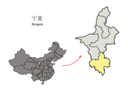 Guyuan City (yellow) within Ningxia | |
 Guyuan Location of the city center in Ningxia | |
| Coordinates (Zhongxin Park (中心公园)): 36°00′36″N 106°15′25″E / 36.010°N 106.257°ECoordinates: 36°00′36″N 106°15′25″E / 36.010°N 106.257°E | |
| Country | People's Republic of China |
| Region | Ningxia |
| Municipal seat | Yuanzhou District |
| Area | |
| • Total | 14,412.83 km2 (5,564.82 sq mi) |
| Elevation | 1,777 m (5,830 ft) |
| Population (2007) | |
| • Total | 1,455,200 |
| • Density | 100/km2 (260/sq mi) |
| Time zone | UTC+8 (China Standard) |
| Postal code | 756000 |
| Area code(s) | (0)954 |
| ISO 3166 code | CN-NX-04 |
| Licence plate prefixes | 宁D |
| Website | www |


![]() Guyuan (help·info) (Chinese: 固原; pinyin: Gùyuán), formerly known as Xihaigu (Chinese: 西海固; pinyin: xīhǎigù), is a prefecture-level city in the Ningxia Hui Autonomous Region of the People's Republic of China. It occupies the southernmost section of the region, bordering Gansu province to the east, south, and due west. This is also the site of Mount Sumeru Grottoes (须弥山), which is among the ten most famous grottoes in China.[1] As of the end of 2018, the total resident population in Guyuan was 1,124,200.[2]
Guyuan (help·info) (Chinese: 固原; pinyin: Gùyuán), formerly known as Xihaigu (Chinese: 西海固; pinyin: xīhǎigù), is a prefecture-level city in the Ningxia Hui Autonomous Region of the People's Republic of China. It occupies the southernmost section of the region, bordering Gansu province to the east, south, and due west. This is also the site of Mount Sumeru Grottoes (须弥山), which is among the ten most famous grottoes in China.[1] As of the end of 2018, the total resident population in Guyuan was 1,124,200.[2]
History[]
During the Warring States Period, Guyuan belonged to the territory of Qin state, later Qin Dynasty. The original name of the city began in the Ming dynasty (1452 AD). Because of the importance of its transportation in history, Guyuan was a war gate where Chinese soldiers trained and prepared to fight with northwestern minorities. In the Tang dynasty, most of the dealers from middle Asia need to go through this gate, then went to the capital, Chang’an.[3]
According to the First Founder's Biography in History of Yuan Dynasty, Genghis Khan died in Liupan Mountain in Guyuan in 1227 AD, after a war with the Xixia dynasty for two decades.[4]
Liupanshan National Forest Park[]
Liupanshan National Forest Park is one of the most important features of Guyuan, with more than 530 species of wild medicinal plants. There are a number of diversified animals inhabited in the forest, for instance, the national first-class protected animal golden leopard, the third-class protected animal forest musk deer, golden eagle, and red-bellied golden pheasant.[5]
Administrative divisions[]
| Map | ||||||
|---|---|---|---|---|---|---|
| Name | Hanzi | Hanyu Pinyin | Xiao'erjing | Population (2003 est.) | Area (km²) | Density (/km²) |
| Yuanzhou District | 原州区 | Yuánzhōu Qū | ﻳُﻮًاﺟِﻮْ ٿُو | 490,000 | 4,965 | 99 |
| Xiji County | 西吉县 | Xījí Xiàn | ثِکِ ﺷِﯿًﺎ | 460,000 | 3,985 | 115 |
| Longde County | 隆德县 | Lóngdé Xiàn | ﻟْﻮدْ ﺷِﯿًﺎ | 190,000 | 1,269 | 150 |
| Jingyuan County | 泾源县 | Jīngyuán Xiàn | دٍﻳُﻮًا ﺷِﯿًﺎ | 120,000 | 961 | 125 |
| Pengyang County | 彭阳县 | Péngyáng Xiàn | پْعیْا ﺷِﯿًﺎ | 250,000 | 3,241 | 77 |

Geography and climate[]
Guyuan has a monsoon-influenced humid continental climate (Köppen Dwb), with long, cold, dry winters, and warm, rainier summers. With temperatures cooled by the elevation that exceeds 1,770 metres (5,810 ft), highs average slightly below freezing in January and reach only 25 °C (77 °F) in July. Much of the year's precipitation is delivered from June to September.
| hideClimate data for Guyuan (1971−2000) | |||||||||||||
|---|---|---|---|---|---|---|---|---|---|---|---|---|---|
| Month | Jan | Feb | Mar | Apr | May | Jun | Jul | Aug | Sep | Oct | Nov | Dec | Year |
| Record high °C (°F) | 13.1 (55.6) |
18.3 (64.9) |
22.8 (73.0) |
30.1 (86.2) |
31.5 (88.7) |
32.2 (90.0) |
34.6 (94.3) |
33.8 (92.8) |
31.5 (88.7) |
24.8 (76.6) |
20.2 (68.4) |
14.1 (57.4) |
34.6 (94.3) |
| Average high °C (°F) | −0.4 (31.3) |
2.1 (35.8) |
7.4 (45.3) |
15.1 (59.2) |
19.9 (67.8) |
23.2 (73.8) |
25.0 (77.0) |
23.7 (74.7) |
18.7 (65.7) |
13.0 (55.4) |
6.9 (44.4) |
1.5 (34.7) |
13.0 (55.4) |
| Daily mean °C (°F) | −8.1 (17.4) |
−4.9 (23.2) |
1.0 (33.8) |
8.2 (46.8) |
13.4 (56.1) |
17.0 (62.6) |
18.9 (66.0) |
17.8 (64.0) |
12.8 (55.0) |
6.6 (43.9) |
−0.3 (31.5) |
−6.0 (21.2) |
6.4 (43.5) |
| Average low °C (°F) | −14.2 (6.4) |
−10.6 (12.9) |
−4.4 (24.1) |
1.9 (35.4) |
6.8 (44.2) |
10.3 (50.5) |
12.9 (55.2) |
12.3 (54.1) |
7.7 (45.9) |
1.6 (34.9) |
−5.5 (22.1) |
−11.7 (10.9) |
0.6 (33.1) |
| Record low °C (°F) | −27.0 (−16.6) |
−23.2 (−9.8) |
−18.9 (−2.0) |
−12.0 (10.4) |
−6.4 (20.5) |
0.1 (32.2) |
4.0 (39.2) |
3.1 (37.6) |
−2.3 (27.9) |
−11.2 (11.8) |
−20.0 (−4.0) |
−30.9 (−23.6) |
−30.9 (−23.6) |
| Average precipitation mm (inches) | 3.0 (0.12) |
4.0 (0.16) |
11.8 (0.46) |
24.9 (0.98) |
43.8 (1.72) |
61.8 (2.43) |
88.8 (3.50) |
102.2 (4.02) |
56.1 (2.21) |
29.7 (1.17) |
7.0 (0.28) |
2.1 (0.08) |
435.2 (17.13) |
| Average precipitation days (≥ 0.1 mm) | 2.1 | 2.9 | 4.3 | 3.4 | 5.9 | 8.7 | 12.2 | 11.9 | 8.1 | 4.4 | 2.6 | 1.9 | 68.4 |
| Source: Weather China | |||||||||||||
Transportation[]
The city is served by Guyuan Liupanshan Airport, though travelers may also choose Zhongwei Xiangshan Airport and Yinchuan Hedong International Airport as well. The G70 Fuzhou–Yinchuan Expressway passes through the area on its way to the regional capital of Yinchuan.
As there is no high-speed railways to Guyuan, one of the fastest ways to travel[citation needed] to Guyuan from a major city is an approximately 4-hour drive from Yinchuan, which is actually faster than traveling by train, which takes at least 5 hours[citation needed].
References[]
- ^ "Guyuan Travel Guide: Location, Things to Do, Weather, Map". www.travelchinaguide.com.
- ^ 固原市2018年国民经济和社会发展统计公报 - 中国统计信息网. www.tjcn.org.
- ^ 历史沿革_固原市政府. Guyuan People's Government. 2017-08-25.
- ^ 国学原典·史部·二十四史系列·元史·卷一. www.guoxue.com.
- ^ 自然地理_固原市政府. Guyuan People's Government. 2017-08-25.
External links[]
- Afarther - A year-long commentary and photos of life in Guyuan by Allister Klingensmith
| Authority control |
|---|
- Guyuan
- Prefecture-level divisions of Ningxia