Čestín
show This article may be expanded with text translated from the corresponding article in Czech. (July 2009) Click [show] for important translation instructions. |
Čestín | |
|---|---|
Municipality and village | |
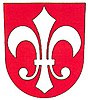 Coat of arms | |
 Čestín Location in the Czech Republic | |
| Coordinates: 49°48′21″N 15°6′23″E / 49.80583°N 15.10639°ECoordinates: 49°48′21″N 15°6′23″E / 49.80583°N 15.10639°E | |
| Country | |
| Region | Central Bohemian Region |
| District | Kutná Hora District |
| Government | |
| • Mayor | Miroslava Sýkorová |
| Area | |
| • Total | 12.57 sq mi (32.55 km2) |
| Elevation | 1,558 ft (475 m) |
| Population (2011) | |
| • Total | 432 |
| • Density | 34/sq mi (13/km2) |
| Time zone | UTC+1 (CET) |
| • Summer (DST) | UTC+2 (CEST) |
| Website | http://www.cestin.cz |

Čestín is a village and municipality in Kutná Hora District in the Central Bohemian Region of the Czech Republic.
History[]
In written sources was mentioned for the first time in 1291. Between 1361 and 1615 it has grown up to the city and was named Čestinkostel (Čestin' Church). A city seal with sign of lily was used at that period.
Historical monuments[]
- – Renaissance building (1572–1582), founded by Adam Slavata of Chlum, partly destroyed in XIX c.
- Church of St Peter and Paul – neo-romanic, built 1859–1861 at the place of a romanic church
- Vicarage
Parts of the village[]
- Čestín
- Čenovice
- Čentice
- Kamenná Lhota
- Kasanice
- Kněž
- Milotice
- Morány
- Polipsy
References[]
| Wikimedia Commons has media related to Čestín. |
- This article was initially translated from the Czech Wikipedia.
| Authority control: National libraries |
|---|
Categories:
- Populated places in Kutná Hora District
- Villages in Kutná Hora District
- Kutná Hora geography stubs