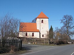
Dobrovítov
show This article may be expanded with text translated from the corresponding article in Czech. (July 2009) Click [show] for important translation instructions. |
Dobrovítov | |
|---|---|
Municipality and village | |
 | |
| Country | |
| Region | Central Bohemian Region |
| District | Kutná Hora District |
| Area | |
| • Total | 3.48 sq mi (9.01 km2) |
| Elevation | 1,598 ft (487 m) |
| Population (1.1.2013) | |
| • Total | 113 |
| • Density | 32/sq mi (13/km2) |
| Time zone | UTC+1 (CET) |
| • Summer (DST) | UTC+2 (CEST) |
Dobrovítov is a village and municipality in Kutná Hora District in the Central Bohemian Region of the Czech Republic.
References[]
| Wikimedia Commons has media related to Dobrovítov. |
- This article was initially translated from the Czech Wikipedia.
| Authority control: National libraries |
|---|
Coordinates: 49°47′N 15°20′E / 49.783°N 15.333°E

Categories:
- Populated places in Kutná Hora District
- Villages in Kutná Hora District
- Kutná Hora geography stubs