Vavřinec (Kutná Hora District)
Vavřinec | |
|---|---|
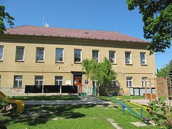 Municipal office | |
 Flag  Coat of arms | |
 Vavřinec Location in the Czech Republic | |
| Coordinates: 49°54′49″N 15°2′0″E / 49.91361°N 15.03333°ECoordinates: 49°54′49″N 15°2′0″E / 49.91361°N 15.03333°E | |
| Country | |
| Region | Central Bohemian |
| District | Kutná Hora |
| First mentioned | 1318 |
| Area | |
| • Total | 10.69 km2 (4.13 sq mi) |
| Elevation | 389 m (1,276 ft) |
| Population (2021-01-01)[1] | |
| • Total | 565 |
| • Density | 53/km2 (140/sq mi) |
| Time zone | UTC+1 (CET) |
| • Summer (DST) | UTC+2 (CEST) |
| Postal code | 285 04 |
| Website | www |

Vavřinec is a municipality and village in the Kutná Hora District in the Central Bohemian Region of the Czech Republic. It has about 600 inhabitants.
Administrative parts[]
Villages of Chmeliště and Žíšov are administrative parts of Vavřinec.
History[]
The settlement was founded together with the local church in the 14th century and was named after the patron of the original Romanesque church – Saint Lawrence.
References[]
| Wikimedia Commons has media related to Vavřinec (Kutná Hora District). |
| Authority control: National libraries |
|---|
Categories:
- Populated places in Kutná Hora District
- Villages in Kutná Hora District
- Kutná Hora geography stubs