Svatý Mikuláš
Svatý Mikuláš | |
|---|---|
 Kačina Castle | |
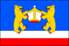 Flag 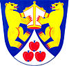 Coat of arms | |
 Svatý Mikuláš Location in the Czech Republic | |
| Coordinates: 49°59′27″N 15°21′2″E / 49.99083°N 15.35056°ECoordinates: 49°59′27″N 15°21′2″E / 49.99083°N 15.35056°E | |
| Country | |
| Region | Central Bohemian |
| District | Kutná Hora |
| First mentioned | 1307 |
| Area | |
| • Total | 17.83 km2 (6.88 sq mi) |
| Elevation | 206 m (676 ft) |
| Population (2021-01-01)[1] | |
| • Total | 879 |
| • Density | 49/km2 (130/sq mi) |
| Time zone | UTC+1 (CET) |
| • Summer (DST) | UTC+2 (CEST) |
| Postal codes | 284 01 |
| Website | www |

Svatý Mikuláš is a municipality and village in Kutná Hora District in the Central Bohemian Region of the Czech Republic. It has about 900 inhabitants.
Administrative parts[]
Villages of Lišice, Sulovice and Svatá Kateřina are administrative parts of Svatý Mikuláš. Lišice and Sulovice form an exclave of the municipal territory.
Sights[]
Svatý Mikuláš is known for the Kačina Castle. It is an Empire style building from 1806–1824 with three parts, a main building and two wings. Today it is used by National Museum of Agriculture, which opened here the Czech Countryside Museum. In the left wing there is a never-finished castle chapel and a castle theatre completed in the middle of the 19th century. In the right wing is the Chotek Library with more than 40,000 volumes of educational and beautiful literature from the 16th–19th centuries.[2]
Gallery[]

Church of Saint Nicholas
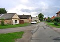
West common
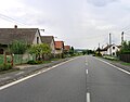
Road No 2


References[]
- ^ "Population of Municipalities – 1 January 2021". Czech Statistical Office. 2021-04-30.
- ^ "Zámek Kačina" (in Czech). Hrady.cz. Retrieved 2021-07-01.
| Wikimedia Commons has media related to Svatý Mikuláš (Kutná Hora District). |
| show Authority control |
|---|
- Populated places in Kutná Hora District
- Villages in Kutná Hora District
- Kutná Hora geography stubs