10th of Ramadan (city)
10th of Ramadan
العاشر من رمضان | |
|---|---|
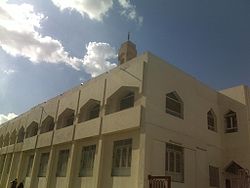 The Al-Tawheed Mosque | |
 10th of Ramadan | |
| Coordinates: 30°18′23″N 31°44′29″E / 30.306503°N 31.741455°ECoordinates: 30°18′23″N 31°44′29″E / 30.306503°N 31.741455°E | |
| Country | |
| Governorate | Sharqia |
| Area | |
| • Total | 94.76 km2 (36.59 sq mi) |
| Population ((2018 census)) | |
| • Total | 511,987 |
| Time zone | UTC+2 (EET) |
| Area code(s) | +(20) 55 |

10th of Ramadan (Arabic: العاشر من رمضان Al-ʿĀshir min Ramaḍān) is a city located in the Sharqia Governorate, Egypt. It is a first-generation new urban community, and one of the most industrialized. It enjoys close proximity to the city of Cairo, and is considered part of Greater Cairo. It was founded by Presidential Decree No. 249 in 1977 in a bid to attract foreign and local capital with the intent of providing job opportunities for the country's youth, as well as move people away from the Nile Valley to ease the stress on existing infrastructure and reduce congestion. The city was named for the commencement of the Yom Kippur War otherwise called the October War. It started on 10 Ramadan, 1393 AH according to the Islamic Calendar.[1] It shares its namesake with the Sixth of October City nearby.
Location[]
Al Ashir min Ramadan is located on the Cairo-Ismailia desert highway, 46 km (29 mi) from Cairo and 20 km (12 mi) from the city Belbeis.
Economy[]
Agriculture[]
47 million Egyptian pounds have been invested in afforestation in the city.
Industry[]
Some of the industries present in the city include electronics, food processing, ready-made garments, plastic, paper, textiles, building materials, steel, pharmaceuticals and furniture. There are many industrial zones in the city.
Industrial zones
| Zone name | Space (in million m2) |
|---|---|
| A1 | 10.46 |
| A2 | 7.62 |
| A3 | 4.06 |
| A4 | 5.33 |
| A5 | 9.47 |
| A6 | 8.33 |
| B1 | 5.24 |
| B2 | 9.85 |
| B3 | 0.31 |
| B4 | 3.00 |
| C1 | 0.75 |
| C2 | 0.75 |
| C3 | 0.11 |
| C4 | 0.16 |
| C5 | 1.23 |
| C6 | 1.29 |
| C7 | 0.33 |
| C8 | 0.15 |
| Total | 72.32 |
Source:[2]
Labor force[]
The population of the city is approximately 500,000 people [3]
Infrastructure[]
The city's infrastructure includes water supply, sewers, an electrical grid and telecommunications.
Water supply[]
The city has been connected with two water purification plants with capacity of 621,000 m^3/day and station wells with capacity of 20,000 m^3/day.[3]
Climate[]
Köppen-Geiger climate classification system classifies its climate as hot desert (BWh)[4] as the rest of Egypt.
| hideClimate data for 10th of Ramadan | |||||||||||||
|---|---|---|---|---|---|---|---|---|---|---|---|---|---|
| Month | Jan | Feb | Mar | Apr | May | Jun | Jul | Aug | Sep | Oct | Nov | Dec | Year |
| Average high °C (°F) | 18.5 (65.3) |
19.9 (67.8) |
23.6 (74.5) |
27.9 (82.2) |
32 (90) |
34.5 (94.1) |
34.9 (94.8) |
34.7 (94.5) |
32.1 (89.8) |
30 (86) |
25.2 (77.4) |
20.6 (69.1) |
27.8 (82.1) |
| Daily mean °C (°F) | 13.1 (55.6) |
14 (57) |
17 (63) |
20.4 (68.7) |
24.2 (75.6) |
27 (81) |
28 (82) |
28.1 (82.6) |
25.7 (78.3) |
23.6 (74.5) |
19.7 (67.5) |
15 (59) |
21.3 (70.4) |
| Average low °C (°F) | 7.8 (46.0) |
8.2 (46.8) |
10.4 (50.7) |
13 (55) |
16.5 (61.7) |
19.6 (67.3) |
21.1 (70.0) |
21.5 (70.7) |
19.3 (66.7) |
17.3 (63.1) |
14.2 (57.6) |
9.5 (49.1) |
14.9 (58.7) |
| Average precipitation mm (inches) | 7 (0.3) |
4 (0.2) |
3 (0.1) |
2 (0.1) |
0 (0) |
0 (0) |
0 (0) |
0 (0) |
0 (0) |
2 (0.1) |
4 (0.2) |
4 (0.2) |
26 (1.2) |
| Source: Climate-Data.org[4] | |||||||||||||
See also[]
References[]
- ^ [1], The Guardian, "New cities in the sand: inside Egypt’s dream to conquer the desert". Retrieved 31 Mar 2021
- ^ "Al Ashir Min Ramadan City Map" (PDF). 10ramadan.info. Archived from the original (PDF) on 18 March 2016. Retrieved 25 November 2015.
- ^ Jump up to: a b "الصفحة الرئيسية لعاشر من رمضان". Newcities.gov.eg. Retrieved 15 October 2017.
- ^ Jump up to: a b "Climate: 10th of Ramadan City - Climate graph, Temperature graph, Climate table". Climate-Data.org. Retrieved 18 October 2013.
| hide Districts and suburbs of Greater Cairo-Giza | ||||||||||
|---|---|---|---|---|---|---|---|---|---|---|
| Cairo Governorate |
|   | ||||||||
| Giza Governorate |
| |||||||||
| Qalyubia Governorate |
| |||||||||
| Authority control |
|
|---|
- Districts of Greater Cairo
- Cities in Egypt
- Populated places in Sharqia Governorate
- New towns started in the 1970s