El Shorouk
El Shorouk
الشروق | |
|---|---|
city | |
 House in El Shorouk | |
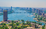
 El Shorouk Location in Egypt | |
| Coordinates: 30°08′42″N 31°38′24″E / 30.144979°N 31.639912°E | |
| Country | |
| Governorate | Cairo |
| Time zone | UTC+2 (EST) |

El Shorouk (Arabic: الشروق pronounced [eʃʃʊˈɾuːʔ, eʃʃɪˈɾuːʔ], "the Sunrise") is a city in the Greater Cairo area, specifically located northeast of Cairo and north of New Cairo in the province of Cairo.[1] El Shorouk is one of Third Generation cities, established by Prime Minister decision Number 326, in 1995. The establishment of the city highlights the efforts of the Egyptian state in managing urban expansion to achieve several development goals. One prominent goal being to absorb the expanding population of Egypt and to ease population pressures currently placed on the aging capital. Other major themes of this project are to redistribute the population of the Greater Cairo area and to raise the standard of living in the region through the provision of new job opportunities from industrial projects in the city.
Climate[]
The Köppen-Geiger climate classification system classifies El Shorouk as a hot desert (BWh),[2][3] as is the rest of Egypt. The climate is generally extremely dry around the capital. In addition to scarce rain, extreme heat during summer months is a general climate feature of El Shorouk. Though, daytime temperatures are milder during autumn and winter.
| Climate data for El Shorouk (altitude: 189m) | |||||||||||||
|---|---|---|---|---|---|---|---|---|---|---|---|---|---|
| Month | Jan | Feb | Mar | Apr | May | Jun | Jul | Aug | Sep | Oct | Nov | Dec | Year |
| Average high °C (°F) | 18.2 (64.8) |
19.8 (67.6) |
23.3 (73.9) |
28 (82) |
32.3 (90.1) |
34.5 (94.1) |
35 (95) |
34.6 (94.3) |
31.9 (89.4) |
29.8 (85.6) |
25 (77) |
20.1 (68.2) |
27.7 (81.8) |
| Daily mean °C (°F) | 12.9 (55.2) |
13.9 (57.0) |
16.7 (62.1) |
20.5 (68.9) |
24.4 (75.9) |
26.9 (80.4) |
27.9 (82.2) |
27.9 (82.2) |
25.5 (77.9) |
23.5 (74.3) |
19.4 (66.9) |
14.7 (58.5) |
21.2 (70.1) |
| Average low °C (°F) | 7.7 (45.9) |
8.1 (46.6) |
10.2 (50.4) |
13 (55) |
16.5 (61.7) |
19.4 (66.9) |
20.8 (69.4) |
21.2 (70.2) |
19.2 (66.6) |
17.2 (63.0) |
13.9 (57.0) |
9.4 (48.9) |
14.7 (58.5) |
| Average precipitation mm (inches) | 6 (0.2) |
4 (0.2) |
4 (0.2) |
2 (0.1) |
0 (0) |
0 (0) |
0 (0) |
0 (0) |
0 (0) |
1 (0.0) |
4 (0.2) |
5 (0.2) |
26 (1.1) |
| Source: Climate-Data.org[2] | |||||||||||||
| Climate data for El Shorouk (altitude: 181m) | |||||||||||||
|---|---|---|---|---|---|---|---|---|---|---|---|---|---|
| Month | Jan | Feb | Mar | Apr | May | Jun | Jul | Aug | Sep | Oct | Nov | Dec | Year |
| Average high °C (°F) | 18.2 (64.8) |
19.9 (67.8) |
23.5 (74.3) |
28 (82) |
32.3 (90.1) |
34.5 (94.1) |
34.9 (94.8) |
34.7 (94.5) |
31.9 (89.4) |
29.9 (85.8) |
25 (77) |
20.1 (68.2) |
27.7 (81.9) |
| Daily mean °C (°F) | 12.9 (55.2) |
14 (57) |
16.9 (62.4) |
20.4 (68.7) |
24.3 (75.7) |
27 (81) |
27.8 (82.0) |
28 (82) |
25.5 (77.9) |
23.6 (74.5) |
19.4 (66.9) |
14.7 (58.5) |
21.2 (70.1) |
| Average low °C (°F) | 7.7 (45.9) |
8.2 (46.8) |
10.3 (50.5) |
12.9 (55.2) |
16.4 (61.5) |
19.5 (67.1) |
20.8 (69.4) |
21.3 (70.3) |
19.2 (66.6) |
17.3 (63.1) |
13.9 (57.0) |
9.4 (48.9) |
14.7 (58.5) |
| Average precipitation mm (inches) | 6 (0.2) |
4 (0.2) |
4 (0.2) |
1 (0.0) |
0 (0) |
0 (0) |
0 (0) |
0 (0) |
0 (0) |
1 (0.0) |
4 (0.2) |
5 (0.2) |
25 (1) |
| Source: Climate-Data.org[3] | |||||||||||||
See also[]
References[]
- ^ "El Shorouk Map & population". CityPopulation.de.
- ^ a b "Climate: Sherook - Climate graph, Temperature graph, Climate table". Climate-Data.org. Retrieved 2014-02-07.
- ^ a b "Climate: Shoruq 2000 - Climate graph, Temperature graph, Climate table". Climate-Data.org. Retrieved 2014-02-07.
| 1,000,000 and more | |
|---|---|
| 300,000–999,999 | |
| 100,000–299,999 | |
| <99,999 |
|
Districts and suburbs of Greater Cairo-Giza | ||||||||||
|---|---|---|---|---|---|---|---|---|---|---|
| Cairo Governorate |
|   | ||||||||
| Giza Governorate |
| |||||||||
| Qalyubia Governorate |
| |||||||||
- Districts of Greater Cairo
- Cities in Egypt