Aghnjadzor
Coordinates: 39°54′08″N 45°14′51″E / 39.90222°N 45.24750°E

Aghnjadzor
Աղնջաձոր | |
|---|---|
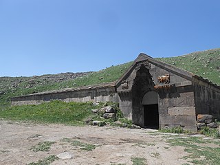
 Silk Road bridge at Selim Pass near Aghnjadzor | |
 Aghnjadzor | |
| Coordinates: 39°54′08″N 45°14′51″E / 39.90222°N 45.24750°E | |
| Country | |
| Province | Vayots Dzor |
| Municipality | Yeghegis |
| Population | |
| • Total | 412 |
| Time zone | UTC+4 (AMT) |
| Aghnjadzor at GEOnet Names Server | |
Aghnjadzor (Armenian: Աղնջաձոր; Azerbaijani: Ağkənd, anglicized: Aghkend) is a village in the Yeghegis Municipality of the Vayots Dzor Province in Armenia. The village had a mixed population of Azerbaijanis and Armenians before the exodus of Azerbaijanis from Armenia after the outbreak of the Nagorno-Karabakh conflict.[2]
Cultural heritage[]
One kilometer north is the site of the notable Lernantsk Caravanserai, appearing east of the road like a half-buried Quonset hut. It was built at approximately the same period as Orbelian's Caravanserai, which is also located near the village, but Lernantsk Caravanserai is smaller in size and more crudely built. Four kilometres north are the ruins of Kapuyt Berd ("Blue Fortress").
Gallery[]
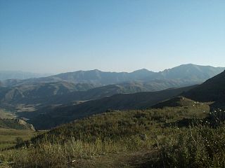
Scenery
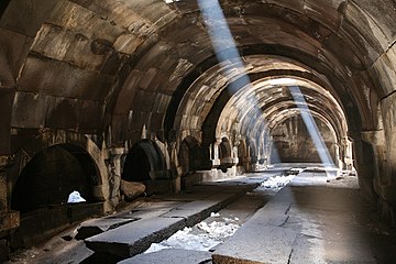
Inside Orbelian's Caravanserai
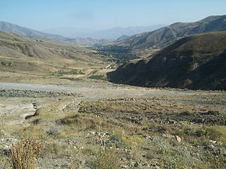
Scenery


References[]
- ^ Statistical Committee of Armenia. "The results of the 2011 Population Census of the Republic of Armenia" (PDF).
- ^ Kiesling, Brady (June 2000). "An Archaeological/Touristic Gazetteer and Map Set for the Historical Monuments of Armenia" (PDF). Retrieved 16 February 2021.
External links[]
| Wikimedia Commons has media related to Aghnjadzor. |
- Report of the results of the 2001 Armenian Census, Statistical Committee of Armenia
- Kiesling, Brady (2005), Rediscovering Armenia: Guide, Yerevan, Armenia: Matit Graphic Design Studio
- Brady Kiesling, Rediscovering Armenia, p. 122; original archived at Archive.org, and current version online on Armeniapedia.org.
Capital: Yeghegnadzor | |||||||||||
| Urban municipalities |
|  | |||||||||
| Rural municipalities |
| ||||||||||
This article about a location in Vayots Dzor Province, Armenia is a stub. You can help Wikipedia by . |
- Populated places in Vayots Dzor Province
- Vayots Dzor geography stubs