Vernashen
Coordinates: 39°47′38″N 45°21′48″E / 39.79389°N 45.36333°E

Vernashen
Վերնաշեն | |
|---|---|
 | |
 Vernashen | |
| Coordinates: 39°47′38″N 45°21′48″E / 39.79389°N 45.36333°E | |
| Country | |
| Province | Vayots Dzor |
| Municipality | Gladzor |
| Population | |
| • Total | 1,113 |
| Time zone | UTC+4 (AMT) |
| Vernashen at GEOnet Names Server | |
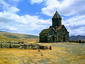
Vernashen (Armenian: Վերնաշեն) is a village in the Gladzor Municipality of the Vayots Dzor Province in Armenia. The 13th-century fortress of Proshaberd (also known as Boloraberd) and the Spitakavor Monastery of 1321 are located near Vernashen.
Toponymy[]
The village was previously known as Bashkend.
Gallery[]
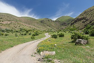
Nature along the tourist route Vernashen - Spitakavor
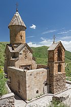
Spitakavor Monastery of 1321 near Vernashen
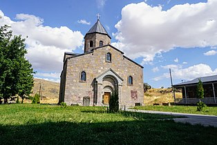
Arkazi Surb Khach

The road through the village towards the Spitakavor monastery
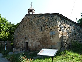
Surp Hakob church of Vernashen
Tanahat Monastery
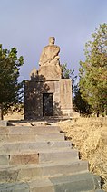
WWII monument


References[]
External links[]
| Wikimedia Commons has media related to Vernashen. |
- World Gazeteer: Armenia[dead link] – World-Gazetteer.com
- Report of the results of the 2001 Armenian Census, Statistical Committee of Armenia
Capital: Yeghegnadzor | |||||||||||
| Urban municipalities |
|  | |||||||||
| Rural municipalities |
| ||||||||||
This article about a location in Vayots Dzor Province, Armenia is a stub. You can help Wikipedia by . |
Categories:
- Vayots Dzor geography stubs
- Populated places in Vayots Dzor Province