Malishka
Coordinates: 39°44′13″N 45°23′15″E / 39.73694°N 45.38750°E

Malishka
Մալիշկա | |
|---|---|
Village Rural Community | |
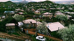 A view of Malishka | |
 Malishka | |
| Coordinates: 39°44′13″N 45°23′15″E / 39.73694°N 45.38750°E | |
| Country | |
| Province | Vayots Dzor |
| Municipality | Malishka |
| Area | |
| • Total | 86 km2 (33 sq mi) |
| Population | |
| • Total | 4,460 |
| Time zone | UTC+4 (AMT) |
| Malishka at GEOnet Names Server | |
Malishka (Armenian: Մալիշկա) is a village and rural municipal community of the Vayots Dzor Province in southern Armenia. Malishka is one of the largest villages in Armenia in terms of population and area.
Economy[]
Almost all of the population lives by subsistence farming. The only other places of employment in the village are the two village schools, the two kindergartens, or one of the many "khanuts" (shops).
Education[]
Peace Corps volunteers have been active in Malishka,[2] having taught English and holding after-school English clubs at Malishka Secondary School no. 1.
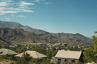
Gallery[]
A view of the village

St. Anna church in Malishka
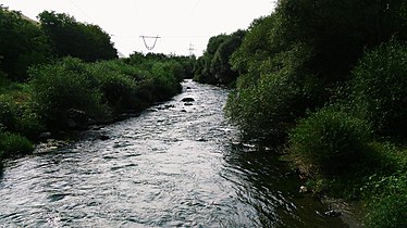
Malishka River


References[]
External links[]
| Wikimedia Commons has media related to Malishka, Armenia. |
- World Gazeteer: Armenia[dead link] – World-Gazetteer.com
- Report of the results of the 2001 Armenian Census, Statistical Committee of Armenia
| hide | |||||||||||
|---|---|---|---|---|---|---|---|---|---|---|---|
Capital: Yeghegnadzor | |||||||||||
| Urban municipalities |
|  | |||||||||
| Rural municipalities |
| ||||||||||
| show Authority control |
|---|
This article about a location in Vayots Dzor Province, Armenia is a stub. You can help Wikipedia by . |
- Populated places in Vayots Dzor Province
- Communities in Vayots Dzor Province
- Vayots Dzor geography stubs