Alafia River
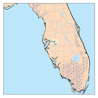
The Alafia River is 25 miles (40 km) long, with a watershed of 335 square miles (870 km2)[1] in Hillsborough County, Florida, United States, flowing into Tampa Bay. The watershed contains ten named lakes and ponds, and 29 named rivers, streams and canals. During the rainy season, excess water is pumped to the new C.W. Bill Young Regional Reservoir, which opened in 2005. The river is formed by two prongs. The north prong starts south of Mulberry and runs for 23.9 miles until it meets the south prong in Lithia.[2] The south prong begins south of Bradley Junction and continues for 28.7 miles.[3] The combined river then flows 24.7 miles west into Tampa Bay.[4][5]
History[]
For centuries the Alafia was home to various native tribes, including the Tocobaga. From their settlement at the mouth of the river to their hunting camps upstream, the Indians left traces of their lives and activities. The Mocoso occupied the area around the mouth of the Alafia in the 16th century and were believed to speak Timucuan.[6]
In the sixteenth century, the expeditions of Pánfilo de Narváez and Hernando de Soto explored the coastal areas of Tampa Bay and visited the Indians, making the first written account and charting the first maps of the Alafia River. On an early map the name 'Alafia' does not appear, but rather the translation, Hunting River. The 'Alafia' is a native word meaning "River of Fire", likely due to the river glowing at night due to high phosphoric content.[7] After the end of the Second Seminole War, white settlers began to arrive, starting with Benjamin Moody in 1843. They settled on the South side of the river around what is now US Highway 301 at the site that later became known as Peru. Shortly thereafter the Barnes family took up residence around Bell Shoals. These early settlers were able to claim land under the "Armed Occupation Act of Florida" which was passed in 1842 and granted 160 acres of land to any head of family or any single man who would bear arms and live on the land in a house for five years. By 1867, a ferry was operated by a Methodist preacher Reverend LeRoy Lesley. A second ferry near Lithia Springs was operated by John Carney.[7]
Because the river is known to experience moderate to high level flooding around twice per year, many nearby homes are built on stilts.[8]
Parks[]
Parks on the river with Hillsborough County include Alafia River State Park, Alderman's Ford Regional Park, Lithia Springs Regional Park, the Alafia Scrub Nature Preserve and the Riverview Civic Center. Williams Park and Mosaic Park are on the river near it's mouth. [9] The Alafia River Reserve is in Polk County near Mulberry.[10]
Phosphate spill[]
In 1997 a dam atop a gypsum stack at a Mulberry Phosphates fertilizer plant broke, spilling 56 million gallons of acidic wastewater into the North Fork of the Alafia. Virtually everything in the 42 miles between Mulberry and Hillsborough Bay was killed. In addition to killing millions of fish and hundreds of acres of vegetation, the spill dumped 350 tons of nitrogen into Tampa Bay. Rather than pay fines, Mulberry Phosphates declared bankruptcy. Five years later, only $3.7 million was recovered from the company's insurance company. In 2002, Mosaic took over maintenance of the stack. In 2007, the cost of closing both stacks was estimated to be $48 million, which will be paid to Mosaic by the Florida Department of Environmental Protection. After closure, Mosaic will be responsible for maintaining the stacks for the next 50 years.[11]
Literature[]
Jules Verne used the Alafia as the site of the fictional moon launch in his 1865 novel From the Earth to the Moon. He described the moon shot taking place from 1,800-foot bluffs overlooking the Alafia, around what is now today’s Bell Shoals Nature Preserve.[12]

On the Alafia River near Lithia Springs Park

Hurrah Lake on the Alafia River

An alligator near the State Park campground
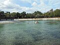
Lithia Springs Park swimming area


References[]
- ^ Lamm, Greg. 1990. Alafia River. in Marth, Del and Marty Marth, eds. The Rivers of Florida. Sarasota, Florida: Pineapple Press, Inc. ISBN 0-910923-70-1.
- ^ https://www.tampabay.wateratlas.usf.edu/waterbodies/rivers/2/
- ^ https://tampabay.wateratlas.usf.edu/waterbodies/rivers/3/alafia-river---south-prong
- ^ https://www.tampabay.wateratlas.usf.edu/waterbodies/rivers/1/alafia-river
- ^ "Alafia River Watershed, 2001". fcit.usf.edu. Retrieved 2021-07-06.
- ^ https://tampamagazines.com/the-history-of-native-americans-in-tampa/
- ^ Jump up to: a b Frazier, Norma Goolsby (1992). "PIONEERING ON THE LOWER ALAFIA AND THE EARLY SETTLEMENT OF PERU". Retrieved 25 May 2021.
- ^ "Less than one year after historic flooding, Alafia River spills its banks again". Tampa Bay Times. May 21, 2018. Retrieved 9 March 2021.
- ^ https://www.hillsboroughcounty.org/en/calendar/03-parksandrec/2018/20180217-canoe-trip-lithia
- ^ "Alafia River Reserve" (PDF). Polk County Environmental Lands Program. Archived from the original (PDF) on June 23, 2014. Retrieved May 24, 2021.
- ^ Palmer, Tom (December 9, 2007). "Alafia River Appears to Have Healed After Acid Spill".
- ^ Nelson, Charles (March 8, 2021). "Facts And Legends From The Shores Of The Alafia". Retrieved 25 May 2021.
Coordinates: 27°51′11″N 82°24′01″W / 27.8530809°N 82.4003712°W

| show Authority control |
|---|
This Hillsborough County, Florida location article is a stub. You can help Wikipedia by . |
- Rivers of Florida
- Rivers of Hillsborough County, Florida
- Tributaries of Tampa Bay
- Hillsborough County, Florida geography stubs
- Florida river stubs