Almendares River
This article does not cite any sources. (August 2017) |
| Almendares River | |
|---|---|
 | |
| Location | |
| Country | Cuba |
| Physical characteristics | |
| Length | 45 km (28 mi) |
The Almendares River is a river that runs for 45 km in the western part of Cuba. It originates from the east of Tapaste and flows north-west into the Straits of Florida. The river acts as a water supply for Havana.
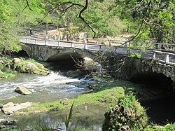
The final stretch divides the municipalities of Plaza de la Revolución (Vedado district) and Playa (Miramar district). Part of the river valley forms the Almendares Park or Metropolitan Park of Havana (PMH), a few kilometers upstream from the ocean.
Several industrial plants line the river banks (paper mills, gas production plants, breweries, food production plants, construction plants).
One of the three major projects by the Havana authorities is to continue the rehabilitation of the PMH (the other two being the restoration of the Old Town and the depollution of the Havana Bay): monitor and control water pollution, reduce and rationalize industrial occupation, maintain the old trees and the vegetation in the park. The area is gradually becoming a green oasis with playground, a few restaurants and footpaths.
The Almendares River, the main river flowing through the city of Havana, is the most contaminated river in the western hemisphere. It is dead, with no animal life
History[]
The Cuban aborigines called it Casiguaguas, and the first colonizers named it La Chorrera, when it was discovered, until they changed it to Almendares in honor of the Bishop of Havana, Enrique Almendaris.
The first aqueduct that was built for the city of Havana took its waters directly from the Almendares River, and it became known as "Zanja Real" -1545-. Over the years, this ditch began to be insufficient and stopped working, giving way to the project of Francisco de Albear y Lara, the largest Aqueduct in the city built in 1859 - 1897. La Zanja Real, remained a few years lending services. The undisciplined social and industrialists began to pour their sewage waters into it, causing the stoppage of the flow from the river and its change of direction, possibly turning this ditch into the First pronounced injection of sewage into Almendares!
In the six years between 1824 - 1829 a lot of money was spent on the conservation and service of the Zanja Real. It was Mr. Conde Villanueva who promoted the conduction of the Fernando VII aqueduct, a work that considerably improved Havana's drinking water supply. There were few obstacles that this man encountered to be able to materialize the project and get the water from the river. In those years, due to the overflows of the Almendares, the use of the Fernando VII aqueduct was insufficient due to the continuous turbulence, many of the people of Havana knew of the flooding of the river (6 meters above the usual level -October 6, 1860-) by The quality of the water that reached Havana was due to the fact that the use of the filters was not enough to clean the liquid that the entire city needed and its pressure was insufficient. The difference in level with the long-awaited Vento Springs where the water was clean and transparent was approximately 13 feet below, which led to the subsequent diversion.
According to Mr. José Luis Casaseca, it must be counted that the first canal built delivered 35 to 40,000 cubic meters per day, a quarter of which flowed the capacity shared with the Fernando VII aqueduct, 9 times greater than what the system filters yielded. Despite this, the qualities of the precious liquid were compared as it appears in one of the tables of the 1864 report to "start the project."
In 1865, after starting the catchment project, Albear describes in one of his notes: “Hundreds of springs scattered over a large area on the margins, and even the very banks, and even within the same waters, of a mighty river ; all different in projection, in quantity, in elevation, in direction; whimsically joining or separating ... "
After the North American intervention in Havana -1898- the engineers of the time began to fiddle with, what is known as the first attempt to divert the Almendares riverbed. A project that thanks to the good sense of Colonel Black (the person who ran the city in those years) ordered to verify and analyze with extreme caution. On December 24, 1907, Mr. Montoulieu, by appointment of Colonel Black, replaced the American Engineer Mr. Arthur S. Hobby B., former Head of water and sewage at the headquarters of the city of Havana.
In 1908, Colonel Black honestly declared: "that he had doubts and fears about the origin of the springs" so he ordered to suspend the excavation works, the planned cuts in the rocky mountains (near the current Fontanar district) and the modification of the river channel at the site, as the nature, the characteristics of the place and the currents that originated the "Vento springs" are unknown.
Urged by the composition of the waters of Havana from the Vento springs, product of the accentuated floods of the river (more than 6 meters above the usual level) and because these waters constitute a patrimony of the capital of Cuba, the work in 1912 for the "Theory of hydraulic plugging" by Eng. Enrique J. Montoulieu. Project that contemplated the construction of a “wooden dam” that would balance the pressures of the precious liquid between the outcrops (springs) and the level of the river, thus avoiding pollution and the escape of pressure to its channel.
In 1912 the first wooden and clay dam was built to maintain the level in the Vento Springs.
The construction of the “Wooden Dam” downstream of the “Taza de Vento”, the questioning of the project, plus the health situation of the city in those years (1912) spread the social problem in the press (Revista de la sociedad cubana engineers and the newspaper "El día"). In 1925, Eng. Juan Antonio Coscullela Barrio published an article entitled: "The Vento channel, what has not been done and should be done" where the nebulous issue of water use was discussed. It was not until 1926 that the necessary liquid retention modifications were approved through the “Wooden Dam” and the water supply in the Albear Canal by Mr. Enrique J. Montoulieu.
On December 15, 1927, the supply of water to the city was increased by 25 million gallons per day due to the arrival to the new "Small Cup" of the groundwater pumped from the "Aguada del Cura" aqueduct, a system that It introduced the mineral to the "Canal de Vento" conceived to withstand the current of water and not its pressure. Over the years, the walls of the “Canal de Vento” began to deform, increasing leaks, penetrating the roots of the trees through the cracks, which began to hinder the movement of the liquid and its maintenance. A deterioration that, if not overcome in 1949, with the new 66-purged pipe placed on the bridge that crosses the river would have caused its destruction.
Later, in the 1940s - 1950s, the consumption of the precious liquid became more pronounced, due to the growth of the city and it was necessary to build a new dam -1949- by Eng. Abel Fernández Simón with a mechanism that would guarantee the control of the fluid , discarding the previous wood and mud dam that had been used since 1926 to maintain recharge levels (infiltration of the water table) in the extraction zone -Vento Cup- built in 1835 and with this the flow level was maintained, the balance and sprouting of the springs in the region.
In 1949, the concrete “New Dam” was built with a solid structure of ramps, aprons and strainers that would prevent the clogging of the gates that would control the river levels in floods, guaranteeing the balance of the system necessary to keep the current in the river, the quality of the water in the aqueduct and the maintenance of the entire area.
It was not until the execution of the “Ejército Rebelde” reservoir (1974) on the “Roca de Vento” that the Almendares (La Chorrera) began to lose its natural strength (downstream) due to the cut off of its current, when “trying to collect water "In a" curtain 2,331 kilometers long and 29.10 m high "-data from the National Institute of Hydraulic Resources- which causes, according to the current behavior and the analysis of the aforementioned investigation, that water infiltrates the" Rock de Vento ”(areas distinguished on maps) towards the water table due to the pressure of the liquid produced by the construction of the reservoir in the place and the evaporation of the water into the atmosphere.
In his work “Towards a Culture of Nature” (1998), Antonio Núñez Jiménez declares: “Man cannot renounce to carry out those works that he believes are necessary for his progress, but he must also understand his enormous inability to foresee the evils that they engender against itself by carrying them out. An example: the Rebelde Army dam on the Almendares River was built to provide more water for agriculture, but it has never been filled, because much of it infiltrates into the limestone subsoil, an advantage, because it hydraulically enriches the water table, but then An unforeseen evil occurred: the Almendares stopped flowing from the Lenin Park downstream with sufficient force for the permanence of the current, which resulted in the stagnation of its waters, its greater contamination and rotting. It happened to its waters what happened to a sanitary service that does not discharge its excrement. A faithful and probative picture of what Federico Engels expressed about Nature taking revenge every time Man tries to modify it to a great extent ”.
The situation of the river in recent years is incomparable in the late 1940s, when the Casiguagua dam was built. In 2011, the water barely exceeded the same in a few moments (only when it rained heavily). In February 2012, the precious liquid is withdrawn from its edge, stagnating the water in the entire section between this place and the “Puente de Calabazar”. Current necessary to maintain the ecosystem (trees and animals), a liquid that infiltrates little by little in the layers of the earth, to the point of completely drying the river in many sections.
In recent years, some media have disclosed the state of the Vento springs, I quote: "As a consequence, for the third time in more than 70 years, the springs that feed the small bowl of the Vento canal were exhausted, and it is the first occasion that this conduit, the lowest part of the Almendares-Vento basin, reaches such depressed levels. This, together with the Ariguanabo, is providing three times less water, than the norm with even more unfavorable forecasts "...
The lawyer Antonio de Cháves, finished forming the project of Juan de Rojas on bringing to this population water from this Almendares river, vividly representing to the Audiencia, the Council of the Indies and the King of Spain the need for it to be executed.1
It was strongly used throughout the colonial, republican and revolutionary period, concentrating large industries, until in the years of the 1990s, it was decided to start a program for its environmental rehabilitation, which has managed to reduce the pollution levels of the river and reforest its basin.
References[]
1. Jacobo de la Pezuela: Diccionario geografico, estadístico, historico, de la isla de Cuba.Editor: Impr. del estab. de Mellado, 1863. Tomo II, página 236 (PDF).
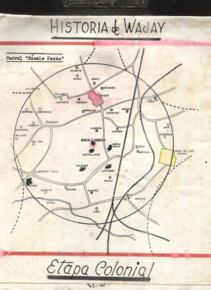
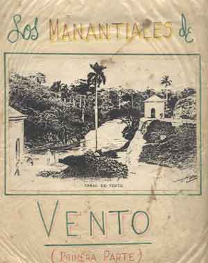
2. Gerardo Gandarilla, Tomado del Trabajo “Historia del Wajay”, Biblioteca “Ramón Herrera (Wajay). 3. Gerardo Gandarilla, Tomado del Trabajo “Los Manantiales de Vento”, Biblioteca “Ramón Herrera (Wajay). 4. Albear y Fernández de Lara, Francisco de: “Memoria sobre el proyecto de conducción a La Habana de las aguas de los manantiales de Vento” -1855-.
5. Albear y Fernández de Lara, Francisco de: “Memoria del proyecto de depósito de recepción y de distribución de las aguas del Canal de Vento”,-1876-.
6. Albear y Fernández de Lara, Francisco de: “Memoria del proyecto de la distribución del agua de Vento en La Habana” -1876-.
7. Albear y Fernández de Lara, Francisco de:“Acueducto de Albear”.
8. Antonio Núñez Jiménez “Hacia una Cultura de La Naturaleza” (PDF) 9. Investigación: “USO DE TÉCNICAS NUCLEARES EN LA EVALUACIÓN DE LA CUENCA ALMENDARES-VENTO PARA LA GESTIÓN SOSTENIBLE DE SUS RECURSOS HÍDRICOS”. Autores: José Luis Peralta Vital; Reinaldo Gil Castillo; Dennys Leyva Bombuse; Leslie Moleiro León y Manuel Pin (PDF). 10. Onelio García Pérez, Seriado Casiguagua “Del pasado al presente”. (PDF). - [https://www.hobbiesenred.com/pdf/Del_pasado_al_presente_ 2.pdf II Parte (PDF)] - [https://www.hobbiesenred.com/pdf/Del_pasado_al_presente_ 3.pdf III Parte (PDF)] - [https://www.hobbiesenred.com/pdf/Del_pasado_al_presente_ 4.pdf IV Parte (PDF)] - [https://www.hobbiesenred.com/pdf/Del_pasado_al_presente_ 5.pdf V Parte (PDF)] - [https://www.hobbiesenred.com/pdf/Del_pasado_al_presente_ 6.pdf VI Parte (PDF)] Categorías: Ríos de CubaProvincia de La Habana
| show |
|---|
| show Authority control |
|---|
Coordinates: 23°08′04″N 82°24′34″W / 23.1344°N 82.4094°W

- Rivers of Cuba
- North America river stubs
- Cuba geography stubs