Alpine, Arizona
Alpine, Arizona | |
|---|---|
 | |
 Alpine | |
| Coordinates: 33°50′53″N 109°08′35″W / 33.84806°N 109.14306°WCoordinates: 33°50′53″N 109°08′35″W / 33.84806°N 109.14306°W[1] | |
| Country | United States |
| State | Arizona |
| County | Apache |
| Area | |
| • Total | 0.60 sq mi (1.56 km2) |
| • Land | 0.60 sq mi (1.56 km2) |
| • Water | 0.00 sq mi (0.00 km2) |
| Elevation | 8,012 ft (2,442 m) |
| Population (2010) | |
| • Total | 145 |
| Time zone | UTC-7 (MST) |
| ZIP Code | 85920 |
| Area code(s) | 928 |
| FIPS code | 04-01920 |
| GNIS Feature ID | 25603 |

Alpine is a census-designated place in Apache County, Arizona, United States,[1] in Bush Valley in the east central part of the state. As of the 2010 census, it had a population of 145.[4]
History[]
Located approximately 75 miles south of the Navajo Nation, Alpine was settled in 1876 by Anderson Bush, a European-American who built a log house there. He originally used it as a trading post known as "Fort Bush". Bush sold his holdings in 1879 to William Maxwell and Fred Hamblin, Mormon settlers who established the town as a Mormon community.[5] They named the community for its lofty elevation.[6]
The Alpine post office has the ZIP code of 85920.[7]
Geography[]

Alpine is located at an elevation of 8,050 feet (2,450 m) above sea level in the eastern end of the White Mountains and surrounded by the Apache-Sitgreaves National Forest. Alpine is near the headwaters of the San Francisco River and six miles from the New Mexico border. Alpine is a popular destination for hunting, fishing, and camping. As of 1960, it was the highest place in the United States where farming was successfully conducted.[5]
Demographics[]
Alpine first appeared on the 1920 U.S. Census as the Alpine Precinct of Apache County.[9] It also was recorded in 1930. In that census it had a white majority.[10] All county precincts were combined into three districts in 1940. It did not appear on the census again until 2010, when it was defined as a census-designated place (CDP).
Climate[]
Alpine has a warm-summer Mediterranean climate (Köppen Csb) influence by its very high altitude and the North American Monsoon, which brings frequent thunder showers during the summer. Although temperatures are generally comfortable during the daytime, the sun is very intense and at night frosts have occurred even in summer and are an almost daily occurrence from October to May.
Winters are cold, with storms bringing precipitation mostly in the form of snow. Because Alpine is on the eastern end of the Mogollon Rim, it experiences a rain shadow from the White Mountains and receives less snowfall than points west at a similar elevation.
| hideClimate data for Alpine, Arizona | |||||||||||||
|---|---|---|---|---|---|---|---|---|---|---|---|---|---|
| Month | Jan | Feb | Mar | Apr | May | Jun | Jul | Aug | Sep | Oct | Nov | Dec | Year |
| Record high °F (°C) | 72 (22) |
72 (22) |
74 (23) |
79 (26) |
92 (33) |
94 (34) |
94 (34) |
88 (31) |
87 (31) |
86 (30) |
77 (25) |
72 (22) |
94 (34) |
| Average high °F (°C) | 44.8 (7.1) |
47.6 (8.7) |
52.3 (11.3) |
59.7 (15.4) |
67.6 (19.8) |
77.5 (25.3) |
78.4 (25.8) |
75.3 (24.1) |
71.2 (21.8) |
62.6 (17.0) |
52.6 (11.4) |
46.2 (7.9) |
61.3 (16.3) |
| Average low °F (°C) | 13.4 (−10.3) |
16.7 (−8.5) |
20.8 (−6.2) |
24.4 (−4.2) |
29.7 (−1.3) |
36.5 (2.5) |
44.7 (7.1) |
43.9 (6.6) |
37.4 (3.0) |
27.9 (−2.3) |
19.7 (−6.8) |
14.2 (−9.9) |
27.4 (−2.6) |
| Record low °F (°C) | −32 (−36) |
−28 (−33) |
−25 (−32) |
−6 (−21) |
8 (−13) |
13 (−11) |
27 (−3) |
29 (−2) |
17 (−8) |
−1 (−18) |
−18 (−28) |
−28 (−33) |
−32 (−36) |
| Average precipitation inches (mm) | 1.35 (34) |
1.29 (33) |
1.30 (33) |
0.63 (16) |
0.75 (19) |
0.86 (22) |
3.43 (87) |
4.47 (114) |
2.41 (61) |
2.38 (60) |
1.44 (37) |
1.35 (34) |
21.66 (550) |
| Average snowfall inches (cm) | 7.4 (19) |
6.8 (17) |
5.8 (15) |
1.4 (3.6) |
0.2 (0.51) |
0 (0) |
0 (0) |
0 (0) |
0 (0) |
1.4 (3.6) |
4.0 (10) |
5.8 (15) |
32.8 (83.71) |
| Average precipitation days (≥ 0.01 inch) | 6.2 | 6.2 | 6.7 | 4.7 | 4.9 | 5.3 | 16.5 | 17.4 | 9.7 | 6.8 | 4.5 | 5.1 | 94 |
| Average snowy days (≥ 0.1 inch) | 2.2 | 2.3 | 2.1 | 1.0 | 0.1 | 0 | 0 | 0 | 0 | 0.6 | 1.4 | 1.9 | 11.6 |
| Source: NOAA[11] | |||||||||||||
Government and infrastructure[]
The U.S. Postal Service operates the Alpine Post Office on U.S. Route 191.[12]
Attractions[]

- Apache-Sitgreaves National Forest
- The Coronado Trail Scenic Byway,[13] a 120-mile (190 km) segment along U.S. Route 191 (formerly US-666) between Springerville and Clifton, Arizona
- Escudilla Mountain (10,877 ft or 3,315 m), a pine and aspen-covered mesa, popular for hiking, horseback-riding, and viewing fall colors
- Luna Lake, 3 miles (5 km) southeast, a popular fishing and camping spot
Education[]
The Alpine Elementary School District, operating Alpine Elementary School, serves Alpine.
The Apache County Library District operates the Alpine Public Library.[14]
Picture gallery[]

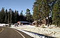
Alpine Country Store
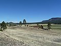
Alpine in November 1990
Wallow Fire in 2011


See also[]
References[]
- ^ Jump up to: a b U.S. Geological Survey Geographic Names Information System: Alpine
- ^ "Population and Housing Unit Estimates". Retrieved June 9, 2017.
- ^ "2016 U.S. Gazetteer Files". United States Census Bureau. Retrieved July 18, 2017.
- ^ "Geographic Identifiers: 2010 Demographic Profile Data (G001): Alpine CDP, Arizona". U.S. Census Bureau, American Factfinder. Archived from the original on February 12, 2020. Retrieved April 17, 2013.
- ^ Jump up to: a b Byrd H. Granger (1960). Arizona Place Names. University of Arizona Press. p. 3. Retrieved November 20, 2011.
- ^ The Utah Genealogical and Historical Magazine, Volumes 9-10. 1918. p. 9.
- ^ Zip Code Lookup Archived June 15, 2011, at the Wayback Machine
- ^ "Census of Population and Housing". Census.gov. Retrieved June 4, 2016.
- ^ http://www2.census.gov/prod2/decennial/documents/06229686v1-7ch02.pdf
- ^ https://www2.census.gov/prod2/decennial/documents/10612963v3p1ch02.pdf
- ^ "ALPINE, AZ" (PDF). National Oceanic and Atmospheric Administration. December 2011. Retrieved December 6, 2011.[permanent dead link]
- ^ "Post Office™ Location – ALPINE Archived August 26, 2012, at the Wayback Machine." U.S. Postal Service. Retrieved on January 30, 2011.
- ^ [1]
- ^ "Alpine Public Library Archived August 13, 2010, at the Wayback Machine." Apache County Library District. Retrieved on January 30, 2011.
External links[]
| Wikimedia Commons has media related to: Alpine, Arizona |
- Alpine Area Chamber of Commerce
- "Alpine" at White Mountains Online
| show Municipalities and communities of Apache County, Arizona, United States |
|---|

| show Authority control |
|---|
- White Mountains (Arizona)
- Census-designated places in Apache County, Arizona
- Populated places established in 1876
- 1876 establishments in Arizona Territory