Arçais
Arçais | |
|---|---|
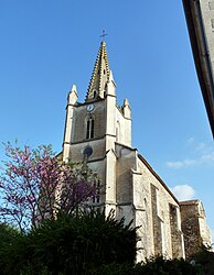 The church in Arçais | |
show Location of Arçais | |
 Arçais | |
| Coordinates: 46°17′49″N 0°41′23″W / 46.2969°N 0.6897°WCoordinates: 46°17′49″N 0°41′23″W / 46.2969°N 0.6897°W | |
| Country | France |
| Region | Nouvelle-Aquitaine |
| Department | Deux-Sèvres |
| Arrondissement | Niort |
| Canton | Frontenay-Rohan-Rohan |
| Intercommunality | CA Niortais |
| Government | |
| • Mayor (2020–2026) | Philippe Leyssene[1] |
| Area 1 | 15.12 km2 (5.84 sq mi) |
| Population (Jan. 2018)[2] | 612 |
| • Density | 40/km2 (100/sq mi) |
| Time zone | UTC+01:00 (CET) |
| • Summer (DST) | UTC+02:00 (CEST) |
| INSEE/Postal code | 79010 /79210 |
| Elevation | 1–36 m (3.3–118.1 ft) (avg. 13 m or 43 ft) |
| 1 French Land Register data, which excludes lakes, ponds, glaciers > 1 km2 (0.386 sq mi or 247 acres) and river estuaries. | |


Arçais is a commune in the Deux-Sèvres department in the Nouvelle-Aquitaine region in western France. It is the only village which is located in the centre of the Marais Mouillé, the so-called "wet marsh" which forms the eastern half of the Marais Poitevin (the Poitou Marshes), near the city of Niort. It is a popular centre for tourism, with several embarcadères which hire out punts and other boats for use on the network of canals that surrounds the village. There are also several shops, bars and other facilities, including bike hire.
See also[]
References[]
- ^ "Répertoire national des élus: les maires". data.gouv.fr, Plateforme ouverte des données publiques françaises (in French). 2 December 2020. Retrieved 7 December 2020.
- ^ "Populations légales 2018". INSEE. 28 December 2020.
External links[]
| Wikimedia Commons has media related to Arçais. |
- The interregional park Marais Poitevin
- Poitou-Charentes Vacances[permanent dead link]: regional tourism website, with links to boat and bike companies in Arcais
This Deux-Sèvres geographical article is a stub. You can help Wikipedia by . |
Categories:
- Communes of Deux-Sèvres
- Aunis
- Deux-Sèvres geography stubs