Saint-Léger-de-Montbrun
Saint-Léger-de-Montbrun | |
|---|---|
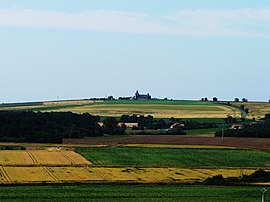 A general view of Saint-Léger-de-Montbrun | |
show Location of Saint-Léger-de-Montbrun | |
 Saint-Léger-de-Montbrun | |
| Coordinates: 46°59′32″N 0°06′59″W / 46.9922°N 0.1164°WCoordinates: 46°59′32″N 0°06′59″W / 46.9922°N 0.1164°W | |
| Country | France |
| Region | Nouvelle-Aquitaine |
| Department | Deux-Sèvres |
| Arrondissement | Bressuire |
| Canton | Le Val de Thouet |
| Intercommunality | Thouarsais |
| Government | |
| • Mayor (2020–2026) | Jean-Paul Montibert[1] |
| Area 1 | 30.72 km2 (11.86 sq mi) |
| Population (Jan. 2018)[2] | 1,262 |
| • Density | 41/km2 (110/sq mi) |
| Time zone | UTC+01:00 (CET) |
| • Summer (DST) | UTC+02:00 (CEST) |
| INSEE/Postal code | 79265 /79100 |
| Elevation | 46–105 m (151–344 ft) (avg. 77 m or 253 ft) |
| 1 French Land Register data, which excludes lakes, ponds, glaciers > 1 km2 (0.386 sq mi or 247 acres) and river estuaries. | |


Saint-Léger-de-Montbrun is a commune in the Deux-Sèvres department in western France.
See also[]
References[]
- ^ "Répertoire national des élus: les maires". data.gouv.fr, Plateforme ouverte des données publiques françaises (in French). 2 December 2020.
- ^ "Populations légales 2018". INSEE. 28 December 2020.
| Wikimedia Commons has media related to Saint-Léger-de-Montbrun. |
This Deux-Sèvres geographical article is a stub. You can help Wikipedia by . |
Categories:
- Communes of Deux-Sèvres
- Deux-Sèvres geography stubs