Sepvret
Sepvret | |
|---|---|
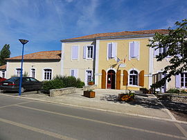 The town hall in Sepvret | |
show Location of Sepvret | |
 Sepvret | |
| Coordinates: 46°17′14″N 0°05′19″W / 46.2872°N 0.0886°WCoordinates: 46°17′14″N 0°05′19″W / 46.2872°N 0.0886°W | |
| Country | France |
| Region | Nouvelle-Aquitaine |
| Department | Deux-Sèvres |
| Arrondissement | Niort |
| Canton | Celles-sur-Belle |
| Government | |
| • Mayor (2020–2026) | Patrick Charpentier |
| Area 1 | 17.01 km2 (6.57 sq mi) |
| Population (Jan. 2018)[1] | 620 |
| • Density | 36/km2 (94/sq mi) |
| Time zone | UTC+01:00 (CET) |
| • Summer (DST) | UTC+02:00 (CEST) |
| INSEE/Postal code | 79313 /79120 |
| Elevation | 117–194 m (384–636 ft) (avg. 171 m or 561 ft) |
| 1 French Land Register data, which excludes lakes, ponds, glaciers > 1 km2 (0.386 sq mi or 247 acres) and river estuaries. | |


Sepvret (French pronunciation: [sɛvʁɛ]) is a commune in the Deux-Sèvres department in western France.
See also[]
References[]
- ^ "Populations légales 2018". INSEE. 28 December 2020.
| Wikimedia Commons has media related to Sepvret. |
This Deux-Sèvres geographical article is a stub. You can help Wikipedia by . |
Categories:
- Communes of Deux-Sèvres
- Deux-Sèvres geography stubs