Arab, Alabama
Arab, Alabama | |
|---|---|
| City of Arab | |
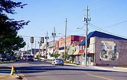 Main Street (SR 69) | |
| Motto(s): "Proud of our past... embracing the future" | |
 Location of Arab in Cullman County and Marshall County, Alabama. | |
 Arab Location of Arab in Cullman County and Marshall County, Alabama. | |
| Coordinates: 34°19′40″N 86°29′55″W / 34.32778°N 86.49861°W | |
| Country | United States |
| State | Alabama |
| Counties | Marshall, Cullman |
| Named for | Arad Thompson |
| Government | |
| • Type | Mayor–Council |
| • Mayor | Bob Joslin |
| Area | |
| • Total | 13.46 sq mi (34.86 km2) |
| • Land | 13.32 sq mi (34.51 km2) |
| • Water | 0.13 sq mi (0.34 km2) |
| Elevation | 1,089 ft (332 m) |
| Population (2010) | |
| • Total | 8,050 |
| • Estimate (2019)[1] | 8,383 |
| • Density | 629.12/sq mi (242.90/km2) |
| Time zone | UTC-6 (Central (CST)) |
| • Summer (DST) | UTC-5 (CDT) |
| ZIP code | 35016 |
| Area codes | 256 , 938 |
| FIPS code | 01-02116 |
| GNIS feature ID | 0113194 |
| Website | www |


Arab (/eɪˈræb/) is a city in Marshall and Cullman counties in the northern part of the U.S. state of Alabama, located 10 miles (16 km) from Guntersville Lake and Guntersville Dam, and is included in the Huntsville-Decatur Combined Statistical Area. As of the 2010 census, the population of the city was 8,050.[3]
History[]
What is now Arab was established by Stephen Tuttle Thompson in the 1840s, and was originally known as Thompson's Village.[4] The current name of the town was an unintentional misspelling by the U.S. Postal Service in 1882 of the city's intended name, taken from Arad Thompson, the son of the town founder, who had applied for a post office that year. "Arad" was one of three names sent to the Postal Service for consideration, the others being "Ink" and "Bird." Arab has frequently been noted on lists of unusual place names.[5]
Arab was incorporated in 1892.[6]
Arab was a sundown town, with a sign warning African Americans not to stay in Arab after dark[7] and, historically, even barring them during the day.[8] Ku Klux Klan material has been disseminated multiple times in Arab in recent years.[9]
Arab was one of the towns reaching contact with the 2011 super outbreak.
Geography[]
Arab is located on top of Brindlee Mountain.[10] The city is primarily in southern Marshall County; a small portion extends south into Cullman County. U.S. Route 231 runs north-to-south through Arab, and State Route 69 runs east-to-west, through the city's business district.
According to the U.S. Census Bureau, the city has a total area of 13.1 square miles (34.0 km2), of which 14.0 square miles (36.3 km2) is land and 0.12 square miles (0.3 km2), or 1.02%, is water.[3] The town's elevation is 1,124 feet (343 m) above sea level.
Demographics[]
City of Arab[]
| Historical population | |||
|---|---|---|---|
| Census | Pop. | %± | |
| 1920 | 264 | — | |
| 1930 | 425 | 61.0% | |
| 1940 | 640 | 50.6% | |
| 1950 | 1,592 | 148.8% | |
| 1960 | 2,989 | 87.8% | |
| 1970 | 4,399 | 47.2% | |
| 1980 | 6,053 | 37.6% | |
| 1990 | 6,321 | 4.4% | |
| 2000 | 7,174 | 13.5% | |
| 2010 | 8,050 | 12.2% | |
| 2019 (est.) | 8,383 | [1] | 4.1% |
| U.S. Decennial Census[11] | |||
Arab was incorporated as a town in 1892, but it did not first report a population on the census until the 1920 U.S. Census.[12]
2000 census data[]
At the 2000 census there were 7,174 people in 3,012 households, including 2,075 families, in the city. The population density was 561.8 inhabitants per square mile (216.9/km2). There were 3,223 housing units at an average density of 252.4 square miles (654 km2) . The racial makeup of the city was 98.29% White, 0.18% Black or African American, 0.49% Native American, 0.39% Asian, 0.17% from other races, and 0.49% from two or more races. 0.66%[13] were Hispanic or Latino of any race.
Of the 3,012 households 31.2% had children under the age of 18 living with them, 54.3% were married couples living together, 11.3% had a female householder with no husband present, and 31.1% were non-families. 28.2% of households were one person and 13.7% were one person aged 65 or older. The average household size was 2.35 and the average family size was 2.87.
The age distribution was 23.9% under the age of 18, 7.2% from 18 to 24, 27.6% from 25 to 44, 23.6% from 45 to 64, and 17.8% 65 or older. The median age was 40 years. For every 100 females, there were 87.2 males. For every 100 females age 18 and over, there were 82.8 males.
The median household income was $36,716 and the median family income was $45,761. Males had a median income of $32,425 versus $24,265 for females. The per capita income for the city was $20,035. About 8.2% of families and 10.0% of the population were below the poverty line, including 12.5% of those under age 18 and 14.9% of those age 65 or over.
2010 census[]
At the 2010 census there were 8,050 people in 3,359 households, including 2,257 families, in the city. The population density was 620 inhabitants per square mile (240/km2). There were 3,693 housing units at an average density of 284.1 square miles (736 km2). The racial makeup of the city was 96.6% White, 0.1% Black or African American, 0.6% Native American, 0.7% Asian, 0.7% from other races, and 1.1% from two or more races. 1.7%.[14] were Hispanic or Latino of any race.
Of the 3,359 households 28.9% had children under the age of 18 living with them, 50.4% were married couples living together, 13.0% had a female householder with no husband present, and 32.8% were non-families. 29.6% of households were one person and 14.9% were one person aged 65 or older. The average household size was 2.37 and the average family size was 2.92.
The age distribution was 23.7% under the age of 18, 8.3% from 18 to 24, 22.0% from 25 to 44, 27.0% from 45 to 64, and 19.1% 65 or older. The median age was 42.2 years. For every 100 females, there were 88.6 males. For every 100 females age 18 and over, there were 91.4 males.
The median household income was $42,435 and the median family income was $64,432. Males had a median income of $44,401 versus $40,062 for females. The per capita income for the city was $23,986. About 13.3% of families and 18.1% of the population were below the poverty line, including 27.7% of those under age 18 and 14.8% of those age 65 or over.
Arab Precinct/Division (1920-)[]
| Historical population | |||
|---|---|---|---|
| Census | Pop. | %± | |
| 1920 | 1,474 | — | |
| 1930 | 1,891 | 28.3% | |
| 1940 | 2,249 | 18.9% | |
| 1950 | 2,739 | 21.8% | |
| 1960 | 6,659 | 143.1% | |
| 1970 | 9,008 | 35.3% | |
| 1980 | 11,393 | 26.5% | |
| 1990 | 12,187 | 7.0% | |
| 2000 | 14,220 | 16.7% | |
| 2010 | 15,490 | 8.9% | |
| U.S. Decennial Census[15] | |||
Arab Precinct (Marshall County 26th Precinct) first appeared on the 1920 U.S. Census. In 1960, it was changed to the Arab Census Division as part of a general reorganization of counties.[16] The census division only includes the Marshall County portion of the town of Arab. The Cullman County portion is in the Baileyton-Joppa Census Division.[17]
Government[]
Arab has a mayor-council form of city government consisting of five council members and a mayor. City elections occur every four years, coinciding with the presidential elections. Council seats are at-large and are not associated with districts. Arab City Schools is the public school district. Arab has its own paid police department. Their fire department has one station, sitting on top of Marshall County 911 center. Both are paid departments.
Infrastructure[]
Utilities[]
Electricity service in Arab is provided through Arab Electric Cooperative, which buys power through the Tennessee Valley Authority. Water service in Arab is provided through Arab Water Works, which gets water from Browns Creek in Guntersville Lake. Natural gas is also provided in Arab through Marshall County Gas District, which is based out of Guntersville.
Transportation[]
 U.S. Highway 231
 Alabama State Route 69
Notable people[]
- Liles C. Burke, United States District Judge of the United States District Court for the Northern District of Alabama[18]
- Vernon Derrick, fiddle and mandolin player[19]
- Fred Nall Hollis, artist[20]
- Jill King, singer/songwriter[21]
- Jack Lively, Major League Baseball pitcher[22]
- Wayne Mills, country music singer[23]
References[]
- ^ Jump up to: a b "Population and Housing Unit Estimates". United States Census Bureau. May 24, 2020. Retrieved May 27, 2020.
- ^ "2019 U.S. Gazetteer Files". United States Census Bureau. Retrieved June 29, 2020.
- ^ Jump up to: a b "Geographic Identifiers: 2010 Demographic Profile Data (G001): Arab city, Alabama". U.S. Census Bureau, American Factfinder. Archived from the original on February 12, 2020. Retrieved June 11, 2014.
- ^ James P. Kaetz, "Arab," Encyclopedia of Alabama, 2013.
- ^ Parker, Quentin (2010). Welcome to Horneytown, North Carolina, Population: 15: An insider's guide to 201 of the world's weirdest and wildest places. Adams Media.
- ^ Foscue, Virginia. Place Names in Alabama. University of Alabama Press, 1989.
- ^ Loewen, James W. (2005). Sundown Towns: A Hidden Dimension of American Racism. New York: The New Press. pp. 347, 380. ISBN 156584887X.
- ^ Windham, Ben. "Cullman's 'sundown town' image worthy of study". Tuscaloosa News. Retrieved 2 November 2019.
- ^ Kern, Kelsey. "KKK propaganda found in Arab for the second time in months". WHNT19 News. Retrieved 2 November 2019.
- ^ "US Gazetteer files: 2010, 2000, and 1990". United States Census Bureau. 2011-02-12. Retrieved 2011-04-23.
- ^ "U.S. Decennial Census". Census.gov. Retrieved June 6, 2013.
- ^ http://www2.census.gov/prod2/decennial/documents/06229686v1-7ch01.pdf , p.23
- ^ "U.S. Census website". United States Census Bureau. Retrieved 2008-01-31.
- ^ "U.S. Census website". United States Census Bureau. Retrieved 2015-08-03.
- ^ "U.S. Decennial Census". Census.gov. Retrieved June 6, 2013.
- ^ http://www2.census.gov/prod2/decennial/documents/37721510v1p2ch2.pdf, 1960 AL Census
- ^ http://www.census.gov/prod/cen2010/cph-1-2.pdf, 2010 AL Census
- ^ Campbell, Anthony (October 17, 2018). "Marshall County's Liles Burke Now a Federal Judge". Advertiser-Gleam. Retrieved 20 May 2019.
- ^ Maze, Steve. "Vernon Derrick". Arab Today Archives. Archived from the original on December 28, 2016. Retrieved November 30, 2014.
- ^ Moore, David (March 11, 2009). "Mary Hollis' friends invited to memorial service Sunday". The Arab Tribune. Retrieved November 30, 2014.
- ^ Cohoon, Rick. "Jill King biography". AllMusic. Retrieved 2008-01-07.
- ^ "Jack Lively Bio". Baseball Reference. Retrieved 31 January 2013.
- ^ Stein, Kelsey (December 8, 2013). "Slain country musician Wayne Mills' funeral in Arab will be live-streamed online Sunday afternoon". Alabama Media Group. Retrieved November 30, 2014.
External links[]
| Wikimedia Commons has media related to Arab, Alabama. |
Coordinates: 34°19′40″N 86°29′55″W / 34.327863°N 86.498613°W
| show Municipalities and communities of Cullman County, Alabama, United States |
|---|

| show Municipalities and communities of Marshall County, Alabama, United States |
|---|

| show Authority control |
|---|
- Cities in Alabama
- Cities in Cullman County, Alabama
- Cities in Marshall County, Alabama
- Huntsville-Decatur-Albertville, AL Combined Statistical Area
- Populated places established in 1882
- 1882 establishments in the United States
- Sundown towns in Alabama