Ardon, Loiret
Ardon | |
|---|---|
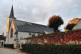 The church in Ardon | |
 Coat of arms | |
show Location of Ardon | |
 Ardon | |
| Coordinates: 47°46′45″N 1°52′29″E / 47.7792°N 1.8747°ECoordinates: 47°46′45″N 1°52′29″E / 47.7792°N 1.8747°E | |
| Country | France |
| Region | Centre-Val de Loire |
| Department | Loiret |
| Arrondissement | Orléans |
| Canton | La Ferté-Saint-Aubin |
| Intercommunality | Portes de Sologne |
| Government | |
| • Mayor (2020–2026) | Jean-Paul Roche |
| Area 1 | 53.65 km2 (20.71 sq mi) |
| Population (Jan. 2018)[1] | 1,092 |
| • Density | 20/km2 (53/sq mi) |
| Time zone | UTC+01:00 (CET) |
| • Summer (DST) | UTC+02:00 (CEST) |
| INSEE/Postal code | 45006 /45160 |
| Elevation | 98–123 m (322–404 ft) |
| 1 French Land Register data, which excludes lakes, ponds, glaciers > 1 km2 (0.386 sq mi or 247 acres) and river estuaries. | |


Ardon (French pronunciation: [aʁdɔ̃]) is a commune in the Loiret department in north-central France.
Population[]
|
|
See also[]
- Communes of the Loiret department
References[]
- ^ "Populations légales 2018". INSEE. 28 December 2020.
External links[]
| Wikimedia Commons has media related to Ardon (Loiret). |
| show Communes of the Loiret department |
|---|
This Loiret geographical article is a stub. You can help Wikipedia by . |
Categories:
- Communes of Loiret
- Loiret geography stubs