Ervauville
Ervauville | |
|---|---|
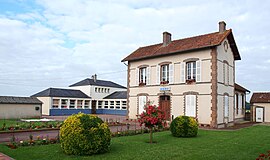 The town hall and school in Ervauville | |
show Location of Ervauville | |
 Ervauville | |
| Coordinates: 48°05′26″N 2°58′57″E / 48.0906°N 2.9825°ECoordinates: 48°05′26″N 2°58′57″E / 48.0906°N 2.9825°E | |
| Country | France |
| Region | Centre-Val de Loire |
| Department | Loiret |
| Arrondissement | Montargis |
| Canton | Courtenay |
| Government | |
| • Mayor (2020–2026) | Claudia Guespin[1] |
| Area 1 | 12.54 km2 (4.84 sq mi) |
| Population (Jan. 2018)[2] | 540 |
| • Density | 43/km2 (110/sq mi) |
| Demonym(s) | Ervauvillois |
| Time zone | UTC+01:00 (CET) |
| • Summer (DST) | UTC+02:00 (CEST) |
| INSEE/Postal code | 45136 /45320 |
| Elevation | 134–164 m (440–538 ft) |
| 1 French Land Register data, which excludes lakes, ponds, glaciers > 1 km2 (0.386 sq mi or 247 acres) and river estuaries. | |


Ervauville is a commune in the Loiret department in north-central France.
See also[]
- Communes of the Loiret department
References[]
- ^ "Répertoire national des élus: les maires". data.gouv.fr, Plateforme ouverte des données publiques françaises (in French). 2 December 2020.
- ^ "Populations légales 2018". INSEE. 28 December 2020.
| Wikimedia Commons has media related to Ervauville. |
| show Communes of the Loiret department |
|---|
This Loiret geographical article is a stub. You can help Wikipedia by . |
Categories:
- Communes of Loiret
- Loiret geography stubs