La Bussière, Loiret
La Bussière | |
|---|---|
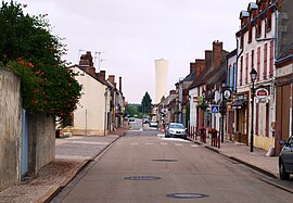 The main road in La Bussière | |
show Location of La Bussière | |
 La Bussière | |
| Coordinates: 47°46′35″N 2°45′00″E / 47.7763°N 2.75°ECoordinates: 47°46′35″N 2°45′00″E / 47.7763°N 2.75°E | |
| Country | France |
| Region | Centre-Val de Loire |
| Department | Loiret |
| Arrondissement | Montargis |
| Canton | Gien |
| Intercommunality | Berry Loire Puisaye |
| Government | |
| • Mayor (2020–2026) | Dominique Geoffrenet[1] |
| Area 1 | 35.23 km2 (13.60 sq mi) |
| Population (Jan. 2018)[2] | 795 |
| • Density | 23/km2 (58/sq mi) |
| Time zone | UTC+01:00 (CET) |
| • Summer (DST) | UTC+02:00 (CEST) |
| INSEE/Postal code | 45060 /45230 |
| Elevation | 144–186 m (472–610 ft) |
| 1 French Land Register data, which excludes lakes, ponds, glaciers > 1 km2 (0.386 sq mi or 247 acres) and river estuaries. | |


La Bussière (French pronunciation: [la bysjɛʁ]) is a commune in the Loiret department in north-central France.
Population[]
|
|
See also[]
- Communes of the Loiret department
References[]
- ^ "Répertoire national des élus: les maires". data.gouv.fr, Plateforme ouverte des données publiques françaises (in French). 2 December 2020.
- ^ "Populations légales 2018". INSEE. 28 December 2020.
| Wikimedia Commons has media related to La Bussière (Loiret). |
| show Communes of the Loiret department |
|---|
| show Authority control |
|---|
This Loiret geographical article is a stub. You can help Wikipedia by . |
Categories:
- Communes of Loiret
- Loiret geography stubs