Aulnay-la-Rivière
Aulnay-la-Rivière | |
|---|---|
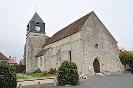 The church in Aulnay-la-Rivière | |
 Coat of arms | |
show Location of Aulnay-la-Rivière | |
 Aulnay-la-Rivière | |
| Coordinates: 48°11′47″N 2°22′47″E / 48.1964°N 2.3797°ECoordinates: 48°11′47″N 2°22′47″E / 48.1964°N 2.3797°E | |
| Country | France |
| Region | Centre-Val de Loire |
| Department | Loiret |
| Arrondissement | Pithiviers |
| Canton | Malesherbes |
| Intercommunality | |
| Government | |
| • Mayor (2020–2026) | Véronique Lévy[1] |
| Area 1 | 16.14 km2 (6.23 sq mi) |
| Population (Jan. 2018)[2] | 502 |
| • Density | 31/km2 (81/sq mi) |
| Time zone | UTC+01:00 (CET) |
| • Summer (DST) | UTC+02:00 (CEST) |
| INSEE/Postal code | 45014 /45390 |
| Elevation | 82–137 m (269–449 ft) |
| 1 French Land Register data, which excludes lakes, ponds, glaciers > 1 km2 (0.386 sq mi or 247 acres) and river estuaries. | |


Aulnay-la-Rivière (French pronunciation: [o(l)nɛ la ʁivjɛʁ]) is a commune in the Loiret department in north-central France.
Population[]
|
|
See also[]
- Communes of the Loiret department
References[]
- ^ "Répertoire national des élus: les maires". data.gouv.fr, Plateforme ouverte des données publiques françaises (in French). 2 December 2020.
- ^ "Populations légales 2018". INSEE. 28 December 2020.
| Wikimedia Commons has media related to Aulnay-la-Rivière. |
| show Communes of the Loiret department |
|---|
| show Authority control |
|---|
This Loiret geographical article is a stub. You can help Wikipedia by . |
Categories:
- Communes of Loiret
- Loiret geography stubs