Bílý Kostel nad Nisou
Bílý Kostel nad Nisou | |
|---|---|
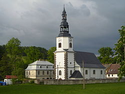 Church of Saint Nicholas | |
 Flag  Coat of arms | |
 Bílý Kostel nad Nisou Location in the Czech Republic | |
| Coordinates: 50°49′24″N 14°55′28″E / 50.82333°N 14.92444°ECoordinates: 50°49′24″N 14°55′28″E / 50.82333°N 14.92444°E | |
| Country | |
| Region | Liberec |
| District | Liberec |
| First mentioned | 1352 |
| Area | |
| • Total | 25.73 km2 (9.93 sq mi) |
| Elevation | 275 m (902 ft) |
| Population (2021-01-01)[1] | |
| • Total | 1,049 |
| • Density | 41/km2 (110/sq mi) |
| Time zone | UTC+1 (CET) |
| • Summer (DST) | UTC+2 (CEST) |
| Postal code | 463 31 |
| Website | www |

Bílý Kostel nad Nisou (German: Weißkirchen) is a municipality and village in Liberec District in the Liberec Region of the Czech Republic. It has about 1,000 inhabitants.
Bílý Kostel nad Nisou lies approximately 11 kilometres (7 mi) west of Liberec and 90 km (56 mi) north of Prague.
Administrative parts[]
Villages of Panenská Hůrka and Pekařka are administrative parts of Bílý Kostel nad Nisou.
Gallery[]

Municipal office

Floods in 2010

Local part Pekařka

Local part Panenská Hůrka


References[]
External links[]
| Wikimedia Commons has media related to Bílý Kostel nad Nisou. |
- Official website (in Czech)
| show Authority control |
|---|
This Liberec Region location article is a stub. You can help Wikipedia by . |
Categories:
- Populated places in Liberec District
- Villages in Liberec District
- Liberec Region geography stubs