Banks Township, Indiana County, Pennsylvania
Banks Township, Indiana County, Pennsylvania | |
|---|---|
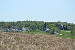 Fields and houses at | |
 Map of Indiana County, Pennsylvania Highlighting Banks Township | |
 Map of Pennsylvania highlighting Indiana County | |
| Country | United States |
| State | Pennsylvania |
| County | Indiana |
| Area | |
| • Total | 31.87 sq mi (82.53 km2) |
| • Land | 31.75 sq mi (82.22 km2) |
| • Water | 0.12 sq mi (0.31 km2) |
| Population (2010) | |
| • Total | 1,018 |
| • Estimate (2016)[2] | 968 |
| • Density | 30.49/sq mi (11.77/km2) |
| Time zone | UTC-5 (Eastern (EST)) |
| • Summer (DST) | UTC-4 (EDT) |
| FIPS code | 42-063-04056 |
Banks Township is a township in Indiana County, Pennsylvania, United States. The population was 1,018 at the 2010 census.[3] It was named after William Banks, a well-known Indiana attorney. It contains the communities of Flora, Horton (previously Smithport), Johnsonburg, Keal Run, Lochvale, Madeline, Raytown, Smithville, and Urey.[4]
Geography[]
According to the United States Census Bureau, the township has a total area of 31.8 square miles (82 km2), most of it land.[5] Hemlock Lake is located in the east, and State Game Lands Number 174 is in the very northeast.
Demographics[]
| Historical population | |||
|---|---|---|---|
| Census | Pop. | %± | |
| 1870 | 747 | — | |
| 1880 | 919 | 23.0% | |
| 1890 | 1,485 | 61.6% | |
| 1900 | 1,798 | 21.1% | |
| 1910 | 1,872 | 4.1% | |
| 1920 | 2,273 | 21.4% | |
| 1930 | 1,356 | −40.3% | |
| 1940 | 1,348 | −0.6% | |
| 1950 | 1,269 | −5.9% | |
| 1960 | 975 | −23.2% | |
| 1970 | 979 | 0.4% | |
| 1980 | 1,084 | 10.7% | |
| 1990 | 995 | −8.2% | |
| 2000 | 997 | 0.2% | |
| 2010 | 1,018 | 2.1% | |
| 2016 (est.) | 968 | [2] | −4.9% |
| U.S. Decennial Census[6] | |||
As of the census[7] of 2000, there were 997 people, 368 households, and 274 families residing in the township. The population density was 31.3 people per square mile (12.1/km2). There were 456 housing units at an average density of 14.3/sq mi (5.5/km2). The racial makeup of the township was 98.40% White, 0.10% Native American, 0.40% Asian, 0.30% from other races, and 0.80% from two or more races. Hispanic or Latino of any race were 0.30% of the population.
There were 368 households, out of which 29.3% had children under the age of 18 living with them, 63.6% were married couples living together, 5.4% had a female householder with no husband present, and 25.3% were non-families. 21.5% of all households were made up of individuals, and 13.0% had someone living alone who was 65 years of age or older. The average household size was 2.60 and the average family size was 3.00.
In the township the population was spread out, with 22.8% under the age of 18, 7.3% from 18 to 24, 27.1% from 25 to 44, 24.5% from 45 to 64, and 18.4% who were 65 years of age or older. The median age was 40 years. For every 100 females there were 109.0 males. For every 100 females age 18 and over, there were 107.0 males.
The median income for a household in the township was $28,938, and the median income for a family was $34,550. Males had a median income of $27,625 versus $16,250 for females. The per capita income for the township was $14,687. About 12.5% of families and 16.5% of the population were below the poverty line, including 25.5% of those under age 18 and 5.5% of those age 65 or over.
References[]
- ^ "2016 U.S. Gazetteer Files". United States Census Bureau. Retrieved Aug 14, 2017.
- ^ a b "Population and Housing Unit Estimates". Retrieved June 9, 2017.
- ^ "Geographic Identifiers: 2010 Census Summary File 1 (G001): Banks township, Indiana County, Pennsylvania". American Factfinder. U.S. Census Bureau. Archived from the original on February 13, 2020. Retrieved April 10, 2018.
- ^ http://www.rootsweb.ancestry.com/~paicgs/townships/banks.shtml
- ^ "Google Maps". Google Maps. Retrieved 2016-03-17.
- ^ "Census of Population and Housing". Census.gov. Retrieved June 4, 2016.
- ^ "U.S. Census website". United States Census Bureau. Retrieved 2008-01-31.
Coordinates: 40°53′00″N 78°52′00″W / 40.88333°N 78.86667°W

Municipalities and communities of Indiana County, Pennsylvania, United States | ||
|---|---|---|
| Boroughs |  | |
| Townships | ||
| CDPs | ||
| Other communities | ||
| ||
| Counties |  Map of the Pittsburgh Tri-State with green counties in the metropolitan area and yellow counties in the combined area | |
|---|---|---|
| Major cities | ||
| Cities and towns 15k–50k (in 2010) | ||
| Airports | ||
| Topics | ||
| ||
- Townships in Indiana County, Pennsylvania