Banten
This article may require cleanup to meet Wikipedia's quality standards. The specific problem is: fix minor grammatical errors. (April 2021) |
Banten | |
|---|---|
 Flag  Coat of arms | |
| Nickname(s): Tanah Jawara (Indonesian) Land of the Champions | |
| Motto(s): إِيمَان تَقْوَى (Arabic) Iman Taqwa (Faith and Piety) | |
 Banten in Indonesia | |
| Coordinates: 6°30′S 106°15′E / 6.500°S 106.250°ECoordinates: 6°30′S 106°15′E / 6.500°S 106.250°E | |
| Capital | Serang |
| Largest city | Tangerang |
| Established | 4 October 2000 |
| Government | |
| • Body | Banten Provincial Government |
| • Governor | Wahidin Halim |
| • Vice Governor | Andika Hazrumy |
| Area | |
| • Total | 9,662.92 km2 (3,730.87 sq mi) |
| Highest elevation | 1,929 m (6,329 ft) |
| Population (2020 Census)[1] | |
| • Total | 11,904,562 |
| • Rank | 5th in Indonesia |
| • Density | 1,200/km2 (3,200/sq mi) |
| Demographics | |
| • Ethnic groups | 47% Sundanese Banten 23% Sundanese Priangan 12% Javanese 10% Betawi 5% Chinese 3% other[2] |
| • Religion | Islam (94.62%) Christianity (3.94%) —Protestant (2.65%) —Catholic (1.29%) Buddhism (1.30%) Hindu (0.10%) Aliran (0.03%) Konghucu (0.01%)[3] |
| • Languages | Indonesian (official) Sundanese (lingua franca) Bantenese (native) Javanese (minor areas) Baduy (native) Betawi Hakka |
| Time zone | UTC+7 (Indonesia Western Time) |
| ISO 3166 code | ID-BT |
| HDI | |
| HDI rank | 8th in Indonesia (2019) |
| GRP Nominal | |
| GDP PPP (2019) | |
| GDP rank | 7th in Indonesia (2019) |
| Nominal per capita | US$ 3,638 (2019)[4] |
| PPP per capita | US$ 11,958 (2019)[4] |
| Per capita rank | 17th in Indonesia (2019) |
| Website | bantenprov |

Banten (Indonesia: Banten; Sundanese: ᮘᮔ᮪ᮒᮨᮔ᮪) is the westernmost province on the island of Java, in Indonesia. Its provincial capital city is Serang. The province borders West Java and the Special Capital Region of Jakarta to the east, the Java Sea to the north, the Indian Ocean to the south, and the Sunda Strait to the west, which separates Java from the neighbouring island of Sumatra. The area of the province is 9,662.82 km2, and it had a population of over 11.9 million at the 2020 Census, up from over 10.6 million during the 2010 census.[5] Formerly part of the province of West Java, Banten became a separate province in 2000. The province is a transit corridor to the neighbouring Indonesian island of Sumatra. The Banten region is the homeland of the Sundanese Banten people (a subgroup of the Sundanese people) and has historically had a slightly different culture from the Sundanese people in the West Java region. In recent years, the northern half, particularly those areas near Jakarta and the Java Sea coast, have experienced rapid rises in population and urbanization, while the southern half, particularly that facing the Indian Ocean, maintains a more traditional character.
Centuries ago, the area in what is now Banten was ruled by the Sundanese Tarumanagara kingdom. After the fall of the Tarumanegara, Banten was controlled by many Hindu-Buddhist kingdoms, such as the Srivijaya Empire and the Sunda Kingdom. The spread of Islam in the region began in the 15th century. By the late 16th century, Islam had replaced Hinduism and Buddhism as the dominant religion in the province, with the establishment of the Banten Sultanate. At that time however, Europeans traders started arriving in the region. The first was the Portuguese, then the British and finally the Dutch. In the end, through the Dutch East India Company (VOC), the Dutch controlled the economy in the region, causing a gradual decline of the Banten Sultanate in the region. On 22 November 1808, the Dutch Governor-General Herman Willem Daendels declared that the Sultanate of Banten had been absorbed into the territory of the Dutch East Indies.[6] This marked the beginning of direct Dutch rule in the region for the next 150 years. In March 1942, the Japanese invaded the Indies and occupied the region for 3 years, before they surrendered in August 1945. The area was returned to Dutch control for 5 years, before they handed the region to the new Indonesian government when the Dutch left in 1950. Banten was absorbed into the province of West Java. However, separatist sentiment ultimately led to the creation of the province of Banten in 2000.[7]
A very diverse province, Banten is populated by many ethnic groups, the most dominant being the Bantenese people. Therefore, the Sundanese language forms the lingua franca of the province, although Indonesian is the main official language. The Javanese language is also spoken by many Javanese migrants from Central or East Java. In the Lebak Regency lives the semi-isolated Baduy people, who spoke the Baduy language, an archaic form of the Sundanese language. Nonetheless, most of the people in Banten can speak Indonesian as fluently as their second language.
History[]
Etymology[]
The name "Banten" turns out to have several possible origins. The first possible origins comes from the Sundanese phrase katiban inten, which means "struck down by diamonds". The phrase comes from the history of the Bantenese people, who were originally animist, then embraced Buddhism or Hinduism. After Islam began to spread in Banten, the community began to recognize and embrace Islam. This spread of Islam in Banten is described as "struck down by diamonds".[8]
Another story about the origin of the name "Banten" is when the Hindu God Batara Guru Jampang traveled from east to west, then arrived at a place called Surasowan (present-day Serang). When arriving in Surasowan, Batara Guru Jampang sits on a rock which is then called watu gilang. The stone was glowing, which was then presented to King Surasowan. It was told that Surasowan was surrounded by a clear river of water, as if this country was surrounded by stars. The place is described as a ring covered with diamonds (Sundanese: ban inten), which then evolved into the name "Banten".[8]
Another possible origin is that "Banten" comes from the Indonesian word bantahan (rebuttal), because the local Bantenese people resisted to be subjected to regulations enacted by the Dutch colonial government at that time.[8]
Apart from the story of the origin of the name "Banten" mentioned above, the word "Banten" apparently has appeared long before the establishment of the Banten Sultanate. This word is used to name a river, namely the Cibanten River. The higher plains on the edge of Cibanten River are called Cibanten Girang which is abbreviated as Banten Girang (Upper Banten). Based on the results of research conducted in Banten Girang, there have been settlements in this area since the 11-12th century.[9] Even in the 16th century, this area developed rapidly. The development of settlements in Banten Girang extends towards Serang and towards the northern coast. The coastal area would later become the Sultanate of Banten which was founded by Sunan Gunung Jati. This Sultanate originally controlled almost all terriitory of the former Sunda Kingdom in West Java. But Sunda Kelapa or Batavia were captured by the Dutch, while Cirebon and the Parahiyangan region were captured by the Mataram Sultanate. The territory of the former Banten Sultanate was later converted to a residentie (residency) by the Dutch.[8]
Pre-colonial era[]

In the 5th century, Banten was part of the Kingdom of Tarumanagara. The Lebak relic inscriptions, found in lowland villages on the edge of the Cidanghiyang River in Munjul, Pandeglang were discovered in 1947 and contains two lines of poetry with Pallawa script and Sanskrit language.[10] The inscriptions which tells the life in the Tarumanegara kingdom under the reign of Purnawarman.[11] After the collapse of the Tarumanagara kingdom, due to an attack by Srivijaya, power in western Java fell to the Kingdom of Sunda. The Chinese source, Chu-fan-chi, written circa 1225, Chou Ju-kua mentioned that in the early 13th century, Srivijaya still ruled Sumatra, the Malay peninsula, and western Java (Sunda). The source identifies the port of Sunda as strategic and thriving, pepper from Sunda being among the best in quality. The people worked in agriculture and their houses were built on wooden poles (rumah panggung). However, robbers and thieves plagued the country.[12] It was highly possible that the port of Sunda mentioned by Chou Ju-kua was probably refer to the port of Banten.
According to the Portuguese explorer, Tome Pires, in the early 16th century the port of Bantam (Banten) was an important port within the Kingdom of Sunda along with the ports of Pontang, Cheguide (Cigede), Tangaram (Tangerang), Calapa (Sunda Kelapa) and Chimanuk (estuarine of the Cimanuk river).[13]
In 1527, just as the Portuguese fleet was arriving off the coast, newly converted Javanese Muslims under Sunan Gunungjati captured the port of Banten and the surrounding area from the Sundanese leaders and established the Sultanate of Banten. The center of this sultanate, according to the Portuguese historian João de Barros, was Banten which was a major port in Southeast Asia rivaling Malacca and Makassar. The city of Banten was located in middle of the bay which is around three miles across. The city was 850 fathoms in length while the seaside town was 400 fathoms in length. Through the middle of town there was a clear river which ships and gale junks could sail into. There is a small tributary of the river extending to the edges of the town. Today, the river is not so large and only small boats can enter. There was a fortress very near to the town whose walls were made of brick and was seven palms wide. There were wooden defense buildings consisting of two levels and armed with good weapons. The middle of the town square was used for military activities and folk art, and as a market in the morning. The king's palace was located on the southern side of the square. Beside the building was an elevated and flat-roofed, called Srimanganti, which was used by the king when meeting the people. To the west of the square was a great mosque, which is now known as the Great Mosque of Banten.
In the early 17th century, Banten was an important commercial center on international trade routes in Asia. At the time, the administration and governance of port were very supportive of economic growth. Its territory included the area which is now the province of Lampung in southern Sumatra.
Colonial era[]

When the Dutch arrived in Indonesia the Portuguese had long been in Banten. The English established a representative site in Banten, a "factory", and were followed by the Dutch. In addition, the French and the Danish also came to trade in Banten. In the ensuring competition between the European traders, the Dutch emerged as the winners. The Portuguese fled Banten in 1601 after their fleet was destroyed by the Dutch fleet off the coast of Banten during the Dutch–Portuguese War.

Although the Dutch won the war, they still allowed the Banten Sultanate to exist. The Sultanate of Banten is a maritime kingdom and relies on trade to support its economy. The monopoly on pepper trade in Lampung, placing the Banten authorities as an intermediary trader and the Sultanate of Banten growing rapidly, became one of the important commercial centers at that time.[14] As sea trade has grown throughout the archipelago, Banten grow to being a multi-ethnic region. Assisted by the British, Danish and Chinese people, Banten trades with Persia, India, Siam, Vietnam, the Philippines, China and Japan.[15] The reign of Sultan Ageng Tirtayasa between 1651 and 1682 was seen as the golden era of the Sultanate.[16] Under his reign, Banten had one of the strongest navy in the region, built on European standard with the aids of Europeans shipbuilders, and also attracts Europeans to work in the Sultanate of Banten.[17] In securing its shipping lane, Banten also sent its fleet to Sukadana or the Kingdom of Tanjungpura (present-day West Kalimantan) and conquered it in 1661.[18] At that time Banten also tried to get out of the pressure of the Dutch East India Company (VOC), which had previously made a blockade of merchant ships heading to Banten.[17]
Around 1680, a dispute arose in the Sultanate, due to a struggle for power and opposition between Sultan Ageng Tirtayasa and his son Sultan Abu Nashar Abdul Qahar. This split was exploited by VOC who provided support to Sultan Hajj, so that the civil war was inevitable. While strengthening his position, Sultan Abu Nashar Abdul Qahar or Sultan Hajj also send two of his envoys to meet King Charles II of England in London in 1682 to obtain support and weapons assistance.[19] In the ensuing war, Sultan Ageng was forced to withdraw from his palace and move to an area called Tirtayasa (present-day Tangerang), but on 28 December 1682 the area was also controlled by Sultan Haji with the Dutch assistance. Sultan Ageng with his other sons Pangeran Purbaya and Syekh Yusuf from Makassar retreated to the south of the Sunda interior. However on 14 March 1683 Sultan Ageng was caught and then imprisoned in Batavia.
The VOC continued to pursue and suppress the resistance of Sultan Ageng's followers who were still in the leadership of Prince Purbaya and Sheikh Yusuf. On 5 May 1683, the VOC sent Untung Surapati, who was a lieutenant and his Balinese troops, joining forces led by the VOC Lieutenant Johannes Maurits van Happel to subdue the Pamotan and DayeuhLuhur areas, where on 14 December 1683 they succeeded in capturing Sheikh Yusuf.[20] Heavily outnumbered, Prince Purbaya surrendered. Untung Surapati was told by Captain Johan Ruisj to pick up Pangeran Purbaya, and on the way to bring Prince Purbaya to Batavia, they met with VOC forces led by Willem Kuffeler, but there was a dispute between them, resulting in a conflict which results Willem Kuffeler forces being destroyed, and Untung Surapati and his followers became fugitives of the VOC.[21]

The VOC assistance and support to Sultan Hajj must be paid by giving compensation to the VOC. On 12 March 1682, Lampung was handed over to the VOC, as stated in the Sultan Haji's letter to Major Issac de Saint Martin, the VOC admiral in Batavia. The letter was later corroborated by an agreement letter dated 22 August 1682 which made the VOC obtain the pepper trade monopoly right in Lampung.[22] In addition, the Sultanate also had to replace the losses due to the war to the VOC.[23] After the death of Sultan Hajj in 1687, the VOC began to increase its influence in the Sultanate of Banten, so that the appointment of the Sultan of Banten had to get approval from the Governor-General of the Dutch East Indies in Batavia. Sultan Abu Fadhl Muhammad Yahya was appointed to replace Sultan Haji but only came to power for about three years, then was replaced by his brother Pangeran Adipati with the title Sultan Abul Mahasin Muhammad Zainul Abidin and later also known as Kang Sinuhun ing Nagari Banten. the next government. The civil war that took place in Banten left behind the instability for the next government, due to dissatisfaction of the VOC's interference in the Bantenese affairs.[18] The people's resistance peaked again at the end of the reign of Sultan Abul Fathi Muhammad Syifa Zainul Arifin, including the resistance of Ratu Bagus Buang and Kyai Tapa. As a result of the prolonged conflict the Sultan of Banten again sought the help of the VOC in reducing some of the people's resistance so that since 1752 Banten had become a vassal state of the VOC.[24]
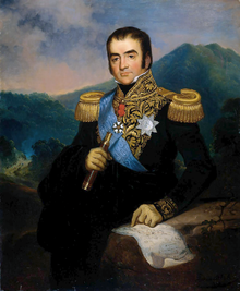
In 1808, at the peak of the Napoleonic Wars, Herman Willem Daendels, Governor General of the Dutch East Indies, ordered the construction of the Great Post Road to defend Java from the British attack.[25] Daendels ordered the Sultan of Banten to move his capital to Anyer and provide labor to build a port planned to be built in Ujung Kulon. The Sultan rejected Daendels' order, as an answer Daendels ordered an attack on Banten and the destruction of Surosowan Palace. The Sultan and his family were held in Puri Intan (Surosowan Palace) and then imprisoned at Fort Speelwijk. Sultan Abul Nashar Muhammad Ishaq Zainulmutaqin was then exiled to Batavia. On 22 November 1808, Daendels announced from his headquarters in Serang that the territory of the Banten Sultanate had been absorbed into the territory of the Dutch East Indies.[26] The Banten Sultanate was officially abolished in 1813 by the British government after the Invasion of Java.[27] That year, Sultan Muhammad bin Muhammad Muhyiddin Zainussalihin was disarmed and forced to abdicate by Thomas Stamford Raffles. This event was the ultimate blow that ended the history of the Banten Sultanate. After the British returned Java to the Dutch in 1814 as part of the Anglo-Dutch Treaty of 1814, Banten was transformed into a residentie (residency) of the Dutch East Indies.[7]
Japanese occupation and independence[]

In March 1942, the Japanese invaded the Indies, expelled the Dutch and occupied Banten. During the three years of occupation, the Japanese built the Saketi-Bayah railway in southern Lebak, primarily for transporting brown coal from the Bayah mines. The project involves work force of approximately a thousand rōmusha (local forced labourers), a few engineers and technicians (mainly Dutch), headed by a Japanese supervisor.[28] While the rōmusha working in the mines were imported from Central and East Java, the railway rōmusha were mainly locals from Banten. The construction took a total of 12 million person-days in 14 months.[29] Working conditions were harsh due to food shortages, lack of medical care, and the tropical climate.[30] Casualties are estimated to range from 20 to 60 thousand victims, not including mine workers.[28]
After the Japanese surrendered in August 1945, the former Dutch East Indies declared independence as the Republic of Indonesia. However, this was opposed by the returning Dutch, resulting the Indonesian war of independence. Over the course of the war, Banten remained under the Republican control. On 26 February 1948, the State of West Java (Indonesian: Negara Jawa Barat, Sundanese: Negara Jawa Kulon) was established and, on 24 April 1948, the state was renamed Pasundan. Pasundan became a federal state of the United States of Indonesia in 1949 but was incorporated into the Republic of Indonesia (itself also a constituent of the USI) on 11 March 1950.[31]
After Indonesia became independent, Banten was absorbed into the province of West Java. However, separatist sentiment ultimately led to the creation of the province of Banten in 2000.[32]
Geography[]


Banten lies between 5°7'50" and 7°1'11" south latitude and 105°1'11" and 106°7'12" east longitude.[33] The province has an area of 9,662.92 km².[34]
Banten is located near the Sunda Strait's strategic sea lanes that link Australia and New Zealand with Southeast Asia, for example Thailand, Malaysia, and Singapore. In addition, Banten is the link between Java and Sumatra. Economically, the Banten region area has many industries. Banten also has some seaport that is developed in anticipation to capture the excess capacity of the seaport in Jakarta,[35] and is also intended to be an alternative to the Port of Singapore.[36]
Located on the western tip of Java makes Banten as the gateway to Java and Sumatra and the adjacent areas of Jakarta which is the capital of Indonesia. The geostrategic position caused Banten to become the center of trade lanes between Sumatra and Java even as part of a circulation of Asian and international trade as well as the location of agglomeration economies and potential settlements. As the province borders the Java Sea to the north, the Sunda Strait to the west, and the Indian Ocean to the south, the province has an abundant marine resources.[37]
Topography[]

The topography of Banten province at an altitude ranging from 0–1000 m asl. In general the topography of Banten is mostly low land which ranges between 0–200 m above sea level, located in Cilegon, Tangerang, Pandeglang Regency, and most of the Serang Regency. The Central region of the Lebak Regency and Pandeglang Regency has a height ranging from 201 m to 2000 m and the Eastern region of the Lebak Regency has an altitude 501–2000 m located at the summit of Mount Sanggabuana and Mount Halimun.
The topography of the province associated with the surface expression shape or morphology of a region. The morphology of Banten is generally divided into three groups: the lowlands, sloping hills and steep hills.[38]
The lowlands are generally found in the northern and southern portion of the province. The lowlands generally has a height of less than 50 meters.
The sloping hills region have a minimum height of 50 m above sea level. In the north of the city of Cilegon there is a hill called Mount Gede that has an altitude of 553 m above sea level, while there are hills in Serang Regency, precisely in southern region of the regency at the Mancak District and the Waringin Kurung District. The area at the southern part of the Pandeglang Regency are also mostly hilly. In eastern part of the Lebak Regency that is bordering Bogor Regency and Sukabumi Regency in West Java, most of the area is made up of very steep hills which has the characteristics of lithology lithologic unit occupied by the old sediments intruded by igneous rocks such as granite, granodiorite, diorite and andesite. Usually the area contains tin and copper ore deposits that are economically valuable.[39]

Climate[]
The climate in the Banten is strongly influenced by monsoon wind and the La Niña or the El Niño wave . During the rainy season, the weather is dominated by the west wind (of Sumatra, the Indian Ocean south of the Indian Subcontinent) and are joined by winds from Northern Asia passing through the South China Sea. During the dry seasons, the weather is dominated by the east wind which causes Banten harsh drought, especially in the northern part of the coast, especially when there is the El Niño phenomenon. Temperatures in coastal areas and hills ranging between 22 °C and 32 °C, while the temperature in the mountains with an altitude of between 400 –1350 m above sea level ranging between 18 °C and 29 °C.
The highest rainfall is around 2712–3670 mm which happens in the rainy season months of September to May cover 50% area of the western part of the Pandeglang Regency and rainfall 335–453 mm in the month from September to May cover 50% area of the northern part of the Serang Regency, the entire area of the city of Cilegon, 50% area of the Tangerang Regency and the entire area of the city of Tangerang. In the dry season, the highest rainfall of 615–833 mm in April–December cover 50% area of the northern part of the Serang Regency, the whole area of the city of Cilegon, 50% area of the northern part of the Tangerang Regency and the entire area of the city of Tangerang, while the bulk the lowest rainfall in the dry season as much as 360–486 mm in the month of June to September 50% coverage area of southern Tangerang Regency and 15% area of southeastern Serang Regency.

Administrative divisions[]


Banten Province is subdivided into four regencies (kabupaten) and four autonomous cities (kota), listed below with their populations at the 2010 and 2020 Censuses.[40] The cities and regencies are additionally subdivided into 140 districts, 262 urban villages and 1,242 villages.
| Name | Capital | Area (km2) | Population
Census 2010 |
Population
Census 2020 |
HDI[41] 2014 Estimates |
|---|---|---|---|---|---|
| Cilegon City | 175.50 | 374,559 | 434,896 | 0.715 (High) | |
| Serang City | 266.71 | 577,785 | 692,101 | 0.702 (High) | |
| Lebak Regency | Rangkasbitung | 3,426.56 | 1,204,095 | 1,386,793 | 0.616 (Medium) |
| Pandeglang Regency | Pandeglang | 2,746.89 | 1,149,610 | 1,272,687 | 0.620 (Medium) |
| Serang Regency | Ciruas | 1,734.28 | 1,402,818 | 1,622,630 | 0.639 (Medium) |
| Western Banten totals (outside Jabodetabek) |
8,349.94 | 4,708,867 | 5,409,107 | ||
| South Tangerang City | 147.19 | 1,290,322 | 1,354,350 | 0.791 (High) | |
| Tangerang City | 153.93 | 1,798,601 | 1,895,486 | 0.758 (High) | |
| Tangerang Regency | Tigaraksa | 1,011.86 | 2,834,376 | 3,245,619 | 0.695 (Medium) |
| Eastern Banten totals (within Jabodetabek) |
1,312.98 | 5,923,299 | 6,495,455 | ||
| Banten totals | 9,662.92 | 10,632,166 | 11,904,562 | 0.698 (Medium) | |
Notes:
- Tangerang City was incorporated as an autonomous city on 27 February 1993 out of the Tangerang Regency, in which it previously served as administrative capital. It was subsequently replaced by Cipasera (see below).
- Cilegon City was incorporated as an autonomous city on 10 April 1999 out of the Serang Regency, in which it previously served as administrative capital. It was subsequently replaced by Serang (see below).
- Serang City was incorporated as an autonomous city in November 2007 out of the Serang Regency, in which it previously served as administrative capital. It was subsequently replaced by Ciruas.
- South Tangerang City (formerly Cipasera) was incorporated as an autonomous city on 29 October 2008 out of the Tangerang Regency. in which it previously served as administrative capital. It was subsequently replaced by Tigaraksa.
Demographics[]
In 2006, the population of Banten numbered 9,351,470 people, with a ratio of 3,370,182 people (36.04%) children, 240,742 people (2.57%) elderly people, the remaining 5,740,546 people aged between 15 and 64 year. This makes Banten the fifth-most populated province in Indonesia, after West Java, East Java, Central Java and North Sumatra.

Ethnic groups[]
The Bantenese people are the largest group in the province, forming 47% of the total population. The Bantenese are a subgroup of the Sundanese people, with distinct culture from the Sundanese living in West Java. They mostly inhabit the central and southern part of the province. The origins of the Bantenese people; which are closely related to the Banten Sultanate, are different from the Cirebonese people whom are not part of the Sundanese people nor the Javanese people (unless it is from the result of a mixture of two major cultures, namely Sundanese and Javanese). The Bantenese people along with the Baduy people (Kanekes) are essentially sub-ethnics of the Sundanese people that occupies the former region of the Banten Sultanate (region of Bantam Residency after the abolishment and annexation by the Dutch East Indies). After the formation of the Banten Province only did people began to regard the Bantenese as a group of people with a culture and language of their own.[42]

Most of the people in northern Banten are Javanese. Most of the Javanese are migrants from the central and eastern part of Java. The Betawi people lives in the Greater Jakarta area, such as Tangerang. Chinese Indonesians can also be found in urban areas, also mostly in the Greater Jakarta area. A sub-group of the Chinese Indonesian called the Benteng Chinese lives in Tangerang and the surrounding area. They are somewhat distinct from the normal Chinese-Indonesian.[43][44][45]
Languages[]
The most dominant language is Sundanese.[46][47] The indigenous people living in Banten Province speak a Sundanese dialect derived from an archaic version of Sundanese. The dialect is classified as informal or harsh register in modern Sundanese,[48] having different registers as in Javanese language.[49] Due to the influence of the Javanese culture during the reign of the Islamic Mataram kingdom, the Sundanese language – especially in the Parahyangan area – have different registers starting from the most formal, or "halus/lemes" (smooth) version, to the everyday "loma/lancaran" version and the informal or harsh version. Mataram Sultanate tried to take control over Java island, including the Banten territory, covering the whole West Java region. However, the Sultanate of Banten was able to defend its territory excluding the Parahyangan area. In the mountainous regions and most of present-day Banten, the "loma" version of Sundanese language is the most dominant. By contrast, this version is considered "harsh" by people from Parahyangan. Bantenese language is commonly used especially in the southern region of Banten such as Pandeglang Regency and Lebak Regency.[50] However, around Serang and Cilegon, Banten Province, a dialect of the Javanese language, Banyumasan, is also spoken by about 500,000 people.[51] In the northern part of Tangerang, Indonesian with the Betawi dialect is also used by Betawi immigrants. Besides Sundanese, Javanese and the Betawi dialect, Indonesian language is also widely spoken especially by other ethnic immigrants from other parts of Indonesia especially in urban centers. The Baduy people speak the Baduy language, also an archaic form of the Sundanese.[52]

Religion[]
Religion in Banten
The majority of the people living are generally practicing Muslims, which is due to being inseparable from a strong Islamic cultural background. This case is also closely related to the history of Banten Sultanate as one of the largest Islamic kingdom in the island of Java. Besides that, the artistry in Banten region also portrays Islamic activities of its society, such as the Rampak Bedug performance from Pandeglang Regency. Even so, Banten Province is a multi-ethnic society consisting of various ethnics and religions. Adherents of other faiths from various non-indigenous ethnic groups live alongside each other peacefully in this region, such as the Benteng Chinese community in Tangerang and the Baduy people that practices Sunda Wiwitan in Kanekes, Leuwidamar, Lebak Regency.
Based on archaeological data, the early period of Banten society was influenced by several kingdoms that brought Hindu-Buddhist beliefs, such as Tarumanagara, Sriwijaya and the Sunda Kingdom. According to the Babad Banten, Sunan Gunung Jati and Maulana Hasanuddin carried out the spread of Islam intensively to the authorities of Banten Girang and their inhabitants. Some mystical stories also accompanied the process of Islamization in Banten, including when Maulana Yusuf began to spread da'wah to the inhabitants of the interior, which was marked by the conquest of Pakuan Pajajaran.
Islam became the pillar of the founding of the Banten Sultanate, the Sultan of Banten was referred to as having genealogies to the Prophet Muhammad, and placing the ulamas had a profound influence on the lives of his people, along with the tarekat and tasawuf also developed in Banten, while the culture of society absorbs Islam as an inseparable part. Some existing traditions are influenced by the development of Islam in society, as seen in the Debus martial arts.

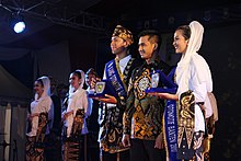
Culture[]
The culture is hugely based on Hinduism and Buddhism and, more recently, Islam. The cultural peculiarities of the people of Banten include the Pencak Silat martial arts, Debus, Rudad, Umbruk, Saman Dance, Mask Dance, Cokek Dance, Dog-dog, Palingtung and Lojor. In addition, there are also many religious locations, including Great Mosque of Banten, the Keramat Panjang Tomb, and well as other places.
In the central and southern part of the province lives the Baduy people, which can further be separated into the Outer Baduy tribes and the Inner Baduy tribes. The Inner Baduy tribes are native Sundanese who still maintain the tradition of anti-modernization, both dress and other life patterns, whereas the Outer Baduy tribes are more open to modernization. The Baduy-Rawayan tribe live in the Kendeng Mountains Cultural Heritage; an area of 5,101.85 hectares spanning the Kanekes area, Leuwidamar District, Lebak Regency. Baduy villages are generally located in the Ciujung River in the Kendeng Mountains. This area is known as the place of inheritance from ancestors, which is require to site be maintained properly and not to be damaged.[53]
Traditional weapon[]
Golok is the traditional weapon of Banten. This type of weapon is very similar to the warrior and champion of Banten[who?]. Formerly, Golok functioned as a self-defense weapon, but now only as a martial arts tool. One of the famous types of Golok is the Ciomas Golok, which is only made in Ciomas at the Serang Regency. Ciomas Golok is famous for their sharpness and mystical value. According to the story of Ciomas Golok, it is only made during the Islamic month of Maulud through a long ritual stage.
Golok is also inextricable from the culture of both the Bantenese people and the Baduy people. The Baduy people always carry a Golok with them. Golok becomes the main tool when they are farming and hunting in the forest. In addition, Banten also has other types of traditional weapons, such as the kujang, kris, spears, sledgehammer, machetes, swords and arrows.
Traditional housing[]
Traditional housing in Banten is called Rumah Panggung. The roofs are thatched and the floor is made of split and pounded bamboos. The walls were made from the booth (gedek). To buffer stage house is a stone that has been created in such a way that ends shaped beam decreasing as the stone used for pounding rice pedestal.[vague] This type of traditional house is still widely found in areas inhabited by the Kanekes people or the Baduy.
Traditional clothes[]
Traditional Bantense men tend to wear with koko shirts and closed neck. The bottom clothes are equipped with trousers and tied with batik cloth. Usually, men would wear a belt and tuck a Golok in the front of the belt. As well as on the shoulder, a piece of cloth is attached[where?].
Bantenese women, treated as subordinates, usually wear traditional kebaya clothes and inner fabrics. This garment is also slung over a cloth on the shoulder and decorated with a hand-crafted brooch in front of the belly button. The hair is tied into a bun and is decorated with a golden sway flower.
Arts[]
There are signs that Banten art is a heritage before Islam and combined or colored with Islam. For example, the mosque architecture with three levels as a symbol of faith, Islam, Ihsan, or Shariat, Tariqa, and essence. Such architecture applies in all mosques in Banten. Then there is the tendency to change into a dome shape, and maybe in what form, but what appears to be a tendency to escape from the symbolization of religion but in the art itself.[53]
Martial arts[]
Pencak Silat[]
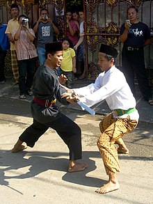
The Pencak silat culture is a martial art rooted in the original Indonesian culture. It is alleged that pencak silat had spread to all corners of the archipelago since the 7th century. The development and spread of pencak silat historically began to be recorded when its spread was much influenced by the Ulama, along with the spread of Islam in the 15th century in the archipelago. At that time the martial arts had been taught together with religious studies at the pesantren (Islamic boarding schools) and also the surau-surau. The culture of prayer and martial arts is a close attachment in the spread of pencak silat. Silat then developed from just martial arts and folk dance, becoming part of the country's defense education to confront invaders. Pencak silat is also a part of spiritual practice.
Many of Banten's martial arts were taken from Arabic, as its was tightly linked to Islam. Pencak silat Banten began to be known along with the establishment of the Sultanate of Banten which was founded in the 15th century with its first king Sultan Maulana Hasanuddin. At that time, the development of pencak silat was inseparable from the use of martial arts as a tool for the mobilization of the royal soldiers for provision of state defense dexterity, taught by martial arts teachers who carried out various schools. Silat is also the basis of the defense tools of the kingdom and the general public of Banten in fighting colonisers during the colonialism period.
At this time Banten is still known and widely recognized with its warriors and judges, as people who are proficient in martial arts.[53]

Debus (from Arabic: دَبُّوس, romanized: dabbūs) is a martial art from Banten. This art was created in the 16th century, during the reign of Sultan Maulana Hasanuddin. Debus, an art that demonstrates extraordinary human abilities, immune from sharp weapons, immune from fire, drinking hard water, inserting objects into whole coconuts, frying eggs on the head among others. The name derives from Arabic, which refers to a sharp weapon made of iron with a pointed tip and is slightly round in shape. With this tool, the debus players are injured, and usually cannot be penetrated even though the debus is hit repeatedly by others.[54]
Transport[]
Banten is located in the most western tip of Java island has a very strategic position, and has a huge economic potential either for local, regional, national, and even international scale. Facilitation of the movement of goods and passengers from and to the activity centers of national, regional and local level in the province of Banten became very important in the effort to support economic development in the province of Banten.
Until 2006, the condition of 249.246 km of national roads were in good condition, 214.314 km under moderate conditions, and as long as 26.840 in damaged condition. Provincial road conditions until the end of 2006 with a total length of 889.01 km roads were in good condition at 203.670 km, 380.020 km moderate condition and the damaged condition of 305.320 km. The national roads in Banten currently has a traffic volume average of 0.7 which means that the smooth flow of traffic disturbed by the activities of trade, industry, shopping centers along the way as well as the limited capacity for width of the road an average of 7 meters on the national road in northern Banten (Tangerang-Merak) and the Tangerang-Jakarta segment. Performance of service roads on provincial roads are generally quite well with the ratio of traffic volume per average capacity of 0.4. Traffic congestion is generally localized which occur at the local community center.
- Transportation in Banten
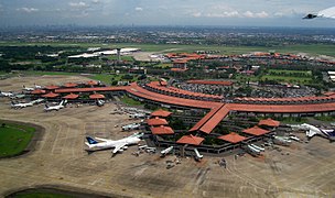
Soekarno–Hatta International Airport in Tangerang. It is the main airport of the province, as well as the main gateway to Jakarta and Indonesia

A Commuter Line in the Tangerang railway station
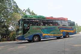
A public bus in Poris terminal, Tangerang

The Port of Merak serves ferries to and from Sumatra


To serve the movement of passengers and goods in Banten, there is extensive public transportation between cities, with over a hundred routes and thousands of vehicles providing transportation. Up to 2005, of the total rail line of 305.9 kilometer, only 48% of the rail line in Banten is still in operation with the average amount of movement of passenger trains approximately 22 trains per day, and a freight train as many as 16 trains per day. The decline in the facility services has implications for the declining tendency also on the number of passenger and goods.
The railway network in the province of Banten along 305.90 km majority are 'single track' which consisted of Merak-Tanah Abang, Tangerang-Duri and Cilegon-Cigading with a total of 141.6 km, and disused railways such as Rangkasbitung-Labuan, Saketi-Bayah, and Cigading-Anyer with a total164.3 km. In Banten, there are five ports consisting of two cultivated port that is Port Ciwandan and Port Bojonegara and three ports that are not cultivated comprising Port of Karangantu, Port of Labuan, and Port of Bojonegara.
Soekarno-Hatta International Airport nationally is the main airport in Indonesia as the gateway entrance of goods and passengers from within and outside the country. In addition there are also other airports such as Pondok Cabe airport in South Tangerang, in Tangerang and in Serang. Pondok Cabe Airport is an airport for general aviation activities, Budiarto Airport is the airport used for training flight activity. While Gorda Airport was used as a military airport used by the Indonesian Air Force.
Economy[]
In 2006, the population of Banten totaled 9,351,470 people, with a ratio of 3,370,182 people (36.04%) to children, 240,742 inhabitants (2.57%) elderly, the remaining 5,740,546 persons aged between 15 and 64 year.
Gross Regional Domestic Product (GDP) in 2005 was mostly from manufacturing industry sector (49.75%), followed by trade, hotel and restaurant sector (17.13%), transportation and communication (8.58%), and agriculture which is only 8.53%. However, based on employment, industry absorbed 23.11% of labor, followed by agriculture (21.14%), trade (20.84%) and transportation / communication only 9.50%.
The development of the Banten is based more on output orientation than equity which is reflected in the conditions between northern Banten and southern Banten. Northern Banten has several infrastructures such as Soekarno Hatta International Airport with the largest and busiest airport in Indonesia and the Port of Merak as the largest ferry port in Indonesia. Likewise with shopping centers that are developing in the city of Tangerang, the city of South Tangerang, and the Tangerang Regency. However, this case is very contrary to the conditions in southern Banten that are far behind.
Geographically, Banten has a strategic position which is the link between Java and Sumatra. With a very strategic and economically potential position, Banten is one of the investment destinations in Indonesia. However, the amount of investment in Banten is absorbed more by the Tangerang City and South Tangerang City and mostly in the regencies and cities in northern Banten. The value of investment in the city of Tangerang with the City of South Tangerang because of good infrastructure, the proximity to Jakarta and as a buffer city of Jakarta. Other regencies and cities in northern Banten have high investment values because they have supporting infrastructure such as ports, roads, electricity supply, education and health. This is inversely proportional to the condition of southern Banten, where infrastructure the is still poor.
The availability of infrastructure in increasing economic growth is significant, but it causes output due to its development policies that prioritize growth rather than equity. The existence of development inequality in Banten, it is important to analyze the availability of infrastructure to economic growth in Banten in the period 2009–2012. The growth of the infrastructure sector in Banten has experienced a significant increase and has a substantial contribution to economic growth in several cities and districts in northern Banten. Infrastructure development is experiencing problems in Pandeglang and Lebak regencies. Even in regards to investment, investors will choose areas with complete infrastructure, as adequate infrastructure will increase competitiveness.
Tourism[]

Ujung Kulon National Park is one of the national parks and nature conservation sites that are important in Indonesia, and the world. This national park is located in the most western peninsula of the island of Java, plus some smaller islands as well as Peucang, Handeuleum Island, and the island of Panaitan. The highest point is Mount Honje. The distinctive feature of this national park is its role as a natural habitat of wildlife species that are protected, such as the Javan rhino, deer, antelope, buffalo, various species of primates, wild boar, jungle cat, sloth, and various species of birds. This area can be reached via Labuan or via the sea by boat to one of the islands there. Ujung Kulon has been equipped with various means of telecommunications networks, electricity, and clean water. Tourism facilities such as accommodation, information centers, travel guides, and transportation facilities have also been provided. UNESCO has stated that the Ujung Kulon area is a nature reserve world heritage sites.
Pulau Dua which is located near Serang is well known the natural beauty of the ocean in the form of clusters of coral, various types of fish, and of course various types of birds. The area is about 30 ha. Each year between April and August, the island is visited by thousands of birds from 60 species originating from various countries. Approximately forty thousand of these birds fly from the continent of Australia, Asia, and Africa. Two of the islands can be reached by traditional boats or motor boats; or on foot within 15 to 30 minutes through aquaculture area in Sawah Luhur and Kasemen. Due to sedimentation for decades, the island has been united with the mainland Java.
Mount Krakatau actually included the province of Lampung is located in the Sunda Strait. This mountain is one of the most famous mountains in the world, because of the devastating eruption in 1883. The sound of the eruption was heard up to the Australian Continent region, even heat clouds blanketed some areas of Europe during the week. A huge explosion of Krakatoa then formed Anak Krakatau which surfaced in 1928 and still remains active. Although located in the Strait of Sunda and Lampung, nature tourism is more easily accessed in Anyer-Carita Beach, and permission to land on the island volcano Anak Krakatau also be obtained in this area, it takes about an hour by speedboat to reach. Locations: this tour offers natural attractions such as camping, hiking, fishing, and natural scenery of the sea.
Tanjung Lesung Beach is located in the Panimbang district of Pandeglang Regency in the Banten province. The beach is located in the western part of the Pandeglang Regency and has an area of approximately 150 hectares. This area is proposed to Special Economic Zone since 2012 and Tanjung Lesung SEZ been officially in operation since 23 February 2015. Development of the Tanjung Lesung SEZ are mainly focused on the activities of Tourism and Creative Economy.
Cuisine[]

One of Banten's typical foods is Rabeg. Rabeg is a typical Bantenese food that is similar to goat or rawon curry. This food is made from goat meat and offal. The food of the nobility and sultan is only found in Serang Regency. The food is believed to be originated from the Arabian Peninsula, spread by Arab traders during the spread of Islam in Indonesia.[55]
There are also other typical Bantenese foods, such as Nasi sumsum from Serang Regency which is made of white rice and the bone marrow of a buffalo. Other typical foods that can be found in Banten are mahbub, broiler, shark fin soup, milkfish satay, duck soup, duck satay, lemong malimping eggplant sapo, laksa tangerang, sticky rice stick, sticky rice cuer, beef jerky and emping.
Sports[]
Football[]
Persita Tangerang (with home venue at Benteng Taruna Stadium), Cilegon United (with home venue at Krakatau Steel Stadium) and Perserang Serang (with home venue at Maulana Yusuf Stadium) all represent the province in Liga 2.
Motorsports[]
In 2009, Lippo Village International Formula Circuit was built in a bid to host A1 Grand Prix that year, but was removed from schedule due to construction and certification delays; the track was ultimately used for local motorsport and track day events before being dismantled in favor of expansion of the Lippo Village complex, with the paddock area reclaimed by Pelita Harapan University. A replacement street circuit, BSD City Grand Prix, was built in the Bumi Serpong Damai region to further support local motorsport activities.
References[]
- ^ Badan Pusat Statistik, Jakarta, 2021.
- ^ Indonesia's Population: Ethnicity and Religion in a Changing Political Landscape. Institute of Southeast Asian Studies. 2003.
- ^ "Laporan Penduduk Berdasarkan Agama Provinsi Banten Semester I Tahun 2014". Biro Pemerintahan Provinsi Banten. Retrieved 18 October 2018.
- ^ Jump up to: a b c d "Indonesia". Badan Pusat Statistik. Retrieved 20 May 2020.
- ^ Badan Pusat Statistik, Jakarta, 2021.
- ^ Ekspedisi Anjer-Panaroekan, Laporan Jurnalistik Kompas. Penerbit Buku Kompas, PT Kompas Media Nusantara, Jakarta Indonesia. November 2008. pp. 1–2. ISBN 978-979-709-391-4.
- ^ Jump up to: a b Gorlinski, Virginia. "Banten". Encyclopædia Britannica.
- ^ Jump up to: a b c d Banten, BPCB (28 February 2017). "Banten, arti kata dan toponimi". Balai Pelestarian Cagar Budaya Banten. Retrieved 16 March 2019.
- ^ Guillot, Claude, Lukman Nurhakim , Sonny Wibisono, "La principauté de Banten Girang", Archipel,1995, Volume 50, No. 50, page 13-24
- ^ OV (Oudheidkundige Verslag) 1949; 1950:20
- ^ Drs. R. Soekmono. Pengantar Sejarah Kebudayaan Indonesia 2, 2nd ed (in Indonesian) (1973, 5th reprint edition in 1988 ed.). Yogyakarta: Penerbit Kanisius. p. 36.
- ^ Soekmono, R. (1973). Pengantar Sejarah Kebudayaan Indonesia 2, 2nd ed (5th reprint edition in 1988 ed.). Yogyakarta: Penerbit Kanisius. p. 60.
- ^ Heuken, A. (1999). Sumber-sumber asli sejarah Jakarta, Jilid I: Dokumen-dokumen sejarah Jakarta sampai dengan akhir abad ke-16. Cipta Loka Caraka. p. 34.
- ^ Heriyanti Ongkodharma Untoro, (2007), Kapitalisme pribumi awal kesultanan Banten, 1522–1684: kajian arkeologi-ekonomi, Fakultas Ilmu Pengetahuan Budaya UI, ISBN 979-8184-85-8.
- ^ Yoneo Ishii, (1998), The junk trade from Southeast Asia: translations from the Tôsen fusetsu-gaki, 1674–1723, Institute of Southeast Asian Studies, ISBN 981-230-022-8.
- ^ Nana Supriatna, Sejarah, PT Grafindo Media Pratama, ISBN 979-758-601-4.
- ^ Jump up to: a b Hasan Muarif Ambary, Jacques Dumarçay, (1990), The Sultanate of Banten, Gramedia Book Pub. Division, ISBN 979-403-922-5.
- ^ Jump up to: a b Atsushi Ota, Banten Rebellion, 1750–1752: Factors behind the Mass Participation, Modern Asian Studies (2003), 37: 613-651, DOI: 10.1017/S0026749X03003044.
- ^ Titik Pudjiastuti, (2007), Perang, dagang, persahabatan: surat-surat Sultan Banten, Yayasan Obor Indonesia, ISBN 979-461-650-8.
- ^ Azyumardi Azra, (2004), The origins of Islamic reformism in Southeast Asia: networks of Malay-Indonesian and Middle Eastern 'Ulamā' in the seventeenth and eighteenth centuries, University of Hawaii Press, ISBN 0-8248-2848-8.
- ^ Ann Kumar, (1976), Surapati: man and legend : a study of three Babad traditions, Brill Archive, ISBN 90-04-04364-0.
- ^ Amir Hendarsah, Cerita Kerajaan Nusantara, Great! Publisher, ISBN 602-8696-14-5.
- ^ Marwati Djoened Poesponegoro, Nugroho Notosusanto, (1992), Sejarah nasional Indonesia: Jaman pertumbuhan dan perkembangan kerajaan-kerajaan Islam di Indonesia, PT Balai Pustaka, ISBN 979-407-409-8
- ^ Atsushi Ota, (2006), Changes of regime and social dynamics in West Java: society, state, and the outer world of Banten, 1750–1830, BRILL, ISBN 90-04-15091-9.
- ^ Ekspedisi Anjer-Panaroekan, Laporan Jurnalistik Kompas. Penerbit Buku Kompas, PT Kompas Media Nusantara, Jakarta Indonesia. November 2008. pp. 1–2. ISBN 978-979-709-391-4.
- ^ Sartono Kartodirdjo, (1966), The peasants' revolt of Banten in 1888: Its conditions, course and sequel. A case study of social movements in Indonesia, Martinus Nijhoff.
- ^ R. B. Cribb, A. Kahin, (2004), Historical dictionary of Indonesia, Scarecrow Press, ISBN 0-8108-4935-6.
- ^ Jump up to: a b Poeze, Harry A. "The Road to Hell: Construction of a Railway Line in West Java during the Japanese Occupation". In Kratoska, Paul H. (ed.). Asian Labor in the Wartime Japanese Empires. Armonk, New York: M.E.Sharpe. pp. 152–178. ISBN 978-0-7656-3335-4.
- ^ Shigeru Sato (1994). "The Bayah-Saketi Railway Construction". War, Nationalism and Peasants: Java Under the Japanese Occupation, 1942–1945. M.E. Sharpe. pp. 179–186. ISBN 978-0-7656-3907-3.
- ^ de Bruin, Jan (2003). "De Zuid-Bantamlijn" [The South Bantam Line]. Het Indische spoor in oorlogstijd [The Indian rail in war time] (in Dutch). Uitgeverij Uquilair B. V. pp. 119–122. ISBN 90-71513-46-7.
- ^ "United States of Indonesia".
- ^ Gorlinski, Virginia. "Banten". Encyclopædia Britannica.
- ^ according to the Law of the Republic of Indonesia No. 23 year 2000
- ^ Biro Pusat Statistik, Jakarta, 2014.
- ^ Deslatama, Yandhi. "Pemprov Banten Ajukan Enam Pelabuhan 'Pembantu' Tanjung Priok". ekonomi. Retrieved 16 March 2019.
- ^ "Banten dan Lampung Bakal Jadi Pelabuhan Penting Internasional". Redaksi Indonesia | Jernih – Tajam – Mencerahkan. 18 October 2015. Retrieved 16 March 2019.
- ^ "Perikanan Jadi Komoditi Andalan Provinsi Banten". SINDOnews.com (in Indonesian). Retrieved 16 March 2019.
- ^ Banten, Website Resmi Pemerintah Provinsi. "Geografi – Profil Provinsi". Website Resmi Pemerintah Provinsi Banten. Retrieved 16 March 2019.
- ^ "Dinas Energi dan Sumber Daya Mineral Provinsi Banten | Potensi Pertambangan". desdm.bantenprov.go.id. Retrieved 16 March 2019.
- ^ Badan Pusat Statistik, Jakarta, 2021.
- ^ Indeks-Pembangunan-Manusia-2014
- ^ "Suku Banten". Kebudayaan Indonesia. 26 August 2013. Archived from the original on 22 March 2017. Retrieved 22 March 2017.
- ^ Lohanda, Mona (1996). The Kapitan Cina of Batavia, 1837–1942: A History of Chinese Establishment in Colonial Society. Jakarta: Djambatan. ISBN 9789794282571. Retrieved 20 September 2017.
- ^ "Sejarah Cina Benteng di Indonesia !". Archived from the original on 7 January 2012. Retrieved 29 August 2017.
- ^ Knorr, Jacqueline (2014). Creole Identity in Postcolonial Indonesia. Berghahn Books. ISBN 978-1-78238-269-0. Retrieved 20 September 2017.
- ^ Language maps of Indonesia (Java and Bali)
- ^ ECAI – Pacific Language Mapping
- ^ "Bahasa Sunda Banten". Perpustakaan Digital Budaya Indonesia. 2014. Retrieved 12 September 2017.
- ^ Purwo, Bambang K. (1993). Factors influencing comparison of Sundanese, Javanese, Madurese, and Balinese.
- ^ Batur Parisi (16 March 2017). "Bahasa dan Sastra Sunda Banten Terancam Punah". Metro TV News. Retrieved 12 September 2017.
- ^ Ethnologue. Retrieved 1 February 2009.
- ^ "Kewarganegaraan, Suku Bangsa, Agama, Dan Bahasa Sehari-Hari Penduduk Indonesia". Badan Pusat Statistik. 2010. Archived from the original on 10 July 2017. Retrieved 18 July 2017.
- ^ Jump up to: a b c Banten, Website Resmi Pemerintah Provinsi. "Kebudayaan – Profil Provinsi". Website Resmi Pemerintah Provinsi Banten. Retrieved 16 March 2019.
- ^ "Debus". www.indonesia.travel. Retrieved 16 March 2019.
- ^ "Banten Introduces Distinctive Dish at Culinary Festival". en.tempo.co. Archived from the original on 15 April 2016. Retrieved 2 April 2016.
External links[]
| Wikisource has the text of the 1911 Encyclopædia Britannica article "Bantam". |
| Wikivoyage has a travel guide for Banten. |
- Official website (in Indonesian)
- Research and Development Agency (in Indonesian)
| show Places adjacent to Banten |
|---|

| show Authority control |
|---|
- Banten
- States and territories established in 2000
- 2000 establishments in Indonesia
- Provinces of Indonesia
- 2000 establishments in Southeast Asia