South Tangerang
South Tangerang | |
|---|---|
| City of South Tangerang Kota Tangerang Selatan | |
 Alam Sutera roundabout | |
 Coat of arms | |
| Motto(s): Cerdas, Modern, Religius (Intelligent, Modern, Religious) | |
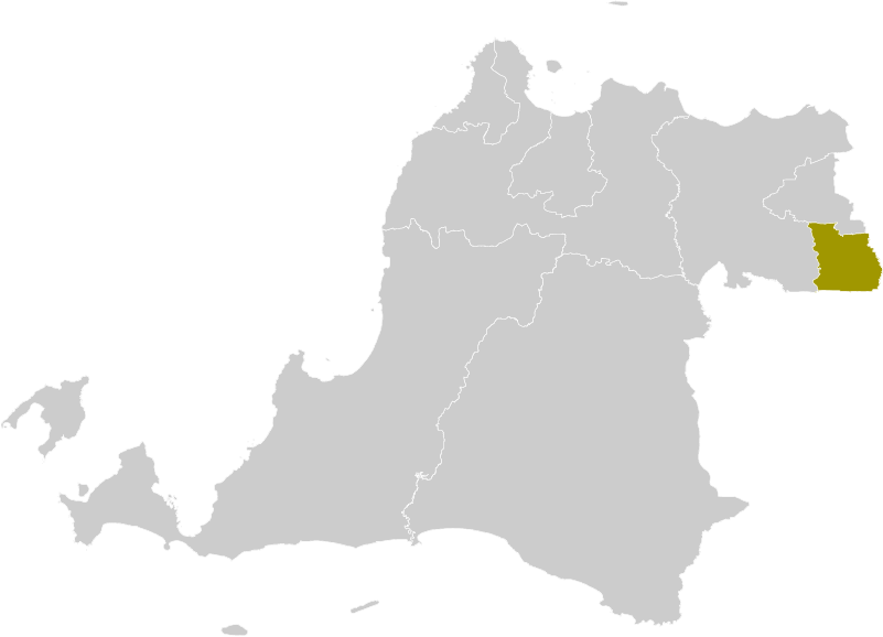 Location within Banten | |
| Coordinates: 6°17′20″S 106°43′05″E / 6.28889°S 106.71806°ECoordinates: 6°17′20″S 106°43′05″E / 6.28889°S 106.71806°E | |
| Country | |
| Province | |
| Granted city status | 29 October 2008 |
| Government | |
| • Mayor | |
| • Vice Mayor | |
| Area | |
| • Total | 147.19 km2 (56.83 sq mi) |
| • Land | 123.58 km2 (47.71 sq mi) |
| • Water | 23.61 km2 (9.12 sq mi) |
| Population (2020 Census) | |
| • Total | 1,354,350 |
| • Density | 9,200/km2 (24,000/sq mi) |
| Time zone | UTC+7 (Indonesia Western Time) |
| Postcodes | 1xxxx |
| Area code | (+62) 21 |
| HDI | |
| Website | tangerangselatankota.go.id |


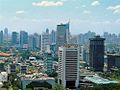
South Tangerang is a city in the province of Banten, Indonesia. Located 30 km (19 mi) on the southwestern border of Jakarta, the city forms part of the Greater Jakarta metropolitan area. It was administratively separated from Tangerang Regency on October 29, 2008.[1] According to the 2020 Census, the city population was 1,354,350 inhabitants. The total area is 147.19 km2 (56.83 sq mi).[2] It's second-largest city in Banten in terms of population, and has grown rapidly, not only as Jakarta's satellite city, but also the development of business districts and commerce due to presence of large-scale planned town by private developers.
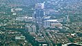
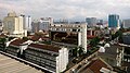
South Tangerang is home to some planned towns built by private developers, the notable ones are Alam Sutera (North Serpong), BSD City (Serpong), and Bintaro Jaya (Pondok Aren), complete with facilities such as business centres, shopping malls, and international schools.
History[]
The municipality of South Tangerang is an autonomous city established on 26 November 2008, based on Banten province's constitution. This establishment was a division out of the Tangerang Regency, to support the better development of government service, construction project, community service, and also to utilize the natural potential so that a greater public welfare could be achieved.[3]
South Tangerang is home to many modernized and planned town and housing complex, such as :
- Alam Sutera
- BSD City
- Bintaro Jaya
- Graha Raya
- Villa Melati Mas
- Paradise Serpong
- Summarecon Gading Serpong
- Villa Serpong
- Residence One BSD City
- The Green BSD
- Paramount Gading Serpong
- The Icon BSD City
Administrative districts[]
The municipality of South Tangerang is divided into seven districts (kecamatan), tabulated below with their areas and population totals from the 2010 Census[4] and 2020 Census.[5] The centre of South Tangerang is the Ciputat district. The table also includes the number of administrative villages (rural desa and urban kelurahan) in each district, and its postal codes. The districts are sub-divided into 49 urban villages (kelurahan) and five rural villages (desa).
| Name | Area in km2 |
Population Census 2010[6] |
Population Census 2020[7] |
Number of villages |
Post codes |
|---|---|---|---|---|---|
| Setu | 14.80 | 66.225 | 84.178 | 6 | 15312-15315 |
| Serpong | 24.04 | 137.212 | 154.744 | 9 | 15310-15311, 15318, 15321-15322 |
| Pamulang | 26.82 | 286.270 | 305.563 | 8 | 15415-15418 |
| Ciputat | 18.38 | 192.205 | 202.722 | 7 | 15411, 15413-15414 |
| Ciputat Timur (East Ciputat) |
15.43 | 178.818 | 172.139 | 6 | 15412, 15419 |
| Pondok Aren | 29.88 | 303.093 | 294.996 | 11 | 15220-15229 |
| Serpong Utara (North Serpong) |
17.84 | 126.499 | 134.008 | 7 | 15320, 15323-15326 |
| Totals | 147.19 | 1.290.322 | 1.354.350 | 54 |
Climate[]
South Tangerang has a tropical rainforest climate (Af) with moderate rainfall from June to September and heavy rainfall from October to May.
| hideClimate data for South Tangerang | |||||||||||||
|---|---|---|---|---|---|---|---|---|---|---|---|---|---|
| Month | Jan | Feb | Mar | Apr | May | Jun | Jul | Aug | Sep | Oct | Nov | Dec | Year |
| Average high °C (°F) | 30.3 (86.5) |
30.5 (86.9) |
31.3 (88.3) |
32.1 (89.8) |
32.4 (90.3) |
32.3 (90.1) |
32.4 (90.3) |
32.9 (91.2) |
33.2 (91.8) |
33.2 (91.8) |
32.5 (90.5) |
31.6 (88.9) |
32.1 (89.7) |
| Daily mean °C (°F) | 26.5 (79.7) |
26.6 (79.9) |
27.0 (80.6) |
27.6 (81.7) |
27.7 (81.9) |
27.3 (81.1) |
27.0 (80.6) |
27.3 (81.1) |
27.5 (81.5) |
27.9 (82.2) |
27.7 (81.9) |
27.2 (81.0) |
27.3 (81.1) |
| Average low °C (°F) | 22.8 (73.0) |
22.8 (73.0) |
22.8 (73.0) |
23.1 (73.6) |
23.0 (73.4) |
22.3 (72.1) |
21.7 (71.1) |
21.7 (71.1) |
21.9 (71.4) |
22.6 (72.7) |
22.9 (73.2) |
22.9 (73.2) |
22.5 (72.6) |
| Average rainfall mm (inches) | 352 (13.9) |
276 (10.9) |
254 (10.0) |
226 (8.9) |
195 (7.7) |
109 (4.3) |
90 (3.5) |
105 (4.1) |
122 (4.8) |
167 (6.6) |
204 (8.0) |
228 (9.0) |
2,328 (91.7) |
| Source: Climate-Data.org[8] | |||||||||||||
Transportation[]

The city is served mainly by land transportation. Buses, minibuses and taxis are the main methods of transportation available. The public transportation mostly goes to Jakarta since many of the residents of South Tangerang commute to Jakarta on a daily basis. There are feeder buses for TransJakarta. The feeder buses goes from Bumi Serpong Damai and Bintaro Jaya to downtown Jakarta in Senayan.
Main road and highway in the city are :
Main road :
- Jl. Raya Serpong
- Jl. Pahlawan Seribu, BSD City
- Jl. Kapten Soebianto Djojohadjikusumo, BSD City
- Jl. Pelayangan, BSD City
- Jl. Ir. H. Juanda, Ciputat
- Jl. Ciater Raya
- Jl. Alam Sutera Boulevard
Highway :
- Jakarta-Serpong Toll Road (connecting Serpong and South Jakarta/JORR 1)
- Serpong-Cinere Toll Road (connecting Serpong and Cinere in Depok)
- Kunciran-Serpong Toll Road (connecting Kunciran in Tangerang City/Soekarno Hatta Airport and Serpong)
- Serpong-Balaraja Toll Road (in progress for section 1A) (connecting Serpong and Balaraja in Tangerang Regency)
The city is also served by commuter rail service KRL Commuterline for those commuters who work in Jakarta. There are five stations located in South Tangerang, namely , Pondok Ranji, Rawa Buntu, Serpong and Sudimara. All stations serves the Tanah Abang - Rangkasbitung Line.
There are two toll roads servicing the city, namely Jakarta–Serpong Toll Road and Jakarta–Tangerang Toll Road. There are also several toll roads currently under planning. The plans are for a Serpong-Balaraja Toll Road which will continue the Jakarta-Serpong toll road, and Jakarta Outer Ring Road 2 which will be connecting the city to Soekarno–Hatta International Airport in the near future. Kunciran-Serpong Toll Road and Serpong-Cinere Toll Road are the latest new infrastructure built in the city.
Pondok Cabe Airport – which is used for military and civilian services – is the only airport located within the city boundaries. It is owned by PT Pertamina, the national oil company. The airport is also used for the maintenance base for Pelita Air Service, also owned by PT Pertamina.
Cycle rickshaws (becak) are still available in some areas in the city. Becak is the only method of transportation currently forbidden to operate in Jakarta as its slow speed has allegedly led to congestion in the traffic of Jakarta. However, since South Tangerang is located on the outskirts of Jakarta (instead of the city proper), it is allowed in the city.
In April 2015, Corridor-2 of which is similar to TransJakarta has been launched to serve public from Pondok Cabe Terminal to Rawa Buntu Station of KRL Jabodetabek. It's free until end of 2015, but only operate between 06:00-09:00, 11:00-14:00 and 16:00-18:00 with notation time of serve will be added as needed. The other seven corridors will be applied gradually.[9]
Churches[]
- GKI Serpong
- GKI Gading Serpong
- GKI Kota Modern
- GKI Villa Melati Mas
- GKI Alam Sutera
- GPdI Villa Melati Mas
- Gereja Katolik Santa Monika BSD
- Gereja Katolik Santo Laurensius
- Gereja Katolik Santo Ambrosius
- GKY BSD
- GKY Gading Serpong
- GBI Kota Modern
- GKI Foresta
Shopping[]
South Tangerang offers some shopping center in the area, such as :
- Living World Alam Sutera
- Bintaro Xchange Mall
- Plaza Bintaro Jaya
- BSD Plaza
- TerasKota Entertainment Center BSD
- Transpark Mall Bintaro
- LOTTE Mall Bintaro
- ITC BSD
- Mall WTC Matahari Serpong
- Mall @Alam Sutera Alam Sutera
- Summarecon Mall Serpong
- TangCity Mall
- AEON Mall BSD
- BSD Junction
- The Breeze BSD
- Serpong Plaza
- Lippo Karawaci Mall
Education[]
Education in South Tangerang is just as the same as the other part of Indonesia, which is from elementary until senior high (compulsory). Here are the list of schools and universities in South Tangerang :
International Schools[]

- Jakarta Japanese School, (Bintaro Jaya)
- Global Jaya School, (Bintaro Jaya)
- German International School Jakarta (BSD City)
- Sinarmas World Academy (BSD City)
- British School Jakarta (Bintaro Jaya)
- BINUS Serpong, Cambridge International School (BSD City)
- Khalifa IMS Bintaro, Cambridge International School
Private Schools[]
- Santa Ursula BSD
- Santa Laurensia School (Alam Sutera)
- BPK Penabur Bintaro Jaya
- SMA Plus Pembangunan Jaya
- SMA Efata Serpong
- SMA Candle Tree
- SMA Islam Cikal Harapan BSD
- SMA Islam Sinar Cendekia
- SMA Stella Maris BSD
- SMA Islam Al Azhar BSD
- Saint John Catholic School BSD
- Sekolah Athalia
- Kharisma Bangsa School
- Sekolah Harapan Bangsa, Modernhill Pondok Cabe
- SMA Al - Mubarak
- SMK Bintang Nusantara
- BPK PENABUR Gading Serpong
- Stella Maris Gading Serpong
- UPH College
- Tarakanita Gading Serpong
- Yayasan Musik Jakarta BSD
- Pahoa Gading Serpong
- Tunas Bangsa School Gading Serpong
- Ora Et Labora BSD
- SMK Pustek
- SMA Yaspita
- Strada Villa Melati Mas
- Solideo BSD
- SMA Kanaan
- Sekolah Markus Tangerang
- Jakarta Multicultural School
- BPK Penabur Kota Modern Tangerang
- Harapan Bangsa School
- Permata Insani Islamic School
- Syafana Islamic School
Public Schools[]
- SMK Negeri 4 Tangerang Selatan
- SMAN 1 Tangerang Selatan
- SMAN 2 Tangerang Selatan
- SMAN 3 Tangerang Selatan
- SMAN 4 Tangerang Selatan
- SMAN 5 Tangerang Selatan
- SMAN 6 Tangerang Selatan
- SMAN 7 Tangerang Selatan
- SMAN 8 Tangerang Selatan
- SMAN 9 Tangerang Selatan
- SMAN 10 Tangerang Selatan
- SMAN 11 Tangerang Selatan
- SMAN 12 Tangerang Selatan
- MAN Insan Cendekia
Public universities[]
- Universitas Terbuka
- UIN Syarif Hidayatullah
Government-affiliated colleges[]
- Sekolah Tinggi Akutansi Negara
- Geophysics and Meteorology Academy (Akademi Meteorologi dan Geofisika)[10]
Private Universities[]
- Pamulang University (Universitas Pamulang)[11]
- Muhammadiyah Jakarta University (Universitas Muhammadiyah Jakarta)[12]
- BINUS ASO School of Engineering, Alam Sutera
- Indonesian Institute of Technology (Institut Teknologi Indonesia)[13]
- Universitas Pembangunan Jaya
- Universitas Bina Nusantara Alam Sutera Main Campus
- Universitas Pelita Harapan Lippo Karawaci
- Swiss German University
- Universitas Prasetya Mulya BSD Campus
- Universitas Gunadarma
- Universitas Atma Jaya BSD Campus
- Universitas Bunda Mulia Alam Sutera
See also[]
References[]
- ^ "Hari Lahir Kota Tangerang Selatan Ditetapkan".
- ^ "Kondisi Geografis dan Iklim".
- ^ "Web Portal Tangerang Selatan". berita.tangerangselatankota.go.id. Retrieved 2019-05-29.
- ^ Biro Pusat Statistik, Jakarta, 2011.
- ^ Badan Pusat Statistik, Jakarta, 2021.
- ^ Biro Pusat Statistik, Jakarta, 2011.
- ^ Badan Pusat Statistik, Jakarta, 2021.
- ^ "Climate: Tangerang Selatan". Climate-Data.org. Retrieved 12 November 2020.
- ^ "Tangerang Selatan Uji Coba Lima Bus Gratis "Trans Anggrek Circle Line"". April 13, 2015.
- ^ "Archived copy". Archived from the original on 2012-04-20. Retrieved 2012-04-17.CS1 maint: archived copy as title (link)
- ^ http://www.unpam.ac.id/
- ^ "Archived copy". Archived from the original on 2012-04-18. Retrieved 2012-04-17.CS1 maint: archived copy as title (link)
- ^ http://iti.ac.id/
External links[]
| Wikivoyage has a travel guide for South Tangerang. |
- (in Indonesian) Official website

| show Authority control |
|---|
- South Tangerang
- Populated places in Banten