Beckton
This article needs additional citations for verification. (November 2010) |
| Beckton | |
|---|---|
 Gas holders at Beckton | |
 Beckton Location within Greater London | |
| Population | 15,141 (ward, 2011)[1] |
| OS grid reference | TQ435815 |
| • Charing Cross | 8 mi (12.9 km) W |
| London borough |
|
| Ceremonial county | Greater London |
| Region | |
| Country | England |
| Sovereign state | United Kingdom |
| Post town | LONDON |
| Postcode district | E6, E16 |
| Dialling code | 020 |
| Police | Metropolitan |
| Fire | London |
| Ambulance | London |
| UK Parliament | |
| London Assembly | |

Beckton is a suburban district in East London, England, within the London Borough of Newham and is located 8 miles (12.9 km) east of Charing Cross. Historically part of Essex, Beckton was unpopulated marshland adjacent to the River Thames until the development of major industrial infrastructure in the 19th century to support the growing metropolis of London. Housing was created in Beckton for workers of the gas and sewage works. Between 1981 and 1995 it was within the London Docklands Development Corporation area, which caused the population to increase as new homes were built and the Docklands Light Railway was constructed.
History[]
Toponymy[]
Beckton is named after Simon Adams Beck, the governor of the Gas Light and Coke Company when work building Beckton Gas Works began in November 1868.
Local government[]
Beckton was located primarily in the parish of East Ham. It stretched into the ancient parish of Woolwich, which included land on the north bank of the Thames and the parish of Barking that included land to the west of the Roding. The parish boundary was also a county boundary, with Barking and East Ham in Essex and North Woolwich in Kent. In 1889 Woolwich became part of the County of London. In 1914 East Ham became a county borough, essentially a county in its own right. In 1965 the London Borough of Newham was created and all three sections of Beckton became part of the new borough in Greater London. Beckton was within the London Docklands Development Corporation area from 1981 to 1995.
Beckton sewage works[]
Beckton Sewage treatment works were first established in 1864 as part of Joseph Bazalgette's scheme to remove sewage (and hence reduce disease) from London by creating two large sewers from the capital, one on each side of the Thames and known as the Southern and Northern Outfall Sewers. The Beckton sewage works (TQ448823), at the end of the northern outfall sewer, is Europe's 7th largest and is now managed by Thames Water. The outfall sewer has been landscaped and now also serves as the Greenway cycle track through east London.
The site was mooted in 2005 as the location for a desalination plant, but the proposal was rejected by Mayor Ken Livingstone as environmentally unacceptable. The scheme has been resurrected by the successive mayor, Boris Johnson, as part of a deal with Thames Water to reduce delays in fixing roadworks throughout London. The sewerage works has been expanded to handle the flow from the Thames Tideway Scheme.
Beckton gasworks[]
Situated north and east of the Royal Docks, the area was formerly heavily industrialised, and was the location of Beckton Gas Works, the largest gasworks in Europe, which served the capital. An adjacent by-products works also produced a wide variety of products including ink, dyes, mothballs, and fertilisers, all by-products of the process of turning coal to coke in the production of town gas. Britain converted from town gas to North Sea natural gas over the period 1966-77 and the Beckton gasworks were closed in 1976.
An extensive toxic spoil-heap from the Gasworks was known ironically as 'Beckton Alps'. Originally running from the Northern outfall sewer south to Winsor Terrace, this was landscaped in the 1980s. Part became a 25 metres (82 ft) high Artificial ski slope for a time, opened by Diana, Princess of Wales, with a viewing platform at the summit and a Swiss-style bar at the foot. However, the site is now derelict.
Urban development[]

Immediately after the Second World War, large numbers of prefabs were built in Beckton to house those made homeless by the war. The prefab-lined streets were all named after well-known generals and war heroes, but in the redevelopment of North Beckton in the 1980s, these were all swept away with the exception of Eisenhower Drive.
Containerisation during the 1960s, and the development of the docks at Tilbury, released all the land from the Thames up to the A13 which had been earmarked for a new, North Albert Dock. The original District Plan envisaged a large Council-owned estate, and major infrastructure works—including a huge drainage scheme with pumping stations—were put in place. However, following the creation of the London Docklands Development Corporation, much of the land was sold off resulting in today's blend of largely private housing.
In more recent times, industry has left the area, leaving huge areas of brownfield land, and Beckton has been redeveloped as part of the Docklands project. It now comprises mainly housing and several out-of-town shopping centres, and the architecture is mostly post-1982. Small areas of Victorian housing survive in Winsor Terrace, originally built as accommodation for Gas Light and Coke Company staff, and in the 'Nottingham' estate off Prince Regent Lane. It is served by local buses and Beckton DLR station, which acts as the terminus of the DLR's Beckton branch. The Victorian 'Cyprus' estate was rebuilt in the 1980s, but the original Cyprus public house survives (named The Ferndale, although now boarded-up, and earmarked for redevelopment, March 2008).
In the early 21st century, Beckton burgeons south and further east, towards Gallions Reach, being an essential part of the Thames Gateway. "Gallions Hotel", part of the Furlong City development by the lock that links the Royal Docks to the Thames, was formerly a rail terminus which connected with passenger ships leaving for all parts of the British Empire. Many colonial officials and their families spent their last night in Britain in the Gallions Hotel, which was mentioned by Rudyard Kipling in his novel, The Light That Failed.
In 2003, the large Gallions Reach Shopping Park was built in Beckton.

1832

1855

1899

1920


Geography[]
Its boundaries are the A13 trunk road to the north, Barking Creek to the east, the Royal Docks to the south, and Prince Regent Lane to the west. The area around Prince Regent Lane is also known as Custom House. Modern Beckton is divided into East Beckton, Mid Beckton, North Beckton, West Beckton, South Beckton and Cyprus (named after the British capture of Cyprus from the Ottoman Empire in 1878, which occurred as the original estate was being built).
Beckton is at the western end of the London Riverside redevelopment zone of the Thames Gateway. Transport for London is planning a new bridge, the Gallions Reach Crossing, which will connect Beckton to Thamesmead on the southern bank of the River Thames.
Demographics[]
Beckton is home to a significant Lithuanian community.[2]
Transport[]
There are Docklands Light Railway services from Beckton station to Canning Town, Stratford International and Tower Gateway. There are a number of stations serving Beckton. The nearest Docklands Light Railway station is Beckton for Mid and North Beckton; Cyprus for Cyprus area; Beckton Park for South Beckton and Royal Albert for West Beckton. Beckton is near the London City Airport and Woolwich. Beckton is served by many Transport for London bus services connecting it with areas including Barking, Beckton Triangle Retail Park, Canning Town, Central London, Chadwell Heath, Dagenham, East Ham, Gallions Reach Shopping Park, Ilford, London City Airport, Manor Park, North Woolwich, Royal Albert, Stratford and Wanstead
Buses
The area is served by TfL bus services 101, 173, 262, 300, 366, 376, 474, 673, 678; and night bus N551
Beckton bus station[]
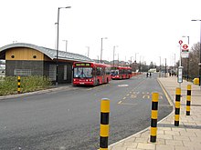
Beckton is a London Buses bus station in the neighbourhood of Beckton, east London. The station is owned and maintained by Transport for London.
Culture and community[]
The Gasworks were still extant—although derelict—in the early 1980s, when Stanley Kubrick's team came scouting for an area that could double for the battle scenes in his 1987 film, Full Metal Jacket. The Gasworks rough concrete structures were painted with Vietnamese script, and then strategically dynamited so as to resemble war-torn Hue. Retail parks now cover most of the Gasworks site.
Other notable films shot in and around the Beckton area during the 1980s included the 1981 James Bond film, For Your Eyes Only, which featured extensive aerial views of the Gasworks in the pre-credit sequence. Beckton was also used as a location in Michael Radford's 1984 feature film adaptation of George Orwell's Nineteen Eighty-Four—the Gasworks served as the setting for Orwell's "Proletarian Zones".
The video for Loop's 1990 single 'Arc-lite' was filmed on the set of Full Metal Jacket,[3] as was the video for the 1997 Oasis single, "D'You Know What I Mean?"
Andrew Birkin's 1990 film of Ian McEwan's novel, The Cement Garden, was also filmed in Beckton and starred Charlotte Gainsbourg, who could often be seen (at the time of filming) shopping in the aisles of ASDA. In several scenes of The Cement Garden, aircraft can be heard taxiing at the nearby London City Airport. Winsor House, which served as the backdrop to the film was later demolished and the Winsor House Hotel stands there now.
In the opening minutes of the 2007 Simon Pegg film Hot Fuzz, the Tate & Lyle factory, Silvertown, and the City Airport aprons can be seen through the window blinds of Building 1000.
England and current A.F.C. Bournemouth striker Jermain Defoe was born in Beckton. Defoe has said Beckton has "made him the man he is today". On 13 February 2006 Jermain Defoe scored his 100th Premier League goal against Charlton. He celebrated making a "B" sign with his hands to commemorate Beckton.[citation needed]
On 14 May 2010 Beckton was the location of a terrorist attack on local Member of Parliament Stephen Timms. He was approached by 21-year-old Islamist Roshonara Choudhry during his constituency surgery at the Beckton Globe library and stabbed twice in an attempted assassination. Timms survived the attack and the perpetrator was jailed for life.[4][5]
Education[]
The University of East London Docklands Campus is a campus of the University of East London (UEL) situated in the Docklands area of east London in the Cyprus area of Beckton. The campus opened in 1999. It is one of three UEL campuses, the others being the Stratford Campus and the new University Square Stratford location.
Kingsford Community School is a secondary school located close to Beckton DLR. It opened in September 2000, and educates full-time children from the ages of 11 to 16.
Gallery[]
This section contains an unencyclopedic or excessive gallery of images. |

Henry Addlington Close in Beckton

Gallions Hotel

Beckton Alps and Gasworks 1973, from the A13


References[]
- ^ "Newham Ward population 2011". Neighbourhood Statistics. Office for National Statistics. Archived from the original on 21 October 2016. Retrieved 17 October 2016.
- ^ Ben Judah (15 November 2013). "From Eastern Europe to the East End: What is life really like in Britain for our immigrant neighbours?". The Independent. Retrieved 1 March 2017.
- ^ "Loop - + Heaven's End". Heavensend.org. 27 January 1990. Retrieved 1 March 2017.
- ^ "MP Timms stabbed in the stomach". BBC News. 14 May 2010.
- ^ "Life term for MP murder attempt". BBC. 3 November 2010.
| show London Borough of Newham |
|---|

| Section 14: | Capital Ring Walking Route | Section 15: |
|---|---|---|
| Hackney Wick | Beckton District Park | Woolwich |
- Beckton
- Areas of London
- Districts of the London Borough of Newham