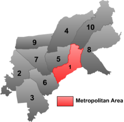
Beilin District, Suihua
Beilin
北林区 | |
|---|---|
District | |
 Beilin District (red) in Suihua City | |
 Beilin Location in Heilongjiang | |
| Coordinates (Beilin District government): 46°38′14″N 126°59′07″E / 46.6373°N 126.9854°ECoordinates: 46°38′14″N 126°59′07″E / 46.6373°N 126.9854°E | |
| Country | People's Republic of China |
| Province | Heilongjiang |
| Prefecture-level city | Suihua |
| Township-level divisions | 6 subdistricts 12 towns 8 townships |
| District seat | (紫来街道) |
| Area | |
| • Total | 359 km2 (139 sq mi) |
| Elevation | 173 m (568 ft) |
| Population (2003) | |
| • Total | 230,000 |
| • Density | 640/km2 (1,700/sq mi) |
| Time zone | UTC+8 (China Standard) |
| Postal code | 152000 |
| Area code(s) | 0455 |
Beilin (Chinese: 北林; pinyin: Běilín; lit. 'northern forest') is the only district of the city of Suihua, Heilongjiang, People's Republic of China.
Administrative divisions[]
There are twelve subdistricts, 15 towns, and five townships in the district:[1][2]
Subdistricts[]
|
|
Towns[]
|
|
Townships[]
- (红旗满族乡)
- (连岗乡)
- (新华乡)
- (五营乡)
- (兴和朝鲜族县)
Notes and references[]
- ^ 2011年统计用区划代码和城乡划分代码:昂昂溪区 (in Chinese). National Bureau of Statistics of the People's Republic of China. Retrieved 2013-01-27.[permanent dead link]
- ^ "国家统计局" (in Chinese). National Bureau of Statistics of the People's Republic of China. Retrieved 2021-12-07.
Categories:
- Administrative subdivisions of Heilongjiang
- Heilongjiang geography stubs
