Beit Ta'mir
Beit Ta'mir | |
|---|---|
Municipality type D (Village council) | |
| Arabic transcription(s) | |
| • Arabic | خربة بيت تعمر |
 Beit Ta'mir Location of Beit Ta'mir within Palestine | |
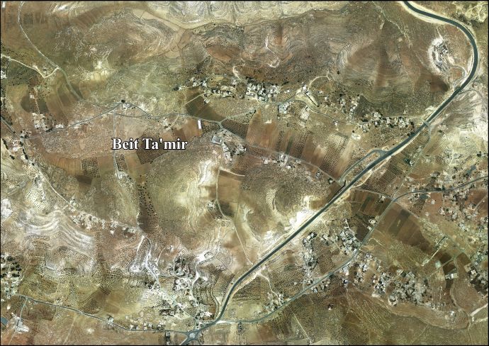
| Coordinates: 31°40′18″N 35°13′36″E / 31.67167°N 35.22667°ECoordinates: 31°40′18″N 35°13′36″E / 31.67167°N 35.22667°E | |
| Palestine grid | 172/120 |
| State | State of Palestine |
| Governorate | Bethlehem |
| Government | |
| • Type | Village council |
| Population (2007) | |
| • Total | 1,229 |
| Name meaning | The house of the T'amirah Arabs[1] |


Beit Ta'mir (Arabic: خربة بيت تعمر) is a Palestinian village located six kilometers southeast of Bethlehem.The town is in the Bethlehem Governorate central West Bank. According to the Palestinian Central Bureau of Statistics, the village had a population of 1,229 in 2007.[2] The village is named after the 'Arab al-Ta'mira Bedouin tribe of the Bethlehem area, and along with Tuqu' and Za'atara forms the 'Arab al-Ta'mira village cluster.
Location[]
Beit Ta’mir is located 5 kilometers (3.1 mi) south-east of Bethlehem. It is bordered by Za'atara to the east, Hindaza to the west and north, and Jannatah and Tuqu' to the south.[3]
History[]
The village mosque, the Mosque of Omar, has been tentatively dated to 636 CE.[4]
Ottoman era[]
Beit Ta'mir was incorporated into the Ottoman Empire in 1517 with all of Palestine, and in 1596 it appeared in the tax registers as being in the nahiya of Al-Quds in the liwa of Al-Quds under the name of Bayt Ta'mar. It had a population of 65 household;[5] who were all Muslims. They paid a fixed tax-rate of 33.3 % on agricultural products, including wheat, barley, vegetable and fruit gardens, goats and beehives, in addition to occasional revenues; a total of 8,100 Akçe. Half of the revenue went to a Waqf.[5]
In 1838, Edward Robinson noted Beit Ta'mar, the village of the Ta'amirah, on his travels in the region,[6] It was also noted as an Arab village, located south of Wadi er-Rahib in the Jerusalem district.[7]
In 1863, Victor Guérin noted it as an ancient site, inhabited by people of the Ta'amereh tribe.[8]
An Ottoman list from about 1870 notes a "sizable" village with a mosque with a small minaret. The villagers were Bedouin.[9]
In 1883 the PEF's Survey of Western Palestine (SWP) described Beit T'amir: "a small village on a hill with wells and a few olives. The name is that of an Arab tribe which was originally settled in the place. The village contains a small mosque named after the Khalif Omar."[10]
In 1896 a population list noted that Beit Ta'mir was "half bedouin".[11]
British Mandate era[]
In the 1945 statistics the population was counted under the name Arab et Ta'amira together with Arab Ibn Ubeid, Arab et Rashayida and Arab et Sawahira; together they had a population of 7,070 Muslims,[12] with Arab et Ta'amira having a total of 209,888 dunams of land according to an official land and population survey.[13] Of this, 24 dunams were used plantations and irrigable land, 12,424 for cereals,[14] while 197,440 dunams were classified as non-cultitivable land.[15]
Jordanian era[]
In the wake of the 1948 Arab–Israeli War, and after the 1949 Armistice Agreements, Beit Ta’mir came under Jordanian rule.
In 1961, the population of Ta'amira was 306.[16]
Post 1967[]
Since the Six-Day War in 1967, Beit Ta'mir has been held under Israeli occupation.
After the 1995 accords, 34.5% of village land was classified as Area A land, 56.2% as Area B, and the remaining 9.3% as Area C.[17]
References[]
- ^ Palmer, 1881, p. 287
- ^ 2007 PCBS Census Palestinian Central Bureau of Statistics. p.117.
- ^ Beit Ta'mir village profile, ARIJ, p. 4
- ^ Kitchener, 1877, p. 100
- ^ Jump up to: a b Hütteroth and Abdulfattah, 1977, p. 114
- ^ Robinson and Smith, 1841, vol 2, p. 159
- ^ Robinson and Smith, 1841, vol 3, 2nd appendix, p. 123
- ^ Guérin, 1869, p. 121
- ^ Socin, 1879, p. 147
- ^ Conder and Kitchener, 1883, SWP III, pp. 29-30
- ^ Schick, 1896, p. 125
- ^ Government of Palestine, Department of Statistics, 1945, p. 25
- ^ Government of Palestine, Department of Statistics. Village Statistics, April, 1945. Quoted in Hadawi, 1970, p. 58
- ^ Government of Palestine, Department of Statistics. Village Statistics, April, 1945. Quoted in Hadawi, 1970, p. 104
- ^ Government of Palestine, Department of Statistics. Village Statistics, April, 1945. Quoted in Hadawi, 1970, p. 154
- ^ Government of Jordan, Department of Statistics, 1964, p. 23
- ^ Beit Ta'mir village profile, ARIJ, p. 17
Bibliography[]
- Conder, C.R.; Kitchener, H.H. (1883). The Survey of Western Palestine: Memoirs of the Topography, Orography, Hydrography, and Archaeology. 3. London: Committee of the Palestine Exploration Fund.
- Government of Jordan, Department of Statistics (1964). First Census of Population and Housing. Volume I: Final Tables; General Characteristics of the Population (PDF).
- Government of Palestine, Department of Statistics (1945). Village Statistics, April, 1945.
- Guérin, V. (1869). Description Géographique Historique et Archéologique de la Palestine (in French). 1: Judee, pt. 3. Paris: L'Imprimerie Nationale.
- Hadawi, S. (1970). Village Statistics of 1945: A Classification of Land and Area ownership in Palestine. Palestine Liberation Organization Research Centre.
- Hütteroth, Wolf-Dieter; Abdulfattah, Kamal (1977). Historical Geography of Palestine, Transjordan and Southern Syria in the Late 16th Century. Erlanger Geographische Arbeiten, Sonderband 5. Erlangen, Germany: Vorstand der Fränkischen Geographischen Gesellschaft. ISBN 3-920405-41-2.
- Kitchener, H.H. (1877). "Lieutenant Kitchener's Report". Quarterly statement - Palestine Exploration Fund. 9: 165–178.
- Palmer, E.H. (1881). The Survey of Western Palestine: Arabic and English Name Lists Collected During the Survey by Lieutenants Conder and Kitchener, R. E. Transliterated and Explained by E.H. Palmer. Committee of the Palestine Exploration Fund.
- Robinson, E.; Smith, E. (1841). Biblical Researches in Palestine, Mount Sinai and Arabia Petraea: A Journal of Travels in the year 1838. 2. Boston: Crocker & Brewster.
- Robinson, E.; Smith, E. (1841). Biblical Researches in Palestine, Mount Sinai and Arabia Petraea: A Journal of Travels in the year 1838. 3. Boston: Crocker & Brewster.
- Schick, C. (1896). "Zur Einwohnerzahl des Bezirks Jerusalem". Zeitschrift des Deutschen Palästina-Vereins. 19: 120–127.
- Socin, A. (1879). "Alphabetisches Verzeichniss von Ortschaften des Paschalik Jerusalem". Zeitschrift des Deutschen Palästina-Vereins. 2: 135–163.
External links[]
- Welcome to Kh. Bayt Ta'mir
- Beit Ta’mir, Welcome to Palestine
- Survey of Western Palestine, Map 17: IAA, Wikimedia commons
- Beit Ta'mir village (fact sheet), Applied Research Institute–Jerusalem (ARIJ)
- Beit Ta'mir village profile, ARIJ
- Beit Ta'mir aerial photo, ARIJ
- The priorities and needs for development in Beit Ta'mir village based on the community and local authorities' assessment, ARIJ
| hide | ||
|---|---|---|
| Cities |  | |
| Municipalities | ||
| Villages | ||
| Religion | ||
| Refugee camps | ||
| Other | ||
- Villages in the West Bank
- Bethlehem Governorate
- Municipalities of the State of Palestine