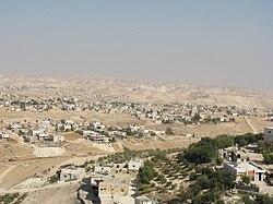
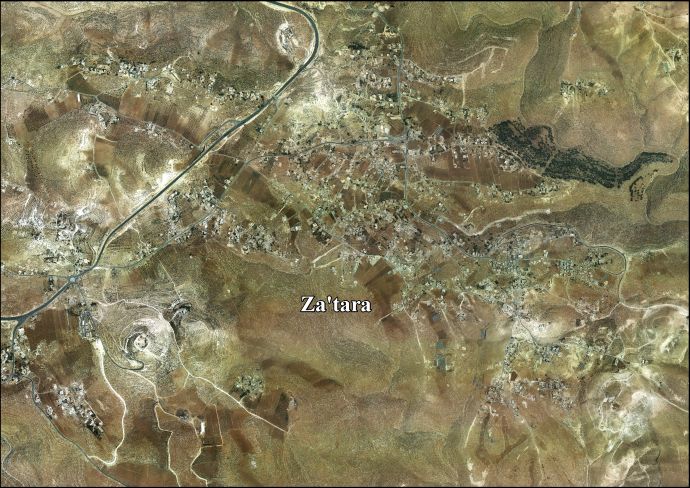
Za'atara
Za'atara | |
|---|---|
Municipality type C | |
| Arabic transcription(s) | |
| • Arabic | زعتره |
 Za'atara | |
 Za'atara Location of Za'atara within Palestine | |
| Coordinates: 31°40′32″N 35°15′20″E / 31.67556°N 35.25556°ECoordinates: 31°40′32″N 35°15′20″E / 31.67556°N 35.25556°E | |
| State | State of Palestine |
| Governorate | Bethlehem |
| Government | |
| • Type | Municipality |
| Population (2007) | |
| • Total | 6,289 |

Za'atara (Arabic: زعتره) is a Palestinian town located eleven kilometers southeast of Bethlehem. The town is in the Bethlehem Governorate central West Bank. According to the Palestinian Central Bureau of Statistics, the town had a population of over 6,289 in 2007.[1]
History[]
In the wake of the 1948 Arab–Israeli War, and after the 1949 Armistice Agreements, Za’atara came under Jordanian rule.
In 1961, under Jordanian rule, the population of Za'atara was 1,003.[2]
Post−1967[]
Since the Six-Day War in 1967, Za'atara has been held under Israeli occupation. The population in the 1967 census conducted by the Israeli authorities was 1,282.[3]
After the 1995 accords, 0.9% of Za'atara land was classified as Area A, 44% classified as Area B, and 32.6% classified as Area C, while the remaining 22.5% is defined as "nature reserves".[4] Israel has confiscated 20 dunams of village land for the Israeli settlement of El David and 10 dunams for an Israeli Military Base.[5]
References[]
- ^ 2007 PCBS Census Palestinian Central Bureau of Statistics. p.118.
- ^ Government of Jordan, Department of Statistics, 1964, p. 23
- ^ Perlmann, Joel (November 2011 – February 2012). "The 1967 Census of the West Bank and Gaza Strip: A Digitized Version" (PDF). Levy Economics Institute. Retrieved 24 June 2016.
- ^ Za'tara Town Profile p. 16
- ^ Za'tara Town Profile p. 17
Bibliography[]
- Government of Jordan, Department of Statistics (1964). First Census of Population and Housing. Volume I: Final Tables; General Characteristics of the Population (PDF).
External links[]
- Welcome To Za'tara
- Za’atara, Welcome to Palestine
- Za'tara town (fact sheet), Applied Research Institute–Jerusalem (ARIJ)
- Za'tara town profile, ARIJ
- Za'tara aerial photo, ARIJ
- The priorities and needs for development in Za'tara town based on the community and local authorities' assessment, ARIJ
| Cities |  | |
|---|---|---|
| Municipalities | ||
| Villages | ||
| Religion | ||
| Refugee camps | ||
| Other | ||
This geography of the State of Palestine article is a stub. You can help Wikipedia by . |
- Towns in the West Bank
- Bethlehem Governorate
- Municipalities of the State of Palestine
- Palestine geography stubs