Beit Sahour
Beit Sahour | |
|---|---|
Municipality type B | |
| Arabic transcription(s) | |
| • Arabic | بيت ساحور |
| • Latin | Beit Sahur (official) Bayt Sahoor (unofficial) |
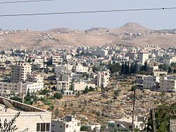 View of Beit Sahour | |
|
Municipal Seal of Beit Sahour | |
 Beit Sahour Location of Beit Sahour within the West Bank | |
| Coordinates: 31°42′N 35°13′E / 31.700°N 35.217°ECoordinates: 31°42′N 35°13′E / 31.700°N 35.217°E | |
| State | State of Palestine |
| Governorate | Bethlehem |
| Government | |
| • Type | Municipality |
| • Head of Municipality | Jehad Khair [1] |
| Area | |
| • Municipality type B | 6,945 dunams (6.9 km2 or 2.7 sq mi) |
| Population (2017)[2] | |
| • Municipality type B | 13,281 |
| • Density | 1,900/km2 (5,000/sq mi) |
| • Metro | 97,559 |
| Name meaning | "House of vigilance"[3] or literally "house of the night watch";[4] "House of the magicians"[5] |
| Website | Beit Sahour Municipality |


Beit Sahour (Arabic: بيت ساحور pronounced ![]() Bayt Saahoor (help·info); Palestine grid 170/123) is a Palestinian town east of Bethlehem under the administration of the Palestinian National Authority. The population of approximately 14,000 [6] is 80% Christian (most of them Greek Orthodox) and 20% Muslim.[7]
Bayt Saahoor (help·info); Palestine grid 170/123) is a Palestinian town east of Bethlehem under the administration of the Palestinian National Authority. The population of approximately 14,000 [6] is 80% Christian (most of them Greek Orthodox) and 20% Muslim.[7]
Modern Beit Sahour is also known as Beit Sahur an-Nasara ("Beit Sahur of the Christians"),[8] or Beit Sahour al-Wadi ("Beit Sahur of the Valley").[9]
Another former village near Jerusalem known as Beit Sahur al-Atiqah ("ancient Beit Sahur") is fully distinct from the town of Beit Sahour[8] and is only mentioned here for technical reasons.
Christian tradition holds Beit Sahour to be the site of the Annunciation to the shepherds, Judean shepherds, but the Christian Palestinian occupants are being driven out of the town, as Israeli settlements occupy land and Israeli courts rule Palestinian homes as illegal and subject to demolition.[10]
There are two enclosures in the eastern part of Beit Sahour that are claimed by different Christian denominations to be the actual 'Shepherds Field': one belonging to the Greek Orthodox Church and the other, the Catholic site, to the Franciscan Custody of the Holy Land.
History[]
Ottoman era[]
Beit Sahour, like the rest of Palestine, was incorporated into the Ottoman Empire in 1517, and in the census of 1525-6 (932 AH), Beit Sahur an-Nasara had 5 Christian and 7 Muslim households, increasing in 1538-9 (945 AH) to 8 Christian and 8 Muslim households.[11] By 1553-4 (961 AH) 13 Christian and 21 Muslim households were noted, and in 1562-3 (970 AH) 9 Christian and 17 Muslim households were counted.[11] In 1596, Beit Sahur an-Nasara was registered as a village in the nahiyah of Quds (Jerusalem) of the Liwa of Quds, with a total population of 24 households; 15 Muslim and 9 Christian. The villages paid taxes on the same products as the villagers of Beit Sahur al-Atiqah.[12]
The Franciscans ceased holding religious services at the shrine by Shepherd's Field around 1820. In 1864 a new Roman Catholic church and school were completed.[13]
An Ottoman village list from about 1870 showed that Beit Sahour el-foka ("the upper Beit Sahour") had a population of 37 "Latins" (Catholics) in 11 houses, and 187 "Greeks" (Eastern Orthodox) in 48 houses, bringing the total population of both Beit Sahours, el-foka and et-tahta, to 190 (men only) in 76 houses.[14][15]
In 1883, the PEF's Survey of Western Palestine (SWP) described Beit Sahur as:
This village is a sort of suburb of Bethlehem, situated on the same ridge, with the broad plateau east of it known as the 'Shepherd's Field' ... [with] the small Greek Church of the Grotto of the Shephard, a subterranean chapel reached by 20 steps, containing pictures and mosaic. Above the vault are ruins with a Latin altar. Bait Sahur contains a well-built modern house belonging to the Latin curé, and is surrounded with olives and vines.[16]
In 1896 the population of Beit Sahour was estimated to be about 861 persons.[17] A construction text, dating to 1897, engraved in the lintel of a door on Municipality Street has been examined, and was found to be a poem in 19th century Christian naskhi script.[18]
British Mandate era[]
In the 1922 census of Palestine conducted by the British Mandate authorities, Bait Sahur had a population 1,519; 285 Muslims and 1,234 Christians,[19] increasing in the 1931 census to 1,942; 395 Muslims and 1,547 Christians, in a total of 454 houses.[20]
In the 1945 statistics the population of Beit Sahour was 2,770; 370 Muslims and 2,400 Christians,[21] who owned 6,946 (rural) and 138 (urban) dunams of land, according to an official land and population survey.[22] 1,031 dunams were plantations and irrigable land, 3,641 for cereals,[23] while 100 dunams were built-up (urban) land.[24]
Jordanian era[]
In the wake of the 1948 Arab–Israeli War, and after the 1949 Armistice Agreements, Beit Sahur came under Jordanian rule.
In 1961, the population of Beit Sahur was 5,316.[25]
Israeli occupation[]
Since the Six-Day War in 1967, Beit Sahour has been under Israeli occupation. The population in the 1967 census was 5,380.[26] The original Christian Palestinian occupants are being driven out of the town, as Israeli settlements occupy land and Israeli courts rule Christian homes as illegal and subject to demolition.[10]
According to ARIJ, 52.8% of the village land is classified as being in Area A, while the remaining 47.2% is in Area C. From 1997 and onwards, Israel has confiscated hundred of dunams of village land for the construction of the Israeli settlement of Har Homa.[27]
Economy[]
The town's economy is largely based on tourism and related industries, such as the manufacture of olive-wood carvings. Agriculture and work in Israel also play a significant role. The town had a prominent role in the Palestinian national "Bethlehem 2000" project, as extensive renovations of tourist sites, hotels and businesses, and historic sites were carried out prior to the millennium celebrations.
During the First Intifada, residents in the town had attempted to develop their own dairy industry—a move resisted by Israeli authorities. These efforts were documented in 2014 film The Wanted 18, co-directed by Palestinian filmmaker Amer Shomali and Canadian Paul Cowan.[28]
Social and economic development were disrupted by the Second Intifada.
Political activism[]

Beit Sahour is a center of Palestinian political activism. The town played a key role in the First and Second Intifadas, with local activists pioneering nonviolent resistance techniques. During the First Intifada and the Second Intifada, the Palestinian Center for Rapprochement between Peoples (PCR) based in Beit Sahour encouraged non-violent activism under the aegis of the International Solidarity Movement. George Rishmawi is director of PCR.[29] During the First Intifada, the Palestinian Center for Rapprochement between Peoples issued an invitation to Israelis of goodwill to come and spend a weekend (Shabbat) in Palestinian homes using the slogan "Break Bread, Not Bones".
The Alternative Information Center is also partly based in the town. Elias Rishmawi, a member of the Beit Sahour council, is co-founder, together with Ghassan Andoni, Majed Nassar, Rifat Odeh Kassis and Jamal Salameh, of the Alternative Tourism Group (ATG), a non-governmental organisation specializing in tours of the Palestinian territories,[30] where the olive harvest is used as a backdrop for showing the effects of the Israeli occupation and land confiscation on the Palestinian population.[31]
Tax resistance[]
In 1989, during the First Intifada, the Palestinian resistance (Unified National Leadership of the Uprising, UNLU) and Ghassan Andoni and , urged people to stop paying taxes to Israel, which inherited and modified the previous Jordanian tax-collection regime in the West Bank.[32] "No taxation without representation," said a statement from the organizers. "The military authorities do not represent us, and we did not invite them to come to our land. Must we pay for the bullets that kill our children or for the expenses of the occupying army?"[33] The people of Beit Sahour responded to this call with an organized citywide tax strike that included refusal to pay and file tax returns.
Israeli defense minister Yitzhak Rabin responded: "We will teach them there is a price for refusing the laws of Israel."[34] The Israeli military authorities placed the town under curfew for 42 days, blocked food shipments into the town, cut telephone lines to the town, tried to bar reporters from the town, imprisoned ten residents (among them Fuad Kokaly and Rifat Odeh Kassis) and seized in house-to-house raids millions of dollars in money and property belonging to 350 families.[35] The Israeli military stopped the consul-generals of Belgium, Britain, France, Greece, Italy, Spain and Sweden when they attempted to go to Beit Sahour and investigate the conditions there during the tax strike.[36]
Israel's military occupation had the authority to create and enforce taxes beyond the baseline Jordanian code enacted in 1963 in areas formerly administered by that country, including Beit Sahour.[32] During the Intifada, they used that authority to impose taxes on Palestinians as collective punishment measures to discourage the Intifada, for instance "the glass tax (for broken windows), the stones tax (for damage done by stones), the missile tax (for Gulf War damage), and a general intifada tax, among others."[37]
The United Nations Security Council considered a resolution demanding that Israel return the property it confiscated during the Beit Sahour tax resistance. The United States vetoed the resolution, which was supported by the other eleven council members.[38]
Development projects[]
'Ush Ghurab, a hill occupied by a military base until 2006, is now the site of a development project. A restaurant, a climbing tower, a football field and a park are being built on the hillside. The municipality of Beit Sahour also has plans for a hospital and a sports center.[39]
Municipal government[]
The municipal council of Beit Sahour was established by the British Mandate on April 16, 1926, but was formally implemented in 1929. Prior to that date, the first village council was established in 1925 at the initiative of the citizens of Beit Sahour. The village council developed into a municipal council in 1955 under the chairmanship of Nicola Abu Eita.[40]
In the 2005 municipal election, two lists gained seats in the municipal council. Eight seats went to 'United Beit Sahour' and five to 'Sons of Beit Sahour'. The most popular vote was for Hani Naji Atallah Abdel Masieh of United Beit Sahour with 2,690 votes, followed by Elen Michael Saliba Qsais of Sons of Bethlehem with 2,280 votes.[41]
Demography[]
According to the 1984 census, there were 8,900 Beit Sahouris. 67% were Greek Orthodox, 17% were Sunni Muslim, 8% were Latin Catholic, 6% were Greek Catholic and 2% were Lutheran.[42]
"Shepherds' Field" pilgrimage churches[]
Beit Sahour is reputed to be close to the place where, according to the New Testament, an angel announced the birth of Jesus to the shepherds - the "Annunciation to the shepherds".[13] The eastern part of Beit Sahour is home to two sites alleged to be the biblical "Shepherds' Field".
Greek Orthodox monastery[]
According to tradition, St. Helena built a convent at the site, which is today known as the shepherd's cave.[43] The Franciscans acquired a shrine there in 1347.[13]
The new Greek Orthodox monastery, which includes the ancient church, was established through the efforts of Archimandrite Serapheim Savvaitis as a metochion of the Lavra of St. Sabbas between 1971-1989.
Catholic monastery[]

The Catholic site belongs to the Franciscan Custody of the Holy Land and includes the Chapel of the Shepherds' Field, along with two cave chapels and the ruins of a Byzantine monastery.
Archaeology[]
Khirbet Umm-Toba[]
Within the environs of Beit Sahour is the ruin Khirbet Umm Toba. An archaeological survey-excavation was conducted at the site in 2010, 2013 and 2016 by Zubair Adawi on behalf of the Israel Antiquities Authority (IAA), which yielded pottery from the Byzantine era.[44][45][46] Some had surmised that the site may have been the Caphartobas of Josephus.
International relations[]
Twin towns – Sister cities[]
Beit Sahour is twinned with many cities and communes across the world.[47][48]
| City | Country | Date |
|---|---|---|
| Al Manama | 1990 | |
| Fiorenzuola d'Arda | 1990 | |
| Roman | 1995 | |
| Korydallos | 2000 | |
| Opsterland | 2000 | |
| Concon | 2001 | |
| Laconi | 2001 | |
| Province of Piacenza | 2003 | |
| Rimini | 2003 | |
| Quatrro-Castella | 2005 | |
| Vaulx-en-Velin | 2006 | |
| Fuheis | 2008 | |
| Mira | 2008 | |
| Anghiari | 2009 | |
| Clichy | 2009 | |
| Doha | 2009 | |
| San Fernando | 2009 | |
| Xanten | 2011 | |
| Alba Iulia | 2015 | |
| Utena | 2015 | |
| Tralee | 2019 |
Notable residents[]
- Ghassan Andoni
- Israa Ghrayeb
- Rifat Odeh Kassis
- Fuad Kokaly
- Qustandi Shomali
- Mazin B. Qumsiyeh
Beit Sahur al-Atiqah near Jerusalem[]
Beit Saḥur al-Atiqah (Palestine grid 171/123)[9] is geographically distinct from Beit Sahour and lies very close to the Old City of Jerusalem, upon a lofty hill across the valley of Kidron, not far from En-Rogel. It surrounded the tomb of Sheikh Ahmad al-Sahuri, a local saint to whom the local Arab tribe of al-Sawahirah attribute their name. The Sawahirah originate from the Hejaz and entered Palestine through al-Karak.[18] Mujir al-Din mentions this place in a biography of a Muslim scholar Sha'ban bin Salim bin Sha'ban, who died in Beit Sahur al-Atiqah in 1483 at the age of 105.[8] The site is mentioned in the eleventh chapter of 2 Maccabees under the name Bethsura (the slightly aspirated ḥ elided in the Greek text) as being at a distance of 5 stadia from Jerusalem.
In 1596, Beit Sahour al-Wadi appeared in Ottoman tax registers as a village in the nahiyah of Quds of the Liwa of Quds. Beit Sahour al-Wadi had a population of 40 Muslim households. The villagers paid taxes on wheat, barley, vines or fruit trees, and goats or beehives; a total of 4,500 akçe. All of the revenue went to waqfs;[49] half of which was to the madrasah Muzhiriyya in Jerusalem.[50]
The place was noted by French geographer Guerin in 1863 as being 40 minutes south-east of Jerusalem, a short distance south of the Kidron Valley.[51]
An Ottoman village list from about 1870 showed that Beit Sahour et-Tahta ("the lower Beit Sahour") had a population of 66, with a total of 17 houses, but the population count included men only.[14][15]
In 1883, the PEF's Survey of Western Palestine (SWP) described the place as: "Ruins of a village with wells and a mukam."[52] Clermont-Ganneau found here several old tombs in the 1890s.[53]
See also[]
- Palestinian Christians
- Palestinian diaspora
References[]
- ^ [1] Archived November 20, 2008, at the Wayback Machine
- ^ "Main Indicators by Type of Locality - Population, Housing and Establishments Census 2017" (PDF). Palestinian Central Bureau of Statistics (PCBS). Retrieved 2021-01-19.
- ^ Sahour_cp_en.pdf Beit Sahour City Profile - ARIJ[permanent dead link]
- ^ VisitPalestine.ps, 22 Oct. 2016
- ^ Palmer, 1881, p. 286
- ^ 2017 PCBS Census Palestinian Central Bureau of Statistics.
- ^ History, Economy, and Tourism Archived 2014-03-20 at the Wayback Machine Beit Sahour Municipality.
- ^ Jump up to: a b c Sharon, 1999, p. 154
- ^ Jump up to: a b The ancient Beit Sahur, also called Beit Sahur of the valley, according to Palmer, 1881, p. 287
- ^ Jump up to: a b Philp, Catherine (24 December 2013). "Settlements choke peace in the little town of Bethlehem". The Times. pp. 28–29.
- ^ Jump up to: a b Toledano, 1984, p. 312
- ^ Hütteroth and Abdulfattah, 1977, p. 115
- ^ Jump up to: a b c Kildani, 2010, p. 332
- ^ Jump up to: a b Socin, 1879, p. 147
- ^ Jump up to: a b Hartmann, 1883, p. 124 noted 76 houses
- ^ Conder and Kitchener, 1883, SWP III, p. 29; partially cited in Sharon, 1999, p. 154
- ^ Schick, 1896, p. 121
- ^ Jump up to: a b Sharon, 1999, p. 155
- ^ Barron, 1923, Table VII, Sub-district of Bethlehem, p. 18
- ^ Mills, 1932, p. 35
- ^ Government of Palestine, Department of Statistics, 1945, p. 24
- ^ Government of Palestine, Department of Statistics. Village Statistics, April, 1945. Quoted in Hadawi, 1970, p. 56
- ^ Government of Palestine, Department of Statistics. Village Statistics, April, 1945. Quoted in Hadawi, 1970, p. 101
- ^ Government of Palestine, Department of Statistics. Village Statistics, April, 1945. Quoted in Hadawi, 1970, p. 151
- ^ Government of Jordan, Department of Statistics, 1964, p. 7
- ^ Perlmann, Joel (November 2011 – February 2012). "The 1967 Census of the West Bank and Gaza Strip: A Digitized Version" (PDF). Levy Economics Institute. Retrieved 24 June 2016.
- ^ Beit Sahour City Profile, ARIJ, p. 26
- ^ Cullen, Patrick. "REVIEW: The Wanted 18". Point of View. Documentary Organization of Canada. Retrieved 20 November 2014.
- ^ PCR Archived 2009-01-04 at the Wayback Machine annual report
- ^ Beit Sahour Archived 2008-09-14 at the Wayback Machine municipality council members biographical details
- ^ Joint Advocacy Initiative Archived July 24, 2011, at the Wayback Machine Alternative Tourism group Olive Picking Program 2008
- ^ Jump up to: a b
- Local Government in the West Bank and Gaza (says parenthetically that the property tax "rate and base" were "unchanged since 1963")
- Baxendale, Sidney J. "Taxation of Income in Israel and the West Bank: A Comparative Study" Journal of Palestine Studies, Vol. 18, No. 3 (Spring, 1989), pp. 134-141 "it retained the Jordanian tax law"
- ^ Gradstein, Linda "Palestinians Claim Tax is Unjust, Many Don't Pay" [Ft. Lauderdale] Sun-Sentinel 8 October 1989, p. 12A
- ^ Sosebee, Stephen J. "The Passing of Yitzhak Rabin, Whose 'Iron Fist' Fueled the Intifada" The Washington Report on Middle East Affairs. 31 October 1990. Vol. IX #5, pg. 9
- ^
- Grace, Anne "The Tax Resistance at Bayt Sahur" Journal of Palestine Studies 1990
- New York Times Lewis, Anthony "It Can Happen There" 29 October 1989, p. E23
- Curtius, Mary "Palestinian Villagers are Defiant After Israeli Troops End Tax Siege" Boston Globe 2 November 1989, p. 2
- Williams, Daniel "Israeli troops withdraw after failing to stop tax revolt" Austin American Statesman. 1 November 1989, p. A6
- "Israel abandons attempt to crush town's tax revolt" The Ottawa Citizen 1 November 1989, p. A10
- "Food to West Bank Town Blocked" The Washington Post 28 October 1989, p. A18
- "Israelis stop bishops from helping besieged town" The Ottawa Citizen 28 October 1989, p. A10
- Sela, Michal "Elias Rashmawi's 'Tea Party'" Jerusalem Post 29 September 1989, p. 9
- Williams, Daniel "Anti-Israel Boycott: Tax Man Cometh, but an Arab Town Resists" Los Angeles Times 9 October 1989, p. 10
- ^
- "Envoys turned back on road to Beit Sahour" The [Toronto] Globe and Mail 7 October 1989, p. A9
- "Israeli Troops Bar Western Envoys" Los Angeles Times 6 October 1989, p. 1
- ^ "A Matter of Justice: Tax Resistance in Beit Sahour" Nonviolent Sanctions Albert Einstein Institution, Spring/Summer 1992
- ^ "U.S. vetoes UN resolution that Israel return property seized in tax revolt" The [Montreal] Gazette. 8 November 1989, p. A14
- ^ "Middle East Report Online Bypassing Bethlehem's Eastern Reaches". Archived from the original on 2008-11-21. Retrieved 2008-10-12.
- ^ "Beit-sahour.info".
- ^ West Bank Archived 2007-06-30 at the Wayback Machine Local Elections ( Round two)- Successful candidates by local authority, gender and No. of votes obtained, Beit Sahour p 24
- ^ Glenn Bowman, 'A Death Revisited: Solidarity and Dissonance in a Muslim-Christian Palestinian Community,’ in Ussama Samir Makdisi, Paul A. Silverstein (eds.) Memory and Violence in the Middle East and North Africa, Indiana University Press, 2006 pp.27-48 p.30.
- ^ Guérin, 1868, p. 213; partially cited in Sharon, 1999, p. 154
- ^ Israel Antiquities Authority, Excavators and Excavations Permit for Year 2013, Survey Permit # A-6741; Excavators and Excavations Permit for Year 2010, Survey Permit # A-5868, led by Zubair Adawi and Ann Eirikh-Rose; Excavators and Excavations Permit for Year 2016, Survey Permit # A-7615.
- ^ Félix-Marie Abel (1938), p. 385
- ^ Israel Antiquities Authority, Kh. Umm Ṭuba (M) (north)
- ^ "Twinning". Welcome in ..:: Beit Sahour ::.. Municipality. Archived from the original on 2016-06-18. Retrieved 2016-06-02.
- ^ "Tralee signs twin deal with Palestinian town".
- ^ Hütteroth and Abdulfattah, 1977, p. 119
- ^ Burgoyne, 1987, p. 579
- ^ Guérin, 1868, p. 207; partially cited in Sharon, 1999, p. 154
- ^ Conder and Kitchener, 1883, SWP III, pp. 85-86; cited in Sharon, 1999, p. 155
- ^ Clermont-Ganneau, 1899, vol 1, p. 435
Bibliography[]
- Abel, F.M. (1938). Geographie de la Palestine. 2, Geographie Politique. Les villes. Librairie Lecoffre.
- Barron, J.B., ed. (1923). Palestine: Report and General Abstracts of the Census of 1922. Government of Palestine.
- Burgoyne, Michael Hamilton (1987). Mamluk Jerusalem. ISBN 090503533X.
- Clermont-Ganneau, C.S. (1899). [ARP] Archaeological Researches in Palestine 1873-1874, translated from the French by J. McFarlane. 1. London: Palestine Exploration Fund.
- Conder, C.R.; Kitchener, H.H. (1883). The Survey of Western Palestine: Memoirs of the Topography, Orography, Hydrography, and Archaeology. 3. London: Committee of the Palestine Exploration Fund. 29; 29, 85 (Beit Sahur al-Atiqah)
- Government of Jordan, Department of Statistics (1964). First Census of Population and Housing. Volume I: Final Tables; General Characteristics of the Population (PDF).
- Government of Palestine, Department of Statistics (1945). Village Statistics, April, 1945.
- Guérin, V. (1868). Description Géographique Historique et Archéologique de la Palestine (in French). 1: Judee, pt. 1. Paris: L'Imprimerie Nationale.
- Hadawi, S. (1970). Village Statistics of 1945: A Classification of Land and Area ownership in Palestine. Palestine Liberation Organization Research Centre.
- Hartmann, M. (1883). "Die Ortschaftenliste des Liwa Jerusalem in dem türkischen Staatskalender für Syrien auf das Jahr 1288 der Flucht (1871)". Zeitschrift des Deutschen Palästina-Vereins. 6: 102–149.
- Hütteroth, Wolf-Dieter; Abdulfattah, Kamal (1977). Historical Geography of Palestine, Transjordan and Southern Syria in the Late 16th Century. Erlanger Geographische Arbeiten, Sonderband 5. Erlangen, Germany: Vorstand der Fränkischen Geographischen Gesellschaft. ISBN 3-920405-41-2.
- Kildani, Hanna (2010). Modern Christianity in the Holy Land. AuthorHouse. ISBN 9781449052843.
- Mills, E., ed. (1932). Census of Palestine 1931. Population of Villages, Towns and Administrative Areas. Jerusalem: Government of Palestine.
- Palmer, E.H. (1881). The Survey of Western Palestine: Arabic and English Name Lists Collected During the Survey by Lieutenants Conder and Kitchener, R. E. Transliterated and Explained by E.H. Palmer. Committee of the Palestine Exploration Fund.
- Robinson, E.; Smith, E. (1841). Biblical Researches in Palestine, Mount Sinai and Arabia Petraea: A Journal of Travels in the year 1838. 2. Boston: Crocker & Brewster. (pp. 157, 159, 171)
- Sharon, M. (1999). Corpus Inscriptionum Arabicarum Palaestinae, B-C. 2. BRILL. ISBN 90-04-11083-6.
- Schick, C. (1896). "Zur Einwohnerzahl des Bezirks Jerusalem". Zeitschrift des Deutschen Palästina-Vereins. 19: 120–127.
- Socin, A. (1879). "Alphabetisches Verzeichniss von Ortschaften des Paschalik Jerusalem". Zeitschrift des Deutschen Palästina-Vereins. 2: 135–163.
- Toledano, E. (1984). "The Sanjaq of Jerusalem in the Sixteenth Century: Aspects of Topography and Population". Archivum Ottomanicum. 9: 279–319.
External links[]
- Beit Sahour Municipality
- History of Beit Sahour residents
- Beit Sahour City
- Welcome To The City of Bayt Sahur
- Survey of Western Palestine, Map 17: IAA, Wikimedia commons
- Beit Sahour City Profile, Applied Research Institute–Jerusalem (ARIJ)
- The priorities and needs for development in Beit Sahour city based on the community and local authorities’ assessment, ARIJ
- Beit Sahour, A living Heritage on YouTube

| show Authority control |
|---|
- Bethlehem Governorate
- Cities in the West Bank
- Palestinian Christian communities
- Municipalities of the State of Palestine