Sa'ir
Sa'ir | |
|---|---|
Municipality type B | |
| Arabic transcription(s) | |
| • Arabic | سعير |
| • Latin | Sa'eer (official) Saiour (unofficial) |
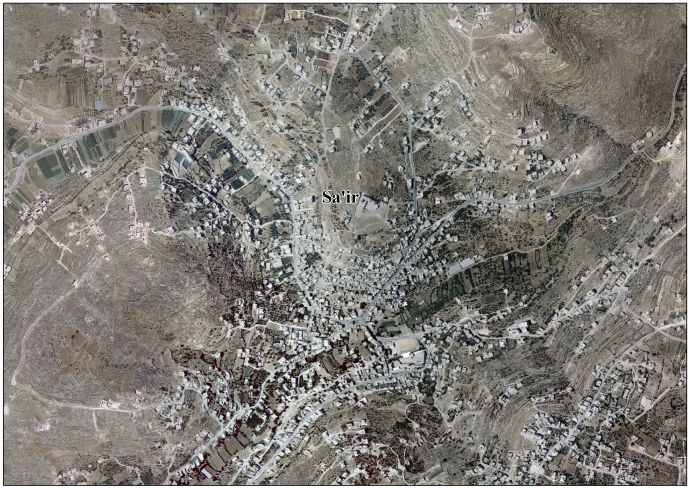
 Sa'ir Location of Sa'ir within the West Bank | |
| Coordinates: 31°35′04″N 35°08′43″E / 31.58444°N 35.14528°ECoordinates: 31°35′04″N 35°08′43″E / 31.58444°N 35.14528°E | |
| Palestine grid | 163/110 |
| State | State of Palestine |
| Governorate | Hebron |
| Government | |
| • Type | Municipality |
| • Head of Municipality | Hakim Shlalda |
| Area | |
| • Total | 117,000 dunams (117.0 km2 or 45.2 sq mi) |
| Population (2007) | |
| • Total | 18,045 |
| • Density | 150/km2 (400/sq mi) |
| Name meaning | from personal name, or Zior[1] |


Sa'ir (Arabic: سعير, also spelled Saeer, Seir, or Si'ir) is a Palestinian town in the Hebron Governorate in the southern West Bank located 8 kilometers (5.0 mi) northeast of Hebron. Nearby localities include Beit Fajjar and al-Arroub to the north, Beit Ummar to the northwest, Halhul to the west and Beit Einun and ash-Shuyukh to the south. The Dead Sea is just east of Sa'ir's municipal borders.[2] In the 2007 census Palestinian Central Bureau of Statistics, the town had a population of over 18,045.[3]
It has municipal jurisdiction over 117,000 dunams, 6,000 of which is built-up area and 11,715 of which is cultivated. The main economic activities in Sa'ir are agriculture and the Israeli labor market, although the latter has been adversely affected as a result of the Israeli restrictions following the Second Intifada in 2000–04. Olives are the major cash crop.[2]
Name[]
According to the Applied Research Institute Jerusalem (ARIJ), Sa'ir "was established on the town of Saeer (صعير) or Saiour (صعيور)", and during the Roman era the town was known as "Sior".[2] The Book of Joshua (15:54) mentions a town in this area called Tsi`or (ציער, also transliterated Sior or Zior). The Hebrew name is related to a root meaning "small".
History[]
Byzantine ceramics have been found.[4] The PEF's Survey of Western Palestine (SWP), wrote that: "The tomb of El 'Ais (Esau), south of the village, is in a chamber 37 feet east and west by 20 feet north and south, with a Mihrab on the south wall. The tomb is 12 feet long, 3 1/2 feet broad, 5 feet high, covered with a dark green cloth and a canopy above. An ostrich egg is hung near. North of the chamber is a vaulted room of equal size, and to the east is an open court with a fig-tree, and a second cenotaph rudely plastered, said to be that of Esau's slave. Rock-cut tombs exist south-west of this place."[5]
Ottoman era[]
In 1596 Sa'ir appeared in the Ottoman tax registers as part of the nahiya of Halil in the Liwa of Quds. It had an entirely Muslim population consisting of 72 households. Taxes were paid on wheat, barley, summer crops, olive trees, goats and/or beehives.[6]
The French explorer Victor Guérin visited the village in the 1860s, and found it having about 400 inhabitants.[7] SWP described Sa'ir in 1883 as "a village of moderate size, in a valley surrounded with cultivated ground." A maqam (shrine) located in Sa'ir was believed by the local Muslims to house the tomb of Esau who they referred to as "Aisa." The SWP stated this identification was false and that Esau's tomb was in the Biblical Mount Seir.[8][9][10]
Under the name Sa'in, an Ottoman village list of about 1870 indicated 84 houses and a population of 186, though it is proposed that the population count included men, only.[11][12][13]
British Mandate period[]
In the 1922 census of Palestine, conducted by the British Mandate authorities, Sa'ir had a population of 1,477 inhabitants, all Muslim.[14] In the 1931 census the population of Si'ir was a total of 1,967, still entirely Muslim, in 388 inhabited houses.[15]
In the 1945 statistics the population of Si'ir was 2,710, all Muslims,[16] who owned 92,423 dunams of land according to an official land and population survey.[17] 2,483 dunams were plantations and irrigable land, 10,671 for cereals,[18] while 76 dunams were built-up (urban) land.[19]
Jordanian period[]
In the wake of the 1948 Arab–Israeli War, and after the 1949 Armistice Agreements, Sa'ir came under Jordanian rule.
In 1961, the population of Si'ir was 2,511.[20]
1967 war and aftermath[]
Sa'ir has been under Israeli occupation since the 1967 Six-Day War. The population in the 1967 census conducted by the Israeli authorities was 4,172.[21]
Following the 1993 Oslo Accords Sa'ir was designated within "Area B" giving the Palestinian National Authority (PNA) control over the town's civil affairs while Israel maintained its control over security. In 1997, an elected 13-member municipal council was established by the PNA to administer Sa'ir. Its municipal borders include a number of small villages, including al-Uddeisa, ad-Duwwara, Irqan Turad, Kuziba, Wadi ar-Rum and Ras at-Tawil. Principal families include Shlaldah, Froukh, Al-Lahaleeh, Jaradat, Mtur, al-Jabarin, al-Kawazbeh, Arameen and al-Turweh.[2] Hakim Shlaldah was elected mayor in the 2005 municipal elections.[22]
In January, 2013, Rafat Jaradat, 30 years old, from Sa'ir, died in jail five days after he was arrested by the Israelis. Israeli sources said his death was caused by "sudden heart attack while under interrogation", while Palestinian officials said that Jaradat had been tortured while in Israeli detention. His body had bruises and broken ribs, which the Israelis said came from attempts to revive him, while his brother said it looked as if Jaradat had been severely beaten.[23][24][25]
Hamas candidates have won election to the town council,[26] which is described in the Israeli press as "Hamas affiliated,"[27] and as "having close ties to Hamas."[28]
Between October 2015 and mid January 2016 eleven Sair residents were shot dead by the Israeli army in alleged attacks on Israeli soldiers.[29] Almost half of them were killed at Beit Einun Junction where the IDF controls access to the town.[30]
References[]
- ^ Palmer, 1881, p. 408
- ^ Jump up to: a b c d Sa'ir Town Profile. Applied Research Institute-Jerusalem. 2008. Retrieved on 2012-03-12.
- ^ 2007 PCBS Census Palestinian Central Bureau of Statistics. p.118.
- ^ Dauphin, 1998, p. 936
- ^ Conder and Kitchener, 1883, p. 379
- ^ Hütteroth and Abdulfattah, 1977, p. 122
- ^ Guérin, 1869, pp. 150-1
- ^ Conder and Kitchener, 1883, p. 309
- ^ Conder, 1881, pp. 215-6
- ^ Conder, 1889, pp. 123-4
- ^ Socin, 1879, p. 159
- ^ Hartmann, 1883, p. 142 also noted 84 houses
- ^ U. O. Schmelz (1990). "Population characteristics of Jerusalem and Hebron regions according to Ottoman census of 1905". In Gad G. Gilbar (ed.). Ottoman Palestine 1800–1914. Leiden: E. J. Brill. pp. 15–67.
- ^ Barron, 1923, Table V, Sub-district of Hebron, p. 10
- ^ Mills, 1932, p. 33
- ^ Government of Palestine, Department of Statistics, 1945, p. 23
- ^ Government of Palestine, Department of Statistics. Village Statistics, April, 1945. Quoted in Hadawi, 1970, p. 50
- ^ Government of Palestine, Department of Statistics. Village Statistics, April, 1945. Quoted in Hadawi, 1970, p. 94
- ^ Government of Palestine, Department of Statistics. Village Statistics, April, 1945. Quoted in Hadawi, 1970, p. 144
- ^ Government of Jordan, Department of Statistics, 1964, p. 14
- ^ Perlmann, Joel (November 2011 – February 2012). "The 1967 Census of the West Bank and Gaza Strip: A Digitized Version" (PDF). Levy Economics Institute. Retrieved 24 June 2016.
- ^ "Local Elections (Round Two)–Successful candidates by local authority, gender and No. of votes obtained" (PDF). Central Elections Committee–Palestine. Retrieved 2008-11-19.
- ^ Palestinian prisoner dies during interrogation in Israeli jail, 24 February 2013, The Independent
- ^ What killed Arafat Jaradat?, 02.03.13, Haaretz
- ^ Palestinian Arafat Jaradat gets hero's funeral after death in Israeli custody
- ^ Gutman, Matthew (24 May 2005). "Militant Hamas striding into realm of legitimate politics". USA Today. Retrieved 15 December 2015.
- ^ Gross, Judah Ari (24 November 2015). "More crackdowns are just more of the same". Times of Israel. Retrieved 15 December 2015.
- ^ Gross, Judah Ari (23 November 2015). "In the Etzion Bloc, no easy answers to terror". Times of Israel. Retrieved 15 December 2015.
- ^ mfa.gov.il https://mfa.gov.il/mfa/foreignpolicy/terrorism/palestinian/pages/victims%20of%20palestinian%20violence%20and%20terrorism%20sinc.aspx. Retrieved 2020-02-21. Missing or empty
|title=(help) - ^ [1] Maan 14 January 2016 Palestinian shot dead after alleged attack attempt near Hebron
Bibliography[]
- Barron, J. B., ed. (1923). Palestine: Report and General Abstracts of the Census of 1922. Government of Palestine.
- Conder, C.R. (1881). "Tour of Their Royal Highnesses Princes Albert Victor and George of Wales in Palestine". Quarterly statement - Palestine Exploration Fund. 13: 214–234.
- Conder, C.R. (1889). "Bezetha". Quarterly statement - Palestine Exploration Fund. 22: 122–123.
- Conder, C.R.; Kitchener, H.H. (1883). The Survey of Western Palestine: Memoirs of the Topography, Orography, Hydrography, and Archaeology. 3. London: Committee of the Palestine Exploration Fund.
- Dauphin, Claudine (1998). La Palestine byzantine, Peuplement et Populations. BAR International Series 726 (in French). III : Catalogue. Oxford: Archeopress. ISBN 0-860549-05-4.
- Government of Jordan, Department of Statistics (1964). First Census of Population and Housing. Volume I: Final Tables; General Characteristics of the Population (PDF).
- Government of Palestine, Department of Statistics (1945). Village Statistics, April, 1945.
- Guérin, V. (1869). Description Géographique Historique et Archéologique de la Palestine (in French). 1: Judee, pt. 3. Paris: L'Imprimerie Nationale.
- Hadawi, S. (1970). Village Statistics of 1945: A Classification of Land and Area ownership in Palestine. Palestine Liberation Organization Research Center.
- Hartmann, M. (1883). "Die Ortschaftenliste des Liwa Jerusalem in dem türkischen Staatskalender für Syrien auf das Jahr 1288 der Flucht (1871)". Zeitschrift des Deutschen Palästina-Vereins. 6: 102–149.
- Hütteroth, Wolf-Dieter; Abdulfattah, Kamal (1977). Historical Geography of Palestine, Transjordan and Southern Syria in the Late 16th Century. Erlanger Geographische Arbeiten, Sonderband 5. Erlangen, Germany: Vorstand der Fränkischen Geographischen Gesellschaft. ISBN 3-920405-41-2.
- Mills, E., ed. (1932). Census of Palestine 1931. Population of Villages, Towns and Administrative Areas. Jerusalem: Government of Palestine.
- Palmer, E.H. (1881). The Survey of Western Palestine: Arabic and English Name Lists Collected During the Survey by Lieutenants Conder and Kitchener, R. E. Transliterated and Explained by E.H. Palmer. Committee of the Palestine Exploration Fund.
- Socin, A. (1879). "Alphabetisches Verzeichniss von Ortschaften des Paschalik Jerusalem". Zeitschrift des Deutschen Palästina-Vereins. 2: 135–163.
External links[]
- Welcome To Sa'eer
- Sa’ir, Welcome to Palestine
- Survey of Western Palestine, Map 21: IAA, Wikimedia commons
- Sa'ir Town (Fact Sheet), Applied Research Institute–Jerusalem (ARIJ)
- Sa'ir Town Profile, ARIJ
- Aerial Photo, ARIJ
- Needs for development in Sa'ir town based on the community and local authorities’ assessment, ARIJ
- Israeli Colonists set Olive Trees on Fire in Sa'ir Town 04, June, 2010, POICA
- Israeli Colonists Plough 20 Dunums of the Town of Sa’ir in Hebron Governorate. 01, January, 2011, ARIJ
- Israeli Colonists Level Tens of Dunums of Palestinian lands in Sa'ir town- Hebron Governorate 19, August, 2011, POICA
- Military Demolition Orders in Sa’ir Village northeast of Hebron City at the Southern parts of the West Bank 20, August, 2011, POICA
| hide | ||
|---|---|---|
| Cities |
|  |
| Towns |
| |
| Villages |
| |
| Refugee camps | ||
| show Authority control |
|---|
- Hebron Governorate
- Cities in the West Bank
- Municipalities of the State of Palestine