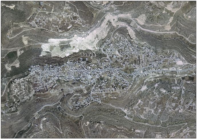
Taffuh
Taffuh | |
|---|---|
Municipality type B | |
| Arabic transcription(s) | |
| • Arabic | تفّوح |
 Taffuh, in 2017 | |
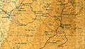
 Taffuh Location of Taffuh within Palestine | |
| Coordinates: 31°32′21″N 35°3′11″E / 31.53917°N 35.05306°ECoordinates: 31°32′21″N 35°3′11″E / 31.53917°N 35.05306°E | |
| Palestine grid | 154/105 |
| State | State of Palestine |
| Governorate | Hebron |
| Government | |
| • Type | Municipality |
| Population (2007) | |
| • Total | 10,597 |
| Name meaning | from "Beth Tappuah"[1] |

Taffuh (Arabic: تفّوح) (lit. fragrance) is a Palestinian town located eight kilometers west of Hebron.The town is in the Hebron Governorate in the southern West Bank. According to the Palestinian Central Bureau of Statistics, the town had a population of over 10,597 in 2007.[2]
History[]
The city of Beth-tappuah, literally House of Apple [tree], cited in the Book of Joshua (15: 53), is often located in the hill country of the Tribe of Judah, 5 km west northwest of Hebron.[3] Archaeological finds in the vicinity of the hill site include remains of an ancient road, a well to the west, cisterns, and rock-cuttings.[4] Some, but not all, experts identify this now with the modern Palestinian village established not far from the cite.[5] The PEF's Survey of Western Palestine (SWP) noted: "Evidently an ancient site; there are caves here, with trenches leading down to them, as at Khurbet 'Aziz, and the rock is quarried. An ancient road leads past the village."[6]
Ottoman era[]
In the Ottoman census of the 1500s, Taffuh was located in the nahiya of Halil.[7]
In 1838, Edward Robinson noted Teffuh as Muslim village, located north of el-Khulil, and west of the road from Jerusalem.[8] Robinson further described it as: "an old village [..] it contains a good number of inhabitants, and lies in the midst of olive groves and vineyards, with marks of industry and thrift on every side. Indeed many of the former terraces along the hill sides are still in use [..] Several portions of walls, apparently those of an old fortress, are visible among the houses..."[9]
In 1863 Victor Guérin visited, and found the village to have 400 inhabitants. He also noted that several houses seemed ancient.[10] An Ottoman village list of about 1870 counted 54 houses and a population of 161, though the population count included men.[11][12]
In 1883, the PEF's Survey of Western Palestine (SWP) described Taffuh as "A village of ancient appearance, standing high at the edge of a ridge ; on the north are the steep slopes of Wady Kedir, in which are olives belonging to the place. An ancient main-road passes through the village, and runs along flat ground to the west for a little way, then descends the ridge. There is a well to the west, with cisterns, caves, and rock-cuttings. The village has vineyards round it, and good springs in the valley to the west."[13]
British Mandate era[]
In the 1922 census of Palestine conducted by the British Mandate authorities, Taffuh had a population of 461 inhabitants, all Muslims,[14] increasing in the 1931 census to 580, all Muslim, in 124 inhabited houses.[15]
In the 1945 statistics the population of Taffuh was 780, all Muslims,[16] who owned 12,103 dunams of land according to an official land and population survey.[17] 1,073 dunams were plantations and irrigable land, 3,543 for cereals,[18] while 31 dunams were built-up (urban) land.[19]

Taffuh, British Mandate map, 1:20,000
Taffuh 1945 1:250,000


1948-1967[]
In the wake of the 1948 Arab–Israeli War, and after the 1949 Armistice Agreements, Taffuh came under Jordanian rule. It was annexed by Jordan in 1950.
The Jordanian census of 1961 found 1,282 inhabitants in Taffuh.[20]
1967-present[]
Since the Six-Day War in 1967, Taffuh has been under Israeli occupation.
Footnotes[]
- ^ Palmer, 1881, p. 408
- ^ 2007 PCBS Census Palestinian Central Bureau of Statistics. p.119.
- ^ Woudstra, 1981, p. 251
- ^ Bugatti, 2002, p. 59
- ^ Wilkinson, Hill and Ryan, 1988, p. 58, note 13
- ^ Conder and Kitchener, 1883, SWP III, p. 379
- ^ Toledano, 1984, p. 305, has Taffuh at location 31°32′30″N, 35°02′30″E
- ^ Robinson and Smith, 1841, vol 3, Appendix 2, p. 116
- ^ Robinson and Smith, 1841, vol. 2, p. 428
- ^ Guérin, 1869, p. 374
- ^ Socin, 1879, p. 161 It was also noted to be in the Hebron district
- ^ Hartmann, 1883, p. 142 noted 53 houses
- ^ Conder and Kitchener, 1883, SWP III, p. 310
- ^ Barron, 1923, Table V, Sub-district of Hebron, p. 10
- ^ Mills, 1932, p. 34.
- ^ Government of Palestine, Department of Statistics, 1945, p. 23
- ^ Government of Palestine, Department of Statistics. Village Statistics, April, 1945. Quoted in Hadawi, 1970, p. 50
- ^ Government of Palestine, Department of Statistics. Village Statistics, April, 1945. Quoted in Hadawi, 1970, p. 94
- ^ Government of Palestine, Department of Statistics. Village Statistics, April, 1945. Quoted in Hadawi, 1970, p. 143
- ^ Government of Jordan, Department of Statistics, 1964, p. 22
Bibliography[]
- Bagatti, B. (2002). Ancient Christian villages of Judaea and the Negev. Franciscan Printing Press.
- Barron, J.B., ed. (1923). Palestine: Report and General Abstracts of the Census of 1922. Government of Palestine.
- Conder, C.R.; Kitchener, H.H. (1883). The Survey of Western Palestine: Memoirs of the Topography, Orography, Hydrography, and Archaeology. 3. London: Committee of the Palestine Exploration Fund.
- Government of Jordan, Department of Statistics (1964). First Census of Population and Housing. Volume I: Final Tables; General Characteristics of the Population (PDF).
- Government of Palestine, Department of Statistics (1945). Village Statistics, April, 1945.
- Guérin, V. (1869). Description Géographique Historique et Archéologique de la Palestine (in French). 1: Judee, pt. 3. Paris: L'Imprimerie Nationale.
- Hadawi, S. (1970). Village Statistics of 1945: A Classification of Land and Area ownership in Palestine. Palestine Liberation Organization Research Center.
- Hartmann, M. (1883). "Die Ortschaftenliste des Liwa Jerusalem in dem türkischen Staatskalender für Syrien auf das Jahr 1288 der Flucht (1871)". Zeitschrift des Deutschen Palästina-Vereins. 6: 102–149.
- Mills, E., ed. (1932). Census of Palestine 1931. Population of Villages, Towns and Administrative Areas. Jerusalem: Government of Palestine.
- Palmer, E.H. (1881). The Survey of Western Palestine: Arabic and English Name Lists Collected During the Survey by Lieutenants Conder and Kitchener, R. E. Transliterated and Explained by E.H. Palmer. Committee of the Palestine Exploration Fund.
- Pringle, Denys (1993). The Churches of the Crusader Kingdom of Jerusalem: A-K (excluding Acre and Jerusalem). I. Cambridge University Press. ISBN 0 521 39036 2. (pp. 29-30)
- Robinson, E.; Smith, E. (1841). Biblical Researches in Palestine, Mount Sinai and Arabia Petraea: A Journal of Travels in the year 1838. 2. Boston: Crocker & Brewster.
- Robinson, E.; Smith, E. (1841). Biblical Researches in Palestine, Mount Sinai and Arabia Petraea: A Journal of Travels in the year 1838. 3. Boston: Crocker & Brewster.
- Socin, A. (1879). "Alphabetisches Verzeichniss von Ortschaften des Paschalik Jerusalem". Zeitschrift des Deutschen Palästina-Vereins. 2: 135–163.
- Toledano, E. (1984). "The Sanjaq of Jerusalem in the Sixteenth Century: Aspects of Topography and Population". Archivum Ottomanicum. 9: 279–319.
- Wilkinson, John; Hill, Joyce; Ryan, William Francis (1988). Jerusalem pilgrimage, 1099-1185. Hakluyt Society.
- Woudstra, M. (1981). The book of Joshua. Grand Rapids: Wm. B. Eerdmans Publishing Co.
External links[]
- Welcome To Taffuh
- Survey of Western Palestine, Map 21: IAA, Wikimedia commons
- Taffuh Town (Fact Sheet), Applied Research Institute–Jerusalem (ARIJ)
- Taffuh Town Profile, ARIJ
- Taffuh aerial photo, ARIJ
- The priorities and needs for development in Taffuh town based on the community and local authorities’ assessment, ARIJ
| hide | ||
|---|---|---|
| Cities |
|  |
| Towns |
| |
| Villages |
| |
| Refugee camps | ||
- Hebron Governorate
- Towns in the West Bank
- Ancient Jewish settlements of Judaea
- Municipalities of the State of Palestine